Overview
This fun Class III scramble runs directly along the crest of the ridge that stretches between
North Truchas Peak and its outrigger to the North,
UN 12,900. It works in both directions. It is probably the shortest way to climb North Truchas, if one ascends UN 12,900 from Trampas Lakes. Alternatively, if one climbs North Truchas by another route, it makes a wonderful side trip culminating in terrific views of Las Trampas drainage and the Truchas Massif.
![UN 12,900]() Looking back north toward UN 12,900
Looking back north toward UN 12,900Getting There
Ascend
UN 12,900 from Trampas Lakes, or ascend
North Truchas Peak to do the route south to north.
Route Description
From UN 12,900, strike out due south along the ridge crest. You will run into two small craggy blocks, both of which can be dealt with by dropping a little to the right (west). In both cases, you should ascend back to the ridge crest as soon as is feasible. You will find a little bit of loose ground, and some Class II (maybe easy Class III) scrambling, but no major difficulties.
![The Headwall]() The Headwall
The HeadwallAfter crossing these two blocks, you will come to the crux of the ridge, a steep headwall, maybe 50-60 feet high.
This trip report describes going "left around a blind corner... some sketchy traversing... narrow gully... loose, scary." That option looked wretched to me. I found a steep Class III trench (though it felt a bit more difficult on the descent) about 15 feet to the right of the ridge crest, marked by a small cairn. This trench heads straight up for 20 feet or so, then turns 90 degrees left and continues another 15 or 20 feet. This climbing definitely requires hands, and some people might call it Class IV; however, it does not feels exposed at all. The trench leads back to the ridge crest. Continue with another 20 feet or so of Class III scrambling, which is now significantly less steep but more exposed (there was some snow here when I came through, which made things a bit more nerve-wracking). The ridge soon mellows out until you can stand up and walk to the summit.
![Headwall Route]() Route Detail
Route DetailIt also looked like there was another feasible line heading right up the wall almost upon the crest. Use your judgement and pick the line that looks best to you.
If you're coming the other direction, from N. Truchas to UN 12,900, just scramble down a little to the right (east) of the ridge crest until it starts steepening; then look for the sluicebox trench heading left and down.
Essential Gear
Standard hiking gear should suffice. Gaiters might be nice in spring or fall.
External Links
Trip Report Summit Views
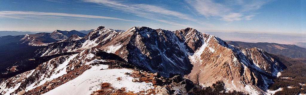
Looking South at the other Truchas Peaks, Trailriders Wall and the Pecos Baldies |
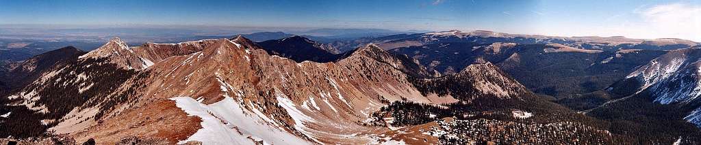
Looking North to Sheepshead Peak, Un 12,900, Rio Santa Barbara and Jicarita Peak |

 9979 Hits
 81.84% Score
 14 Votes

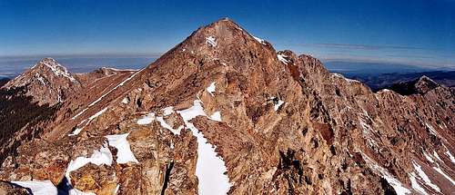 Looking back north toward UN 12,900
 The Headwall
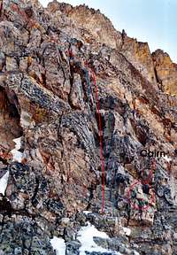 Route Detail