
-
 15702 Hits
-
 89.77% Score
-
 30 Votes
|
|
Mountain/Rock |
|---|---|
|
|
29.79240°N / 8.95901°W |
|
|
Anti-Atlas, Jebel El Kest |
|
|
Hiking, Trad Climbing |
|
|
Spring, Fall, Winter |
|
|
6562 ft / 2000 m |
|
|
Overview
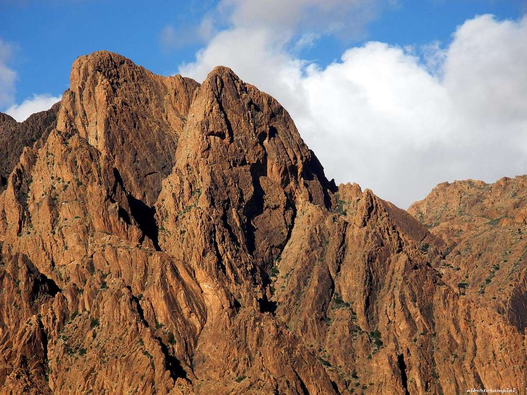
Lion's Head
An enigmatic huge Lion's Face...
Lion's Head is a great and charming peak belonging to the Anti-Atlas Range and lying in the South side of the Jebel El Kest Group, just overlooking the Ameln Valley. The peak shows a magnificent and enigmatic South Face, overlooking the oasis of Tafraoute and named Lion's Face because of its surprising likeness with a huge lion's head, especially when seen late in the afternoon.
This surprising peculiarity is well visible from the town of Tafraoute and draws the eye of the climbers. For this reason Lion's Head has been appointed and it's considered as the symbol of this wild mountain chain. In the middle of the wall there is a tremendous roof, looking like a big stairway upside down.
Getting There
Getting to Tafraoute
Tafraoute is the most important town in the Jebel El Kest area and can be suitably approached from Marrakech or Agadir. Several international flights run to both the airports of Marrakech and Agadir. The best choice is hire a car (in the Airports there are many Car Hire Agencies).

|

|
- From Marrakech the road to Tafraoute involves a trip of 400 Kms and takes nowadays about 5 hours via the new Motor-way connecting Marrakech to Agadir, then following a busy road via Inezgane (near Agadir), Biougra and Ait Baha; pass Ait Baha the road skirts the North side of Jebel El Kest range, rising to the Tizi'n Tarakatine Col and descending to the town of Tafraoute in the Ameln Valley, the valley running below the South side of Jebel El Kest. Alternatively, from Marrakech you can follow the road via Asni, crossing the High Atlas range, quite a long and adventurous trip along a narrow mountain road inside a charming and scenic landscape, then getting the town of Taroudant (it takes at least 7-8 hours).
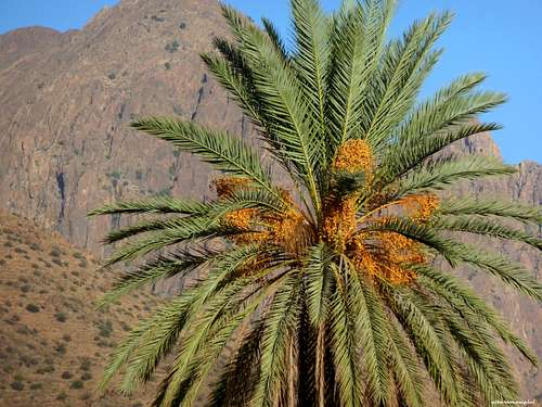
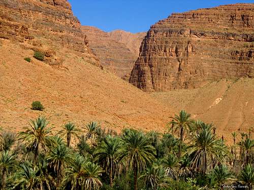
High walls and date palms in Ameln Valley |
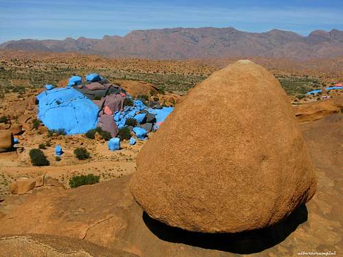
Les Pierres Bleues |
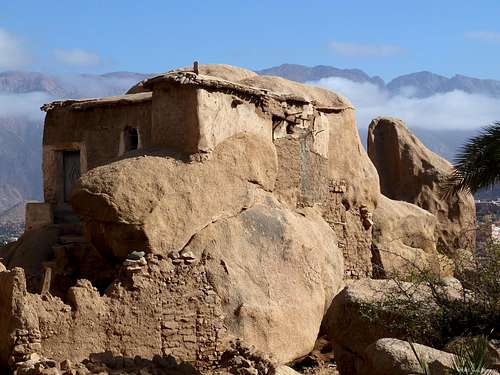
An ancient house in Tazka, near Tafraoute |
- From Agadir the travel is shorter (you can drive to Tafraoute in 2 hours on a 170 kms good road), but the flights’ choice is more restricted.
Road approach from Tafraoute From Tafraoute follow the road to the Ameln Valley; getting the round-about, turn to left. After some hundred meters on the main road, leave it and take on the right the unsurfaced road getting at first to the main village of Asgaour and after to the small last settlements on the East end of the village. Small parking.
Gorges Tizerkine |
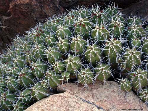
The perfect shape of an Euphorbia |
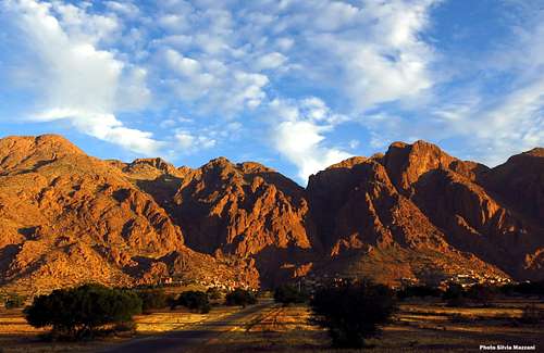
Last sunrays over Lion's Head chain |
Walking approach from Asgaour to the Lion's face A complex and long scramble along a large vegetated gully, starting near the Asgaour water pipeline. From the village follow the path along the water pipe-line and after five minutes, before crossing the stream, leave the main path and walk up towards left following the main large vegetated gully, rising towards the face.


Scramble up easily along the gully; when the gully starts turning towards left, climb some easy rocks on the right, then head towards left, reaching an exposed ledge, involving one climbing move at its end. Gain the upper vegetated large gully. Walk up along the gully, then scramble up along some easy slabs, reaching the bottom of the face. Reach the various starting points of the routes skirting the wall from left to right.
Lion's Head routes overview
Five routes had been traced on the face - Grades are expressed in the alpha-numerical British Scale

A - Lion's Face Ridge (SSW Ridge) VS 4c - 400 m. L. Brown- C.E. Davies- D.W. Walker- A.P. Tumbull 1998
B - Lion's Face (South Face) HVS 5a - 300 m. P. Ross - L. Brown 1995
The route of the British pioneers, the first realized on the face
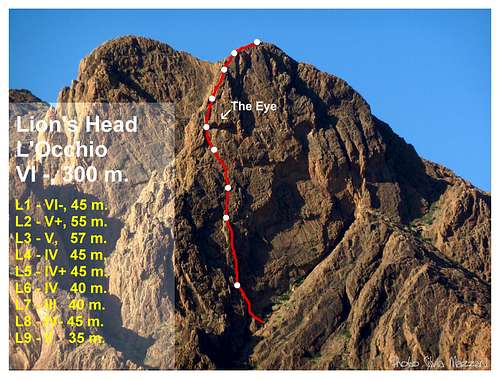
C - L'Occhio (The Eye) HVS 5a 300 m. Alberto Rampini - Silvia Mazzani 30-10-2010
A superb modern classic ascent
D - Polish Route VS 4c - 220 m.
Few details; the route climbs the first big chimney situated in the shorter right-hand side of the face, to the right of the overhangs
E - Lion's Garden VS 4c - 165 m. O. Guenay, H. Heuser, D. Kuch dec 2007
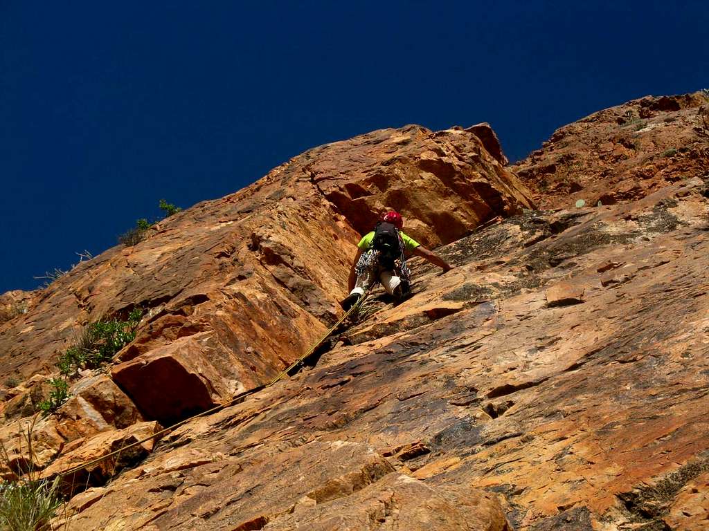
L'Occhio (The Eye) route report
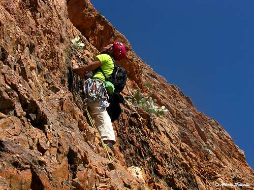
A great adventurous trad route in a wild milieu
L'Occhio (The Eye) route report
Difficulty: 5a max British Scale - VI- UIAA
Length: 400 m
Exposition: South
Equipment: none
Starting point: Asgaour, Ameln Valley
Approach trail
From Tafraoute reach the small village of Asgaour, then the last settlements at the East end of Asgaour. Park the car and follow the water pipe-line path. Before crossing the river, leave the main path and walk up towards left following the main large vegetated gully, rising towards the face. Scramble up easily along the gully; when the gully starts turning towards left, climb some easy rocks on the right, then head towards left reaching an exposed ledge involving one climbing move at the end. Gain the upper vegetated large gully. Walk up along the gully, then scramble up along some easy slabs on the right, reaching a flat stance near some blocks, under a regular yellow dihedral-crack, closed by a small roof. The starting point is a short crack heading to the dihedral-crack, lying on the left of the great tremendous roof in the middle of the face.
Climbing report (British Scale)
L1 - Climb the dihedral-crack, reach the little roof and skirt it to the to right, then climb straight up to a belay on a rocky ledge. 5a, 45 m
L2 - Starting a very long pitch straight up on a red steep pillar; from the belay move to right, climbing a red wall. After a short traverse towards right, return to the left in the middle of the red pillar, and climb directly it to its top. 5a, 55 m
L3 - Another great pitch straight up some steep little walls, then slanting right to a red slab, reaching a belay. 4c, 57 m

")
L4 - Straight up along easier rocks to a good belay under the left end of the big roof (Lion’s left eye) 4b, 45 m
L5 - Follow the pillar straight up, then a ramp towards right to an exposed belay, with a characteristic “euphorbia”, at the left end of the enormous yellow roof (Lion’s left eye) 4c, 40 m
L6 - L7 Climb straight up some corners and little walls to reach the ridge, 4b, 40 m
L8 - L9 Climb along the right-hand side of the ridge with easier climb reaching the summit cairn.
Report grades are in English Scale, as it's custom in the area. No pegs neither others equipements had been left in place from the first climbers, but the route can be quite protected by excentrics and friends.
Descent: along the Normal route, a long nice trip! From the summit head to North (cairns), getting the bottom of a charming valley with a fresh water pot. Cross the water, getting the other side and rise slanting right, following a ledges'system (cairns) and heading to a huge cairn. From the cairn walk down slanting right, getting the bottom of a little valley. A good path with several hairpins descent to a great saddle. Towards right, getting the starting path.


Essential gear
Double ropes, a complete set of friends and nuts, quickdraws and slings, helmet, water...
Geology and rock
The most common rock is a pre-Cambrian quartzite, which quality is often perfect; its plenty of cracks allows a pleasant and sure climbing, with many opportunities of good natural protections.
Red Tape and Ethics
Climbing doesn’t suffer any official and established restrictions, but however climbers are urged to respect the ethics of the pioneers, in order to preserve in the area the adventurous traditional climbing. In all the routes to date, no bolts and a few pitons have been fixed or used. The quarzite provides ideal cracks to place friends and nuts.
Hiking
Lion's Head Normal Route
Difficulty: a long walk up
Difference in level: 1100 m.
Time required: from 3 to 4 hours
Starting point: last settlements on the East end of Asgaour. Small parking.


The Normal Route to the Lion's Head summit is a long trip, but really fine, inside a wild environment: it's an easy walk and doesn't involves any climbing. The ascent is rather tiring and it's not recommended during very hot days. The starting point is the same as for the climbing routes: East end of Asgaour. From here follow the water pipe-line as for approaching South Face to climbing, but when you're getting to the river you must cross it - instead of rising up the gully - and continue to follow by walking the main path. The track rises for a long time, reaching a wide saddle and some steep scree-slopes leading to an incredible system of ledges, crossing a wall and leading to an unexpected small lake in the very middle of the desert landscape. From the small lake head to left, taking the slopes in front of, leading to the top (3-4 hours from Asgaour).
When to climb and hike

The best seasons to climb are fall (from the middle of october) and spring, till april, when the weather is mainly fine and the temperature is pleasant. Late in the spring and in summer the temperature rises up dramaticaly, and climbing is virtually impossibile. Winter (december to february) is traditionally the wet season and rain, cold and even snow, on the highest peaks, sometimes may be a problem. Nevertheless, you can find often pleasant temperature also in winter during the day, though the evening and the night can be quite chilly.
Where to stay


A pleasant choice in Tafraoute is the Hotel Les Amandiers on a hill dominating the town. HOTEL LES AMANDIERS
Other options in Tafraoute: Argana Guesthouse www.argana-tafraout.com, Hotel Salama, Hotel Tanger, Auberge Les Amis and Hotel Tete du Lion In Tafraoute there are also two equipped campsites. Free camping near the town must be avoided.
Guidebooks and maps


"Tafraout - Rock Climbing in Morocco's Anti-Atlas" Vol I - The South Side of Jebel El Kest and the Ameln Valley" by Steve Broadbent, Oxford Alpine Club 2013
"Climbing in the Moroccan Anti-Atlas" by Claude Davies - 2004
Meteo forecast
External links
