Peak: Little Bear Peak - 14,037’, South Little Bear Peak – 14,020’ TH/Route: SW Ridge from Tobin Creek Distance: 8mi Elev Gain: 5800' Time: 13:30 (4:45am - 6:15pm) Technical Gear: Microspikes Travelers: Jed, Matt Lemke, Josh, Sarah
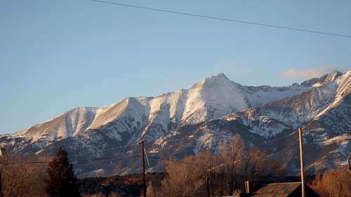
So this was it! This would be my 2012 finale and what a way to end a dynamic year in the mountains for me than climbing Little Bear Peak in calendar winter. I had made the 1,400 mile drive from Seattle to do this climb. The day after I arrived in Denver I met with Josh around noon and we drove down to Fort Garland and got there just before the sun set. I had been in contact with Jed and Sarah about this climb and Jed planned to meet us there later that night since he had to work and Sarah was just going to meet us at the trailhead coming from Vail. I shot a nice photo of Little Bear from town at sunset and was getting really excited to see the entire SW ridge was about completely wind blown. Josh and I walked into the first motel we saw in town assuming there could only be one in this tiny town. Once inside the Motor Inn this lady who must have been possessed by the devil comes out and gives us rude looks and chases us out. We did manage to get her to tell us where the $55/night motel was and once we checked into the correct motel the guy at the desk said that lady is his best customer! I wondered how she stayed in business. Anyway, Josh and I got the key and threw some stuff in the room then walked across the street for dinner. It was getting very cold and the forecasted low temperature in Fort Garland was -12 degrees! We were happy to have the warm motel room.
Sunset on Little Bear from Fort Garland
Josh and I spent the evening organizing gear and trying to find all the junk in my car which was filled with crap to the brim. Once we had everything organized and packed we went to bed, however we couldn't sleep and by 10pm Jed arrived and we were up for the next hour talking about what the climb may be like before finally going to sleep at 11.
The alarms went off at 3 in the morning and with reluctance to leave the motel, we packed into Jed's Subaru and drove to where Sarah was parked. She joined us and Jed drove us up the network of rough roads to the now state famous "corner" in the road which marks the trailhead for the SW ridge. There was a couple inches of snow on the road in places and at one point Jed had to back down and gun it to make it up the hill. We luckily made it all the way and in a matter of minutes, we were hiking in the dark through juniper trees and pointy plants that I had fun breaking. I have no mercy when it comes to branches that are in my way so I just break them off and the brittle cold trees were no match! Right at 9,100 feet we crossed Tobin Creek and since there was at most 4-5 inches of snow on the ground we ditched the snowshoes.
We were headed straight for the crest of the ridge and followed the left side of the creek up the steep slope to the ridge where the first light started to come in. The brush was beginning to thin out and we made great time to the ridge-crest. I could however already tell I was going to be much slower than Jed and Josh since I had just come free sea level and was living in Seattle since August. As the sun rose we all took a snack break at a small notch in the ridge. Since it was well below zero that morning my water froze solid and I could have killed someone with my loaf of bread I had to eat that day. I managed to eat some though and we continued up the now obvious ridge as we began to break out of the trees.
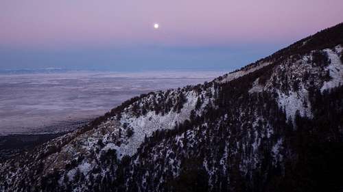
Moonset looking across Tobin Creek
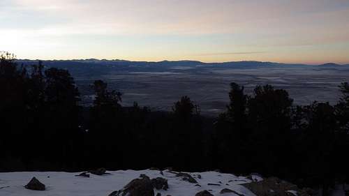
Twilight from the SW ridge
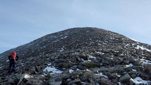
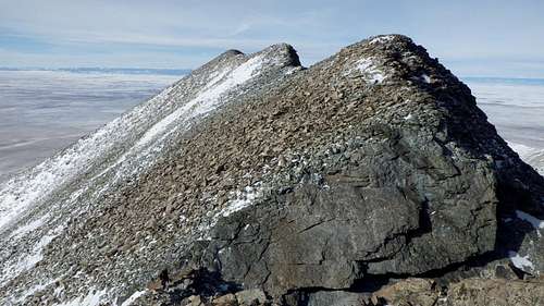
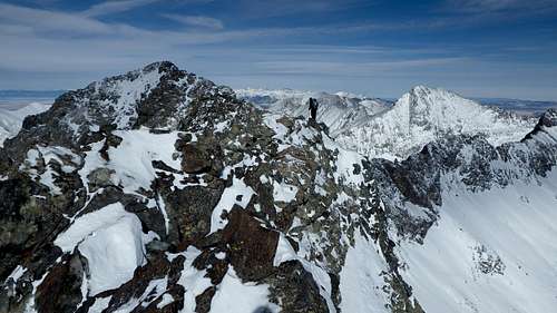
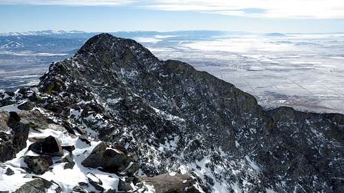
Jed and Josh went on ahead as Sarah and I stayed together. We slowly made our way up the easy ridge as the sun began to warm us up. Just as we passed the last grove of trees we took one more break out of the wind and I ate one more piece of bread. Beyond this point the trees ended and we faced the wind directly however it wasn't that bad. We were lucky the winds were no more than 15-20 miles per hour. We saw Jed and Josh crest Point 12,900 as we continued to slog up the talus. Finally we reached Point 12,900 on the ridge which provided us with our first views of Little Bear! I was amazed at this view...all I could saw was wow. From here the ridge flattened out and we traversed up and down a few more small ridge bumps as we watched them continue well on ahead of us. Sarah stated we may be doing the traverse ourselves but I said I would make them wait if necessary.
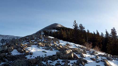
Looking up the SW ridge in the morning
Sarah making her way up the ridge now above treeline
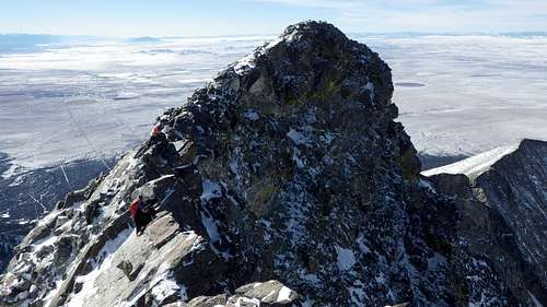
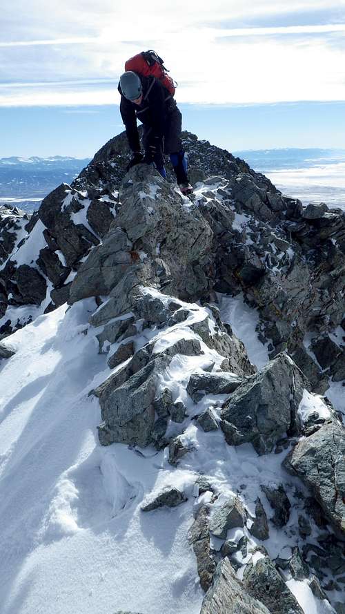
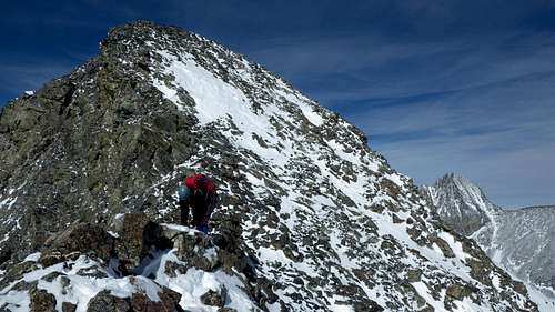
To my surprise, just as Sarah and I walked over the forth ridge bump, we caught up to Jed and Josh. Jed had led the way across a knife edge section of ridge and was waiting as Josh had spent around a half hour trying to find a way across. The problem with this knife edge section was that it made a 3 foot step up halfway across and some climbing moves were required to make it across. A few hundred feet of exposure was on the right side with a couple thousand feet to the left side! Josh then also tried to go around below it to the right to no avail since lower down was just snow covered steep slabs where a slip would surmount to a slide down a few hundred feet. So he decided to call it quits and began heading down. Sarah and I knew this is where the fun began so we both threw on our Microspikes and I went first across the knife edge ridge. I just grabbed the knife edge with both hands and walked across the right side with my feet which I had great traction with the spikes on. The step up wasn't too bad since my long arms made it easy to grab the ridge and continue over to where Jed was standing. Sarah followed perfectly.
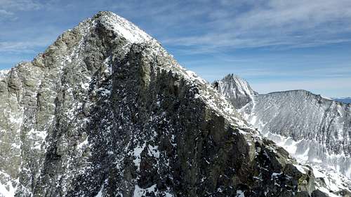
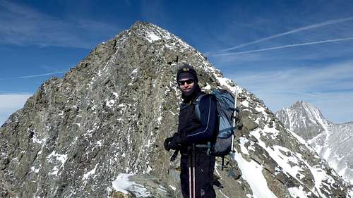
Jed and South Little Bear
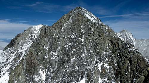
Our first views of Little Bear from Point 12,900
Sarah making her way on the ridge
Looking back the SW ridge
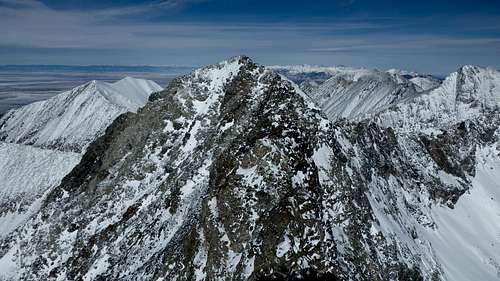
Looking up to S Little Bear
Jed and S. Little Bear
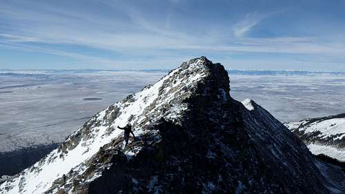
Sarah contemplating the knife edge
Sarah crossing the knife edge
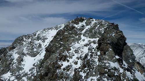
The next difficulty was a very exposed step across a tiny notch with limited footholds and handholds. As I stepped my left foot across I looked between my legs to see 2000 feet of air! A year ago I would have turned around but my comfort level with this kind of stuff is much better. I located the key foothold and mantled myself up the other side. Sarah followed and we continued up the final 200 foot slope to the summit of South Little Bear which felt like it took forever. By now I was beginning to feel the altitude and a small headache was coming on. I was going very slow so Jed just went on ahead. I pushed through the pain and Sarah and I arrived at the summit of South Little Bear where Jed was waiting. I drank lots of water on the top and from here we studied the Mamma Bear Traverse. We decided it was GOOD and started.
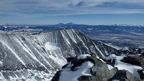
Spanish Peaks from S. Little Bear
Tobin Creek drainage from S. Little Bear
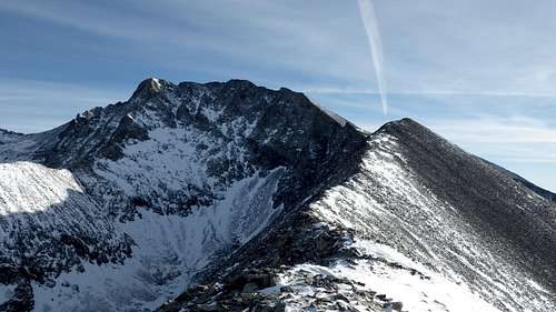
A look at the Mama Bear Traverse
Jed halfway across the traverse
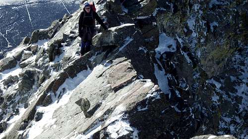
We made the initial descent off of South Little Bear which is supposed to be the first crux but this was far easier than I expected. We dropped to the left side of the ridge to an obvious ledge and crossed it to avoid a small tower on the crest. The footing here was really good and handholds were plentiful. Exposure to the left side wasn't too bad either. We regained the ridge and basically stayed on the ridge crest the whole way across to the next crux which was the descent to the notch above the hourglass. The ridge in this section was mainly flat with many very narrow sections requiring good balance and a strong mental game. The exposure on both sides was relentless and due to my worsening headache I had to be very strong mentally to stay alive! One short knife edge section looked sketchy because the rocks looked like they weren't all that stable and if they had broke you'd fall thousands of feet to either side. The photo below shows Sarah on this section which I thought was the sketchiest of the whole traverse due to the nature of the rock. It is only a matter of time before this part of the ridge breaks...hopefully with no one on it.
Sarah on the sketchy knife edge
Jed on the summit while we continue traversing
Sarah traversing on Mama Bear
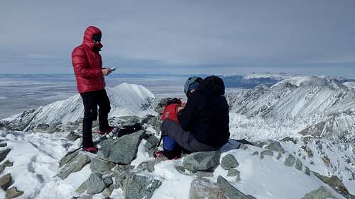
The descent to the hourglass notch was the crux of the route and required steep downclimbs on slabby rock and a careful leap of faith to the snow at the notch itself. Beyond here the last 50 foot ascent to the summit of Little Bear Peak was technically easy but my head got much worse here. Jed was on the summit waiting for us. He had finished the traverse on about 25 minutes where it took Sarah and I almost 40. Once we were all on the summit we rejoiced and took some photos. We saw the group on Blanca Peak and noticed their snowshoe track all the way up! I probably looked like death as my head was killing me and I was beginning to feel slightly nauseated. I tried my best to enjoy the moment though as the views were truly spectacular. Blanca Peak from this vantage looks very similar to Boston Peak in the Cascades which I had climbed in August earlier in the summer.
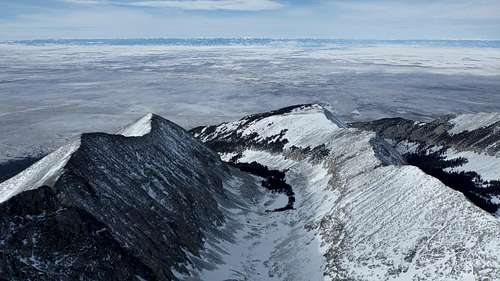
S Little Bear from Little Bear
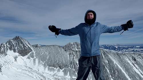
Me on the summit looking like death
Jed and Sarah on Little Bear
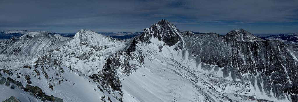
Little Bear Peak summit panorama
I knew I wasn't out of the clear yet though as I still had to traverse back feeling worse. So I began heading back while Jed continued to eat. I only made it to the hourglass notch though when he caught up to me and he said he'd wait on S Little Bear. Sarah and I made the traverse back in about the same time and I stayed mentally strong despite beginning to feel like I wanted to barf. The final climb back up to S Little Bear was the worst part. I was going slower than molasses in January! We descended the steep slope off S. Little Bear together and once we managed to get across the first knife edge that Josh turned around on, I felt very relieved to now be in the clear. I was really in pain after making that last class 3-4 move across the ridge and I just said I was going to start running down ahead sine I knew I needed to get down.
I never imagined hiking back over three small ridge bumps could be so painful but it was. I was very happy to finally get back to Point 12,900 where I could start losing elevation quickly. I started descending to treeline quickly and at about 11,300 feet I met back up with Josh who said he was getting worried about us. I told him how the climb went and waited with him for Jed and Sarah who were about 20 minutes behind me. Once we all met back up we finished the descent all the way back down to 9,100 feet and re-crossed Tobin Creek at which point it got dark on us. The only photo I managed to get on the descent was the sunset from the final steep hike down off the ridge.
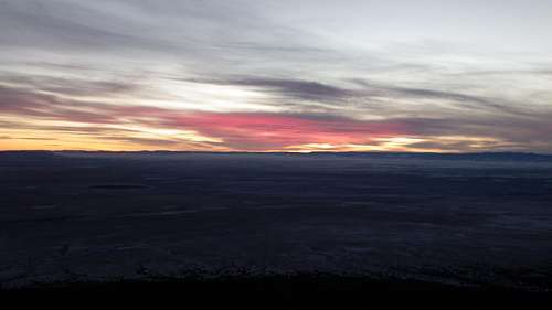
Sunset over San Luis Valley
The final hike through the trees to the car was in the dark but we soon made it back to the car where my headache was slowly improving. Once sitting inside Jed's car I could tell I needed a full day to recover. So we drove back down the roads to Sarah's car where she started back to Vail. Jed, Josh and I went back to Fort Garland for a nice dinner but since I was recovering from AMS I didn't eat much. A nice older guy in the restaurant who played some live music couldn't believe we just climbed Little Bear and he entertained us a bit while we ate. After the nice dinner Jed dropped us off back at the motel where I had left my car and Josh drove us back to his house where I quickly went to sleep. The next day Josh and I had a great day relaxing and watching football.
Aftermath
This climb goes down as the most difficult day climb I have ever done effort-wise simply because I had just returned from sea level. Sarah said multiple times she couldn't believe I was doing this. Technically, the climb was far easier than I had thought it would be which was a pleasant surprise. If the ascent had been a few hundred more feet anywhere along the route I wouldn't have likely made it. The way I see it though is that climbs like these build character. Although the descent was miserable and the car ride home sucked, I look back at this climb as a huge success and a testament to what I can do when I put mind over matter. I am very happy I did this and this summit gave me the same feeling of accomplishment I had after topping out on Pico de Orizaba. Thanks Josh, Jed and Sarah for the great company.
and awesome day out there!! you sure know how to pull through when the going gets tough...there were definitely a couple of times I thought you weren't gonna make it! But great job putting the altitude aside and getting the summit...and helping me get my last remaining "hard" 14er! It sure feels good to have LB now! Sorry KC didn't work out...let me know when you're in CO again (or if I get out to WA again) and we'll climb something else!
I promise I wasn't using any PED's! :) Unless Pizza Hut Supreme pizzas are laced with something... In some way that I don't yet understand the stars of conditioning, nutrition, hydration all aligned for me on this climb and I felt fantastic all day and not once fatigued or short of breath. I just hope I can repeat that performance on furture climbs!
I remember heading up that way last winter. Lean conditions by the looks of your pictures. I basically 'walked' my way across that knife portion much as you did. Tho I didn't think the traverse from South LB to LB was all that bad. Can't argue with the views though! Nice pic of the pano (LB/Blanca).
Nice report, Matt.
Yeah the traverse wasn't so bad...I was just lightheaded from being weak at altitude. I swear I'll never live at sea level again lol but that probably won't happen. Thanks for commenting Kiefer!
Children refers to the set of objects that logically fall under a given object. For example, the
Aconcagua mountain page is a child of the 'Aconcagua Group' and the 'Seven Summits.' The
Aconcagua mountain itself has many routes, photos, and trip reports as children.
Parents refers to a larger category under which an object falls. For example, theAconcagua mountain page has the 'Aconcagua Group' and the 'Seven Summits' asparents and is a parent itself to many routes, photos, and Trip Reports.


Comments
Post a Comment