
-
 22350 Hits
-
 89.01% Score
-
 28 Votes
|
|
Mountain/Rock |
|---|---|
|
|
34.24870°N / 117.6752°W |
|
|
Los Angeles |
|
|
Hiking |
|
|
Spring, Summer, Fall, Winter |
|
|
6812 ft / 2076 m |
|
|
Overview: A Contribution to the Theory of Relativity
This mountain has some character owing to its role in the measurement of the speed of light in the 1920’s. Granted, it has a commonplace name. It first appeared on a U.S. Forest Service map in 1926 as “Baldy Lookout.”It is reported that the first lookout tower in southern California existed on this summit between 1914 and 1927. So it seems that maybe it should be called Lookout #1. In any event, the lookout was subsequently removed to nearby Sunset Peak.
Lookout Mtn.#2 (6,812') (center left) dwarfed by Mt. Baldy (10,064') as seen from the summit area of Sunset Peak 1/27/07
A Caltech professor and first American winner of the Nobel Prize in physics in 1907, A.A. Michelson, measured the speed of light by projecting a beam of light from a rotating mirror on Mt. Wilson, 22 miles away, towards a parabolic mirror constructed on the summit of Lookout and reflecting the beam back to Wilson. Yep, it turned out to be 186,000 miles per second. Apparently, Einstein acknowledged to Prof. Michelson that the latter’s experiment had paved the way for the Theory of Relativity.
All that remains on the summit of Lookout’s contribution to science are three concrete foundations which supported the parabolic mirror.

A marker embedded in one of the concrete foundations that supported the parabolic mirror used to measure the speed of light
Route 1
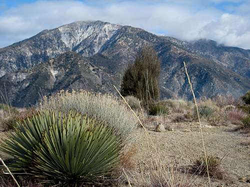
The least difficult route is from Cow Canyon Saddle, a 4-mile round trip with 2,900 feet of gain. From the trailhead parking area hike north up the dlrt road (see the Red Tape section below on permission to hike this short section of road) until the road turns to go left. At this point, you will see a ridge with a firebreak immediately in front of you. ![Lookout Mtn.#2 (6812 ), San Gabriel Mtns.]()
Lookout Mtn. #2 from near start of route ![Thunder Mtn. (C), San Gabriel Mtns.]()
Telegraph Peak (center) and Thunder Mtn. (center left) in clouds Go up this ridge about 200 feet to a use trail that goes left. This trail contours the slope for about a mile to a saddle at 5,480 feet. ![Sugarloaf Pk (C) and 3 T s seen from Lookout Mtn.#2 s west slope]()
Sugarloaf Peak, center, and going left, Telegraph Peak and Thunder Mtn.From the saddle, continue following the use trail which goes in a northerly direction. You will be traversing under the summit. There are fabulous views looking east across the Bear Canyon Trail towards the "3 T's" and Sugarloaf Peak along this section.

Lookout Mtn. #2 from near start of route

Telegraph Peak (center) and Thunder Mtn. (center left) in clouds

Sugarloaf Peak, center, and going left, Telegraph Peak and Thunder Mtn.
The use trail will reach a ridge coming down the east side of the peak. Follow the trail up the ridge. The trail will turn south (left) and lead you right to the summit.
As you approach the summit, the use trail will go to the right. You will now be climbing and traversing under the summit. Continue to a ridge that comes down the east side of the peak. Go left and climb up, or just below, this ridge to the peak’s main ridge. At this point, go left (south). Now, pick your way through any openings in the thick manzanita and buckthorn to the summit.

Sugarloaf Peak from west slope of Lookout
On a clear day, you can see the ocean and Catalina Island from Lookout’s summit. To the east, the uniquely-shaped Sugarloaf Peak, and surrounding peaks like Thunder Mountain, also provide superb scenery.
Route 2
This route begins on the Bear Canyon Trail near the Mt. Baldy Visitor’s Center. The route begins by going to Bear Flat and then into the west fork of Bear Canyon. It eventually reaches a saddle north of Lookout and then you reach the summit by going south up through the brush. The foregoing is only a general reference to the route and is not intended as even a general description of the entire route. Although the route is only Class 1, navigation is difficult. This route is 10 miles round trip with 2,800 feet of gain. For a detailed route description see the Sierra Club’s HPS website for this mountain.
Route 3
Like Route 2, this route also begins on the Bear Canyon Trail near the Mt. Baldy Visitor’s Center. You take the trail to elevation 4,800 feet where you leave it to embark on a canyon route that eventually joins up with the saddle at elevation 5,480 feet that is part of Route 1. The foregoing is only a general reference to the route and is not intended as even a general description of the entire route. Although the route is only Class 2, navigation is difficult. This route is 4 miles round trip with 2,600 feet of gain. For a detailed route description see the Sierra Club’s HPS website for this mountain.
Getting There
From the 210 Freeway, exit at Baseline Road in the City of Claremont. At the bottom of the off-ramp, turn left (west) on Baseline Road and go to Padua Ave., the very next traffic light. Turn right on Padua and go north 1.8 miles to Mt. Baldy Road. Go right on Mt. Baldy Road and continue for about 8 miles to Glendora Ridge Road in Mt. Baldy Village.For Route 1, turn left onto Glendora Ridge Road and in one mile you will be at Cow Canyon Saddle. There used to be a large sign with the saddle's name, but it is no longer there. There is parking along the south side of the Glendora Ridge Road and some park in the large dirt area on the north side of Glendora Ridge Road. The route begins on the north side of Glendora Ridge Road by following the road adjacent to the large dirt area north.
For Routes 2 and 3, continue on Mt. Baldy Road past the Glendora Ridge Road junction less than a mile to the Mt. Baldy Visitor’s Center on your left in Mt. Baldy Village. Park in the Visitor’s Center parking lot or along Mt. Baldy Road.
Routes 2 and 3 begin on Bear Canyon Trail. To get there, hike past the church on Bear Canyon Drive, which road is about 200 feet south of the Visitor’s Center. The road becomes Bear Canyon Trail. Be aware that the Bear Canyon Trail is called the “Baldy Trail” on the USGS topo Mt. Baldy 7.5 (1967 PhotoRevised 1988).
Red Tape
At this time, no permits are required for hiking any of the routes mentioned above even though this mountain is within the Sheep Mountain Wilderness Area. However, you will need an Adventure Pass to park your car at Cow Canyon Saddle or the Mt. Baldy Visitor’s Center. You can purchase one ($5 per day or $30 for a yearly pass) at the Baldy Visitor’s Center on Mt. Baldy Road. Or you can buy a pass at most Southern California sporting goods stores.The beginning of Route 1 is along a road that is on private property so you should have permission to hike this short section. The Sierra Club’s Hundred Peaks Section website for this mountain has available a “permission to walk” slip from Baldy Ranch LLC that you can copy and carry with you. Go to that link and hit "permission slip" under "Special Conditions" for Hiking Route 1.
Camping
Manker Flat is the closest campground in the area. It is, however, several miles away from Cow Canyon Saddle and the Baldy Visitor’s Center.When to Climb
Year round, except that you may encounter snow and/or icy conditions during the winter months. Accordingly, come prepared with appropriate gear for the conditions.Mountain Conditions
Check the Mt. Baldy website www. mtbaldy.com for Mt. Baldy weather conditions.Other Information
USGS Topos Mt. Baldy 7.5 and Mt. San Antonio 7.5On Routes 2 and 3, an altimeter may be useful in your navigation.
External Links
Mt. Baldy websiteAngeles National Forest
Sierra Club Hundred Peaks Section website