The Creation Of The "Dewey Approach"
One year ago, a trip report was placed online that was written by local peakbagger Andy Dewey regarding his recent summit trip of Lyman Hill, located in Skagit County, Washington. Lyman Hill is widely ignored by most hikers, but the low-elevation and heavily-forested mountain is a favorite among hardcore peakbaggers because of it being the 36th-most prominent peak in Washington. Past trip reports and accounts I had read about Lyman Hill involved a long 25-mile roundtrip adventure involving only forest roads and mountain bikes on the mountain's southeastern slopes.
But unlike those previous trip reports and accounts, Andy Dewey chose a different approach. He attempted, and successfully so, to summit Lyman Hill via a western approach. I know others had at least attempted it (and I believe even Eric Noel had made the western attempt, previously), but Andy Dewey's account was the first public description online of the approach. His route was considerably less distance than the old standard route, although it also had its share of pitfalls. One month after Andy Dewey's trip report was written, local peakbagging pioneers Eric Noel, Edward Earl, Duane Gilliland, and Greg Slayden ascended the peak together at least partially using Andy Dewey's accounts as a reference.
On November 1, 2009, I summited Anderson Mountain, the nearest peak located west of Lyman Hill. During that trip, I could not help but look over at the western slopes of Lyman Hill and admire the peak's long massive stature. I quickly wondered about the possibility of ascending Lyman Hill via those western slopes I was looking at. When I got home I put the summit attempt on my "to do" list, but shortly thereafter I put my mountaineering on the backburner to take care of more important things.
Then, at the beginning of February 2010, I found the forementioned Andy Dewey trip report for Lyman Hill online. Typically being fairly good with orienteering skills, the main things I wanted to know was Andy Dewey's starting point and any "red tape" (cautionary advice) he had. His account provided enough description for me to begin planning my own route. I ultimately chose to make some variations to Andy Dewey's ascent route, to potentially make the ascent/descent easier, but I nicknamed the western summit route the "Dewey Approach" in honor of him setting up the general route descriptions and for inspiring other peakbaggers to follow a similar plan.
From Road To Forest... Then Road... Then Forest... Then Road...
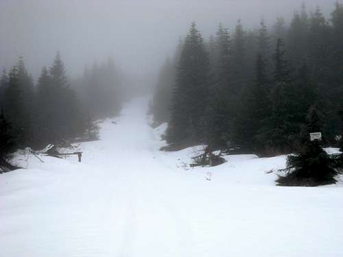
I parked at the automobile turnout just prior to the forest road gate (~460' elevation) located at the end of Hathaway Road (north of Sedro-Woolley). I noticed some local residents watching me intently, probably wondering what kind of stranger would want to apparently just go hiking up the mountain rather than for hunting or ATV use. After putting on a snowshoe pack on my back and wearing a day pack around my waist, I began my hike at 8:30 AM.
![Lyman Hill - Gate On West Side]() Gate At Beginning Of Western Approach
Gate At Beginning Of Western Approach
Unlike Dewey's trip, where he followed ATV trails up the lower western slopes of Lyman Hill, I attempted to simplify the ascent route even if it meant potentially adding a little more distance. I decided to continue following the main forest road as it first headed northward and then switchbacked eastward. At ~1530' elevation, the main forest road veered left (north) while a branch forest road continued straight. Looking over my map and GPS, I chose to continue straight along the branch road. By ~1700' elevation the road encountered a "Y" intersection. The leftside road appeared to travel along the slopes higher up than the rightside road, which appeared to head downhill along the slopes. My basic objective was to "keep going up" so I chose the leftside road.
![Lyman Hill - Important Forest Road Intersection]() At ~1530' Elevation... Go Straight!!!
At ~1530' Elevation... Go Straight!!!
The road reached its highest point at ~2030' elevation, but then appeared to go slightly downhill further along the mountain slopes. At the highest point, I quickly noticed a trail (for dirt bikes, perhaps?) apparently heading north through forest but seemingly backtracking from the direction I intended to travel. I decided to continue following the road. I could hear a small stream nearby, which the road passed over, and soon I found myself at the end of the road (~2000' elevation) near a slightly bigger (yet much steeper) cascading stream. From here I began my forest ascent, at 10:00 AM. During my forest road walk, and later during what would become my forest hike, I stopped several times to answer cell phone calls coming in. I was shocked my cell phone signal was so good under the thick forest cover, but my GPS signal was also still very good most of the time.
![Stream On Lyman Hill]() Stream Immediately South Of Road-End
Stream Immediately South Of Road-End
Andy Dewey had referenced staying left of the first stream due to the high amount of logging debris to the south, and even Eric Noel made a similar reference. Seeing how thick and brushy the groundcover on the north side of the stream was near the road-end, I decided to cross the streambed and take my chances on the other side. I could see an open logging area along the slopes not-too-far south of my location, so I began ascending in a ESE manner once I was on the other side of the stream as an effort to stay under tree-cover. It also kept me going in a basic linear path towards the summit. The beginning of the forest ascent, between ~2000'-2500' elevation, was the worst part of the entire trip. The high amount of old logging debris, as well as naturally-fallen trees and branches, was bad enough. But then add in the wet, mossy, loose ground and the steep forested ascent was slowed. I tried to stay on top of an eastward-trending slope positioned between two streams, and that seemed to work the best for me.
![Lyman Hill - Thick Western Forest]() Hiking Up Thick Forest...
Hiking Up Thick Forest...
At ~2900' elevation, I encountered a VERY old logging road, or possibly (but less likely) an old railroad grade. It was obvious from how overgrown it was that nobody had used motorized vehicles on it for many years. I briefly followed it south, passing a stream, and then once again ascended east up forested slopes. Then, at ~3100' elevation, I passed some old large bundles of wood. At ~3350' elevation, I encountered a north-south trending forest road. This road was indicated on one of my maps, although faintly so, and I began walking south and uphill along the road. Snow was not at all present, at first, and did not cover the road until ~3500' elevation.
![Evidence Of Logging On Lyman Hill]() Old Bundles Of Wood
Old Bundles Of Wood
There was one branch forest road that turned left and headed uphill northeast toward a section of the ridgetop located north of the true summit, but I opted to instead continue on the forest road I was already walking along so that I could attain the ridgetop with minimal elevation gain needed. I followed the road until ~3600' elevation, beyond the true summit, but then left the road headed east through thick forest until reaching the ridgetop forest road at ~3800' elevation.
![Lyman Hill Summit Road]() At Entrance To Summit Road...
At Entrance To Summit Road...
I was standing at the intersection of two forest roads; a north-south trending ridgetop road and and eastern branch forest road. The entire ridgetop was covered in snow, and even some rain/snow mix was lightly drizzling on me. The snow was easy enough to walk on (or through), so I opted to not bother taking out my snowshoes as my mountaineering boots were waterproof. A snowed-over gate and a "Tower Site" sign marked the entrance to the ridgetop/summit road heading north. I followed the snow-covered road up ~500' elevation to the true summit, which is the location of a small communications facility. I arrived at 12:45 PM, although I was partially delayed by cell phone calls and an elongated route path. I did not enter any of the buildings or get too close to the communications towers, and I was disappointed that the supposed "Partly Cloudy" weather forecast for the mountain that day was overcast, drizzling, and prevented any outward views from the peak. I left the summit at 1:00 PM.
![Lyman Hill Summit]() Communications Facility At Summit
Communications Facility At SummitA Careful But Carefree Descent
Rather than retrace my steps down the ridgetop/summit road, I instead opted to head essentially due west until reaching the forest road I had previously been on at ~3450' elevation. During this direct descent, I had passed by the alternate branch forest road that I previously mentioned (which heads to a section of the ridgetop located north of the true summit). The end of the second forested section prior to the correct forest road was the worst part of that direct descent, as it was steep near the road. I traversed slightly north along the forested slopes and followed a small streambed down to the roadside.
![Lyman Hill Summit Stream]() Small Stream Found West Of Summit
Small Stream Found West Of Summit
Once at the correct forest road, I retraced the ascent route and used it for my descent route. The forest descent was fairly uneventful. I was able to quickly descend the forested slopes, although the slippery terrain below 2500' elevation required me to slow down and use extra caution. By 2:30 PM I was back at the original road-end (~2000' elevation) that was mentioned earlier in this trip report. The rest of the descent was as easy as possible, as it was only several miles of walking down logging road switchbacks. I arrived back at my car by 3:30 PM.
Final Trip Analysis
ROUNDTRIP TRIP DISTANCE: 12 Miles
ROUNDTRIP TRIP TIME (including stops & breaks): Seven Hours
ELEVATION GAIN (from gate to summit): 3820'
Due to its low elevation and lack of hiking trails, I can understand why many people avoid Lyman Hill. But this is not to diminish the accomplishment of reaching its summit, especially considering the time and effort required to do so. The lack of other visitors made the trip quite peaceful. I have to admit that there were several times during the forest section between 2000' and 2500' elevation when I thought to myself,
"What am I doing?!?!?" but I continued to monitor my time and progress and never quit. Although I was disappointed the weather conditions had prevented any outward views from the mountain, I was satisfied that I completed yet another Washington peak with over 2000' of prominence. The "Dewey Approach" provided a good catalyst, and I took care of the rest.
Comments
No comments posted yet.