
-
 9118 Hits
-
 82.48% Score
-
 15 Votes
|
|
Mountain/Rock |
|---|---|
|
|
34.95374°N / 32.97675°E |
|
|
Hiking |
|
|
Spring, Summer, Fall, Winter |
|
|
5262 ft / 1604 m |
|
|
Overview
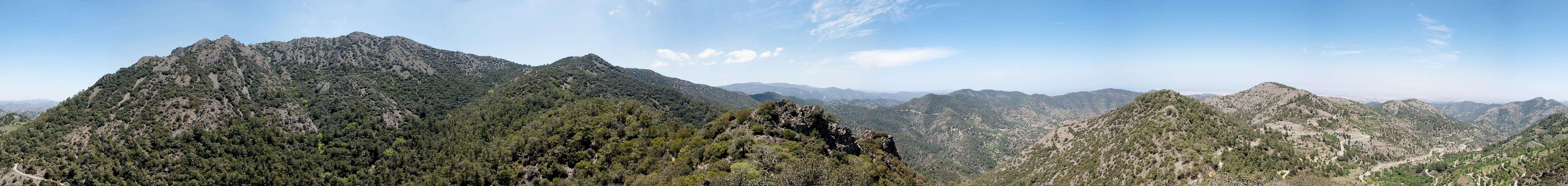
 The highest summits of Madari Ridge The highest summits of Madari Ridge |
The mountains on Cyprus are neither high nor overly impressive. There are exceptions of course like the Kyrenia Range in the northern Turkish part of the island or the rocky, almost dolomite like summit of Adelfoi in the eastern Troodos Range. In both cases the limestone structures which underlie most of the mountains on the island come to the surface. The rock is old, however and thus erosion is far advanced.
The summit of Adelfoi stands at the end of, yet clearly separated from a ridge which heads toward it from the west. The ridge, Madari (Μαδαρή in Greek)is 4km long and is one of the most panoramic places you can find on the island. It is located almost in the centre of Cyprus and thus offers among the best views to all sides. While the high Troodos with the island's highest mountain Olympos dominates the east on all other sides the views end at the coasts only.
 |  | 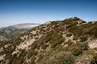 |
The Madari Ridge starts at Doxa si o Theos, a road saddle north of Kyperounta, a former mining town in the eastern Troodos. From there a winding trail leads across the multiple summits of the ridge towards its end, a saddle which separates Madari from Adelfoi. In between there are numerous lookouts, some of which "official", a term we coined for those lookouts which are advertised by signs. The last and highest of the summits naturally offers the best views
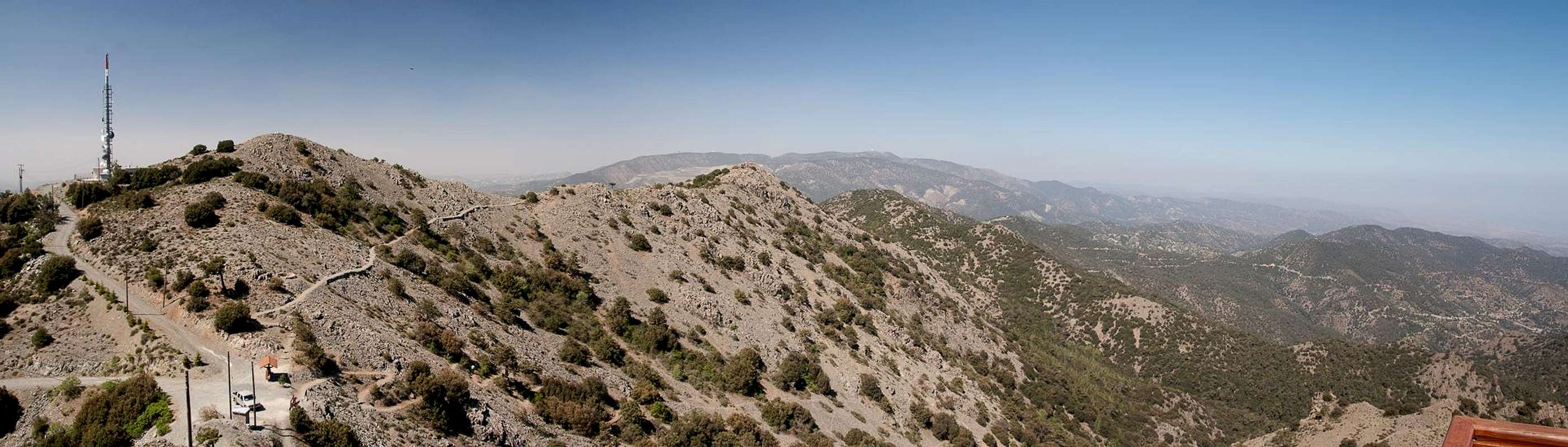  |
A dirt road leads to this saddle from the village of Lagoudera and goes on to one of the last Madari summits, on which a radio tower has been established. This road is the shortest access to the ridge but is rarely used by hikers. Trekkers, however use it often as it is part of the European Long Distance Trail E4, which runs right across Madari Ridge in one of its stages. The Lonely Planet Guides claim that the ridge is #6 of 14 things to do in the area, which ensures that it is well visited at all times of the year.
360° Panorama
 |
Getting There
 Troodos with Olympos, Cyprus' highest mountain
You can reach the Greek (southern) part of Cyprus from any major airport in Europe. The island has two international airports at Larnaka in the east and Pafos in the south-west. Both airports are connected by a motorway.
While there are several possible trailheads for Madari, the best one is at Doxa si o Theos, a saddle which belongs to the town of Kyperounta. It is located on the eastern outskirts of high Troodos an can be reached as follows:
- From one of the international airports of Southern Cyprus, at Larnaka or Pafos take the motorway (A1 / A6) to Lemesos
- At the exit 27 take E110 to Agros and Chandria
- Look for signs to the locality Spilla from where a short ascending road takes you north to the saddle Doxa si o Theos
Red Tape
 Madari Ridge from its base in the north
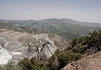
There is no real red tape here. Dirt roads lead to within several hundred metres of the highest summit on the Madari Ridge but they are only open for forestry personnel. The fire lookout on the summit of neighbouring Adelfoi is the only one on the island, which is open for hikers / visitors. There is a small picnic area underneath its roof.
Accommodation
Accommodation of all kinds is easy to find along the coasts of the island. You can book hotels and apartments from any travel office. Moreover, a lot of British expatriates are living on the island part time. You can get lucky to book one of their winter homes in summer.Near Madari few accommodation can be found. The closest village is Lagoudera, about 100m underneath and east of the summit. It didn't look like there were any hotels or inns in the village. However, on the south coast on the strip between the cities of Lemesos and Larnaka there is lots of accommodation.
Weather Conditions
Maps & Books
Maps
I must admit that I didn't find any decent maps of the island, maybe caused by the military nervousness mentioned above. I have used the following street map:
- Cyprus / Chipre / Zypern
1:200 000
Freytag & Berndt
ISBN: 978-3-7079-0478-9
Books
Here the situation is different. An excellent guidebook is available from Rother Verlag, both in German and English. It covers the whole island in 50 daytours.
- Zypern (Süd & Nord) / Cyprus (South & North)
Rolf Goetz
Rother Wanderführer / Rother Walking Guide
Rother Verlag
ISBN (German): 978-3-7633-4271-6
ISBN (English): 978-3-7633-4814-5