
-
 3466 Hits
-
 73.06% Score
-
 3 Votes
|
|
Route |
|---|---|
|
|
46.73860°N / 12.67920°E |
|
|
Scramble |
|
|
Half a day |
|
|
Walk-Up, Exposed |
|
|
Approach
The ascent starts at Untertillach. See the "Getting There" Section on the main page.
Route Description
- Start altitude: 1235mm
- Summit altitude: 2591m
- Prevailing exposition: S
- Type: 1h over forest roads, 1h over paths, 1h 30min summit scramble
- Protection: marked but without security
From Untertillach you follow the road to Kirchberg. You can go to the village by car but have to stop there. From Kirchberg still follow the road which turns into a gravel one and soon you'll get to an intersection. Take the left hand road, marked 35. After some 3km the trail leaves the road to the left and starts to ascend steeply through the forest. It takes another 600m to get you to the lower part of Kircher Alm, where you leave the forest at a cross beside the trail.
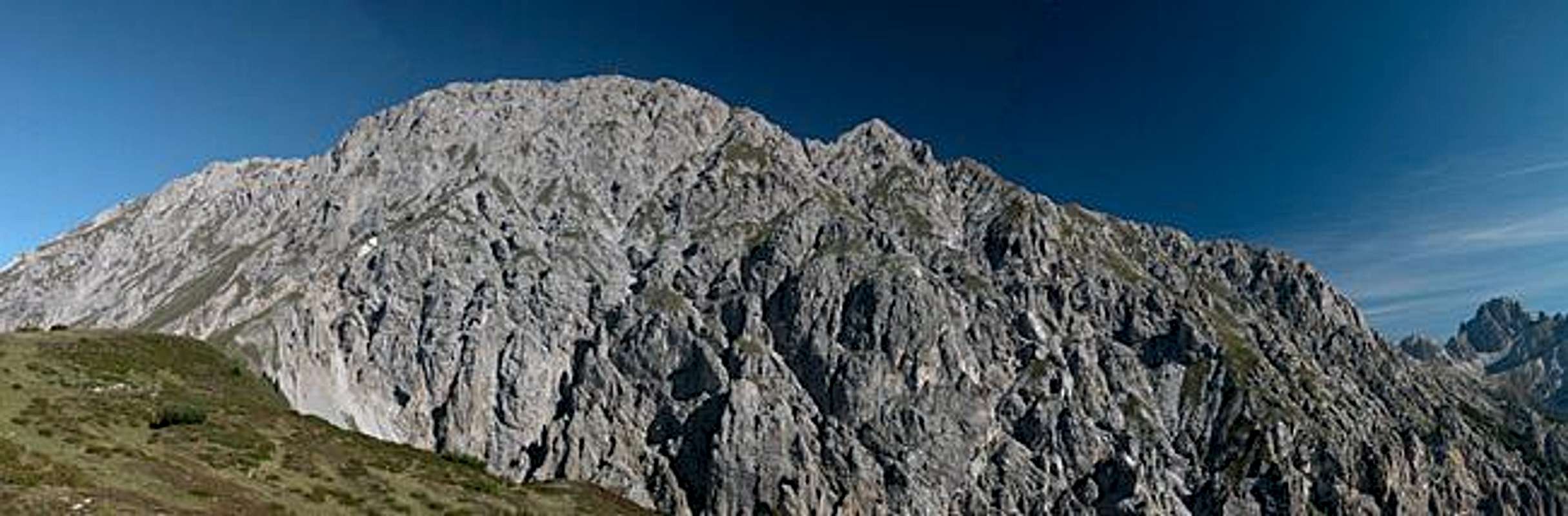
From the cross turn directly northwards and scramble across the meadow in the direction of Eggenkofel. There is no trail, there are no marks; we followed the tracks of a truck or tractor. You'll reach the cabins of Kircher Alm and have to head onwards to the north. After another 500m a trail meets our ascent route from the east (the Gailtaler Höhenweg trekking trail). Still head northwards, though now on almost level terrain. You'll reach the Halsl Joch easily.
At Halsl another Ascent route (from Eggen) meets ours also coming from the east. We however head northwest to look for the starting point of the final ascent. It is marked by a wooden sign, which is rather hard to read. The first steps of the ascent are easy but after 15 minutes you reach the bottom part of the scree gully. Negotiate to the other (western) side and there start ascending along the gravel. The gully gets narrower and you have to climb a short UIAA grade II section. In fact this climbing section is among the easier parts of the ascent.
Once on top of the climbing section the now usual gravel starts again, leading into a beautiful gate / pass. Take your breath since now the following steep ledge - also covered by scree - has to be negotiated. The ledge is moderately exposed but there is no sure footing.
On top of the ledge the trail turns west and now heads - more or less - direclty for the summit. A last traverse is required before you reach the summit cross. The traverse to the western summit is not too demanding but very exposed in places.
 |  |  |  |
Essential Gear
Normal hiking gear is sufficient, ropes are of no use in this type of rock.