
|
|
Mountain/Rock |
|---|---|
|
|
49.24656°N / 19.10180°E |
|
|
Hiking, Scrambling |
|
|
Spring, Summer, Fall, Winter |
|
|
4408 ft / 1344 m |
|
|
Overview
|
|
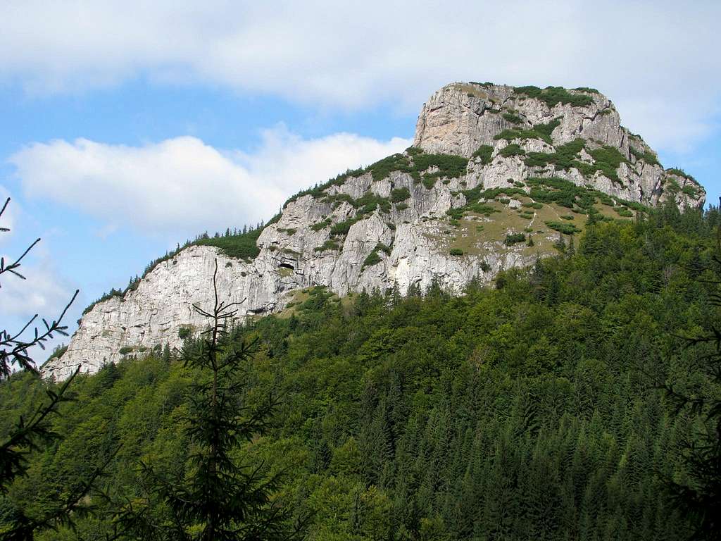
Malý (Little) Rozsutec (1343.5m) stands about a mile north of Veľký (Great) Rozsutec. As the below photograph illustrates, the mountain is aptly named. Malý Rozsutec, being 266m lower and smaller in bulk than Veľký Rozsutec, does look equally bold and is perhaps only a little less alluring. An ascent of Malý Rozsutec can be an interesting addition to the climbing of Veľký Rozsutec. A there-and-back walk from the saddle called Medzirozsutce (literally Between Rozsutecs), which lies at the northeastern end of the Veľký Rozsutec massif, takes less than an hour. (The climax of this walk is an exposed, chain-assisted YDS Class 3 scramble.) But Malý Rozsutec can surely be a destination in itself, which is what the next chapter is concerned with. |
|
Route
|
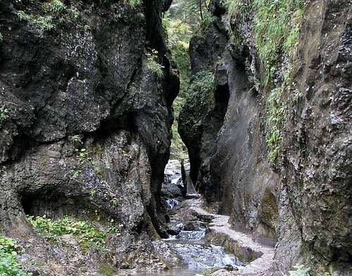 The gate to the gorge The gate to the gorgeThe best start point for climbing Malý Rozsutec alone is the eastern part of the village of Terchová which is named Biely potok (White Stream), after the brook which runs along the highway and connects here to Hlboký potok aka Dierový potok, flowing from the mountains. From Biely potok two trails head south-east, towards Malý Rozsutec. You can make these trails into a neat loop hike: nearly 12km long, lasting 4.5-5 hours, with a total elevation gain of over 800m (net approx. 700m). The green trail, which diverges off to the left immediately to slowly run uphill, seems to be more appropriate for the descent. The blue trail runs all along Hlboký potok up to its sources at Medzirozsutce saddle and is an attraction in itself. The stream has carved a narrow gorge, which is traversed by the trail with the assistance of steel ladders, chains and fixed cables. The local name for a gorge is ‘diery’, which literally means ‘holes’. You will be walking up Dolné (Lower), then Horné (Upper) diery. 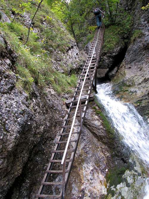 In the gorge In the gorgeAt Medzirozsutce saddle (1200m) turn left, following the red marks, to walk half a kilometre to Zákres saddle (1229m) at the east foot of Malý Rozsutec. 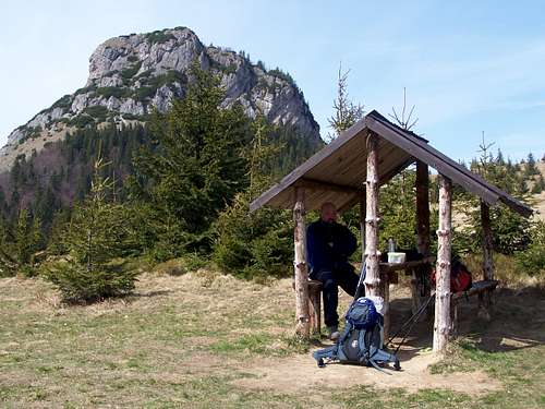 From Medzirozsutce saddle - by bartek From Medzirozsutce saddle - by bartekAt Zákres saddle bear left again and – picking the green marks – start the final stage of the ascent. Part of this section is exposed and chain-assisted, and can be classed as YDS Class 3. This is the diagonal couloir visible in the above photograph parallel to the left-hand side of the roof of the shelter, more or less halfway between the roof and the upper edge of the photo.  Zákres saddle from near the top - by rama Zákres saddle from near the top - by rama The flat and pretty broad top of Malý Rozsutec offers some good views, especially that of the north face of Veľký Rozsutec.  Veľký Rozsutec from the summit - by bartek Veľký Rozsutec from the summit - by bartekThe descent down the other, west side of the mountain, despite being less exposed than the final section of the ascent that you have just made, is even steeper and can be unpleasantly slippery, especially when it is wet. Where there is no chain to help you, you can – to some extent – rely on the springy branches of dwarf mountain pine, whose bushes line the path near the summit. After this tricky section, the rest of the walk is a rather steady descent along forest tracks and across meadows, past the abandoned hamlet of Podrozsutec with a few chalets and summer cottages. 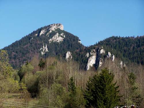 From Podrozsutec - by bartek From Podrozsutec - by bartek |
Maps
Red Tape & Warning

- The area is part of the National Nature Reserve Rozsutec, which is a part of the Malá Fatra National Park. Camping and rock climbing are not permitted. You have to stick to the waymarked trails.
- Malý Rozsutec is accessible all year round whereas the trail over Veľký Rozsutec is closed from 1 March to 15 June.
- In Slovakia those who do not carry commercial insurance have to pay for any rescue services rendered by Mountain Rescue Service (HZS). In an emergency call 18 300
Getting There & Accommodation

- The most convenient trailheads for climbing Malý Rozsutec are at the village of Terchová, which lies about 25km east of Žilina, one of the largest cities in Slovakia. There is a quite frequent direct bus service from the city to the village.
- Timetables for Slovakia's trains and buses
- There are hundreds of rooming houses, guesthouses and several hotels in the nearby villages. You can check out the following link for Terchová.
When To Climb & Weather
To avoid the crowds, it is advisable to go on a weekday in late spring, September or October. Some people might be keen on a winter adventure, for which you will need the basic gear and some experience: Here is an interesting video.