Prologue
Stats:
Mountains: Mt. Sherman (14,036’) and Dyer Mt. (13,855’)
Route: Started at winter road closure and climbed W. Slopes of Sherman, traversed to Dyer and skied S.E Slopes down to Iowa Amphitheater and back to the Sherman road.
Elevation Gain - 3400’ (approx)
Roundtrip Mileage - 12 miles (approx)
Crew: Joe, Prakash
NOAA conjured up a fantastic weekend forecast for the high country in general and the stage seemed well set for a 14er. After some incessant haggling I managed to convince Joe to give up delectable alpine ice routes to climb a mind-numbing heap of rubble instead. The plan included lugging skis to the top and finding something worthwhile to ski down. Neither of us had been up in the high country in over a month thanks to extended vacations at or below sea level. We were both interested in a warm-up and were both interested in a preliminary snowpack assessment. I was also excited to test my newly acquired overkill mitts (OR Alti mitts) on a winter 14er for the first time. We also carried standard avalanche gear – Beacon, probe, shovel plus first aid kits, sam splint, spare parts, stove and emergency bivy gear.
We got to the winter trailhead at 8:15AM after driving around for a little while and getting stared down fiercely by an honest gas station owner whose bathroom I shamelessly used without purchasing any of his fine goods. Trailhead directions from 14ers.com mention taking Monroe Street to Toledo St. at the South end of downtown Leadville. It’s probably worth noting that Monroe Street is now unmarked where it meets US 24. If you see a turnoff for CR-6 on your left while following 14ers.com directions, you’ve gone too far.
Snowpack Shear Tests
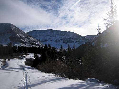
We skinned up and set out along the road shortly after 8:30AM. There were skin tracks heading up it so trail-breaking was a non-issue.
![001]() Skinning up the Sherman road
Skinning up the Sherman road
The first objective of the day showed up after a short while of un-interrupted skinning. A more un-picturesque heap of rubble than Sherman is yet to be seen but it was going to be a glorious day nevertheless.
![003]() Sherman makes an appearance
Sherman makes an appearance
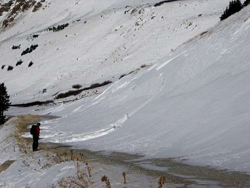
A short while before arriving at the summer trailhead at 12000’ (it’s 3 miles to this point) Joe decided to test the snowpack. A few jumps on a Southwesterly snow-slope below the road produced a clean shear, releasing a 6 inch to 1 foot thick slab that ran five feet.
![011]() Fracture
Fracture![013]() Closer look at the fracture
Closer look at the fracture
We skinned on a little further up the road and Joe decided to test the slope above the road…
![016]() More snowpack testing
More snowpack testing
A few jumps on a similar aspect as before produced nothing and he skinned a few feet and began skiing down producing a large ~60 yard (maybe more) long clean fracture line varying in depth from a few inches to a foot. It ran a few feet down to the road.
![032]() Results of second shear test
Results of second shear test![029]() Closer look at results of second shear test
Closer look at results of second shear testSherman Ascent
These interesting discoveries strongly suggested conservative route choices for the rest of the ascent and ski descent. We stopped to brew up some noodle soup near the upper TH at 12000’. Beacons went on and were tested after brunch. Some questionable terrain remained prior to attaining the dry upper West Slopes of Sherman. Joe led the questionable areas. As the more experienced BC traveler his decision making is far quicker than mine. I followed without debate. We stayed as high as possible on most slopes and close to rocks and tundra whenever they were available.
![040]() Safe Route Selection
Safe Route Selection
One gully had slid earlier showing debris.
![038]() Wind lip and Slide Debris
Wind lip and Slide Debris
More avalanche debris coming from Sheridan had slid down into the prominent gully on Sherman’s W. Slopes on a more active avalanche day.
![043]() Debris from Sheridan
Debris from Sheridan
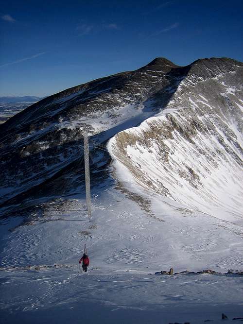
We were glad to finally be gaining elevation after miles of skinning a flattish road. We were soon on the saddle between Sherman and Sheridan.
![045]() Sherman - Upper W.Slopes
Sherman - Upper W.Slopes
After a short sugar / water break we continued on to the summit. Wind picked up and balaclavas went on. I always remember baklava when I put my balaclava on… Note to self: Bring baklava on next winter hike. After a long ridge walk we reached the summit just before the safe turnaround time. We would have no time to relax on the summit though. We decided to start heading off to Dyer after a couple summit pictures and half a power bar.
![047]() Looking into the future
Looking into the future![048]() When atop an ugly heap like Sherman you look elsewhere for beauty - Photo (c) Joe
When atop an ugly heap like Sherman you look elsewhere for beauty - Photo (c) Joe
D’yer Mak’er… (use your best British accent for desired effect)
![049]() Dyer Mountain (13855')
Dyer Mountain (13855')Traverse to Dyer and Descent
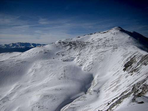
We began heading over to the saddle between the Geminis. We crested the cleavage between the Geminis and headed down to the ridge over to Dyer quickly. Some cornices / wind lips appear on the ridge and are easily avoided.
![053]() The ridge to Dyer - © Joe
The ridge to Dyer - © Joe![054]() The ridge to Dyer - 2 © Joe
The ridge to Dyer - 2 © Joe
Conservative ski lines were available...
![057]() What shall we ski? © Joe
What shall we ski? © Joe
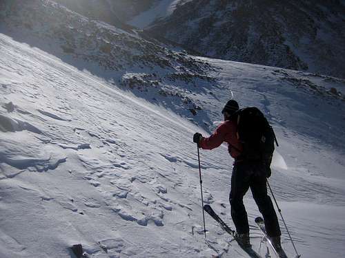
But the summit had to be reached first. Crunchy snow was available, beautiful, solid and perfect for climbing. These conditions produce a beautiful feeling. Joe built a staircase…
![058]() Stairmaster © Joe
Stairmaster © Joe![060]() Crunchy solid snow - Perfect for staircases © Joe
Crunchy solid snow - Perfect for staircases © Joe
The summit was reached. It took 1:15 to traverse over from Sherman. We ate some food and drank some Gatorade that had by now turned into a delicious icy slurpy.
![064]() Dyer
Dyer
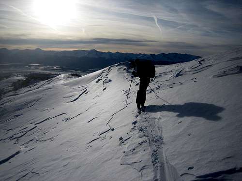
Thanks to the relatively quick time to traverse we didn’t need to rush the descent… which was great for me personally, since I intended to spend most of the descent skiing the available trap crust ludicrously fast, with no control, falling on my mug with obscene regularity. Joe watched patiently and shook his head in abject dismay. I cast a veil of modesty over the numerous pictures of me planting my face in ‘crap’ crust. Instead, here are a few more picturesque ones of Joe’s descent…
![072]() To Iowa Amphitheater we go
To Iowa Amphitheater we go![075]() Safe Ski line along the ridge
Safe Ski line along the ridge![077]() Safe Ski line along the ridge 2
Safe Ski line along the ridge 2![078]() Skiing into the sunset
Skiing into the sunset
Quick time was made on the descent (compared to my past experiences with snowshoes). We were back at the car shortly after 5. A safe and fun first winter ascent for 2010 is in the books.


Comments
Post a Comment