
|
|
Mountain/Rock |
|---|---|
|
|
48.04326°N / 121.8959°W |
|
|
Snohomish |
|
|
1470 ft / 448 m |
|
|
Overview
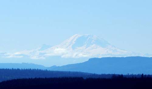
Menzel Hill is a nondescript, 1470' (740' prom.) high point located four miles southeast of Granite Falls, WA. Covered with a patchwork of clearcuts and second growth of various ages, it is by no means a pleasure to look at. It is the views FROM this foothill, however, that can make it a worthy objective when the 'big peaks' are snowed in.
While Menzel Hill is just one of the many Granite Falls area 'Dumpster Dives', it does have one distinct advantage that many of them do not: reasonable walkup access. With a distance of less than three miles from the 'trailhead' to the summit area, this viewpoint will appeal to those who are 'mountain bike challenged'. Having said that, a bike will make this trip more enjoyable, as well as enabling further exploration (particularly for those who must touch the true summit).
Note: 'Menzel Hill' is a name of my own concoction. I have not been able to find any reference for this high point beyond 'Point 1470'. I figured since this hill lies immediately east of Menzel Lake and Menzel Lake Road, the name is as good as any. If anyone can point out a previously appointed name or more appropriate name, I will be happy to make the change.
From Granite Falls, follow Menzel Lake Road (starts out as E Pioneer Street) southeast from town for 4.3 miles. Locate the 'trailhead' on the left (east) side of the road, which is easily identified by a wide gravel turnout and yellow gate (N48 02.068 W121 54.873 Elev. 549').
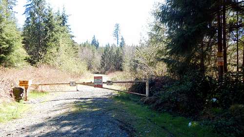
Menzel Hill 'Trailhead'
Do not confuse this 'trailhead' with the much larger P5000 'trailhead', which is on the same side of the road, just 2000 feet to the south. There is ample parking for 4-6 cars, although I've never seen more than two cars parked at this location. Please ensure that you park off to the side, and do not block the gate. Unfortunately, this area now requires a 'Discovery Pass' for parking.
Please note that for those approaching from the south, it is perfectly acceptable to drive up from the Lake Roesiger area. Simple follow Lake Roesiger Road/Menzel Lake Road for 3.8 miles north from the Lake Roesiger store.
Note: The map below would seem to suggest that it would be simple to approach Menzel Hill from Scotty Road. Indeed, this was the case until recently. Unfortunately, tank traps and log piles have made this approach unreasonably difficult. It may be just as well, as the approach from Menzel Lake Road is much more scenic.

Menzel Hill route map
From the gate, walk/ride the moderately steep mainline, ignoring badly overgrown spurs, for 1.2 miles, to an intersection labeled as 969' on the USGS map. (For those interested in a really short trip, taking the left fork to the end will place you in a new clearcut with expansive west views.) Turn right, and continue on the mainline 0.3 miles to another intersection. Turn left, staying on the mainline, which will begin climbing steeply - most will prefer to walk their bikes through this short section. After another 0.4 miles (1.9 from the gate), at a left switchback, the views to the south and west will begin to open up.
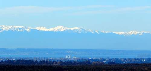
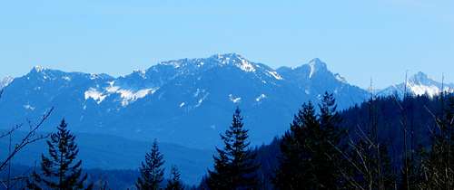
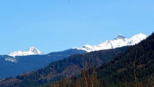
Downtown Everett and Olympics from Menzel Hill
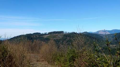
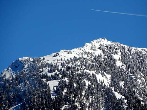
Continuing up the mainline, in short order you will pass by a gravel quarry area on the right. If you are thoroughly bored, it is possible to scramble to the top of the quarry for some views, but it isn't anything you won't see from higher up. As you continue on, the mainline will twist to the right and left a few times. At a point roughly 2.8 miles from the gate, you will arrive at the first of two spurs leading off to the right. Ignore this spur, continuing up the hill a short distance to the second spur. At this point, you will be at the mainline's 'summit', at an elevation of 1410'. Recent logging in this area has opened up the views nicely, particularly to the north and east.

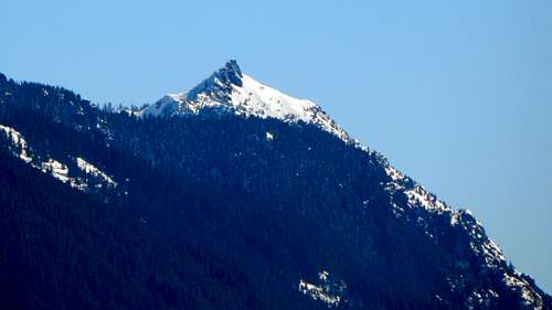
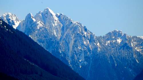
Menzel Hill north through southeast pano

For the strange prominence peakbagger types who need to touch the true summit, continue on the mainline another 0.8 miles to a well defined spur on the left - you will lose about 300' of elevation in the process. Follow this spur 0.4 miles to a four-way intersection. Turn left and follow this spur to its end. At this point, you will be in the 'summit area', but it will be necessary to leave the road and bang around in the second growth with your GPS to get the job done. Note that there are three candidates for the true summit (enclosed by 1460' contours), none of which provide views.
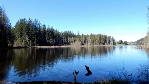
Assuming you did take the time to visit the no-view summit, there is a small, unnamed lake in the area which can be claimed as a consolation prize. Interestingly, it is not shown on the USGS map. It is actually nicer than it looks on Google Earth (although it is probably a swamp in late summer), and seems to get visited by a plethora of waterfowl. The blue line on the route map above shows the side trip to the lake.

Unnamed lake on Menzel Hill
Speaking of lakes, if you have ever wondered where Menzel Lake Road gets its name from, you are in luck. From the 'trailhead', Menzel Lake is just a three minute walk away. Cross Menzel Lake Road, and locate a poorly defined dirt road that is blocked with a cement ecology block. Follow this dirt road/path downhill through the woods (unfortunately, passing copious quantities of garbage along the way), and before you know it, you'll be at the south end of Menzel Lake.
Menzel Lake