
-
 9064 Hits
-
 87.31% Score
-
 24 Votes
|
|
Mountain/Rock |
|---|---|
|
|
34.38050°N / 118.1967°W |
|
|
Los Angeles |
|
|
Hiking |
|
|
Spring, Summer, Fall, Winter |
|
|
6015 ft / 1833 m |
|
|
Overview: The View's The Thing
NOTE: At the present time, and until further notice, most of the Angeles National Forest is closed to access due to the destructive "Station" fire that ravaged the San Gabriel Mountains in August and September of 2009.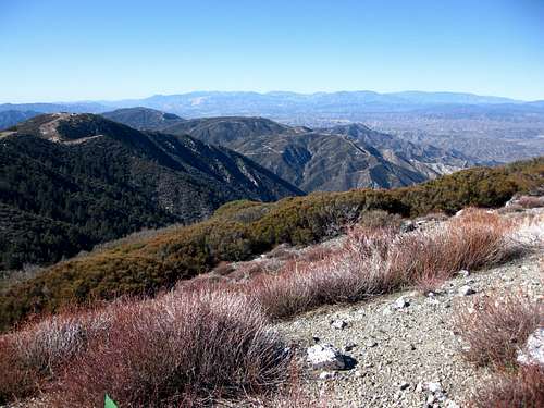 View west from summit of Messenger Peak, 1.16.09
Frankly, the sole reason for giving this peak a page is that the views from its summit are fabulous. They are incomparably better than the views from its close, better known neighbor, Mt. Gleason. To the north, enjoy the expanse of the desert and Antelope Valley. Magic Mountain is to the west. Southward is the Big Tujunga watershed and southeast rests the Mt. Wilson crest.
The route described here has you going first over the Mt. Gleason summit. The other option is drive all the way to Messenger Flats Campground and ascend from there, but that is hardly a hike.
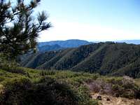 Looking SE along route to Messenger Peak
 View south to Mt. Wilson crest en route to Messenger Peak
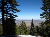 Mojave Desert view from PCT near Mt. Gleason 1.16.09
From your parking location as described below in Driving Directions, pick up the Pacific Crest Trail (PCT) on the north side of the road. Continue on the PCT for about 2 miles where you will reach the ridge north of Mt. Gleason. Go left (south/southwest) for less than ½ mile to the broad open summit of Gleason.
From here, continue in the same direction for a few minutes and you will come to gate abutting the main road near some microwave towers. Take a right past the gate and follow the road and signs for about 1.5 miles to Messenger Flats Campground. Continue past the campground. You can either stay on the road all the way to the summit or get off the road and head directly up a steep firebreak to the top.
This route is about 8 miles round trip with about 1800’ of gain. Note that you could start this hike 4 miles further back by starting at the spot where the PCT first intersects the Mt. Gleason Road.
Driving Directions
From the 210 Freeway, exit at Angeles Crest Highway (SR 2) and go north for 9.5 miles to Angeles Forest Highway. Turn left onto Angeles Forest Highway and drive 14.2 miles to the signed Mill Creek Summit Picnic Area on the right. Immediately across from the Mill Creek Summit is the Mt. Gleason Road (County Road 3N17). Take a left onto Mt. Gleason Road. At 6.2 miles there is a fork. A paved road goes right into a correctional facility. Take the dirt left fork around the facility. The dirt road returns to pavement near the bottom of a saddle. Park off the road in this vicinity. The Pacific Crest Trail is on the north side of the road.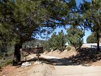 Fork: prison on right; freedom of the hills straight ahead
Red Tape
No permit needed for hiking. You will need an Adventure Pass to park your vehicle. They cost $5 for a daily pass and $30 for yearly. Interagency Annual, Senior, and Access Passes may also be used. These passes are sold at Forest Service stations, most sporting goods stores, and, as of February 1, 2008, on-line.Camping
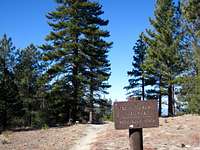 PCT across from Messenger Flats Campground 1.16.09
Right below the peak is Messenger Flats Campground, a fully developed facility, including car camping. Lightning Point Campground is a group facility within a couple of miles of Messenger Flats.
When to Climb/Mountain Conditions
Year round. In the winter there may be snow cover on the route so boots or snowshoes may be appropriate depending on conditions.Check forecast information in local newspapers or internet weather services during the winter months. Check with Cal Trans (see link below) on road conditions and closures.
Other Information
USGS Topos Acton 7.5Tom Harrison Angeles Front Country Trail Map (1:63,360 scale)
San Gabriel Mtns. Recreation Topo Map (1:62,500 scale), Western Section
(Angeles National Forest and the Verdugo Mountains) by Fine Edge Productions
External Links
San Gabriel Mountains Discussion ForumCalifornia Dept. of Transportation
Adventure Pass information
Purchasing forest parking passes on-line