

Comments
No comments posted yet.
|
|
Trip Report |
|---|---|
|
|
Nov 11, 2017 |
Since Shaylee's brother had been to the Mexican Volcanoes the year before, it was time for a daddy-daughter trip. Shaylee (my 13 year old daughter) and I headed for Mexico in November 2017 to climb some volcanoes (ones I hadn't climbed yet), go horseback riding (at the time Shaylee's favorite thing to do), and to do several other activities. Shaylee also wanted to see the butterflies at Cerro Pelón since we had watched a documentary on the butterfly migration. She is a big fan of art, so we went to some of the famous artistic towns as well, but since this is a mountaineering website, the focus of the trip report will be on that.
This would be Shaylee's first trip to the Mexican Volcanoes and my thrid (thus Mexican Volcanoes III in the title of the trip report).
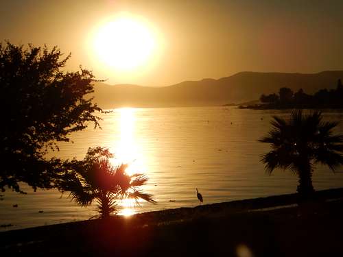
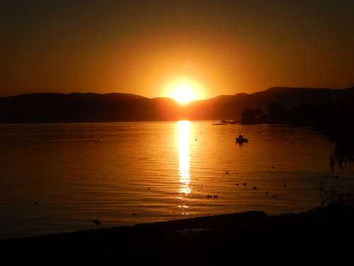
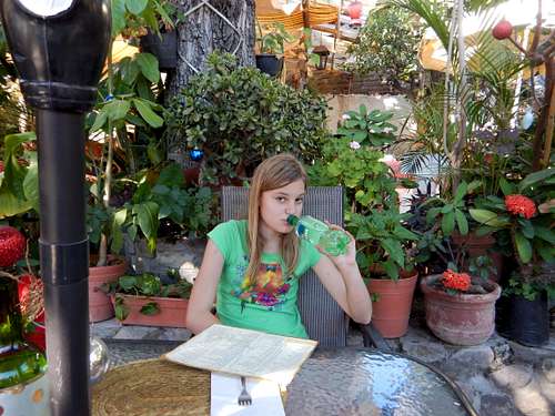
After arriving in Guadalajara that morning, Shaylee and I headed for Ajijic to view the art galleries and to walk along the lake. After walking around town and the art galleries at Ajijic, we walked the trail along Lago Chapala. There were many birds in the shallow lake including herons, ducks, and pelicans. There were many colorful birds in the trees as well. We saw the sunset from the end of the trail at which point we walked back to the hotel.
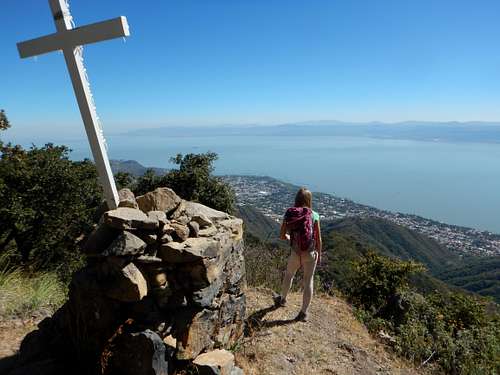
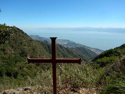
Today we hiked up the Sierra El Tucuan and La Chupina above Ajijic and Lago Chapala. We took the "red" Chapilla Trail up the steep ridge. The views of the lake were nice and we saw several vultures, but the hike was very hot. We made it to the ridge top where there were views of Gualajara and then headed west along the ridge to the crosses at a viewpoint. We then climbed over a high peak before reaching a religious shrine at a saddle. After heading to the highpoint, we returned up and over the mountain and and came down the Chapilla Trail. Since it was hot we were running a little low on water. We took a side trail that dropped into the canyon with the waterfalls, but they were dry. We passed several cows and made out way to an alternate trailhead and then to the hotel. We then took a bus to Guadalajara and then Cuidad Guzman to get ready for our next climb.
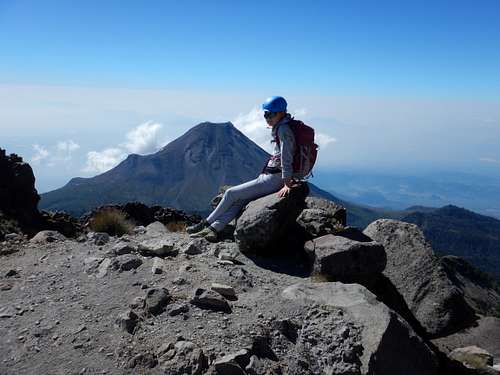
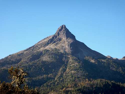
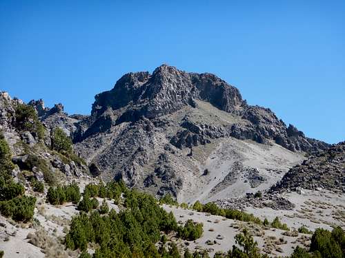
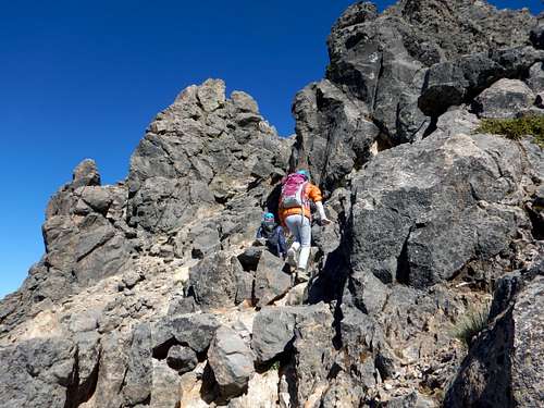
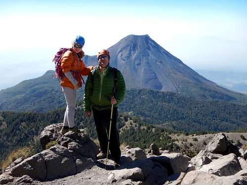
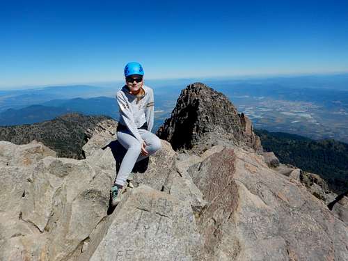
Today Shaylee and I got up early and headed for Nevado de Colima with a driver/guide (unless you have your own car, it is hard to get to the mountain without a driver/guide). From the north, the peak resembles the Matterhorn and is one of the more interesting mountains in Mexico.
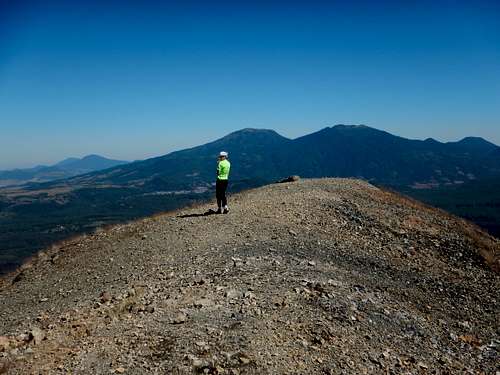
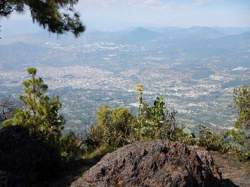
We made the long drive to the peak and then to near the radio towers. We traversed the south side of the mountain to a steep scrambling route up the south face. We made it to the summit without any trouble.
It was sunny, but there was some pollution in the lower valleys.
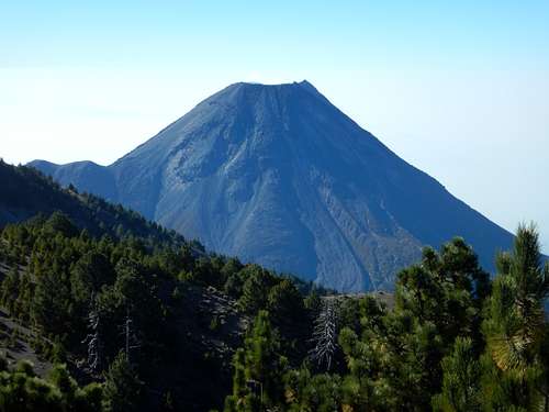
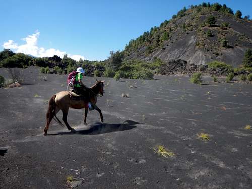
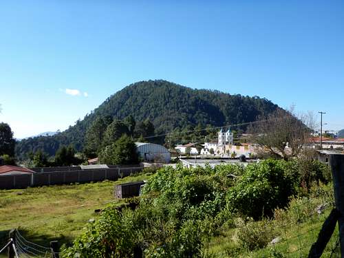
Today we got up early and took a taxi to Angahuan so we could climb Parícutin, the world's youngest mountain. We found some horsed and a guide (Shaylee wanted to go horseback riding) and rode the horses to the base of the volcano. It as a punishing ride of several hours in a hard wooden saddle!
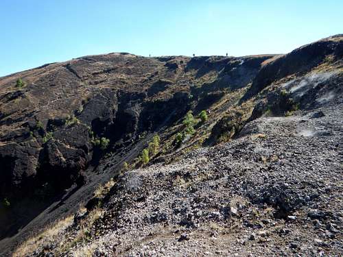
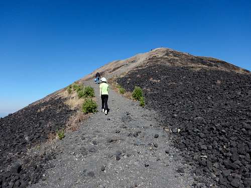
We climbed the volcano from the south side. It wasn't that long of a climb, but since the route was steep and over loose cinders, it was quite strenuous.
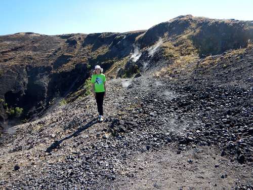
Once on top, the view of the crater was impressive and the rocks were still steaming. Some girl sat too close to one of the vents and burned her butt.
The views were nice and after having a snack on the summit, we headed back down a steep cinder chute. It was a very fast run down!
Parícutin was formed between 1943 and 1952. It erupted in February 1943 and grew into a volcano after only a few months.
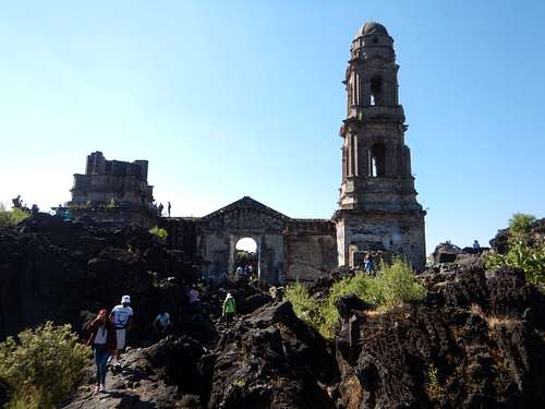
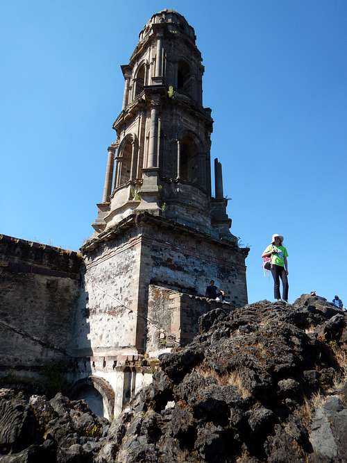
After descending the volcano, we got back on the horses and rode to the trailhead for the old San Juan Cathedral ruins. The rest of two towns here was buried under lava and only the church sticking out of the lava remains.
After visiting the old church we got back on the horses and headed back for town. We caught a ride to the main highway and waited for a minibus to Uruapan. While waiting for the minibus, someone was selling local produce, including some giant peaches. Shaylee at one.
After reaching Uruapan we went for ice cream and walked around town.
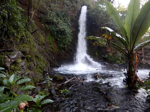
In the morning we visited and walked through the Parque Nacional Barranca del Cupatitizio near Uruapan. There were some nice waterfalls and birds. After walking through the national park, we returned to town where there was a parade going on since it was Revolution Day in Mexico.
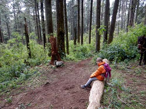
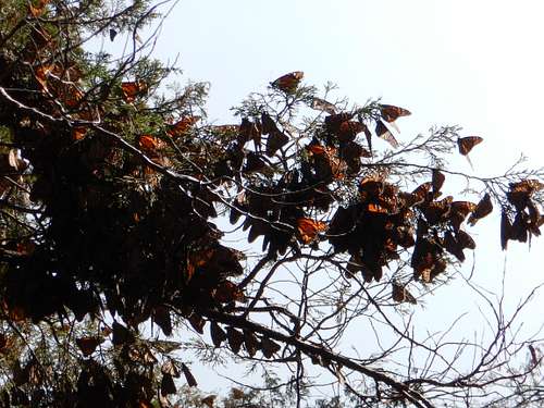
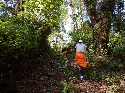
Today Shaylee and I rode horses up to a meadow on Cerro Pelón to see the butterflies. Hundreds of millions (maybe even billions) of monarch butterflies gather here for the November through March season. There are so many butterflies on the tree branches that they sag from the weight and when the butterflies take to flight it is actually noisy.
We walked up the steep path up the mountain to the butterfly colony. At first all of the were rather docile since it was cloudy. we waited around for the sun to come out and once it did, the butterflies took to flight and there were thousands of them. It was an impressive sight.
We also saw several humming birds and other birds.
After seeing the butterflies, we hiked back down the mountain and rode the horses back to the village of Mucharos, where we were staying.
Today's ride was much less punishing than the one on Parícutin since the saddles were nicer!
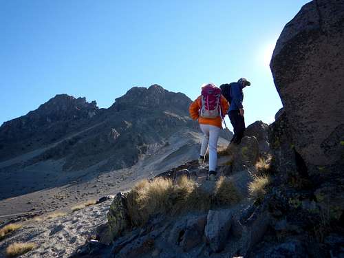
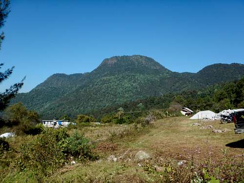
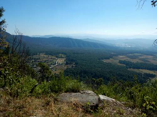
Shaylee wasn't feeling well today, so without her and with a local, I climbed Cacique, an impressive mountain south of Macharos.
We walked down to the village of Rincón, though avocado fields, and over a few barbed wire fences to the trail. We followed several trails and an old road to a spring high on the mountain.
From the spring, we followed a steep trail up to a cave and after checking it out, to a faded trail and a minor bushwhack to the summit plateau. There were cows near the summit. We say many colorful birds and some butterflies.
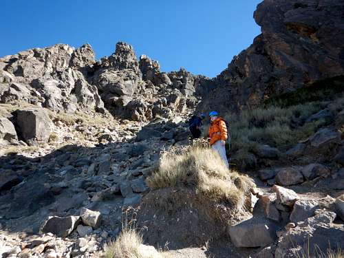
We walked across the summit plateau to a huge cross at a viewpoint of Zitácuaro. We took a nice rest there and headed over to the true summit with some bushwhacking along the way.
We tried to follow a more direct route down to the cave, but there were too many cliffs and too much bushwhacking. We returned to the trail we took up and followed it to the cave and spring.
From the spring we took a different way down. We took a trail which was faded in places that traversed the west side of the mountain and stayed above town. We eventually met the trail from Cerro Pelón and followed it down to Macharos. It was a nice hike, but pretty long. The route down was longer than the route up.
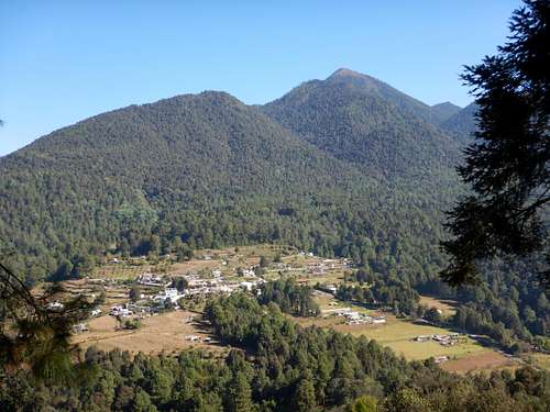
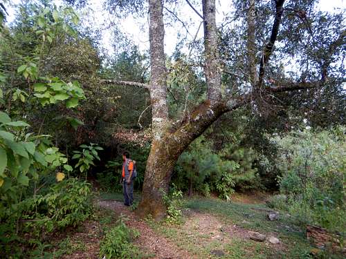
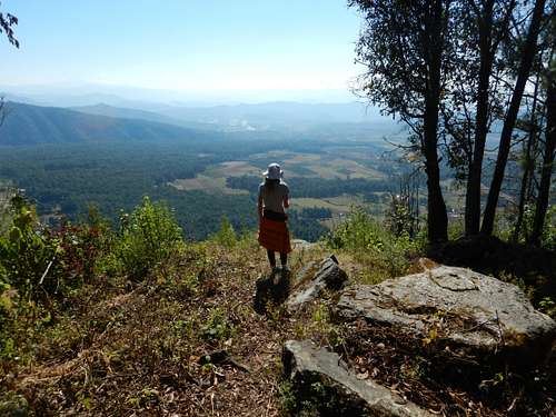
Today Shaylee and I climbed Cerro de la Silla from Macharos. It was a shorter climb than I had yesterday. We went with a local so he could point out the Aztec pyramid in the forest near the summit. It hadn't been excavated, but had been grave robbed.
After visiting the pyramid, we headed for the summit. There was a nice viewpoint just before the summit and we could see all the way to snow covered Nevado Toluca.
We saw several birds including hawks and eagles.
After enjoying the views we headed over the summit and came down a different route. It was a nice hike.
After the hike we head to take a taxi to Zitácuaro and then a bus to Mexico City since we had to fly out the next morning.
After visiting Cerro de la Silla, it was time to head for Mexico City. We spent a day seeing the sites in the city before heading for home. It was a memorable trip and one of Shaylee's favorites.