
-
 3554 Hits
-
 78.27% Score
-
 9 Votes
|
|
Route |
|---|---|
|
|
46.40420°N / 12.48610°E |
|
|
Summer |
|
|
Most of a day |
|
|
II/II+ PD |
|
|
Overview
What's New on this Page?
* Jul 28, 2017 - Ownership switched by andrea
* Jul 31, 2017 - Page under review
* Dec 16, 2019 - Overhaul
Monfalcon di Montanaia seen from east
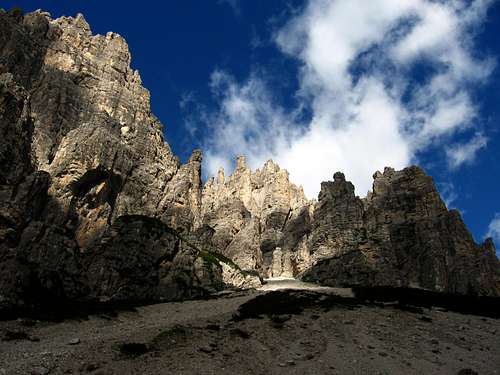
The Normal route of this mountain allows the ascent along the easiest and logical way. The mountain is fraught with pinnacles, and the identification of the route is difficult because very twisted. The peak appears only at the last moment. However, the route is marked by red marks, often very faded.
The route here reported is a typical normal route: too hard for a simple hiker, but not enough for a rock climber... For this reason it’s not overcrowded like the surrounding via ferratas or the fashion climbing routes where you have to put yourself in queue... Here, instead, you can find the emotions of the first pioneers.
The rock, is in general quite crumbly, and the danger of falling rocks is very high. However, on this area, climbers are rarely, especially in autumn (best time for Domites). The difficulties almost never exceed the II °, and for the more skilled climbers the use of the rope is optional. Indeed, in some cases the rope may be the cause of falling rocks.
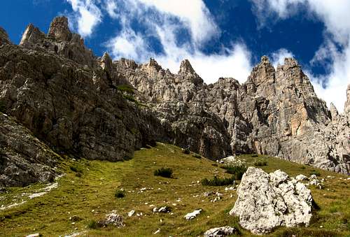
The "Cadinut di Cimoliana"
It 'a climb "old style", on a mountain a little known and very different from the modern routes of nowadays. It requires no special climbing skills, but self-control and sense of direction. As well as the absence of dizziness.
The route starts from the "Cadinut di Cimoliana", a gravelled basin at the foot of the east side of the mountain. The approach starts from the car park of refuge Pordenone in "Val Cimoliana", directly with path n.349 or paths n. 353-359.
Climbed for the first time by A.Ferrucci/F.Luzzato/A.Giordani - 04/08/1891
Approach
Normal route
Almost at the end of it, the road finish a car park. The road continues, but a barrier closes it for the tourists. From the car park in 10 minutes of walk to the refuge Pordenone 1249m.
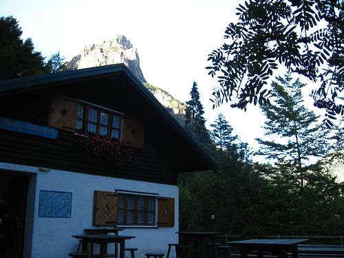
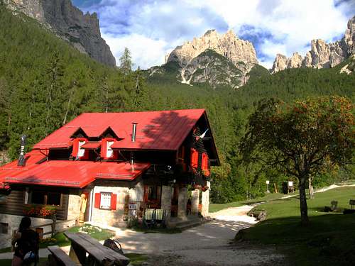
The refuge Pordenone
The route
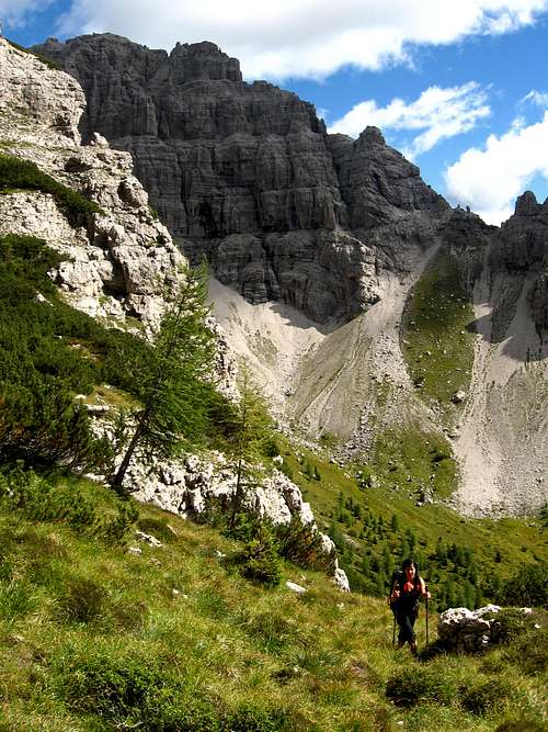
Now aim the cliff above, the base of which lies the path and follow it to the left, up to a grassy gully and an excellent water source. Climb up the grassy gully that allows you to enter the beautiful and lonely "Cadinut of Cimoliana".
Is now time to stand holding the left, without venturing on the gravel slope (useful instead to return); always continue to rise on plates always keeping to the left until you reach the base of the rocks through the scree towards two large red signal.
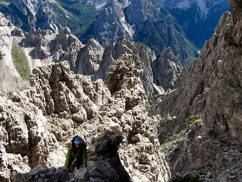
Now the path proceeds in rare red marks and essential stonepiles. Going up the debris of the channel is one of the most challenging steps: a first step of II+ (4m) and a subsequent chimney of 15m of II, following the release of unsafe debris (take care to the stones that will inevitably come in the chimney).
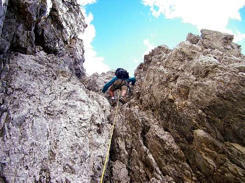
Chimney
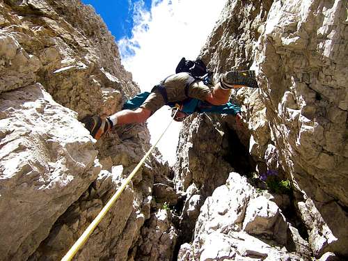
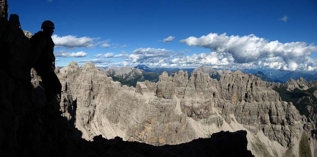
You proceed now on ledges alternating with fun steps up on the ridge, then switch to side of "Val d'Arade" (west side of the mountain) and then you face the second stretch; a chimney of broken rock, often wet and very exposed (10m , II), after which you goes directly to the summit, 2548m.
Exposed passage
The main summit is separated with common summit by a narrow notch, not difficult to overcome. Anyway the cross is placed on the first summit. From the main one, is possible admire the "Val Montanaia" and the famous "Campanile di Val Montanaia".
Same route for the descent. Helmet is hobligatory!! Useful a 30m rope for rappeling.
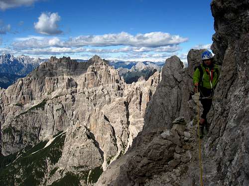
The summit
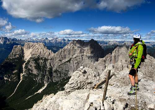
View from the summit
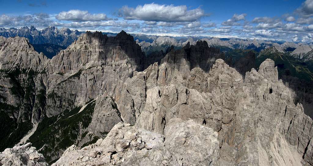
North side: Cridola and Monfalcon di Forni
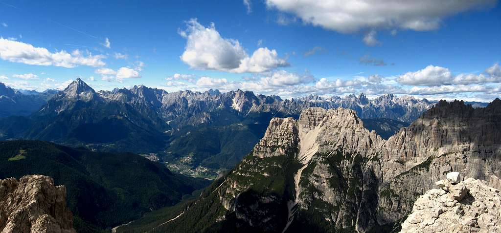
West side: Antelao and Dolomiti di Cadore
East side: the group of "Monfalconi"
Red Tape
No fees no permits required
Huts
Rifugio Padova - Photo andrea
- Rifugio Pordenone 1249 m. CAI Sez. Pordenone - Guardian: Marika Freschi Open: from the end of May to the end of September Phone: Hut 0039042787300- Mobile 00393355224961 Getting there: 10 minutes from Pian Meluzzo
- Rifugio Padova 1287 m CAI Sez Padova - Guardian: Paolo De Lorenzo Open: 25.04 - 31.10 = 24.12 - 06.01 Hut Phone: 0039043572488 Getting there: by car from Domegge di Cadore across Val Talagona
- Bivacco Perugini 2060 m - CAI Camposampiero Getting there: from Pian Meluzzo 2.30h
- Bivacco Marchi-Granzotto 2170 m - CAI Pordenone Getting there: from refuge Pordenone 3.30h
Guidebooks and Maps
Maybe the most useful and detailed guidebook of this area. Even if a little dated:
Guida dei Monti d'Italia - "Dolomiti Orientali" volume II - Antonio and Camillo Berti - 1982 - 25 euro
Map:
"Dolomiti di Sinistra Piave" - edition Tabacco - n.021 - 1x25000
Kompass - n.55/58