-
 3169 Hits
-
 82.48% Score
-
 15 Votes
|
|
Route |
|---|---|
|
|
45.63161°N / 7.53941°E |
|
|
Hiking, Mountaineering, Scrambling, Skiing |
|
|
Spring, Summer, Fall |
|
|
Most of a day |
|
|
Alpine F - EE - |
|
|
Overview
Mont Glacier Normal route
Mont Glacier 3186 m is a beautiful mountain belonging to the Graie Alps and located along the watershed among the Valle di Champorcher, the Vallone di Champdepraz and the Val Clavalité. It's an elongated mountain situated in the Eastern sector of the Parco Naturale Mont Avic and extends from West to East. Its Northern slope overlooks the Northern part of the Park, while its Southern side overlooks the beautiful Dondena basin with a superb view of the Rosa dei Banchi and Lago Miserin.
With its 3186 meters of altitude Mont Glacier exceeds the threshold of 3000 meters above sea level. It's the highest summit among the mountains in the Champorcher Valley and a double-sided mountain, with a rocky and challenging North face and an affordable Southern slope where it runs the Normal route. The broad view visible from the summit is absolutely incredible, really exciting because it has an amplitude of just 360 degrees as it is not always easy to see on other summits!
The climb on this mountain is therefore absolutely advisable, even for the wild environment with spectacular blooms. The ascent to the mountain described here is the Normal route to summit Mont Glacier. Starting from Dondena, situated at the head of the Valle di Champorcher, it's a long but easy itinerary, without particularly difficulties in summer condition. While not even presenting orientation problems, the route must not be taken lightly, the mountain is still a 3000s, with possible weather changes.
For more information on this mountain, please visit here on SP the main Mont Glacier page owned by the member Antonio Giani and the pages created by the member Osvaldo Cardellina, who climbed some new routes on the mountain: Who thawed Mont Glacier? and The different faces of Mont Glacier.
Getting There
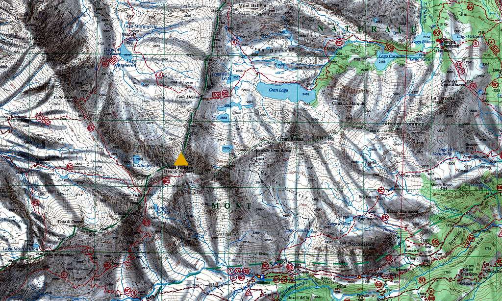
The starting point to climb is the place named Dondena, located in the Valley of Champorcher, the first tributary low valley in the left flank of the main Aosta Valley. The nearest village is the namesake village of Champorcher 1427 m. The Valley of Champorcher starts in Hone, a little town located near the well know majestic fortress of Bard.
Road access
From Italy - Take the A5 Motorway and exit Pont Saint Martin, then continue on the road SS26 toward Hone-Bard. Here leave the main road and turn to left on the road SR2 entering the Valle di Champocher, and follow the signposts to Champorcher. The road steeply rises with some hairpins, pass Pontboset then stretches in the valley towards Champorcher.
Road access to Dondena
Once you reach Champorcher take the road to the right to Dondena, climbing the mountain up to La Cort (signpost), where it becomes unpaved. The dirt road proceeds to half-sail for a good stretch, then it starts cutting the slope S of Bec Raty. Drive beyond the rocks at the base of Bec Raty Ridge, then drive up to the locality Dondena. The dirt road is passable up to a bar in Dondena, located just before the road comes down to cross the Ayasse stream. Parking lot near some info panels with a good map.
From France - Reach Aosta through Mont Blanc Tunnel or Petit S. Bernard Pass. From Aosta drive to Hone - Bard. From here continue as in the previous point.
From Switzerland - Reach Aosta through the Grand S.Bernard Tunnel or the namesake col. From Aosta drive to Hone - Bard. From here continue as in the previous point.
Route Description
Summit altitude: 3186 m
Difficulty: EE - F (presence of ice/snow)
Difference in level: 1100 m from Dondena
Starting point: Dondena 2097 m
Profitable itinerary that in summer condition doesn't oppose particular difficulties. At the beginning of the season, in case of snow or ice, some steep stretches of the route can require ice axe and crampons. Two variants are possible at the start and another one later.
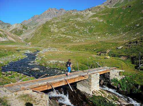
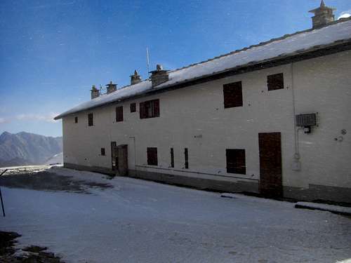
From the small parking lot in locality Dondena proceed on the dirt road that descends to the left a few dozen meters towards a bridge over the Ayasse stream, just before which, at a house perched on a rock, you ignore the deviation to Chardonney (path 2). After the bridge follow the dirt road rising up climbs up to the first houses of Dondena and then to the Refuge Dondena 2192 m. More briefly it's possible to take some shorter paths on the meadows cutting the hairpins bends of the road. Once reached the refuge take the trail to the right skirting the large building of the shelter on its right side to continue always on a dirt road cutting through the slopes until getting a large green valley, Pian Enseta. Here you will find a signpost to Mont Glacier and Col Fussy (trail number 8c) to the right. It's possible to reach this point following immediately passed the bridge at the start a trail that ignores the dirt road to the Refuge Dondena, rising up the pastures in the West direction, passing next to a great barn and rejoining the road.
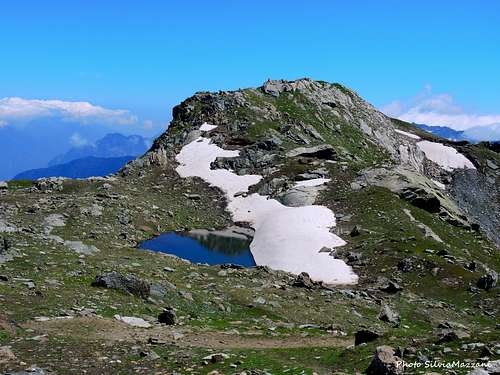
At the signpost we leave the main dirt road and go down to the Ayasse stream, crossing it by a bridge. After crossing the bridge there are two possibilities. In fact, after a few tens of meters from the bridge, on a boulder, two directions are indicated: taking the one on the left, which will cross the clearing, you will take the normal path, while on the right you will take a shortcut, steeper but much shorter. It follows the description of the normal path. Skirting the stream the path crosses horizontally the grassy plateau. The itinerary soon begins to rise along the grassy slopes in the NW direction on a wide and comfortable track which with several hairpin bends allows to gain altitude. At the junction at the altitude of 2459, ignore the path to the left (heading to Colle Fenis, path n. 8) and take the right one, making a long diagonal halfway up the hill at the end of which it climbs with wide hairpin bends on a steep cone grassy, which ends under the south face of Mont Delà. Once at the end of the grassy fan, the path proceeds in the East direction to cross under the steep walls of Mont Delà and reach the stony basin where it's located the Lago Gelato 2824 m.
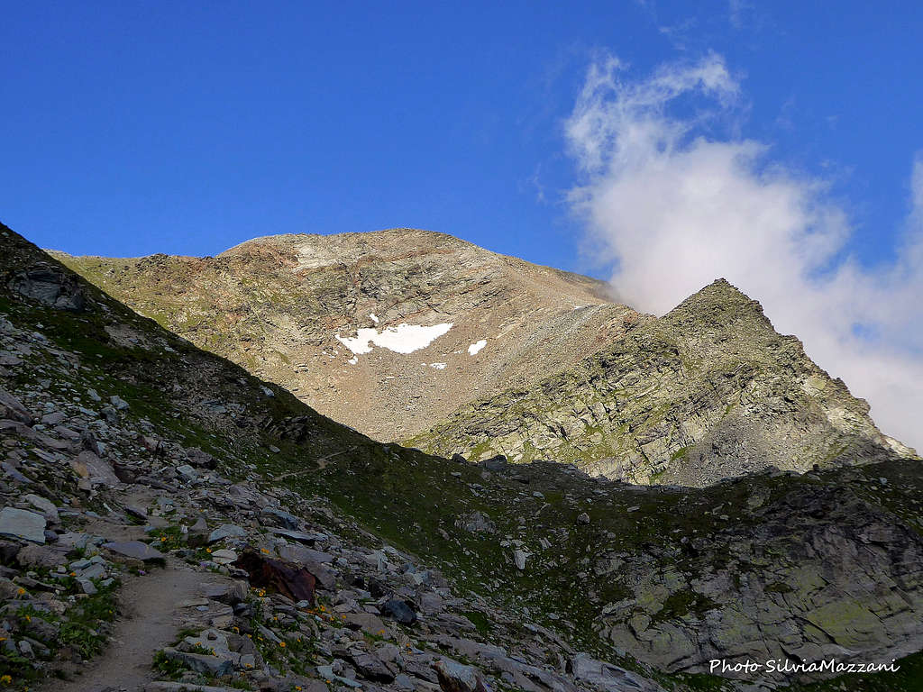
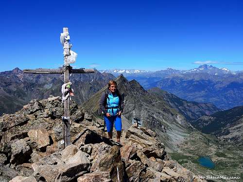
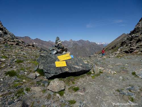
Staying high above the lake in about 10 minutes you will reach the fine saddle of Col Fussì 2912 m, where the view opens to the Vallone della Clavalité on the opposite side. From the pass, take the path on the right, obvious enough, crossing to the right through debris. Here at the beginning of the season, it is easy to encounter a lot of snow. The crossing cuts the South side of Mont Glacier and heads to the SE ridge which is followed up to the summit (cairn and small cross). The ascent of the last stretch takes about an hour.
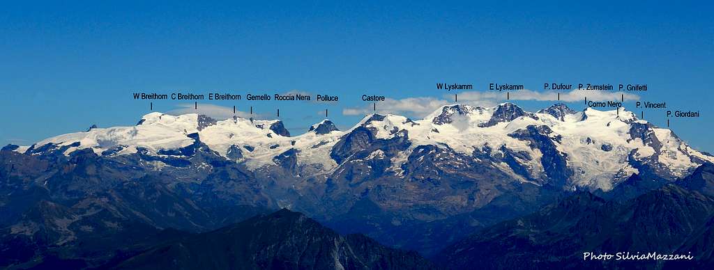
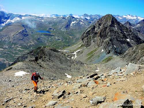
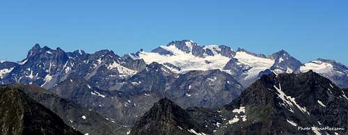
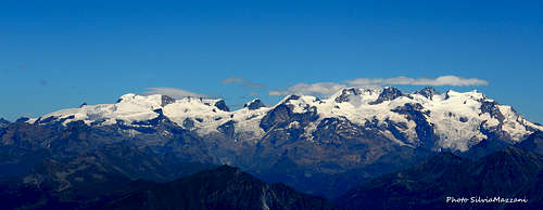
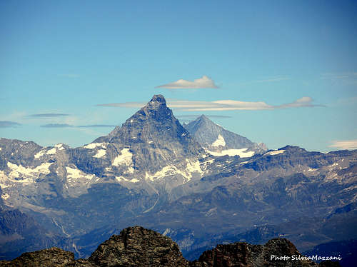
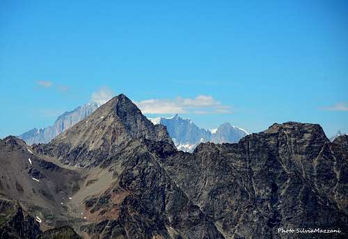
From the summit you can enjoy an incomparable view: we can admire the whole area of the Mont Avic Regional Park, with its various lakes; to the South a superb view over the valley of Champorcher, Lake Miserin and the Rosa dei Banchi; much farther away to the SW it's possible to see also the piramyd of Monviso; to the West the Gran Paradiso group. But the view of all the most important peaks of the Aosta Valley is magnificent with the Mont Blanc Group to the North, the Gran Combin, the piramyd of Cervino and the Monte Rosa group and the 4000s of the Monte Rosa Group and also of the Wallis to the NE.
Descent: reversing the same route
Essential Gear
Normal high mountain equipment including mountain boots. Spring ascents with snow require an ice axe and crampons.
Summit views
Red Tape
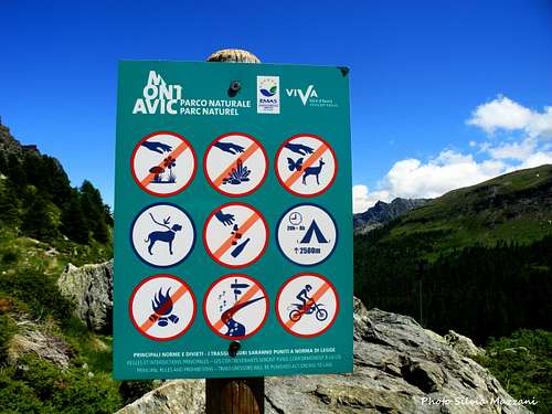
No fees no permits required. Mont Glacier is located is located inside the protected area of Parco Naturale Monte Avic.
When to climb
The best period goes from June to October.
Where to stay
- B&B, agriturismo and hotel in the Valley of Champorcher.
Meteo
Guidebooks and maps


"Emilius - Rosa dei Banchi" - Parco del M. Avic - G. Berutto, L. Fornelli - Collana Guide dei Monti d'Italia CAI-TCI
"Dal Monviso al Sempione" - R. Aruga, C. Poma CDA.
Map: L’Escursionista Editore n.11 Valle di Champorcher, Parco Monte Avic
External Links