Mont Glacier is a summit in the Champorcher Valley, the first left valley that we met entering in the Aosta Valley; it is one of the highest mountains in the area, and from the top the view is wide; you can see the most important tops of the Aosta Valley, and the whole area of the Avic park, a natural park that includes a lot of wonderful lakes.
Il Mont Glacier è una Cima all'interno della valle di Champorcher, ovvero la prima a sinistra che abbiamo incontrato entrando in Valle d'Aosta; è una delle più alte montagne della zona, e dalla vetta il panorama è vasto; si posson vedere le cime più importanti della Valle d'Aosta, e tutta la zona del Parco Regionale del Monte Avic, un parco naturale comprendente un notevole numero di laghi meravigliosi.
First Ascents
- First on the Summit: Abbot Pierre Chanoux, (Summer, 1848) in ascent very probably by SW Slope.
- In winter: Mario Aldrovandi with Champorcher Mountain Guide Vassoney, (January, 1924), in ascent from Dondena.
- SW Slope: Abbot Pierre Chanoux, (Summer, 1848), from Dondena.
- S Face (Direct Variant): Osvaldo Cardellina and Gianfranco Vicentini (Jun 20th, 1999), in ascent from Dondena.
- SW Ridge (from Fussì Pass) : Unknown; in descent: Roberto Nicco and Companions, (Years '70?), from the Summit.
- W Slope (High Comba Tersiva): S.U.C.A.I. Turin?, (Years '70?), in ascent from Eyelé Pass and Gelato Lake.
- NW Ridge: Osvaldo Cardellina, lone, (Sep 13th, 2007), in descent to Etsely Hill.
- N-NW Wall: Osvaldo Cardellina, lone, (Sep 13th, 2007), in ascent through Savoney Walloon.
- N-NE Arête: Carlo Assale, Giuseppe "Pinot" Quaglia and Eugenio Saragat, (Jul 25th, 1915), in ascent from Medzove Pass.
- N-NE Spur/Arête (E Side): Pietro Bosonetto and Elio Vittaz, (Summer 1983), in ascent from Medzove Pass.
- NE Wall (Central Gully): Pietro Bosonetto and Elio Vittaz, (Jun, 1979), in ascent from Medzove Pass with traverse to the East; first repetition: Andrea, Claudio and Silvio Bastrentaz with Paolo Zappa, (June 08th, 1986); in descent from E Ridge: Mario Aldrovandi with wife and Champorcher Guide Vassoney (Summer 1924).
- E Arête (to Western Gran Rossa Pass): Osvaldo Cardellina, lone, (Aug 28th, 1975), in descent from the Summit.
- Integral Traverse from Medzove Pass: Quota 2.848m, Mount Glacier-Quotas 3.110m, 3.003m, 2.917m, Gran Rossa West and East Hills-Antesummit West, Gran Rossa-Quotas 2.804m, 2.734m, 2.792m, 2.746m, 2.708m and descent on North Slope to Gran Lago. Osvaldo Cardellina, lone, Aug 28th, 1975, in day Pt. Mont Blanc.
- E Face: Mario Aldrovandi with Champorcher Mountain Guide Vassoney, (Summer 1924), directly through Giasset Walloon with crossing to West-northwest.
- SE Crest (to Quota 3.003m): Unknown, from Dondena Village.
- S-SE Face (to Quota 3.003m): Felici Mondini, Giulio Toesca di Castellazzo and Nicola Vigna, (Oct 06th, 1895) through Giasset Walloon with crossing to Northwest.
- S Slope (from Shoulder 3.110 meters: Felici Mondini, Giulio Toesca di Castellazzo and Nicola Vigna, (Oct 06th, 1895), in descent.
Getting There
If you take the motorway, exit in Pont San Martin (very nice roman bridge)and follow the direction Aosta along the normal route on SS.26; take care after Donnas Municipality: right side, immediately after the village, you can see approx.
100 meters of the roman consular road and a nice arc. Immediately after, on a hill, the Bard Fortress, a defensive castle that kept busy Napoleone Bonaparte for a long period, during his Italian Campaign of the 1800. A few hundreds meters after the fort there is a bridge left side, over the Dora river, with the indication Champorcher; follow it. Drive a few km, till the village of Château, and look right side for the indication Peit Mont Blanc. Follow this road, not too large, for a lot of km. Part is asphalted, the most part no. Usually the conditions of this second part are good, ask in the area. Follow this road till Dondena; at the end a sign forbids the traffic after the parking; there are 3/4 parking area, but the road is steep and demaged; take care and park in the upper one.
Come arrivarci: se si prende l'autostrada, uscire a Pont San Martin (ponte romano molto bello) e seguire la direzione per Aosta lungo la via normale sulla SS.26; far attenzione dopo il Comune di Donnas: sul lato destro, subito dopo il paese, si può veder ancora un tratto d'un centinaio di metri della strada consolare romana con splendido arco. Subito dopo, su un promontorio, s'innalza il Forte di Bard, roccaforte difensiva che bloccò Napoleone Bonaparte per un lungo periodo, durante la sua Campagna d'Italia del 1800. A poche centinaia di metri dopo il medesimo esiste sul lato a sinistra un ponte , sopra il Fiume Dora Baltea, con l'indicazione per Champorcher; seguirla. Guidare per pochi Kilometri, fino al villaggio di Château, ed individuare sulla destra l'indicazione per Petit Mont Blanc. Seguire questa strada, non troppo grande, per diversi Km. La stessa in parte è asfaltata, ma per la maggior parte no. Di solito le condizioni di questa seconda parte son abbastanza buone, però meglio prender informazioni in zona. Seguirla fino a Dondena; al termine un cartello ne vieta il traffico, subito dopo il parcheggio; lo stesso é ristretto e limitato a lato della strada; meglio utilizzare quello subito appresso ed appena sopra.
Approaches & Route
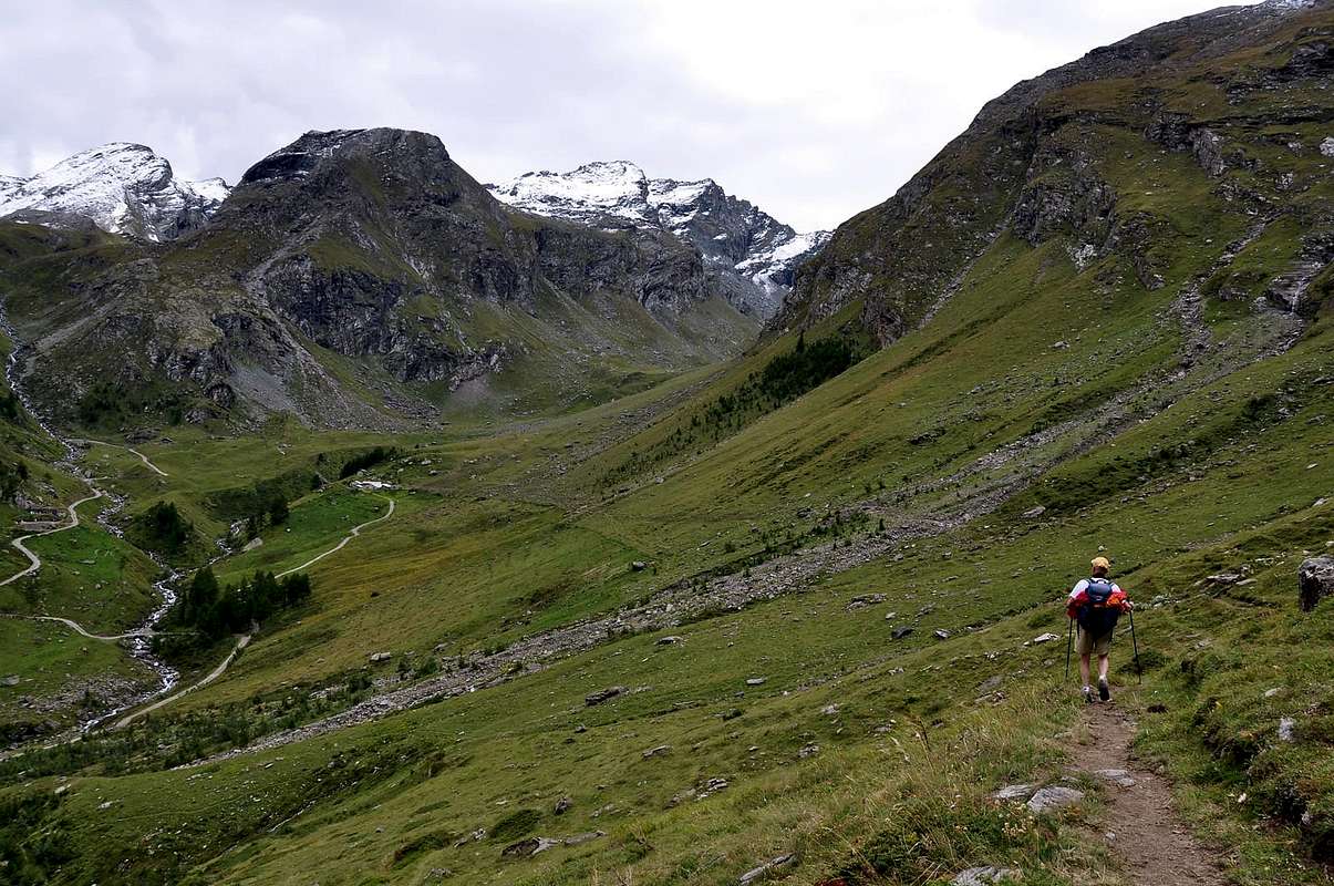
Approach A (from Champorcher Valley withe the Savoias Royal Road to Dondena Village): From the center (Château 1.427m) turn right (North) reaching upward and passing the Hamlets of Petit/Grand Mont Blanc (1.683m) through the asphalt road up to the and near the Village of La Cort (1.775m); going from here to the West there is a small parking lot ((around 1.805 meters; on the right way for the Regional Park of Mount Avic and the Refuge Barbustel, in the Vallon of Champdepraz also called Walloon of the Lakes). Instead continue on the "dusty" private road for Dondena (2.110m), crossing, after a junction for Chapy Alp and upper Raty Loch, through the Pastures of Brenvey, Long Champ (1.845m) and Leituerie (2.066m) up to a small parking lot followed by a short descent to the Torrent Ayasse. From this, passing near the homonym Refuge (2.192m) to follow the dirt road, concomitant with the path n° 7B/7C, Haute or High Route Aosta Valley n° 2, as well as Historical Real Road built by the Savoias; (shortcut to North after the bridge actually to the Alp/Village Dondena (2.171m) and to the following cross 2.242 meters) for the Fenêtre of Champorcher (Window) actually to the small and attractive bridge that crosses the Torrent Ayasse to altitude 2.334 meters (1h'00 Dondena). Approach B (from Fénis-Barche through Clavalité Valley: From Fénis little town (Barche Village 607m) along the dirt road (no access mark), after Lovignana (1.162m - 9km) that, boarding the Clavalitè Stream ascends the whole valley up to the Baite di Grand Alpe (2.120m), at the beginning of the Comba Tersiva, under the Fénis Pass (2.857m). From the pastures toward East along the path n° 102 up to the Cuneu stabling buildings (2.156m), near the new Bivouac E. Borroz of Clavalité Rotary. Leaving in left (North) the ground road to Etsely Damon (2.434m), in quota (2.156m), near Cuneu's also Cuneux Alp (2.156m), continue, by Southeast direction and path n° 5C,5D up to the an alternative of paths immrdiately after of the La Tramouaille-de-Cuneux or Tramouail, otherwise the more raised Alp and, after the abandon right the path 5D to Moutsaillon Pass, reach the same. With route more in East-southeast through a morainic small walloon to arrive on Fussì Hill; by a short descent of twenty meters reach the previous Approach A from Dondena Village (4h'45/5h'00 from Barche; 3h'30/4h'00 from no thoroughfare near Lovignana Pasture). Otherwise, see Variant below, just longer but with definitely more scenic route through a very ancient route ("Hunters Via"). Variation: from Cuneux or Bivouac of Rotary you can, via the private road towards the North, reaching the Tramouaille-de-L'Echellier or, for the locals, Etsely (2.437m). From this last alp the following path n° 5/102, initially oriented to the East and then South-east leads near the watershed between the Etsely (North) and Fussì Passes; a variant n° 5A reaches this last passing below the dividing crest and the Lac Glacier (2.935m) via a long diagonal towards the South-southeast over an old mule-track (a quarter hour later).
Route: to continue at the moment along the path n° 8B for the Moussaillon Pass (2.853m), leaving the same to the leftt (Northeast) and continue with that (path n° 8C) for the Pass Fussì and nearby Mount Glacier, with a double diagonal between two series of hairpin bends leading to a large saddle around 2.900 meters altitude on a rocky promontory at the base of the Eastern Face of Mont Delà (3.139m). Initially trace for a short time against the walls of this and later, Via a short diagonal down to North, move towards Fussì Pass (2.910m) passing high above Lake Gelato (2.824m) and arriving immediately below the same. From this point the path, with semi circular course under the Southwest Ridge, through an area of large, rotten and broken blocks alternating with stretches of fine debris and then, heading further East, climb a steeper slope, boring and tiring reaching the great Southwest Shoulder (3.003m) immediately on your left (North) of the same; this changing completely the direction towards the North-northwest reaches the East Ridge, which rises from the two Hills of the Grande Rossa, in its final part and, through this, with easy rocks addressed West you can easily reach the Summit (EE/F; 3h'15).
The Tall Fénis-Clavalité-Comba Tersiva Valley on Summer 2010 to Great Alp Pastures (2.120m).
Avvicinamento A (dalla Valle di Champorcher con la Strada Reale dei Savoia per il Villaggio di Dondena): Dal centro (Château 1.427 m) svoltare a destra (Nord) portandosi verso l'alto ed attraversando i Villaggi di Petit/Grand Mont Blanc (1.683 m) con la strada in asfalto fino nei pressi del Villaggio di La Cort (1.775 m); da qui salendo verso Ovest si raggiunge un piccolo parcheggio ((1.805 metri circa; a destra via per il Parco Regionale del Monte Avic ed il Rifugio Barbustel, nel Vallone di Champdepraz, conosciuto anche come Vallone dei Laghi). Continuare invece sulla "polverosa" strada poderale per Dondena (2.110 m), attraversando, dopo un bivio per l'Alpe Chapy ed il Lago Raty, verso gli Alpeggi di Brenvey, Champ Long (1.845 m) e Leituerie (2.066 m) fino ad un piccolo parcheggio seguito da una corta discesa verso il Torrent Ayasse. Dal villaggetto, passando presso l'omonimo Rifugio (2.192 m) seguire la strada sterrata poderale, concomitante con il sentiero n° 7B/7C, Alta Via della Valle d'Aosta n° 2, nonché Storica Strada Reale costruita da Re "Toio" dei Savoia; (scorciatoia a Settentrione dopo il ponte sino a Dondena (2.171 m) ed al successivo bivio 2.242 metri) per la Finestra di Champorcher sino al piccolo e grazioso ponticello che attraversa il Torrente Ayasse a quota 2.334 metri (1h'00 da Dondena). Avvicinamento B (da Fénis-Barche attraverso il Vallone della Clavalité: Partendo da Fénis, (località Barche 607 m), percorrere la lunga strada poderale (palina di divieto dopo Lovignana; (1.162 m, dopo 9 Km) che, costeggiando il Torrente Clavalité, risale l'intera omonima valle sino alle Baite di Grand Alpe (2.120 m), all'inizio della Comba Tersiva, sottostante il Colle di Fénis (2.857 m). Dall'Alpeggio seguire verso E il sentiero intervallivo n° 102 fino alle baite superiori del Cuneu o Cuneux od ancora Cuneus (2.156 m), al di sopra delle quali da poco è stato edificato il Bivacco E. Borroz del Rotary Clavalité. Continuare verso Sudest lasciando a sinistra (Nord) la strada poderale per l'Alpeggio Etsely Damon (2.434 m), in quota (2.156 m), presso l'Alpe del Cuneux. Con il sentiero n° 5C,5D e stessa direzione Sudest, continuare fino ad un bivio subito prima di La Tramouaille-de-Cuneux o Tramouail, ovvero l'alpeggio più elevato e, dopo aver lasciato sulla destra il sentiero n° 5D che si indirizza al Col Moutsaillon, raggiungerla. Con percorso più ad Est-sudest in un valloncello morenico pervenire al col Fussì; una discesina d'una ventina di metri riallaccia al precedente Avvicinamento A (4h'45/5h'00 da Barche; 3h'30/4h'00 dal divieto di Lovignana). Oppure, vedi sotto, con l'antica "Via dei Cacciatori". Variante: dal Cuneux si può, tramite la poderale verso Settentrione, raggiungere La Tramouaille-de-L'Echellier o, per gli abitanti locali, Etsely (2.437 m). Da quest'ultima alpe il successivo sentiero n° 5/102, orientato dapprima ad Est e poi Sudest, conduce nei pressi dello spartiacque tra i Colli dell'Etsely (Nord) e Fussì; una variante n° 5A raggiunge quest'ultimo passando al di sotto della cresta divisoria e del Lac Glacier (2.935 m), con lungo diagonale verso Sud-sudest su d'una antica mulattiera (circa un quarto d'ora in più).
Via: proseguire momentaneamente lungo il sentiero n° 8B per il Colle Moussaillon (2.853 m), lasciandolo a sinistra (Nordovest) e proseguire con quello (sentiero n° 8C) per il Col Fussì ed il vicino Mont Glacier, con un doppio diagonale tra due serie di stretti tornanti che conduce ad una larga sella quota 2.900 metri circa su d'un promontorio roccioso alla base della Parete Est del Mont Delà (3.139 m). Dapprima risalire per breve tempo contro le pareti di questo ed in seguito, tramite un corto diagonale in discesa verso Nord, portarsi in direzione del Col Fussì (2.910 m) passando alti sopra il Lago Gelato (2.824 m) ed arrivando immediatamente al di sotto del medesimo. Da questo punto il sentiero, con percorso semi circolare sotto la Cresta Sudovest, attraversa una zona di grandi blocchi alternata a tratti di fine detrito per poi, dirigendosi maggiormente ad Est, risalire un pendio più ripido, noioso e faticoso raggiungendo lo Spallone Sudovest (3.003 m) subito sulla sua sinistra (Nord); da qui cambiando, completamente direzione verso Nord-nordovest, raggiunge la Cresta Est, che sale dal doppio Colle della Gran Rossa, nella sua parte finale e, tramite questa, con facili roccette si giunge facilmente alla Sommità (EE/F; 3h'15).
Red Tape
No restriction at all.
Nessuna restrizione per tutti.
When To Climb
In case you want to sleep in the Dondena refuge, the tel is Italy Cell. 348/2664837 - 347/2548391 ; in the Avic Park, in case you are interested to spent one day looking at the nomerous lakes, there is another refuge, Barbustel,Tel. Rifugio: 0166/510001- Cell. 347/7892089 - Tel. home: 0125/804604.
Condizioni della montagna: nel caso in cui si desidera dormire al Rifugio Dondena, il telefono cellulare è per l'Italia: 348/2664837 - 347/2548391; nel Parco dell'Avic, nel caso siate interessati a trascorrervi una giornata guardando i numerosi laghi, esiste un altro rifugio, il Barbustel, tel. Rifugio: 0166/510001- cellulare. 347/7892089 - Tel. casa: 0125/804604.
Campings
In Aosta Valley the camping is forbidden below
2.500 meters.
Campeggio: in Valle d'Aosta il campeggio è vietato al di sotto dei 2.500 metri.
Mountain Conditions
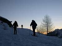
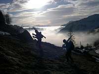
The path is on the South side of the mountains; June, July, September, sometimes October. Ski mountanering end of March/April, depending on the condition; the face is quite steep, don't go in case of recent snow, it is dangerous.
Il sentiero trovasi sul lato Meridionale delle montagne; Giugno, Luglio, Settembre, a volte Ottobre. Sci-Alpinismo sino alla fine di Marzo/Aprile, a seconda delle condizioni; il pendio è abbastanza ripido, per la qual cosa conviene non andarvi in caso di neve recente, poichè pericoloso.
Webcam
- WEBCAM on Aosta Valley:
- Webcam
Books and Maps
BOOKS:
- "Guida delle Alpi Occidentali" di Giovanni Bobba e Luigi Vaccarone C.A.I. Sezione di Torino Volume II (parte II), 25 Maggio 1896.
- "Guida dei Monti d'Italia – Emilius Rosa dei Banchi-Parco del Mont Avic" di Giulio Berutto e Lino Fornelli - Club Alpino Italiano/Touring Club Italiano, Marzo 2005.
- "Diari Alpinistici" di Osvaldo Cardellina e Indice Generale accompagnato da Schedario Relazioni Ascensioni 1964-2019 (inediti).
MAPS:
- Ingenia "Parco Naturale del Mont Avic" Carta dei sentieri 1:25.000.
- Enrico Editori Ivrea "Carta turistica del Canavese" 1:100.000
- Enrico Editore Ivrea-Aosta "Gruppo del Gran Paradiso" 1:50.000.
- L'Escursionista editore "Valle di Champorcher Parco Mont Avic" Carta dei Sentieri (11) 1:25.000.
- L'Escursionista "Valle di Cogne" Carta dei Sentieri 1:25.000.
Important Information
Useful numbers
- Protezione Civile Valdostana località Aeroporto n° 7/A Saint Christophe (Ao) Tel. 0165-238222.
- Bollettino Meteo (weather info) Tel. 0165-44113.
- Unità Operativa di Soccorso Sanitario Tel. 118.

 9004 Hits
 87.76% Score
 25 Votes