
-
 6163 Hits
-
 77.48% Score
-
 8 Votes
|
|
Route |
|---|---|
|
|
45.90470°N / 7.36529°E |
|
|
Mountaineering |
|
|
Summer |
|
|
One to two days |
|
|
F |
|
|
Overview
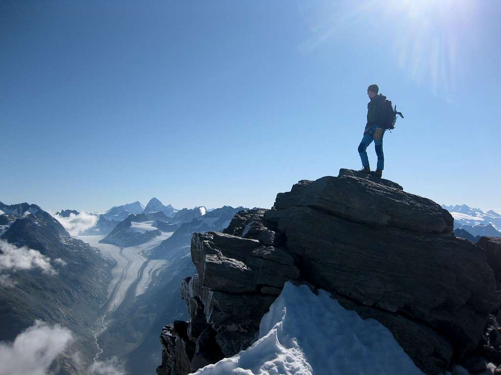
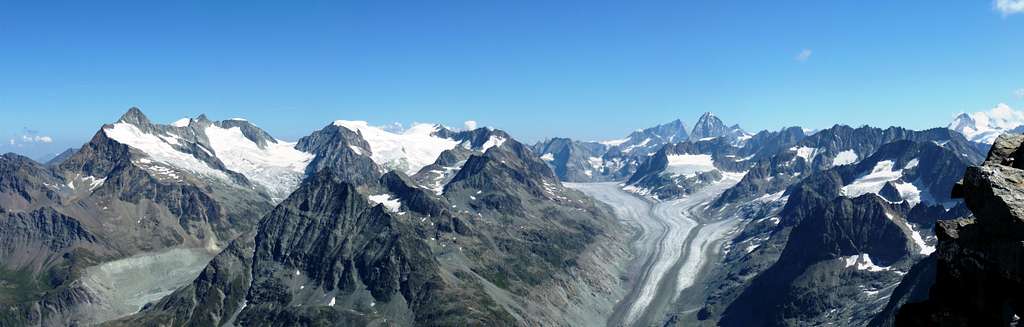
Mont Gelè is a very popular mountain both for mountaineers and skiers. The Normal route from the Colle di Mont Gelé is a classic and interesting itinerary with low difficulties. On Colle di Mont Gelé two different itineraries converge, in fact Mont Gelè can be climbed both from Comba di Crete Seche (via the Refuge Crete Seche) and from Conca di By (via Bivacco Regondi-Gavazzi). Both routes are good for mountaineering and ski-mountaineering, but at the current state the itinerary described in this page is more suitable for summer ascents than the itinerary from the Bivacco Regondi.
Getting there
To climb the Normal route starting from Ruz you must take the Valpelline.
Road Access to Valpelline
- From Turin and Milan: follow the A5 Motorway and exit to Aosta Est. Follow the road S27 towards Gran San Bernardo Tunnel, getting after about 10 km. to Variney m. 782; here you must leave the road to Grand San Bernardo and turn to right towards Valpelline m. 960, the valley’s main resort. Exit Valpelline, ignoring the road to Ollomont on the left, and carry on along Val Pelline main road. The road is reaching Oyace m. 1377, Bionaz m. 1606, the main resort of the upper valley, and Dzovenno. Leave the main road and turn to right to Ruz m. 1697 (parking). A "not well visible" wooden panel help for Telephone number and open/close label of Refuge Crete Seche. Go ahead about 2,5 km and park the car in the tiny village of Ruz, just before the road becomes unpaved. - From Switzerland (Grand Saint Bernard Pass or Tunnel). Drive to Aosta direction. 4 km before arriving in Aosta, just before first tunnel, there is Variney village. Turn right for Valpelline and Place Moulin direction.
- From France via Mont Blanc tunnel or Petit St. Bernard pass. Follow Aosta direction via SS n.26. or Motorway A5 (exit Aosta Ovest because itdoesn't exist an exit to Aosta Est driving from Aosta to Turin). Once reached Aosta, follow the Grand St. Bernard direction. If you are on the old road for Grand St. Bernard, it joins the new one at Variney. Follow Valpelline, Place Moulin Lake direction. From Variney. Follow Valpelline, Place Moulin lake direction
 |
 |
 |
 |
 |
Route Description
Monte Gelé Normal route from Ruz (Valpelline)
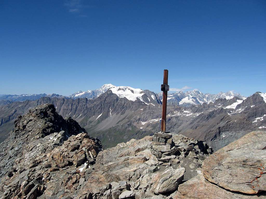
Summit altitude: m 3519
Difficulty: Alpine F
Difference in level: 1100 m from Rif. Crête Sèche
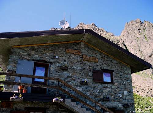
Hut: Rifugio Crête Sèche m 2410
Starting point: Ruz 1696 m, upper Valpelline
A very interesting and panoramic route inside a wild environment. The itinerary follows at first a good path, then the ice-slopes and the summit ridge. From this side, Mont Gelè can be climbed in one day, but is highly recommended to rest a night in Rifugio Crete Seche, or Bivacco Spataro.
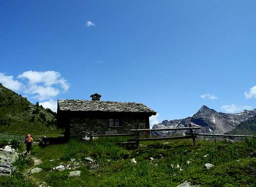
Walking approach to Rifugio Crête Sèche
From Ruz follow the road with paved sections alternate with dirt sections (cars not allowed) in the direction of the Baou de Bouque Alp m. 2129 and the Berrier Alp m. 2192. In some places it is possible to follow some traces in the wood cutting the road. Reached the Alpe Berrier 2192 m the road ends, continue along the Alta Via n. 3 which leads to the Rifugio Crête Sèche 2410 m.
Route report
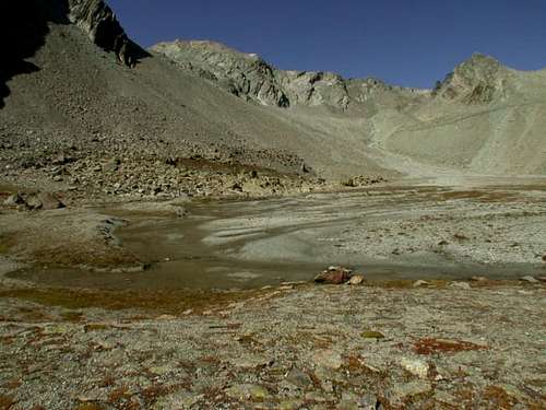
From the refuge Crête Sèche follow the marked trail up along the Comba di Crete Sèche towards the Bivacco Spataro 2600 m, without reaching the bivouac. Continue along the valley until you reach a wide plateau, Plan de la Sabla. Cross it walking on left side of river, often dry at late season, and at the end of the plateau turn to left (NW direction) and begins to fade in a wide stony ground (yellow signs and cairns).
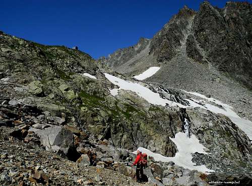
Climb a steep slope of snow or ice (there are some indications of Alta Via n.3 - this is the most challenging section of the climb) and get a little plane, then the glacier of the Aroletta (this plateau bears the name of Plan Plat). The glacier will lead you to the Colle del Mont Gelè 3180 m from which it appears the summit cross of Mont Gelè, already visible. At Colle del Mont Gelè ends the trail of non-equipped hiker. Crampons, axe and rope are required from here to Mont Gelè summit.
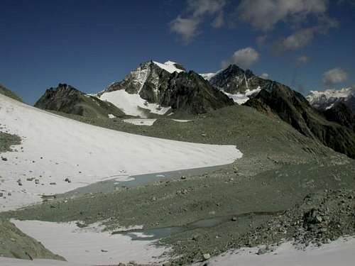
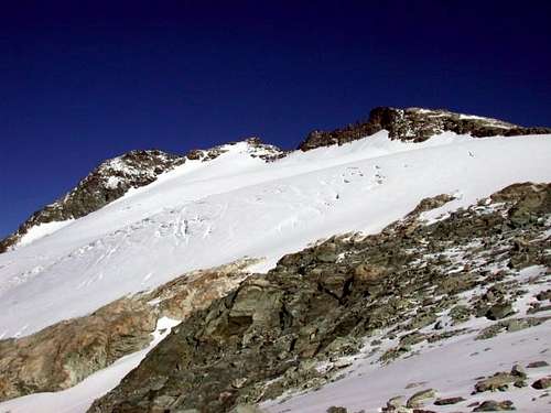
From the pass continue along a snowy slope that acts as a watershed between Bionaz and Ollomont. The direction (North) is toward Mont de la Balme, a stand alone rocky tooth. Successively proceed in WNW direction with a long half-way cross of upper Mont Gelè glacier under the vertical of the summit cross. Once arrived close to the summit walk straight to, after passed terminal crevass, or take advantage of the easier ridge on the right. Awesome sightseen on Grand Combin, Arolla group, Otemma glacier, Matterhorn, Rosa.
Warning: terminal crevass of Mont Gelè is very dangerous. Althought it is very little, a short summer snow will be enough to fill it and hide.
Descent: reversing the route
Essential Gear
Crampons, ice axe and light rope for basic glacier.
Red Tape
No permits required, no seasonal closures, no parking pass required
Huts
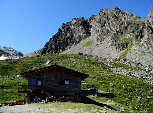
- Rifugio Crete Seche 2.410 m. - 88 places (8 winter site) +39.0165.730030 or +39.347.0330713 (Daniele's mobile phone, hut owner) Winter/Spring 2006: open from February 18th, only for weekend. Booking is mandatory. More info at: www.rifugiocreteseche.com
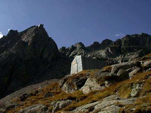
- Bivacco Spataro 2.600 m. - 9 places, bad conditions
When to climb
Mountaineering: from middle June to middle September
Ski mountaineering: from March to early May (it depends on snow conditions)
Meteo
Meteo Regione Valle d'Aosta
Meteo Switzerland
Guidebooks and maps

"Alpi Pennine" by Gino Buscaini - Guide dei Monti d’Italia CAI-TCI
"La Valpelline" Foglio 115 -scale 1:30.000 - IGC (Istituto Geografico Centrale)