
-
 25405 Hits
-
 92.85% Score
-
 40 Votes
|
|
Mountain/Rock |
|---|---|
|
|
45.90494°N / 7.36539°E |
|
|
Valle d'Aosta |
|
|
Mountaineering |
|
|
Spring, Summer |
|
|
11545 ft / 3519 m |
|
|
Overview
Geographical classification: Alps - Eastern part > Pennine Alps > Mont Gelé
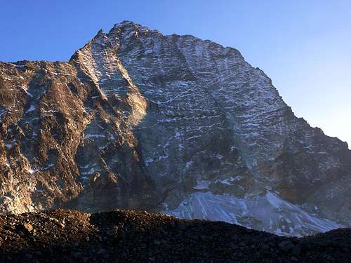
Mont Gelé 3519 m
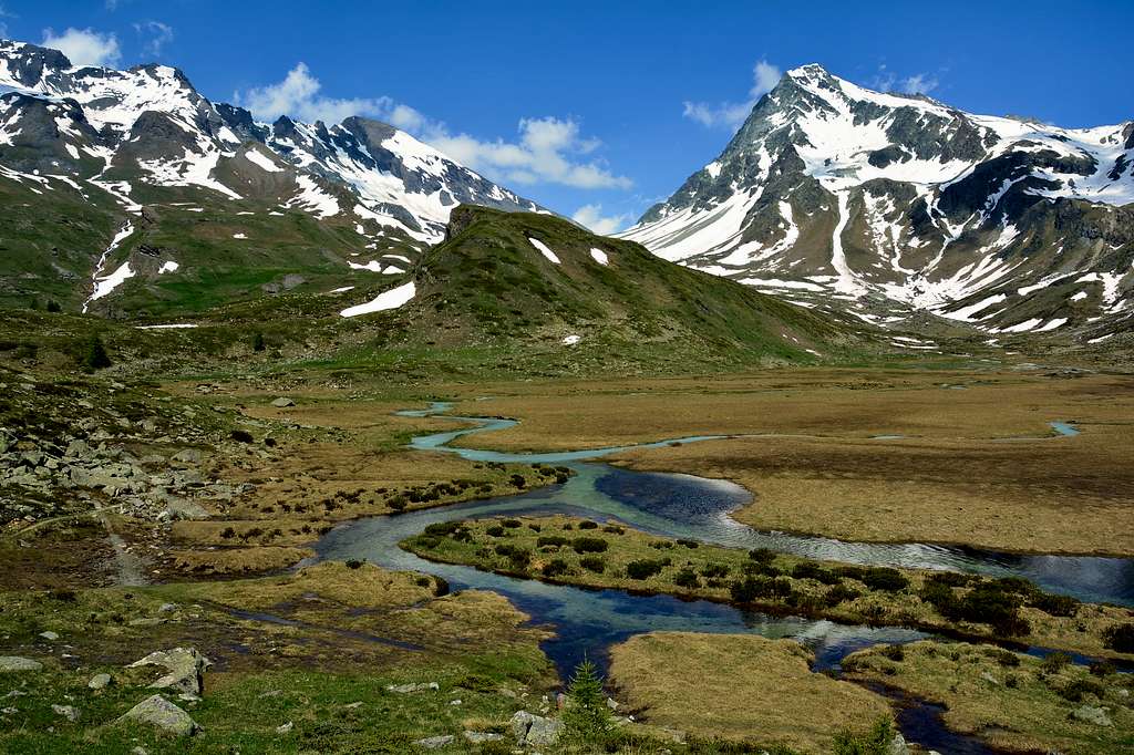
Mont Gelé 3519 m is a mountain belonging to the Pennine Alps, in the Western Alps, and located on the main boundary between Italy (Valpelline, Aosta Valley) and Switzerland (Wallis). Precisely Mont Gelè is situated between the Col Fênetre to the North-West and the Col of Crête Sèche to the South-East. On the italian side it separates the Conca di By area from a right sub-valley of the Valpelline called Comba di Crete Sèche.
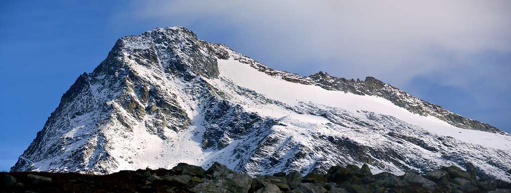
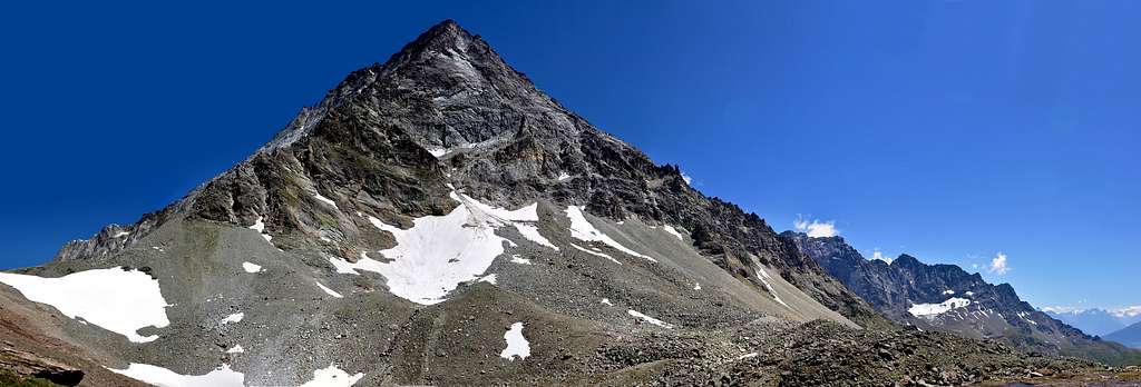
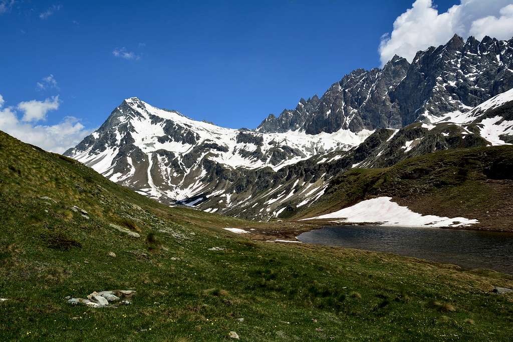
As its name suggests - Gelé means "frozen" - Mont Gelè is surrounded by glaciers, except on its Western side. We see to the North-West the Glacier de Fenêtre, to the North-East and to the East the Glacier de Crête Sèche, now greatly reduced, and to the South-East the Glacier di Mont Gelé.

Mont Gelè is a very popular mountain both by mountaineers and skiers. The standard route from the Colle di Mont Gelé is a classic and interesting itinerary with low difficult. On Colle di Mont Gelé two different itineraries converge, in fact Mont Gelè can be climbed both from Comba di Crete Seche (via Refuge Crete Seche) and from Conca di By (via Bivacco Regondi-Gavazzi). Both routes are good for mountaineering and ski-mountaineering.

Getting There
To climb the Normal route starting from Ruz you must take the Valpelline.
Road Access to Valpelline
- From Turin and Milan: follow the A5 Motorway and exit to Aosta Est. Follow the road S27 towards Gran San Bernardo Tunnel, getting after about 10 km. to Variney m. 782; here you must leave the road to Grand San Bernardo and turn to right towards Valpelline m. 960, the valley’s main resort. Exit Valpelline, ignoring the road to Ollomont on the left, and carry on along Val Pelline main road. The road is reaching Oyace m. 1377, Bionaz m. 1606, the main resort of the upper valley, and Dzovenno. Leave the main road and turn to right to Ruz m. 1697 (parking). A "not well visible" wooden panel help for Telephone number and open/close label of Refuge Crete Seche. Go ahead about 2,5 km and park the car in the tiny village of Ruz, just before the road becomes unpaved. - From Switzerland (Grand Saint Bernard Pass or Tunnel). Drive to Aosta direction. 4 km before arriving in Aosta, just before first tunnel, there is Variney village. Turn right for Valpelline and Place Moulin direction.
- From France via Mont Blanc tunnel or Petit St. Bernard pass. Follow Aosta direction via SS n.26. or Motorway A5 (exit Aosta Ovest because itdoesn't exist an exit to Aosta Est driving from Aosta to Turin). Once reached Aosta, follow the Grand St. Bernard direction. If you are on the old road for Grand St. Bernard, it joins the new one at Variney. Follow Valpelline, Place Moulin Lake direction. From Variney. Follow Valpelline, Place Moulin lake direction

Monte Gelé Normal route from Valpelline
Monte Gelé Normal route from Ruz (Valpelline)
Summit altitude: m 3519
Difficulty: Alpine F
Difference in level: 1100 m from Rif. Crête Sèche
Hut: Rifugio Crête Sèche m 2410
Starting point: Ruz, upper Valpelline
A very interesting and panoramic route inside a wild environment. The itinerary follows at first a good path, then the ice-slopes and the summit ridge

|

|
Walking approach to Rifugio Crête Sèche
From Ruz follow the road with paved sections alternate with dirt sections (cars not allowed) in the direction of the Baou de Bouque Alp m. 2129 and the Berrier Alp m. 2192. In some places it is possible to follow some traces in the wood cutting the road. Reached the Alpe Berrier 2192 m continue along the Alta Via n. 3 which gently leads to the Rifugio Crête Sèche 2410 m.
Route report
From the refuge Crête Sèche go up along the Comba di Crete Sèche towards the Bivacco Spataro 2600 m. Continue along the valley until you reach a wide plateau, Plan de la Sabla, at the end of which you turn to left to climb a steep slope of snow or ice (there are some indications of Alta Via n.3 - this is the most challenging section of the climb), leading to the glacier of the Aroletta (this plateau bears the name of Plan Plat) and getting the Colle del Mont Gelè 3180 m from which it appears the summit cross of Mont Gelè, already visible.

|

|
Continue to the North along a snowy slope that acts as a watershed between Bionaz and Ollomont. Skirt the Mont de la Balme and go leftward in the direction of the top of Mont Gele. Climb up the steep snowy slope located under the vertical of the summit cross or take advantage of the easier ridge on the right.
Descent: reversing the same route.
Other routes
Monte Gelé Normal route from Glacier (Ollomont)
Summit altitude: m 3519
Difficulty: Alpine F
Difference in level: 930 m from Biv. Regondi-Gavazzi
Hut: Bivacco Regondi-Gavazzi
Starting point: Glacier, Valle Ollomont
Road access: A5 motorway to the Aosta Est barrier, then following the signpost to Colle del Gran San Bernardo, take the tunnel and at the end of the second tunnel leave the SS27 of the Gran San Bernardo and follow for Valpelline, where, at the end of the village, turn to left to Ollomont. Continue (follow always "main" road) until the Glacier hamlet, at the end of the road. Park the car at the big ground square just befor to cross a little bridge, the real begin of the path n. 6. Warning: 150 meters before arriving at the park, there are a plenty of yellow panels. This is the footpath to Conca di By (By is pronounced as "(to) Be" in english).
Approach to Bivacco Regondi - Gavazzi
From the parking take the dirt road and then the path that goes up a steep gully to the Conca di By, bend to the right and pass the pastures of Le Piazze. Then skirt the stream up to the plateau, bypassed which, the trail proceeds on steep terrain, turns to the left and with a last climb gains the Lake Leitou and then the Bivacco Regondi Gavazzi, 2590 m, just upstream.
Route report
From the bivouac follow the path that descends near Lake Benseya 2513 m. Continue on the trail (cairns and sparse yellow stamps) until you reach a reddish moraine that climb up to the former glacial basin until the trail gets the glacier. We set foot on the glacier (at about 3000 meters), now divided into two parts.Leaving the Col du Mont Gelé 3180 m on the right, climb up the wide snow slope, skirting Mont de la Balme, until the last short but steep (40/45 °) slope, culminating with the summit rocks, where a large wooden cross is placed. The last snow slope can be avoided by climbing on the easier ridge.

|

|
Essential gear
Rope, ice-axe, crampons,high mountain boots and clothes
Red Tape
No permits required, no seasonal closures, no parking pass required
|
|

|

|
Huts

- Rifugio Crete Seche 2.410 m. - 88 places (8 winter site) +39.0165.730030 or +39.347.0330713 (Daniele's mobile phone, hut owner) Winter/Spring 2006: open from February 18th, only for weekend. Booking is mandatory. More info at: www.rifugiocreteseche.com

- Bivacco Spataro 2.600 m. - 9 places, bad conditions
Via Glassier-bivacco Regondi - Bivacco Nino Regondi, 2.650 m. - 16 places
When To Climb
Mountaineering: from middle June to middle September
Ski mountaineering: from March to early May (it depends on snow conditions)
Meteo
Meteo Regione Valle d'Aosta
Meteo Switzerland
Guidebooks and maps

"Alpi Pennine" by Gino Buscaini - Guide dei Monti d’Italia CAI-TCI
"La Valpelline" Foglio 115 -scale 1:30.000 - IGC (Istituto Geografico Centrale)