


lcarreau - Jun 24, 2010 4:00 pm - Voted 10/10
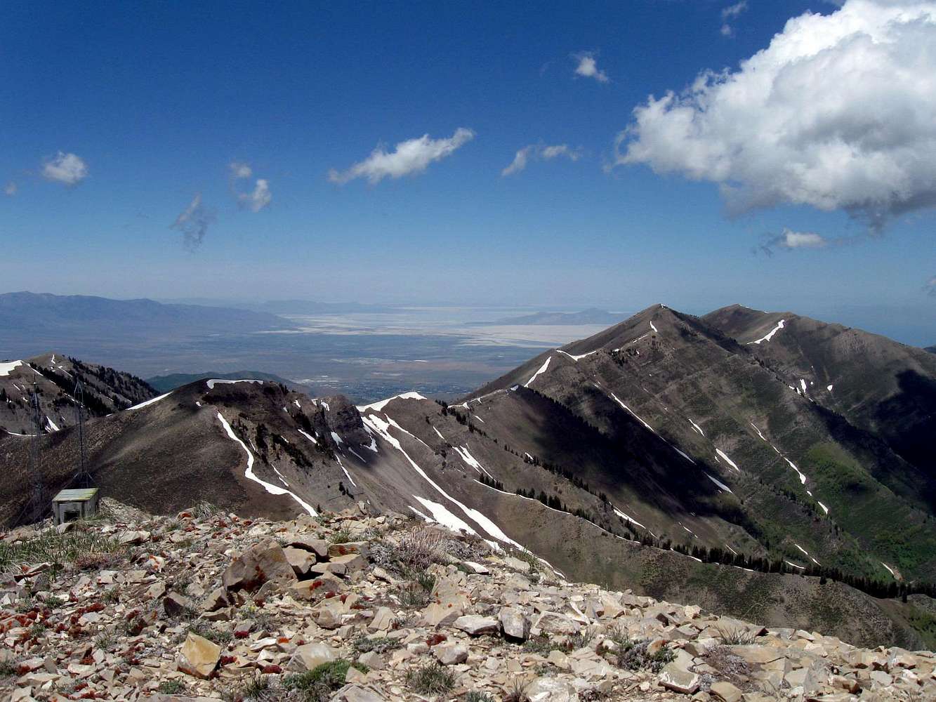
Names ??Left to right:
(1) Peak 9,860' (above Settlement Canyon)
(2) Rocky Peak (10,273') - above Rocky Basin
(3) Kelsey Peak (10,373') - the "highest" in
the chain, as viewed from Tooele.)
(4) White Pine Peak (10,321')
White Pine Peak can be reached via White Pine Flats from Middle Canyon to the east.
I know 'Kelsey Peak' looks more than 100' higher than 'Rocky Peak,' but that's just
an optical illusion.
The 'gap' between Kelsey and White Pine Peaks
is called 'Piney Pass.'

Dean - Jun 24, 2010 4:29 pm - Hasn't voted
Re: Names ??Larry, you have to move back here so we can explore all of those together. Thanks for the naming. I know that Nelson and Farnsworth are up north somewhere as well (out of the picture to the right).
lcarreau - Jun 24, 2010 5:17 pm - Voted 10/10
Re: Names ??Dean, you don't need me; you're doing GREAT! !
What about Butterfield Peaks? You should have
(also) seen them out of the picture to the
right.
Every time I see the Butterfield Peaks from
Middle Canyon, I want to get out a giant
tub of popcorn and start eating !!! : )
I've had many a 'picnic' in Middle Canyon.
In fact, Middle Canyon is to picnics as the
city of Tooele is to .. NERVE GAS.

ridgeguy - Jul 11, 2010 1:54 pm - Hasn't voted
Re: Names ??Thanks for the names. I'd been calling White Pine Peak "North Kelsey".
http://www.willhiteweb.com/oquirrh_mountains/kelsey_peak/butterfield_canyon_trail_048.htm
lcarreau - Jul 11, 2010 8:14 pm - Voted 10/10
Re: Names ??Thank you, Eric !
Finally, some more names for peaks I had
always looked at and hiked as a "Tooele-lite."
So, Clipper can be accessed from West Mountain without trespassing on private land?
You just got done climbing White Pine Peak? Did you happen to see any porcupines
while crossing over White Pine Flats ??
Cool .. I really love the Oquirrhs.
ridgeguy - Jul 15, 2010 2:37 am - Hasn't voted
Re: Names ??So I was south of Clipper and West Mountain on the other side of Butterfield Canyon...to the south.
But since you asked, you can drive up to West Mountain but from the big overlook down to the pit, they have private property/no trespassing signs all around the lot. You can't even go to the highest point on West Mountain without crossing signs. I've read old reports where others trekked over to Clipper from West but those days seem to be gone. When I was up there last year, they were doing some test drilling on the ridge between the two peaks. There was also a security truck sitting in the parking lot.
A winter ascent of Clipper from the west is probably the best way to avoid conflict. Clipper Ridge to the west is public land but as your near the summit of Clipper, it becomes Kennecott land.
lcarreau - Jul 15, 2010 11:54 am - Voted 10/10
Re: Names ??Geez, all this talk about copper makes me want to boogie down to "Wally World" and buy myself a beautiful copper wrist-band.
Thanks for the information. Suppose if a fella really wanted to climb Clipper, it'd be best to do in winter when the security
trucks would be unable to negotiate the
snow-covered roads.
Unless they use a snow-cat or helicopter ..


Comments
Post a Comment