
|
|
Route |
|---|---|
|
|
46.22031°N / 8.95667°E |
|
|
Hiking, Scrambling |
|
|
Spring, Summer, Fall |
|
|
Most of a day |
|
|
T3 |
|
|
Overview
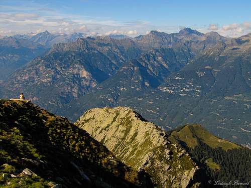 Gaggio summit View towards the North |
The Mornera route is the normal route to the summit of Gaggio. The route has a main advantage over many other routes in the Ticino and especialliy Leventina area: You can climb/hike it in a single day. The valley floors are very deep here with an altitude of 200 to 300 meters above sea level. Since all prominent peaks reach well over 2200 and even 2500 meters, starting from the valley means you have to conquer over 2000 vertical meters up and down in a single day to climb one of the peaks here. The reason Gaggio is climbable in a single day is because of the presence of the Mornera cableway. It brings you up from 250m to 1350 meters of altitude. And don’t worry, it isn’t one of those massive lifts that brings thousands of people up the mountain; No, it is very small and only gets to see a dozen people a day in the summer season. Therefore, in contrary to many other peak close to cableway-station, I can recommend this one if you are looking for a single day climb in the Leventina area.
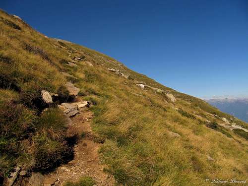 Upper part of the Trail (T3); Nearing the summit of Gaggio | 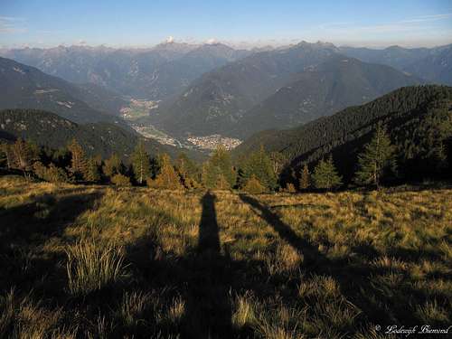 Long shadows in front of the Leventina Valley |
The route starts from Mornera at 1350 meters above sea level. The trail is marked all the way up to the nice little hut named Capanna Albagno at 1870 meters. From this point on you are above the tree line. The route stays marked very well until the summit with its large summit cross at 2267 meters.
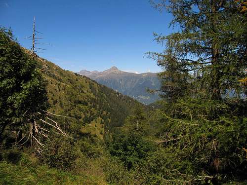
I was told that Gaggio is well-known and popular by the local people, because of its beautiful ascent and its very worthwile summit views. Towards the north you are able to see all the 3000m+peaks of the Ticino Provence. The highest one, Rheinwaldhorn/ Adula (3404m), is dominating the view. Also the whole Leventina- East ridge is visible with peaks like Torrone Alto (2952m), Torent Basso (2820m) and Pizzo di Campedell (2724m). This is special, because you cannot see these peaks from the valley floor. (with Pizzo di Claro being the only exception.) Towards the south you can see Italy’s Po-plain on a clear day. Also very worthwhile are the views towards the great lakes: Lago Maggiore and Lago di Lugano. Towards the west you can see Gaggio’s higher neigbours: Cima d’Efra, Cima dell Uomo and Madone. Finally towards the NW you are able to see the Verzasca mountains with peaks like Poncione Rosso (2505m) and Madom Gross.
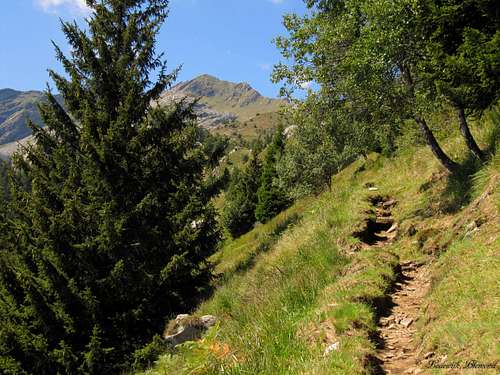 The trail (T3) between Mornera and Albagno | 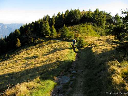 Trail close to Capanna Albagno |
Route Description
 Gaggio Route Map 1: Monte Carasso - Mornera |  Gaggio Route map 2: Mornera - Albagno - Gaggio |
The normal route starts down in the valley in the small village of Monte Carasso, which is more like a suburb of the city of Bellinzona. See the sections ‘How to get there’ and ‘Mornera cableway’ to find your way up to to Mornera, ending point of the cableway. A so-called Grotto is present here, a typical Tessiner restaurant. You can buy water and other things for on the trails here as well.
Opposite to the Grotto a yellow sign says ‘’Albagno’’. This marks the start of the route. The route starts on easy trails (maximum T3) and leads trough the dense forest. After a short while you’ll reach the beautiful Mornera lake, which is used by helicopters from the local fire department to get water from. After passing the lake, you will be in the forest for some time. The trail stays visible all the time and is never exceeding the T3 grading. After walking for an hour and a half the Capanna
Albagno mountain hut is reached. The hut is in good condition and offers 26 sleeping places. The hut is normally not guarded, you can get something to drink here though like coffee or a soda.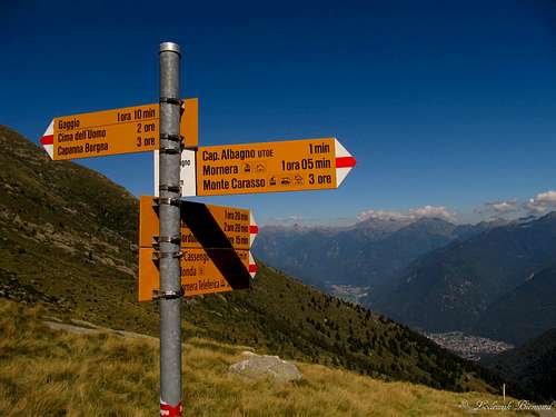 Signpost at Capanna Albagno | 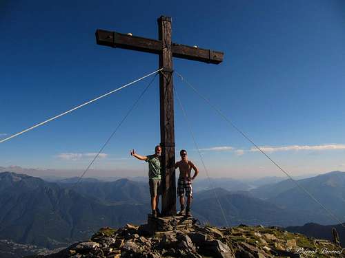 The nice Gaggio Summit Cross |
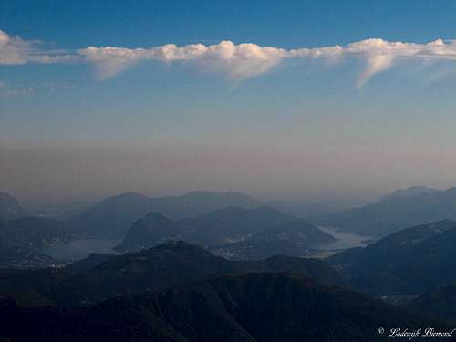 Strange Clouds above the Grand Lakes | 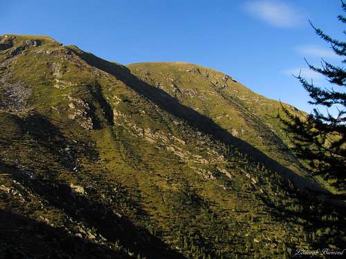 Gaggio in the evening light |
Getting There

Overview Map Gaggio A2 Highway
Coming from Gotthard (north) or Italy (south), drive towards Bellinzona over the A1 highway and go off
at 'Bellinzona-Nord' (see map at right)
From this point on see the Google-Map above. It shows the
directions from the Bellinzona-North exit to the Mornera Cableway station.
Essential Gear
Good hiking shoes are mandatory. Trekking poles can be useful. In summer temperatures are usually high in this southern part of the Alps. The weather can change rapidly though; so some extra clothes against possible colder temperatures and/or rain can be useful.Mornera Cableway
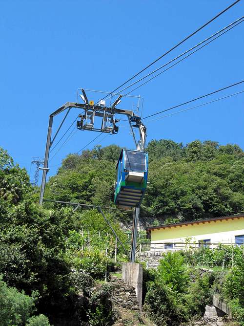
Mornera Cableway
Follow this link for the official page of the Mornera cableway. The Mornera cableway starts in the small village of Monte Carasso, which is located just outside the city of Bellinzona. As mentioned above, the cableway is opened every day in the summer months between 08:00 and 17:00. The cableway runs automatically between 06:00 and 08:00 and between 17:00 and 21:30. For the exact operating hours click here.
Adress & Telephone:
I Fracc 1
CH - 6513 Monte Carasso
+41 91 825 81 88
When to Climb
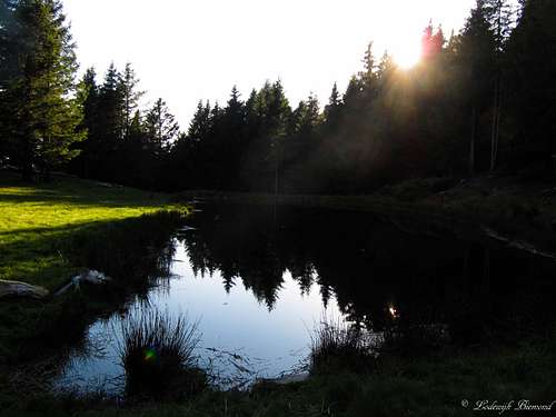
Mornera Lake in the Evening light
Pizzo di Claro as seen from the trail to Gaggio