
|
|
Mountain/Rock |
|---|---|
|
|
46.23173°N / 8.96402°E |
|
|
Hiking |
|
|
Spring, Summer, Fall |
|
|
7438 ft / 2267 m |
|
|
Overview
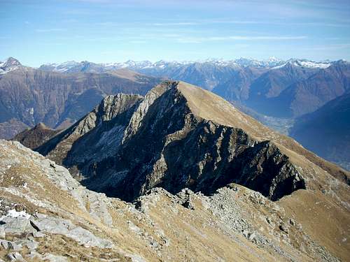
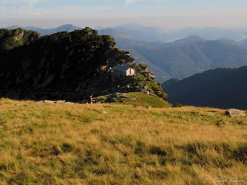
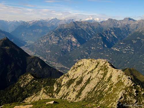 summit view towards Rheinwaldhorn and the Leventina valley | 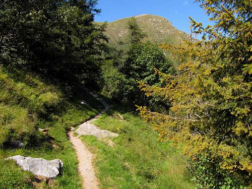 Cima Gaggio (2267m) as seen from the trail to Albagno |
Cima del Gaggio is located in the Italian part of Switzerland (Tessin/Ticino) and is mostly referred to as just ‘Gaggio’. Gaggio is located on the southern tip of the Valle Leventina West Ridge. Because of the location at the border of this mountain ridge, Gaggio offers fantastic and free views towards the north, east and south.
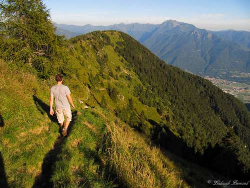
Gaggio is mostly climbed from the south, where the Mornera cableway shortens the ascent and enables people to ascent Gaggio in a single day. From Mornera (at 1347 meters) a well-marked trail starts which heads to the small mountain hut named
Capanna Albagno (1867m). From this mountain hut the trail leads further to the summit of Gaggio. The route is graded T3 and therefore a great destination for the (somewhat) experienced hiker. There are many variations to the standard ascent. It is possible to spend the night in the Capanna Albagno or one of the other huts in the area and climb other peaks on a multiple day outing. It is very popular to climb Cima dell Uomo (2390m), Modone di Vogorno and Pizzo di Vogorno(2442m) in one or two extra days and descent into the Valle Verzasca to the beautiful village of Vogorno, where the cold, clear green water of the Verzasca river awaits.
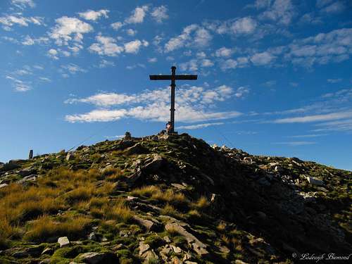 The large summit Cross at 2267 meters | 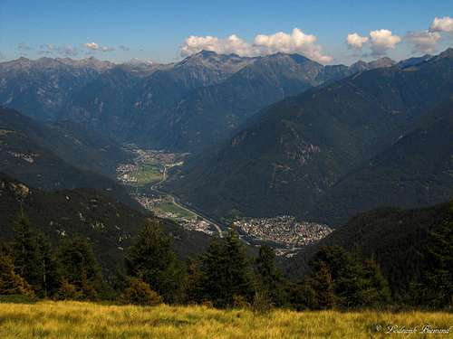 View into the valley towards Roveredo | 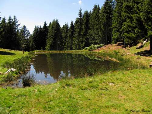 The small lake just above Mornera |
Views from the summit of Gaggio are extraordinary. Deep down in the valley (2000 meters below) you can see the capital of Ticino, Bellinzona with its famous castles. You can see the whole Leventina valley with the highest peaks of Ticino (including the highest: Rheinwaldhorn/Adula (3404m)) rising above it. Towards the south the grand lake Lago Maggiore is visible as well. Towards the east you can see the pyramid shaped Pizzo di Claro (2727m) dominating the view. Towards the west you can see Gaggio’s higher neigbours Cima dell Uomo and Cima d’Erbea.
Gaggio is a popular objective for tourists as well as locals. This is very understandable, since Gaggio offers one of the finest views of all mountains I climbed in the area. Another advantage is the small Mornera cableway and the opportunity to use it in the evening hours (it is works automatic outside ‘’office hours’’). We were able to enjoy the evening sun on the summit and still get down in the valley before dark using the cableway down; very recommended!
Views of Gaggio:
 Gaggio from West | 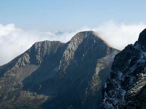 Gaggio from North | 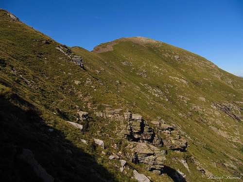 Gaggio from South | 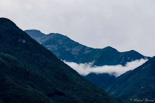 Gaggio from East |
Getting There

Overview Map Gaggio A2 Highway
Coming from Gotthard (north) or Italy (south), drive towards Bellinzona over the A1 highway and go off
at 'Bellinzona-Nord' (see map at right)
From this point on see the Google-Map above. It shows the
directions from the Bellinzona-North exit to the Mornera Cableway station.
Route
 On our way down on the trail below Albagno | 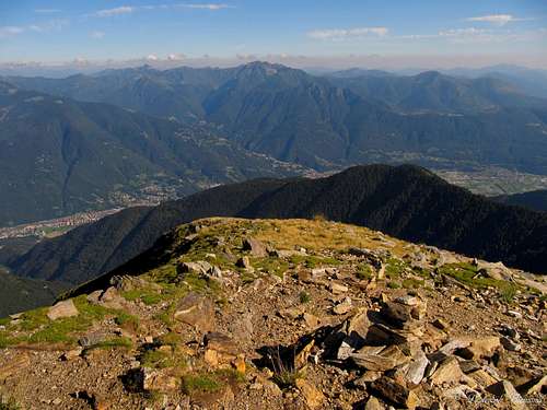 Summit view towards the SE with the Leventina Valley |
The normal route starts at the end of the Mornera cableway at 1347meters above sea level. A big yellow signpost marks the start of the trail. The sign says: ‘’Capanna Albagno’’. It takes about an hour and a half to get there on well-marked
trails (T3). 10 Minutes from the start you’ll pass a small, but beautiful lake, which is created to take water from by helicopters in case of (forest) fires in the mountainous area.
From the capanna it is another hour and a half to the summit of Gaggio, again on well-marked trails (T3). Descent is the same way and this will take about 2-2,5 hours back to Mornera. Gaggio is a great tour for a single-day outing. See the two maps below for the routes. Note that the essential route parts are marked in red. Click on the maps to enlarge the view!
 Gaggio Route Map 1: Monte Carasso - Mornera |  Gaggio Route map 2: Mornera - Albagno - Gaggio |
Mornera Cableway
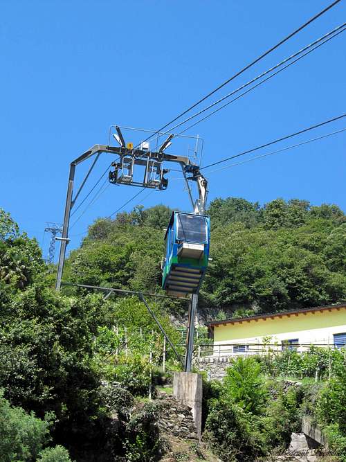
Mornera Cableway
Follow this link for the official page of the Mornera cableway. The Mornera cableway starts in the small village of Monte Carasso, which is located just outside the city of Bellinzona. As mentioned above, the cableway is opened every day in the summer months between 08:00 and 17:00. The cableway runs automatically between 06:00 and 08:00 and between 17:00 and 21:30. For the exact operating hours click here.
Adress & Telephone:
I Fracc 1
CH - 6513 Monte Carasso
+41 91 825 81 88
Capanna Albagno (1870m)
Capanna Albagno UTOE (1870m)

Cima Dell Uomo (2390m) with cap. Albagno
Telephone: +4179274 22 50
Coordinates: 717.100/120.140
Capacity: 28 beds
Opened: Only closed from 01.12 until 31.03
Website: Click Here
When to Climb
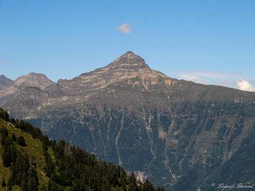
Pizzo di Claro as seen from the trail to Albagno
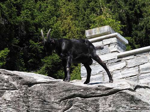
A visitor along the route
Weather
Hotel & Camping
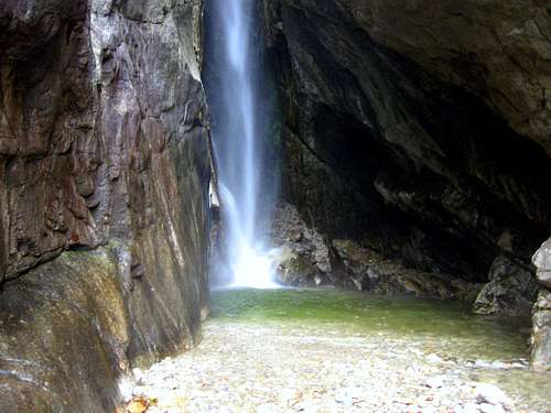
Waterfall near Al Censo Camping
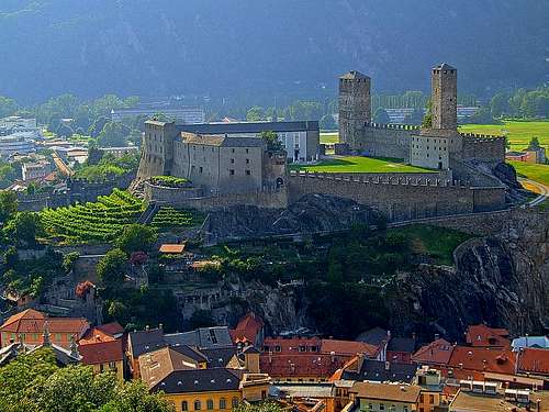
Bellinzona & Castelgrande by Vid Pogachnik
Campings in Ticino can be found on: Camping search
Personal Favourite: Camping Al Censo, Claro
Camping Al Censo
For hotels and other places to stay:Visit the Major cities: Bellinzona, Lugano or Locarno
Hotels
Personal Favourite: Camping Al Censo, Claro
Camping Al Censo
For hotels and other places to stay:Visit the Major cities: Bellinzona, Lugano or Locarno
Hotels
Maps and Books
 | 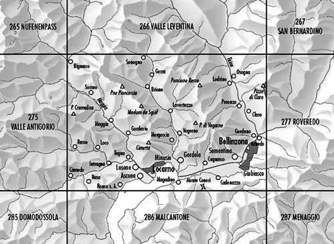 Bundes Landkarte (BLT) 276: Verzasca-Locarno-Bellinzona |
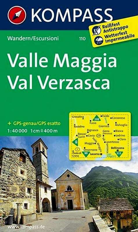
Kompass Map WK110 Valle Maggia ValVerzasca
1:50.000
ISBN13: 9783854913368
Bundes Landkarte (BLT) 276
1:50.000
Verzasca-Locarno-Bellinzona