
-
 24434 Hits
-
 81.84% Score
-
 14 Votes
|
|
Route |
|---|---|
|
|
51.22780°N / 115.5625°W |
|
|
Trad Climbing |
|
|
Summer |
|
|
Most of a day |
|
|
5.7 (YDS) |
|
|
8 |
|
|
Overview/Approach

Lloyd MacKay and Gunther Boehnisch put this route in. Chris Perry calls it a classic at tabvar.org (where he has a good topo up), but I beg to differ. The route is not sustained and offers little in terms of challenge compared to your typical 5.6-5.7 trad routes in the Canadian Rockies. That being said, its close proximity to Banff and ease of access do make it an honorable objective when faced with suspect weather.


Mother’s Day follows the obvious edge of the Mother’s Day Buttress which is a prominent buttress on the southeast side of Cascade Mountain, just to the east of the Cascade Falls and Rogan’s Gully winter ice climbs (falls in the summer).
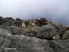
Mother’s Day Buttress is located about 1 km east on the Lake Minnewanka road from the first TransCanada exit for Banff when traveling west/north bound. Once you exit, turn right and cross the cattle guard and park in the first paved pullout you come to on your right. Walk down the road another .2kms to a drainage on the left side. Step into the drainage and follow it north for a short distance looking for a cairn on the right bank. From this cairn, pick up a faint trail that continues north and works its way up to the tree line on the buttress and the first slabby pitch which overlooks the main drainage down to the left.
The route can be done in eight pitches or less and the belay stations are fixed. The descent involves a westerly circumnavigation of Cascade over to Rogan’s Gully’s descent which involves one short rappel (chained) in the summer.
Route Description
335 Meters, 7 Pitches, 5.71st Pitch- 40m- 5.4/ I soloed the first pitch and then brought the 2nd up to a chained station. You get to the base of some low angled slab. Climb up to some small trees and then angle left to the chains.
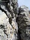
2nd Pitch- 60m- 5.7/ This pitch can be divided into two easier pitches by traversing out left from the belay. But that would miss the only good climbing of the day (albeit quite dirty and loose). Climb straight up into a right facing corner. There is a station towards the top of the corner if you want it, but I chose to run it out to the next station. Top out on the corner and move left into a huge steep groove. Pass two pitons in the groove and traverse right out onto the right face past another piton and make a solid move up and over to a small ledge. Climb up and through another corner with piton to reach a comfortable chained station on the buttress ridge proper.
3rd Pitch- 50m- 5.4/ Climb up easy ground past a tree angling slightly left to a fixed station below and right of a short and steep corner.
4th Pitch- 40m- 5.5/ Move left and climb the corner and then traverse right circumventing several blocky corners up to a tree and a fixed station on the wall in front of you.
5th Pitch- 40m- 5.5/ Traverse out right and up an easy, but fun, corner, to the ridge proper again. Look for a fixed station to the left of a big tree.
6th-7th Pitches- 100m- 5.5/ I advise simul-climbing these if you are as bored as I was at this point. Just head straight up easy ground past a fixed belay and tree on a significant ledge and continue angling right following a groove/crack through a small roof problem towards the top (easy to protect with a large cam). Make a steep move through the roof and belay off of any of several trees.
Climbing Sequence
 |
 |
 |
 |
 |
 |
Descent
Look for a faint trail that leads off left and down as it circumvents the first of two large drainages you need to cross on the southeast face of Cascade Mountain. Cross the first drainage without loosing too much elevation (the trail is easy to navigate at this point) and continue through trees to the next drainage (Cascade Falls) and cross the top of the waterfall ice route known as Cascade Falls and continue through trees once more until you come to the waterfall known as Rogan’s Gully. Descend the east side of the gully via short switchbacks keeping your eye out for a chained rappel on a wall to your left. Make a short rap (20m) and continue down the east side of the gully back to the road. Even though the beta at tabvar.org mentions 1.5 hours for this descent, it took us under one hour in no hurry.Essential Gear
I would solo the route if I did it again, so a small rack would be in order, not to mention you come across quite a bit of fixed pro. The roof at the top could use a large cam (#4 Camelot) if you want to protect it. A handful of draws and a few 120cm runners so that you can combine a pitch here and there. One 60m rope would be best. The descent involves one 20m rap, but at least one of the pitches could use a full 60m if you are going to combine two pitches as I did. You can climb in boots if you don’t want to pack anything or take runners to biner to your harness as your descent takes you a different direction. Helmet.External Links
- 100’s of Canmore and Banff National Park multi-pitch rock climbs, ice climbs, alpine climbs and scrambles, just scroll down to routes
- Banff National Park, Parks Canada
- OR: Best True Technical Clothing and Accessories in the Outdoor Industry
- Scarpa, has surpassed La Sportiva in terms of quality, function, value
- Osprey Backpacks, Not a Second Choice
- Great Outdoors Depot
- Mont-Bell
- Cascade Designs (MSR; Thermarest; Platypus)