
-
 8385 Hits
-
 84.27% Score
-
 18 Votes
|
|
Mountain/Rock |
|---|---|
|
|
34.35270°N / 117.917°W |
|
|
Los Angeles |
|
|
Hiking |
|
|
Spring, Summer, Fall, Winter |
|
|
7283 ft / 2220 m |
|
|
Overview
Mt. Akawie, like its close neighbor, Winston Peak, and like Mt. Lewis below Dawson Saddle, is a peak readily accessible off the Angeles Crest Highway (SR2). This peak has apparently never been officially named by the USGS. However, it was formerly known as Buckhorn Peak and is still shown as such on Harrison’s Angeles High Country Trail Map (1998 ed.). The peak received its present name in 1990 when the Sierra Club’s Hundred Peaks Section decided to honor a former leader who had always proclaimed this as his favorite peak.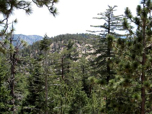 Mt. Akawie from Cloudburst Summit
Because a hike to this peak by either route described below involves little more a mile round trip, you will want to combine Mt. Akawie with other nearby peaks such as Winston Peak, Winston Ridge, Mt. Waterman, and perhaps Twin Peaks.
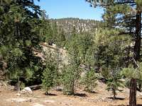 Winston Peak from near summit of Mt. Akawie
Route 1
From the parking area, go past the locked gate and hike northeast on the dirt road about ¼ mile to where a ravine on the left goes up to a small saddle. Go north up to the saddle. Turn right (east) and continue along the ridge to the summit.
This route is about 1.2 miles round trip with 400’ of gain.
 Summit of Mt. Akawie 7.28.07
Route 2
From the parking area, Mt. Akawie’s summit is at a bearing of 44 degrees. From the east end of the parking area start up the slope passing to the right of a descending dirt road. In about 1/8 mile you will pass a gully on your left. Ahead you will note a tall boulder cluster amidst some trees. Continue under and to the right of this high area to a shallow saddle. From here, proceed as in Route 1.
This route is about 1 mile round trip with about 500’ feet of gain.
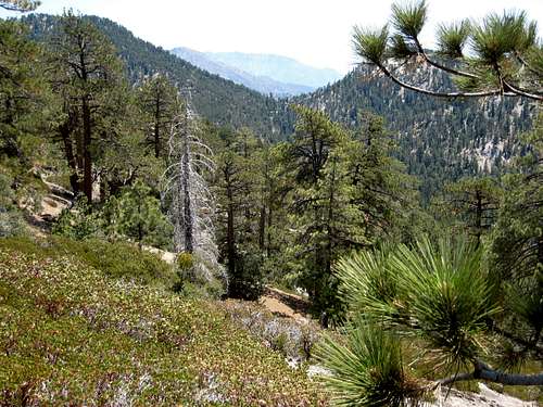 Looking east from near summit of Mt. Akawie, 7.28.07
Getting There
From the 210 Freeway, exit at Angeles Crest Hwy (SR 2) and go north. At 9.5 miles, you will come to the Clear Creek Information Station and junction with Angeles Forest Highway. Continue straight and in 4.5 more miles you will come to the junction with the Mt. Wilson Road at the Red Box Ranger Station and trailhead. From here, continue straight on SR2 for 19 miles more to the signed Cloudburst Summit.For Route 1 described above, continue past Cloudburst Summit another .4 miles to the Mt. Waterman Ski Lift (on your right). About ¼ mile past (east of) the ski lift, you will see a gate leading to a dirt road on the north side of the highway. Park in the turn off area near this gate.
For Route 2, continue past Cloudburst Summit and go .1 mile past the Mt. Waterman Ski Lift where you will see, on your left, a large paved turn off area. Park here.
Red Tape
You will need an Adventure Pass (see link below) to park your vehicle anywhere within the Angeles National Forest, including the parking areas described here. These passes are currently sold at the Clear Creek Information Station and the Red Box Ranger Station ($5 per day or $30 for a yearly pass), which stations you pass along SR2 on the way to the starting locations here. Otherwise, Adventure Passes are also sold at most sporting good stores in Southern California.No permits are required for hiking in the area where this peak is located.
Camping
Buckhorn Campground is just southeast of Mt. Akawie and is reached off of SR2 about a mile past Cloudburst Summit. Alternatively, Cooper Canyon Trail Camp is a developed campsite, just 1.75 miles down the fire road from the gate at Cloudburst Summit.When to Climb
All year round. However, equip yourself appropriately when there is snow cover in the winter.Mountain Conditions
Check forecast information in local newspapers or internet weather services during the winter months. Check with Cal Trans (see link below) on road conditions and closures during the winter. Always carry chains for your vehicle during the winter when there is snow or snow is forecast.Other Information
USGS Topo Maps Mt. Waterman 7.5External Links
California Dept. of TransportationAdventure Pass information
Angeles National Forest