
|
|
Mountain/Rock |
|---|---|
|
|
42.84050°N / 109.1587°W |
|
|
Hiking |
|
|
12250 ft / 3734 m |
|
|
Overview
Mount Chauvenet is in the southern Wind River Range of Wyoming. It resides six miles east of the main crest of the range though it is nearly as high. As a result, the eight-mile-long Windstorm massif, of which it is part, is responsible for obstructing views from the plains into the interior of the range and causing many summertime travelers heading for Yellowstone to wonder when they will see 'real' peaks. It is actually two crests removed from the main crest, one crest removed from the high foothills and 7000' above the desert basin. This massif also contains several granitic glacial cirques where there has been minimal route activity. Its position creates a great viewpoint for the interior of the range and also a vulnerability to high winds. A mile and a half down the east ridge stands a pinnacle, prominent from a distance, called Bears Ears. It is formed from an ancient basement rock that is some of the oldest exposed rock on the continent. The 1400' high south face is the headwall of the Cathedral Lakes cirque. The Bears Ears trail passes within half a mile of the summit. A dayclimb of Chauvenet may leave you questioning the sanity of hefting a full pack over the Bears Ears trail. | 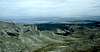 |  |  |
Approach - Roads and Trailheads
Via Dickinson Park. At Hines General Store, in Fort Washakie, head towards the mountains on the Trout Creek-Moccasin Lake road. It turns to dirt, gets rough and switchbacks for 16 miles to the Bears Ears trailhead turnoff. Policy varies from closed, to passable with a WR Reservation fishing license, to publicly open. This road and its trailheads are currently in access limbo as of June 25, 2007. Officially, the Forest Service is calling it CLOSED. Contact Shoshone National Forest for details.Via Big Sandy Opening. From the trailhead, an 18 mile combination of the Fremont Trail, Pyramid Lake Trail, Washakie Pass Trail, and Bear's Ears Trail (all with signed junctions) will put you on the west side of the mountain at Valentine Lake.
Management and Regulations
Managed as the Popo Agie Wilderness of Shoshone National Forest. Wilderness regulations apply for camp locations, group size, campfire restrictions and ethics. Roads can remain closed until early June. The approach is on the Wind River Reservation and fishing permits are often required to use the road. They are purchased at Hines store in Fort Washakie or at sporting goods stores in Lander and Riverton. A campground exists 1.5 miles past the trailhead at Dickinson Creek.Seasons and Conditions
Summer season in the Wind Rivers is generally July-September with roads opening in early June and snow lingering on the higher trails into July. A snow storm is traditional between the last week of August and the second week of September. This is often followed by a dry period with crisp temperatures for 1-4 weeks.A Lander webcam is pointed roughly towards the mountain.
Weather stats near the base of the mountain.
Additional Route
South Ridge. II, 5.5 from Cathedral Lake. 1 asc, James Garrett, 1996.Etymology and Trivia
- While the Hayden Survey was in Wyoming, in 1874, A.R. Marvine was under Dr. Hayden's direction to conduct research in northwest Colorado and Utah. A.R. Marvine's assistant was Louis Chauvenet. Hayden honored Chauvenet by labeling a peak in Wyoming with his name on the 1877 Hayden map, however, that peak was the one we now know as Lizard Head. In the course of the next several decades and maps, the name eventually migrated to its present position on the Mocassin Lake 15' quadrangle of 1937. Marvine's namesakes are a peak in Utah's Fishlake Mountains as well as peaks in Colorado's Flattops. Marvine and Chauvenet published "North-western Colorado and part of Utah, 1881".
- 1st recorded ascent, William Owen, 1890.
- The Bears Ears are approximately 2.6 billion years old and pre-existed the Wind River Range. Geological study has theorized that they are some of the oldest exposed rocks on earth. Other material of this age in this region has undergone metamorphosis.
- Popo Agie is Crow for 'tall grass' and is pronounced "po-po-zsha". Chauvenet is pronounced "sho-veh-NAY".
- The view of the central crest of the Winds from the summit has caused some climbers to effuse anachronistically. Pioneer/mountaineer Edgar Fourt became convinced this was the mountain obtained by Captain Bonneville (based on the semi-fictional account by novelist Washington Irving). Sierra climber/historian Francis Farquhar became convinced this was the peak climbed by Frémont (regardless of the sketches of the accompanying Preuss).
Sources/Bibliography
Turiano, Thomas (2003). Select Peaks; Indomitus Books, Jackson, WY.Bonney, O.H. (1977). Guide to the Wyoming Mountains, 3rd Ed.; Swallow Press. Chicago,IL.
Hastings, Larry (1998). The Wind River Mountains; Paintbrush Productions. Lander, WY.