
-
 22658 Hits
-
 85.87% Score
-
 21 Votes
|
|
Mountain/Rock |
|---|---|
|
|
43.20100°N / 109.68°W |
|
|
Hiking, Mountaineering, Scrambling, Skiing |
|
|
Spring, Summer, Fall |
|
|
13155 ft / 4010 m |
|
|
Overview
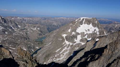
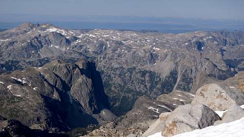
Desolation Peak is a thirteener in the northern Wind River Range of Wyoming, and is tied for the 25th highest peak in Wyoming. It's one of the 13ers (see the list here), and is perhaps one of the more remote ones to reach, hence the name! It is a difficult peak to reach with extensive off trail travel required from all sides. Desolation sits west of the crest with a summit that is a planar surface nearly identical in composition to that of the nearby Continental Divide. The large, flat summit and four steep sides give the peak a squarish appearance. This, combined with the ridged snowcap, makes the peak recognizable. The snowcap is seasonally the highest, shifting point. Desolation is surrounded by lakes filled with glacial silt and several small glaciers, and is sometimes climbed by parties that have an extra day at the base of the west face of Gannett, but not by more than a couple per year. Route difficulties range from Class 3 to mid Class 5 and most faces and ridges have been climbed. The peak appears as part of Gannett when viewed from the Teton Range to the west.
|
|
Approaches
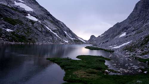
Desolation is perhaps most easily reached by bushwacking up Tourist Creek from Three Forks Park on the upper Green River. Start from the trailhead at Green River Lakes, reached from Pinedale by following highway 191 NW for 6 miles to the Cora road. Follow for 45 miles to the lakes. The Highline trail is followed for 10 miles to Three Forks Park. Instead of crossing the river at the lower end of Three Forks Park, follow use trails for 1 mile up the east side of the river until Tourist Creek is met. Or you could continue on the main trail to Three Forks Park and ford the Green River to reach the mouth of Tourist Creek (waist deep but calm water). From here, a faint bushwacking trail gains 1800' in one mile up the south side of the creek to lake 10090. Continue for 2 miles up the basin to the SE to reach lake 11085 for all routes but the north face. For the north face, branch east to lake 11145. Desolation has been reached from all directions including the notorious Wells Creek, hanging valley approach (which includes a Class 4 waterfall/slot canyon combination). Approaches normally take backpackers 2 days.
Another, roundabout way to approach Desolation is from the continental divide coming off the west flank of Rampart Peak to the Desolation col, the low saddle between Desolation and Rampart. This same col can also be reached via Wells Creek, and hiking past Scott Lake, and Long Skinny Lake and rounding the southeast flank of Desolation Peak where mellow snow and class 2 terrain gets you to the col via it's south side. Reaching this col from the north side from the uppermost lakes in the Tourist Creek drainage requires steeper snow (max 45 degrees).
|
|
Routes
East Ridge - Class 4 (Red)
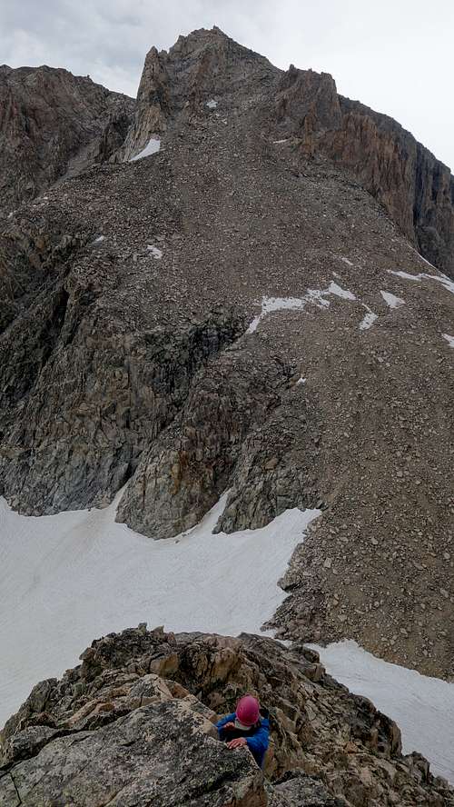
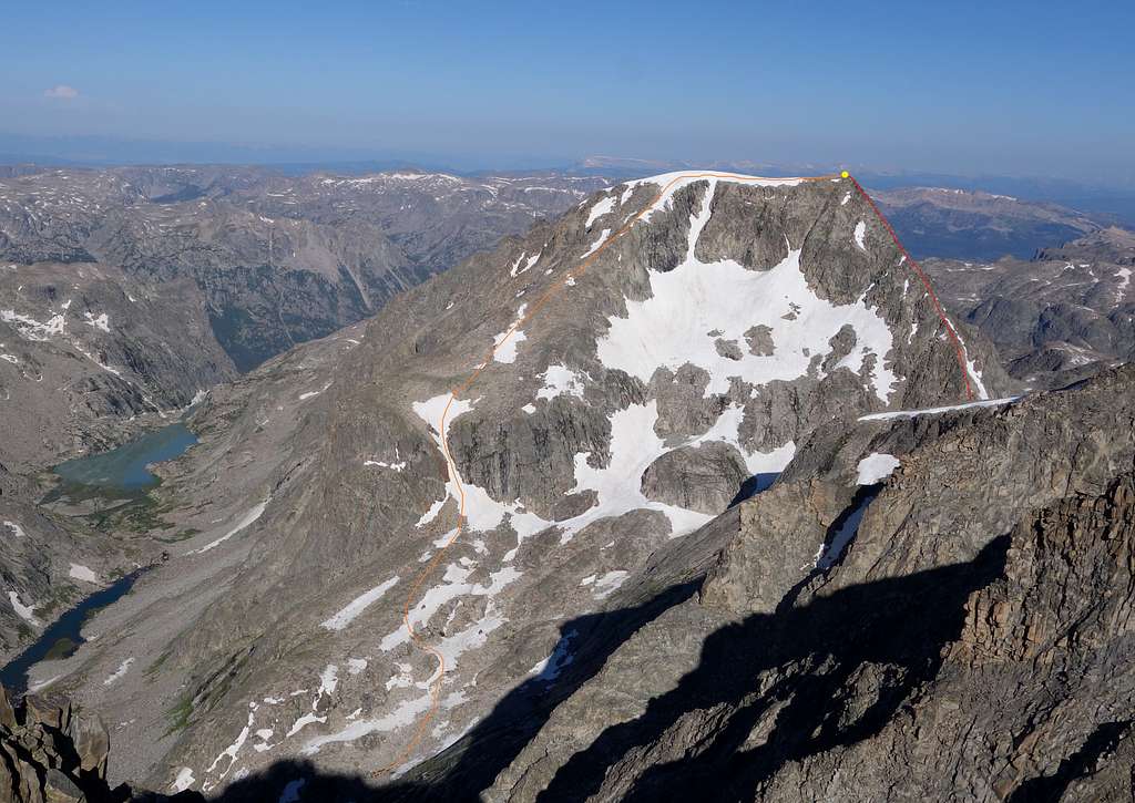
Kelsey describes a handful of routes in the guidebook, however one route he distinctly doesn't include is the amazing east ridge. This is the route I'll describe here, but the standard SE route (class 3) is also displayed on the topo image below. The east ridge begins at Desolation Col, therefore unless you are planning to cross the divide to climb other peaks in the area, it may not make much sense to hike all the way to the Desolation col from western approaches if you're only objective is Desolation Peak. Once you're at the col, the east ridge begins ascending steeply on a narrow spine of mostly excellent rock. During a 2 week slam in the Winds climbing all the 13ers, this was one of the top 3 scrambles we did. It's highly recommended.
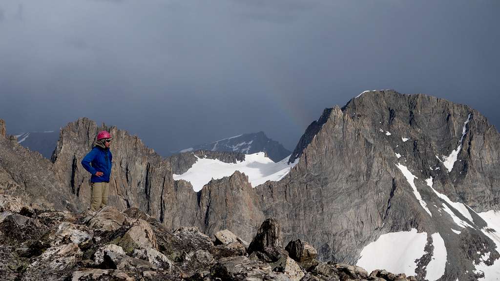
The ridge begins up class 3 scrambling, reaching a small rock outcrop with a 15 foot drop to a tiny notch. Navigating through this small notch, where you'll notice a steep scree gully dropping to the north, was the only loose part of the route. Once above this, the rest of the ridge is a beautiful solid scramble. Occational class 4 rock outcrops, traverses, or steps are encountered, but generally you can avoid any difficulties by cutting left off the crest onto the south side. The ridge will terminate on the summit plateau, just a handful of steps from the highest rock. You get to avoid the flat walk across the often snow covered summit plateau if climbing this route. When we were about 75% of the way up the east ridge from the col, we watched a beautiful thunderstorm pass just to the south of us, and hit Gannett Peak pretty hard. We were able to find a rock to hide under just off the crest, but we never got wet, and a level view of the lightning and virga was super cool. From Desolation Col to the summit the ridge rises 900 feet.
SE Ridge - Class 3 (Orange)
This is the standard route up Desolation, and the least technical, consisting mostly of a talus walk, however the crux does involve a little bit of 35-40 degree snow in the narrow gully that provides access to the gentle upper SE ridge. Crampons and axe are necessary.
Other technical routes exist on the SW ridge, north face and west face.
Seasonal Conditions
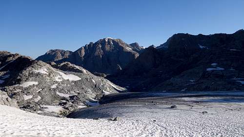
Summer season in the Wind Rivers is generally July-September with snow lingering on the higher trails into July. A snow storm is traditional between the last week of August and the second week of September. This is often followed by a dry period with crisp temperatures for 1-4 weeks. On glacier routes crevasses are hidden in June and begin opening sometime in July. Roads are usually opened in early June. An area webcam points at nearby peaks. The approach is heavy with mosquitos and gnats June thru August, although in drier summers after mid-August most of the bugs will be gone. Camping can be found along many of the lakes in the upper Tourist or Wells Creek drainages.
Map
The map above shows the east ridge route up SDesolation Peak via the purple line from the Desolation Col.
Facts and Trivia
- 1st ascent was made by Theodore and Gustav Koven via a west couloir - 1930.
- Desolation is tied with Split as the 25th highest in Wyoming.
- The longest of its four ridges is the NW which culminates in a point known as "Mount Solitude". Midway across the ridge is a buttress named Three Cirque Needle with established routes. The SW Ridge is a quality 5.7 that bypasses a gendarme called "Broken Hand Pinnacle".
- If the Wells Creek approach is used, the peak will seem easy by comparison. Some backpackers consider this approach one of the great wilderness challenges of the range. It is not passable during peak runoff.
- Desolation Peak is also the name of a peak in the North Cascades.