
-
 6824 Hits
-
 80.49% Score
-
 12 Votes
|
|
Mountain/Rock |
|---|---|
|
|
48.11516°N / 120.94636°W |
|
|
Snohomish/Chelan |
|
|
Hiking, Mountaineering |
|
|
Spring, Summer, Fall |
|
|
7625 ft / 2324 m |
|
|
Overview
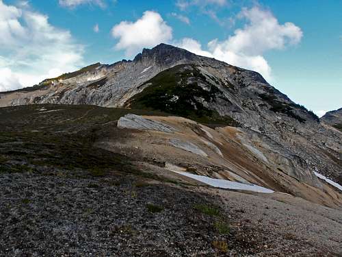
Cleator from below High Pass
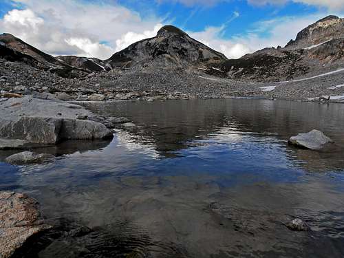
Probably named for Fred Cleator, a conservationist who worked in the National Forest Service for 35 years, this peak is a great vantage point near High Pass. With 545 feet of prominence this is a worthy objective for anyone planning on climbing Buck Mountain from Buck Creek Pass or just a nice finish if camping at High Pass. The view from its South summit provides an excellent combination of Triad Lake with Glacier Peak looming behind. Many Washington top 100's (more than half) are visible from this high point and all of them are stunning. The peak is situated right on the county line of Snohomish and Chelan counties with an interesting diversity of glaciated and wet peaks to the West and very dry rocky crags to the East.
Getting There
From Steven's Pass, head East on US 2 about 20 miles to Cole's Corner (59er Diner) and take a left onto hwy 207 for 4.3 miles. Bear right at Chiwawa Loop Road which joins with hwy 22 in less than a half mile. In about 0.8 miles turn left onto the Chiwawa River Road (NF-62) continuing for 22.7 miles to Buck Creek Pass Trail Head (Trinity). Take the gently rising Buck Creek trail 10.5 miles to Buck Creek Pass. There are many places to camp here and plenty of running water. This is a good jump off point for many good peaks and a decent vantage point of Glacier Peak. Beware that bears will be more common here so remember to keep your food away.
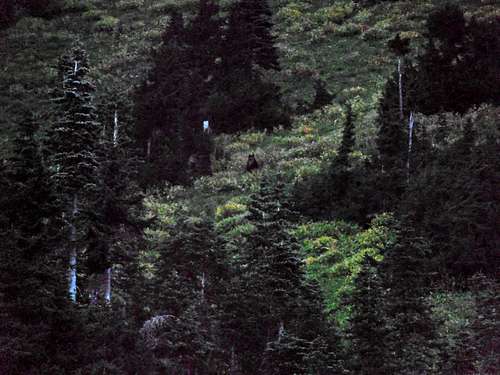
Black bear at Buck Pass
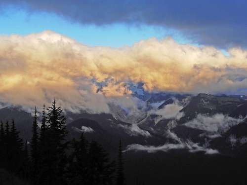
Clouds
Route
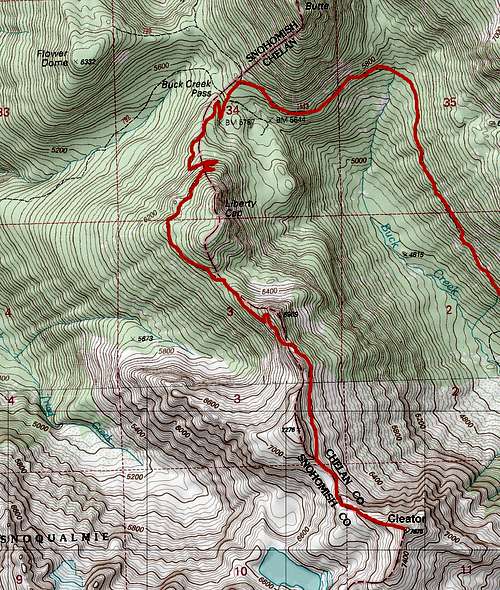 Cleator route up Buck Creek Trail | From Buck Creek Pass follow the trail to near High Pass until its official end then take an obvious NW trending ridge of snow or heather up the mountain's slopes. Water sources after Buck Creek Pass are more limited to snow-melt until High Pass so if in late season remember to fill up. Later in the summer after the snow is gone there are obvious unofficial trails that leave the main trail which will stay close to the county line. When snow cover is present it's probably easier just to follow the county line tagging Liberty Cap on the way. Total distance is about 13 miles each way and 4,800' gain. Another possible (but difficult) route goes from Little Giant Pass down to the Napeequa valley, then up to High Pass. This would be fairly difficult and should not be attempted without good stamina. By that point you are probably not going all that ways just for this peak but also Buck or others nearby. It would make for an interesting and rarely visited trip. In early season bring your ax and crampons because there are notoriously steep sections of snow near High Pass. |
Red Tape
This is fully within the Glacier Peak Wilderness so leave no trace and follow wilderness guidelinesWhen to Climb
For best results go from June to August with snow in earlier season. If going before July, bring an ice-ax and crampons. Given the ease of this peak it should probably be combined with Buck Mountain somehow and best done at sunset. In winter the trailheads might be snowed in making for an incredible approach.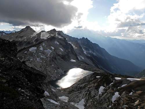
Triad lake from Cleator South summit
Camping
There are no official camp sites near by but plenty of open sandy slopes and terraces. Please stay off of the fragile vegetation and use game trails or barren ground when possible.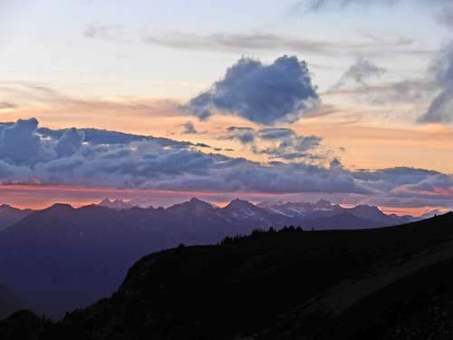
Sunset looking North from above High Pass
Cleator from High Pass
External Links
NOAA Glacier Peak area forecastMount Baker-Snoqualmie National Forest Road conditions
Ranger Frederick William Cleator 1883-1957