
-
 16544 Hits
-
 79.04% Score
-
 10 Votes
|
|
Mountain/Rock |
|---|---|
|
|
49.91780°N / 123.03543°W |
|
|
Download GPX » View Route on Map |
|
|
Hiking |
|
|
Spring, Summer, Fall, Winter |
|
|
6732 ft / 2052 m |
|
|
Overview
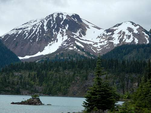
Mount Price Above Garibaldi Lake

The Table and Mount Garibaldi seen from the summit
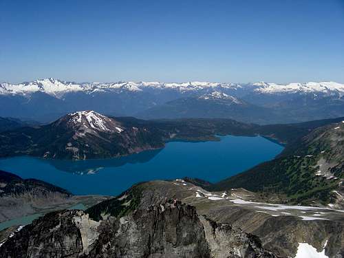
Mount Price and Garibaldi Lake seen from Castle Towers
The Barrier is what is known as a lava dam. It presents a significant risk to the populations of Squamish and the lower Cheakamus River valley. A partial or total collapse of The Barrier could release a tremendous amount of earth and set free the water of Garibaldi Lakes. The most recent partial collapse of The Barrier took place between 1855 and 1856 and created a large boulder field around Rubble Creek. For this reason camping and residing in the area immediately below The Barrier is forbidden.
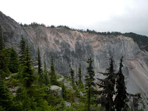
The Barrier
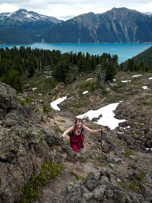
Hiking or skiing to the top of Mount Price is a rather long endeavor for a single day, however in the summer it is not unheard of. The standard route begins below The Barrier and makes use of trails to reach Garibaldi Lake. Official camping is provided by the Provincial Park on the west lakeshore but requires a backcountry permit and payment of a fee. Shared cabins on the lake are also available. From the lake a climbers path follows along a minor ridge through brush and lava boulder fields to the base of the mountain. Scree and snow slopes can be easily ascended to the summit.
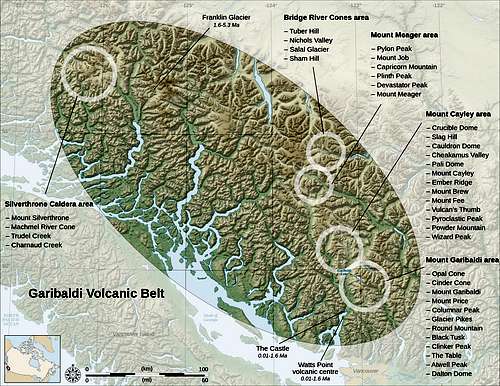
Garibaldi Volcanic Belt
On a clear day, views of The Table, Mount Garibaldi, Mount Tantalus, Cloudburst Mountain, Black Tusk, Panorama Ridge, Gentian Peak, Castle Towers, Mount Carr, Guard Mountain, and Garibaldi Lake down below are truly breathtaking. You might also consider visiting the summit of nearby Clinker Peak while you are in the area which is a short add-on to any itinerary.
Maps
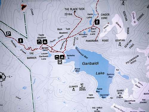
Hiking Signboard Map
Standard Route
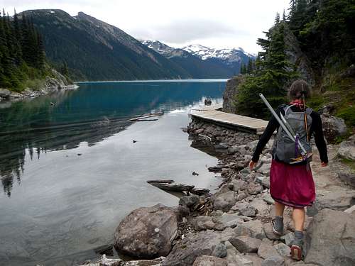
Garibaldi Lakeshore Trail
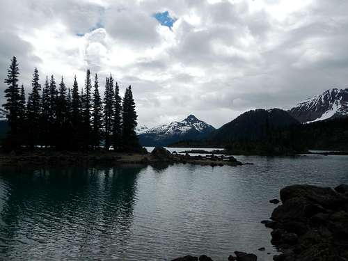
Battleship Islands
From the Rubble Creek parking lot follow the steep trail up past The Barrier to the Taylor Meadows trail junction. Take the right fork to Barrier Lake and continue toward Lesser Garibaldi Lake. At the largest of the three lakes, Garibaldi Lake, turn right at a fork and descend slightly to the Rubble Creek bridge crossing.
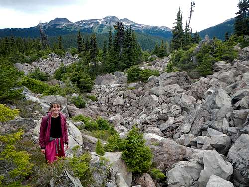
Crossing Lava Boulders
The trail contours the lake-shore and soon comes to the campground. Continue past the campground to Battleship Islands and continue until you come to the rangers boathouse. The Price/Clinker climbers path is behind the boathouse and usually marked with some flagging.
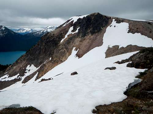
On The North Ridge
The climbers path winds through several boulder fields and can be tricky to follow amid the rocky sections, but is easy to discern for the most part. It will lead all the way to the base of the north ridge which emanates from the high point between Mount Price and Clinker Peak.
Summit and West Saddle (on right)
Scramble class 2 on this north ridge or ascend easy snow slopes to reach the upper saddle just west of Mount Price. If snow cover is at a minimum, expect some amount of volcanic scree. With lots of snow, be careful of avalanche danger on the upper slopes. From the upper saddle, the summit is a short easy walk.
External Links
BC Parks WebsiteCamping Permit Link
Email: ParkInfo@Victoria1.gov.bc.ca
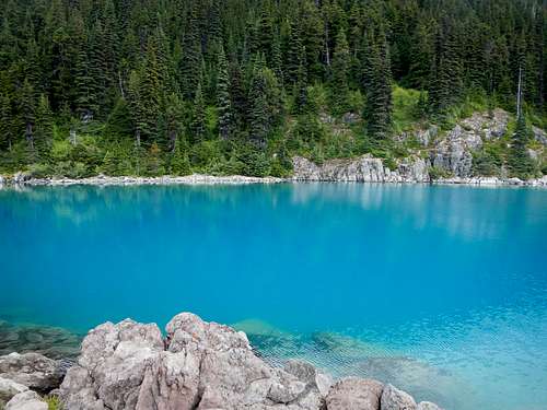 Azure Waters of Garibaldi Lake | External Trip Reports
Useful Wikipedia Links |