
-
 11040 Hits
-
 77.3% Score
-
 8 Votes
|
|
Mountain/Rock |
|---|---|
|
|
48.00183°N / 121.0233°W |
|
|
Chelan |
|
|
Hiking, Mountaineering |
|
|
Spring, Summer, Fall |
|
|
7280 ft / 2219 m |
|
|
Overview
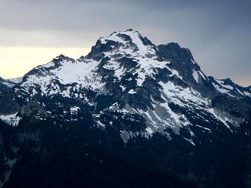
Mount Saul Northeast Face
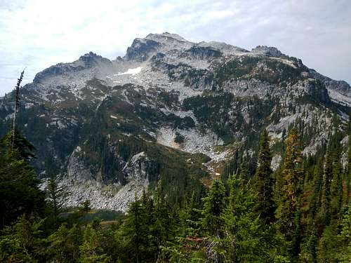
Mount Saul Upper East Face
Details of the first ascent are unknown. Mount Saul has a bare granitic top with a sheer northwest face and features Airplane Lake in a large depression below the upper east slopes. The west ridge extends 4 miles to Indian Head Peak. A traverse route between the two mountains exists, but has likely only been completed a handful of times.
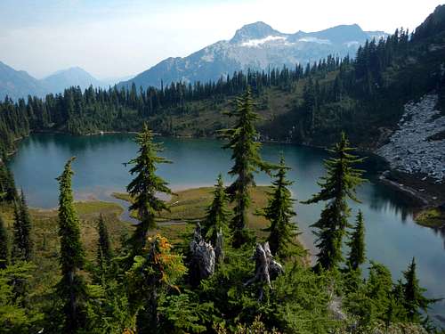
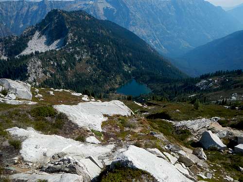
Airplane Lake
The standard route is 16 miles round-trip with 5300 feet of gain. It begins in the White River Valley and uses the Indian Creek trail and Airplane Lake trail to access the peak. From the summit you can enjoy the best view of Dakobed Ridge from anywhere as well as seldom climbed peaks like Tenpeak Mountain and Neyah Point. As of September 2014, there was a mountaineers register present dating back to 1984. Saul sees an average of 4 or 5 ascents a year.
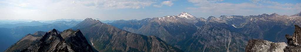
Summit Panorama
Standard Route
Beginning at the same parking lot for Mount David and other Poets Ridge peaks, cross the bridge over White River and turn right (north) on the west bank White River trail. The White River Valley is home to some wonderful large old-growth cedars. One particular specimen has a diameter of 12 feet.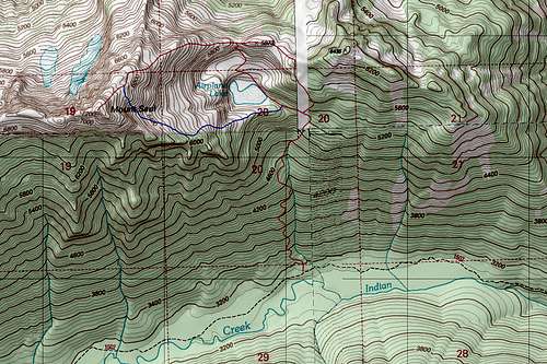
Saul Routes Map
Continue to follow the trail for 3 miles until it turns left (west) into the Indian Creek drainage. Continue another two and a half miles. Watch carefully for the Airplane Lake trail junction. It's easy to miss. It's located on a flat grassy section of trail. There are two indicators to watch for. The first is a small fallen log. The second is the “marking routes is prohibited” sign about 10 yards back from the Indian Creek trail. When you find the sign, you will know you are on the right track.
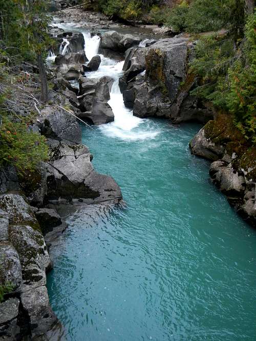
White River
The first part of the Airplane Lake trail is steep and there are a lot of bushes and fallen logs to contend with. But after a tenth of a mile it's more pleasant and easier to follow, albeit steep. Airplane Lake is 2200 feet above Indian Creek with an overall gain of 3200 feet from the trailhead. From the lake it's still another 2000 feet to the summit.
Airplane Lake Far Below
There are 3 viable route options from the lake to the summit. Each has it's own set of difficulties, but no route should exceed the occasional class 3 move. The northeast ridge is a good way to reach the summit, however getting to it can be problematic. North of Airplane Lake a hidden series of cliff bands guards the ridge crest. It can be done, but route finding north of the lake is convoluted. An alternative to gain the northeast ridge is to follow the connecting ridge from east of the lake, but this is also slightly troublesome. One on the northeast ridge, the remainder of the ascent goes pleasantly with clean slabby rock and easy snowfields near the summit
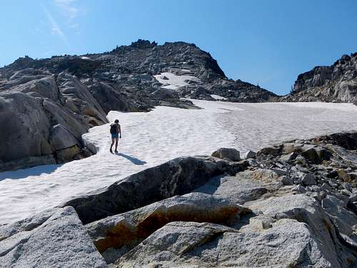
Nearing The Summit
The final option which might involve less brush, has some degree of loose rock and steep talus. This would be to ascend the upper east face directly from Airplane Lake while avoiding obvious cliffs and buttresses. I have not tried the third option myself, but it is more direct and I know folks who have done it.
Getting There / Driving Directions
From Leavenworth, follow Highway 2 westbound for 14.8 miles, or from Everett follow Highway 2 eastbound for 84.5 miles and turn north onto WA-207 towards Lake Wenatchee. Continue for 10.5 miles and just past Lake Wenatchee turn right onto White River Road.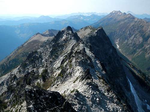
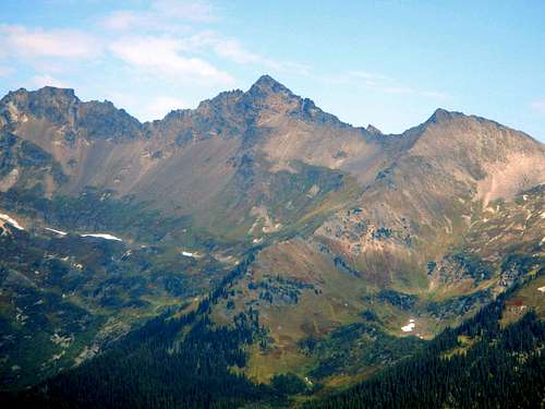
The West Ridge and Indian Head
Continue on White River Road for 10.2 miles to the end of the road, keeping left at all major junctions. There is a fork after 6.3 miles. Keep left onto Forest Road 6400 / White River Road.
Camping / Red Tape
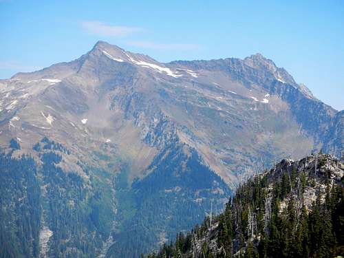
Luahna Peak on Dakobed Ridge
Good camping can be had at Airplane Lake. Please use existing tent spots. Northwest Forest Pass to park at the trailhead.
External Trip Reports
 Clark Mountain on Dakobed Ridge |
|