Overview
Located between the Sultan and Skykomish River Valleys, Mount Stickney is a prominent and noticeable peak while driving highway 2 eastbound. Getting to the top requires a bit of route finding, bringing the right gear and some extra push for the first 4 miles. You'll be either walking, biking, skiing or snowshoeing to get yourself to the good stuff. Because of the low elevation start and it's western location in the Cascades, Mount Stickney makes for a good winter ascent. According to the Cascade Alpine Guide, Stickney was first named Prospect Mountain but later dedicated to a prospector who spent years on nearby claims. It is said he went to Alaska in 1898 and was later killed by wolves.
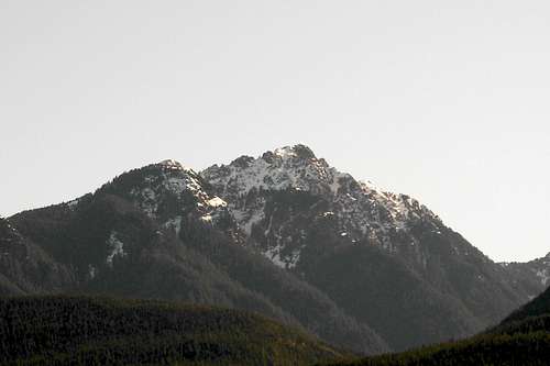
![Mount Stickney]() Stickney from Gold Bar, photo from Redwic
Stickney from Gold Bar, photo from Redwic![Mount Stickney s South Face]() Looking from the summit of Mount Zekes, photo from Flow
Looking from the summit of Mount Zekes, photo from Flow![Mount Stickney Clearing Up]() Stickney in Winter, photo from Flow
Stickney in Winter, photo from FlowGetting There
Take Highway 2 east from Monroe to Sultan, then a left turn on the Sultan Basin Road (a traffic light east of town center). Follow the Sultan Basin Road for 11.5 miles, then turn right on Olney Creek logging road until it becomes impassable, usually within a half mile (or gated at the start now Sept 2012).
![Stickney]() Stickney
StickneyRed Tape
No red tape.
Skykomish Ranger Station
Location:
74920 NE Stevens Pass Hwy.
PO Box 305
Skykomish, WA 98288
Phone Number: (360) 677-2414
Driving Directions: US Highway 2 to milepost 50, one mile east of the town of Skykomish.
Camping
You could stay at the Lake Bronson Associates nudist club with campgrounds, rental cabins, RV hookups, a private lake, tennis courts and recreational facilities on the Sultan Basin Road. Visit
Lake Bronson Club
External Links
10/27/2007 Trip report from nwhikers.net by Dicey, JeffR, PaulK, Mesahchie Mark Click
HERE
NW Ridge Route
Here are the route directions according to the Cascade Alpine Guide, they are good. In winter, it's straightforward following the topography on the map.
Hike the roadway about 200 yds past the ridge saddle, then turn onto a forest path to a crest; then along the ridge until the path fades at about 4200 ft. Continue SE to a pond NE of point 4875, then hike SE to the crest of another ridge. Traverse on an open slope SE and S into the rocky summit basin. Scramble a talus/dirt slope to the summit ridge, then follow the crest E to a small plateau. Walk or scoot across a short exposed ridge section to teh summit hump; walk to the top."
In winter, most groups rope up for the gulley to reach the summit ridge.
![Hiking to Mount Stickney]() Hiking to One Acre Lake
Hiking to One Acre Lake![One Acre Lake]() Crossing One Acre Lake
Crossing One Acre Lake![Ready for Stickney Summit]() Resting for the summit bid
Resting for the summit bid![Mount Stickney]() First view of route up Stickney
First view of route up Stickney![Del Campo & Glacier Peak]() Del Campo & Glacier Peak
Del Campo & Glacier Peak![Big 4 Mountain]() North to Big Four Mountain
North to Big Four Mountain![Puget Sound Lowlands]() West to Puget Sound Lowlands
West to Puget Sound Lowlands![East]() East to Mt. Baring area
East to Mt. Baring area![Firework Show]() New Years Firework Show
New Years Firework Show

 Stickney from Gold Bar, photo from Redwic
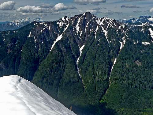 Looking from the summit of Mount Zekes, photo from Flow
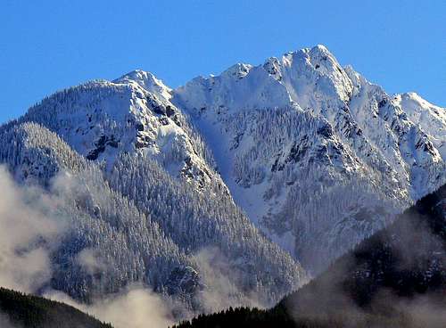 Stickney in Winter, photo from Flow
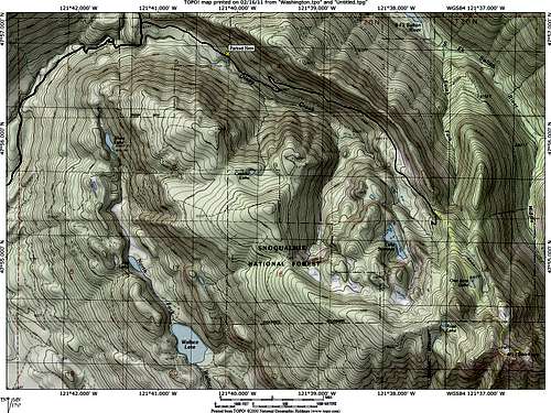 Stickney
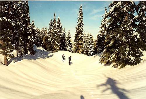 Hiking to One Acre Lake
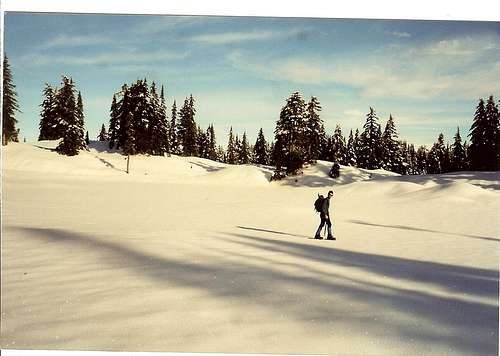 Crossing One Acre Lake
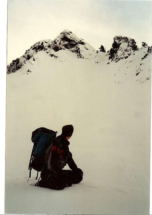 Resting for the summit bid
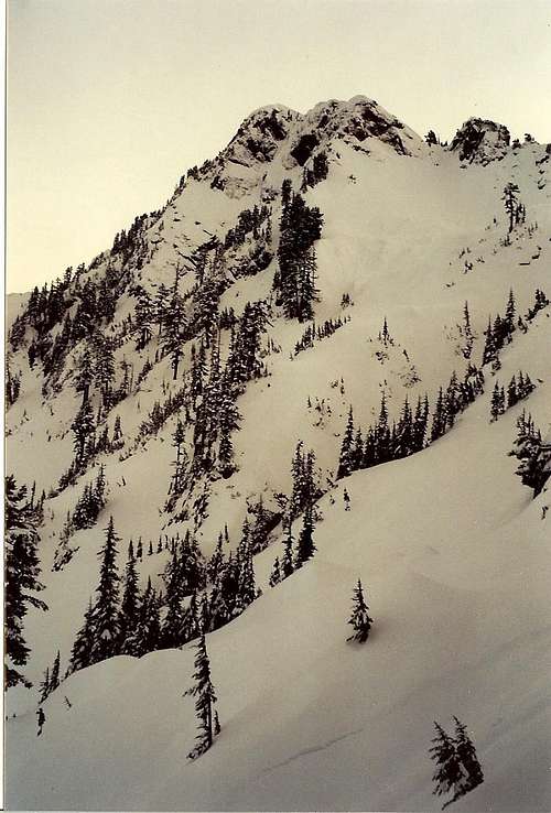 First view of route up Stickney
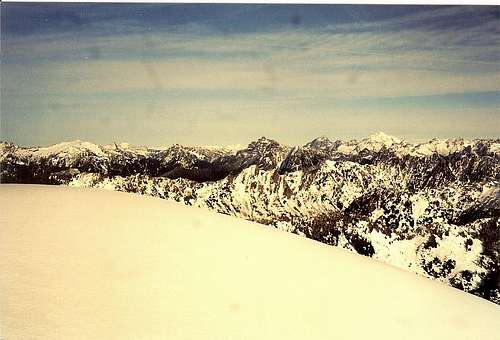 Del Campo & Glacier Peak
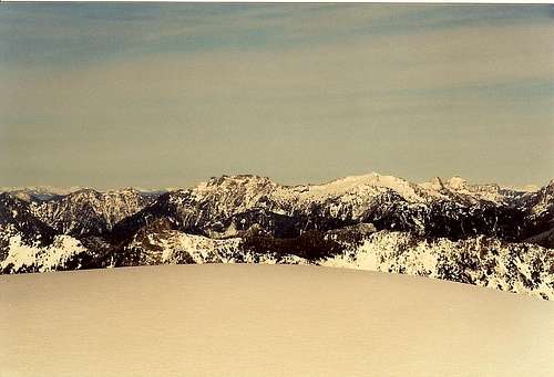 North to Big Four Mountain
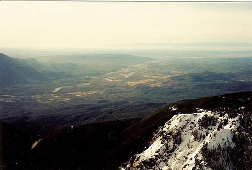 West to Puget Sound Lowlands
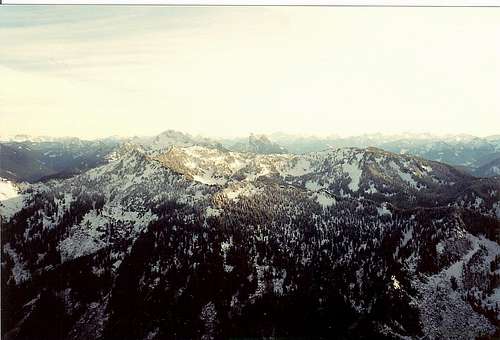 East to Mt. Baring area
 New Years Firework Show
Cascade Scrambler - Sep 1, 2012 9:00 pm - Hasn't voted
Road updateOlney Creek road is gated at milepost 0.0 now.
Waterboy - May 16, 2020 12:24 pm - Hasn't voted
Mount Stickney 5-7-2020Finally managed to climb this one after several attempts. Olney creek logging road is gated at the beginning now (still). The road itself is quite rough and in the snow was difficult to follow. On one attempt I missed the first turn and scrambled up a 600-foot hill to get back to the road. If you use Gaiagps, the road on the map is not correct. IMHO this is far better in snow. The photos I have seen of the scramble route without it look rough. I was solo and handled the gully just fine, but I could see why some would want a rope for it. I have a full topo map on my site at https://hike2hike.com/mount-stickney-climb-wa and also made a video of the winter route you can find at https://youtu.be/YDtPYHcyO8o