
-
 15202 Hits
-
 74.01% Score
-
 4 Votes
|
|
Mountain/Rock |
|---|---|
|
|
36.14990°N / 82.1485°W |
|
|
Carter |
|
|
Hiking |
|
|
Fall |
|
|
4930 ft / 1503 m |
|
|
Overview
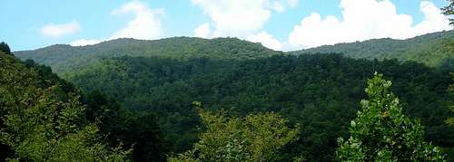
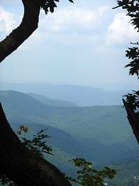
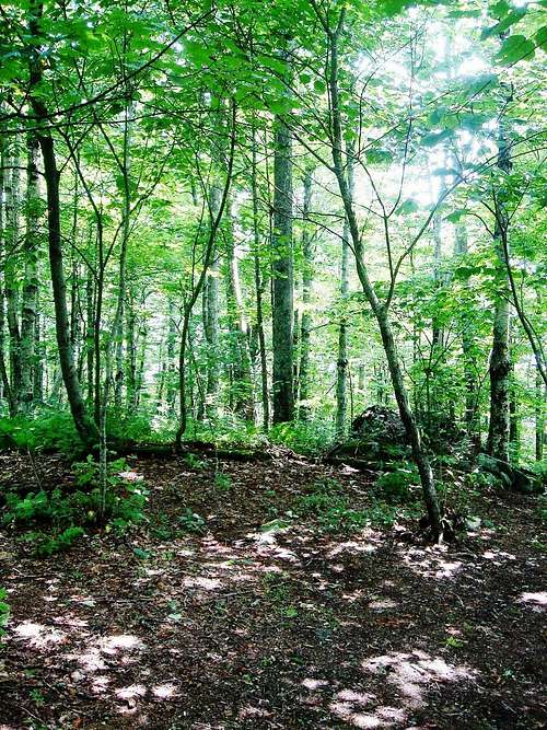
Little Rock Knob, Tennessee’s 37th highest peak,* is one of the principle summits flanking the west side of Roan Mountain. The Appalachian Trail traverses the summit, making this mountain highly accessible. In late spring and early summer, rhododendrons bloom on the lower slopes.A short 2 ½ mile hike from Hughes Gap, Little Rock Knob makes a pleasant day hike and also greets through hikers as they pass south to Great Smoky Mountain National Park or northeast to the Virginia highlands. Fleeting vistas can be caught on the higher slopes of this mountain; however the top is forested.
*According to www.americasroof.com/highest/tn.shtml
Getting There

Tennessee – From Interstate 26 in Johnson City exit US Highway 321 to Elizabethton. Follow 321 to 19E (in Elizabethton) and turn right. Take 19E southeast to Roan Mountain. Turn right on Highway 143 in Roan Mountain. Follow 143 south to Roan Mountain State Park. Drive through the park to the town of Burbank. Turn right on Cove Creek Road, which leaves 143 just before it curves left (SE) to climb the Roan Highlands. Drive 3.1 miles up Cove Creek to a gravel pullout on the right. The AT crosses the road here, at Hughes Gap.
North Carolina – From Elk Park, take 19E to Roan Mountain, TN. Turn left on Highway 143 in Roan Mountain. Follow 143 south to Roan Mountain State Park. Drive through the park to the town of Burbank. Turn right on Cove Creek Road, which leaves 143 just before it curves left (SE) to climb the Roan Highlands. Drive 3.1 miles up Cove Creek to a gravel pullout on the right. The AT crosses the road here, at Hughes Gap.
When to Climb

Year round. Although insects can be pesky in summer, it is usually cool and pleasant even when temps in the lower valleys reach 90 degrees. Late spring is the best time, as the rhododendrons are in bloom.
Camping
Backpackers and hikers can camp at designated spots along the trail. There is a campsite located at the summit. It consists of a fire ring and some flat, open space.
Camping is also located nearby at:
Roan Mountain State Park
1015 Hwy. 143
Roan Mountain, TN 37687
423.772.0190
www.tnstateparks.com
Red Tape
No permits necessary. Please be aware that private land often bounds both sides of the AT.

Eleutheros - Aug 23, 2006 3:03 am - Hasn't voted
Added...Links to URLs and local weather report for roan mountain.