
-
 11519 Hits
-
 82.4% Score
-
 15 Votes
|
|
Mountain/Rock |
|---|---|
|
|
36.15990°N / 82.1261°W |
|
|
Carter |
|
|
Hiking |
|
|
Fall |
|
|
4420 ft / 1347 m |
|
|
Overview

Strawberry Mountain is the 67th highest peak in Tennessee.* Located on Strawberry Mountain ridge, which climbs the flanks of Roan Mountain, its summit is a short but difficult bushwhack from Roan Mountain State Park’s Fred Behrend Trail.
Strawberry Mountain is one of many peaks in the Roan Highlands, the zenith of the Roan-Unaka Mountains, which straddle the Tennessee/North Carolina border. Although this mountain is hardly a destination in itself, it is one of the off-the-beaten-path adventures this area offers. Rhododendron blooms ignite its lower slopes in late spring.
In one epic bushwhack, the stout hiker can bag this peak along with Pine Mountain and Little Rock Knob (4930’) before joining the Appalachian Trail near Hughes Gap.
*According to www.americasroof.com/highest/tn.shtml

Driving Directions
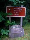
Tennessee – From Interstate 26 in Johnson City exit US Highway 321 to Elizabethton. Follow 321 to 19E (in Elizabethton) and turn right. Take 19E southeast to Roan Mountain. Turn right on Highway 143 in Roan Mountain. Follow 143 south to Roan Mountain State Park. Drive south past the Amphitheater and Park Headquarters and turn right into the campground. The Fred Behrend trail is located across the Doe River and can be accessed from the road that enters the campground.North Carolina – From Elk Park, take 19E to Roan Mountain, TN. Turn left on Highway 143 in Roan Mountain. Follow 143 south to Roan Mountain State Park. Drive south past the Amphitheater and Park Headquarters and turn right into the campground. The Fred Behrend trail is located across the Doe River and can be accessed from the road that enters the campground.
Hiking Directions
 |
 |
GPS is highly recommended, as no trails lead to the summit.
The Fred Behrend trail forms a 2.8 mile loop. Follow the trail south, it will ascend a low ridge and drop into Bearwallow Hollow. Leave the trail and head SW (left) down the hollow. You will pass a ravine and small stream on your right and come to a second ravine and stream about ½ mile from the Behrend trail. A stream runs WNW up the slopes of Strawberry Mountain. Parallel this stream, which runs most of the year, to about the 3500’ level and continue WNW. Although the stream ends, the ravine points directly toward the summit ridge. Once you reach the summit ridge, head WSW along the ridge to the top.
The round trip for this hike is under 5 miles and can be completed in 3 to 4 hours.
When To Climb
Spring and Fall. In summer the forest is warm, humid and filled with biting insects. The vegetation is very thick around this mountain. I’ve climbed it in the summer and have been caught in nettles, thick stands of rhododendron and bracken. After October 1st, when the leaves have fallen, one can get a better view from the summit. Any vistas are normally blocked by the trees.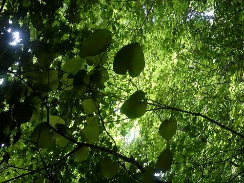
Camping
Roan Mountain State Park1015 Hwy. 143
Roan Mountain, TN 37687
423.772.0190
www.tnstateparks.com
Eleutheros - Aug 23, 2006 3:06 am - Hasn't voted
Added...Hyperlinks for the URLs and local weather forecast. Enjoy.