

rmac10 - Dec 13, 2006 1:47 am - Hasn't voted
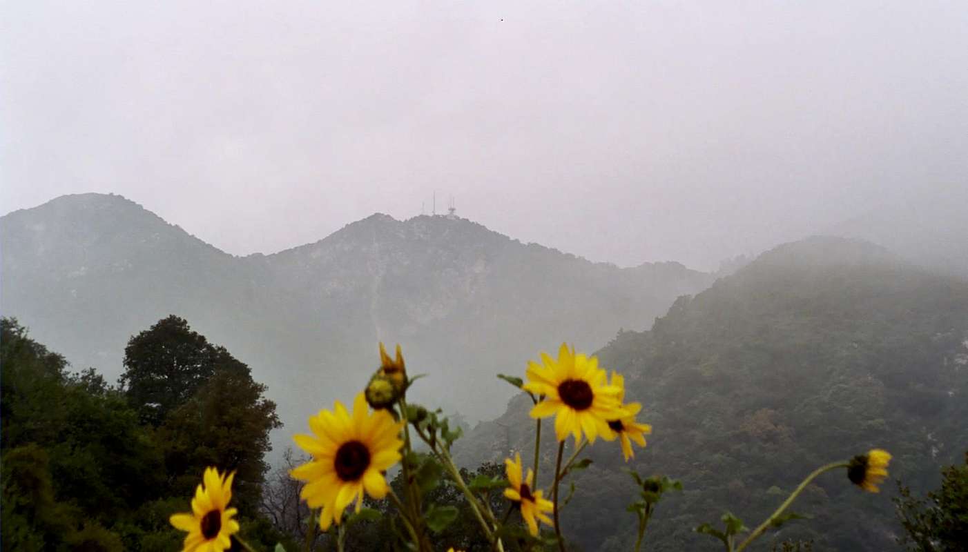
Identity of peakThe peak in the center of the frame is Mt. Harvard 5440 ft. The antennae are: Left, KUSC-FM (public radio); right, cable tv relay transmitter. Mt. Wilson 5736 ft., is in cloud to the right of frame. Left of frame is Harvard Spur (recently re-named, I believe) just over 5000 ft.

Augie Medina - Dec 13, 2006 1:55 am - Hasn't voted
Re: Identity of peakI appreciate the correction and additional information. The elevations I've seen for Wilson are 5710 and 5715. Anyway, I'll correct the caption on my photo. Happy holidays.
rmac10 - Mar 30, 2008 8:51 pm - Hasn't voted
Mt. WilsonI worked at the Mt. Wilson Observatory for 2.5 years. The observatory elevation is 5710'; the highest point on Mt. Wilson is just east of the NBC-TV station. That is where the 5736' elevation is located. Incidentally, Occidental Peak just to the west of CBS-TV is 5730'. Often it looks higher than Wilson, but it isn't.


Comments
Post a Comment