
|
|
Route |
|---|---|
|
|
52.46553°N / 3.78342°W |
|
|
Hiking |
|
|
Spring, Summer, Fall, Winter |
|
|
Half a day |
|
|
Just walking |
|
|
Overview
Many people ignore the northern routes of Pumlumon Fawr, and fool them, because it’s on the northern side of the mountain that the best routes can be found. Also the northern car parks (they are not really carparks just lay-bys on the side of the road) are all free, so if the quality of route doesn’t fully attract you then the saving should be an incentive at the very least. The Nant-y-Llyn Route has the advantage of avoiding the main path that leads to Llyn Llygad Rhediol, taking the walker along the less travelled and pathless valley that leads to the mountains little lake. For the unfit the route may prove quite difficult as the tussocky grass and boggy nature of the terrain can make progress difficult. Rough terrain aside, the route contains no sections of technical difficulty and should be doable for all hikers with an astute grasp of navigation, which is particularly important when visibility is poor. |
Getting There
The only way to get to Pumlumon Fawr, and the start of this route, is along the A44, which runs between Aberystwyth (SN 583 185) and Llangurig (SN 908 798). Don’t bother with the southern side of the mountain; turn off onto an unclassified road at Ponterwyd (SN 749 808) and head north towards the Nant y Moch Reservoir. After around 6km turn right at a fork in the road (SN 762 864) and drive along the road until it ends. Park at the end of the road (SN 774 879), it’s impossible to drive any further anyway. |
  |
Route Description
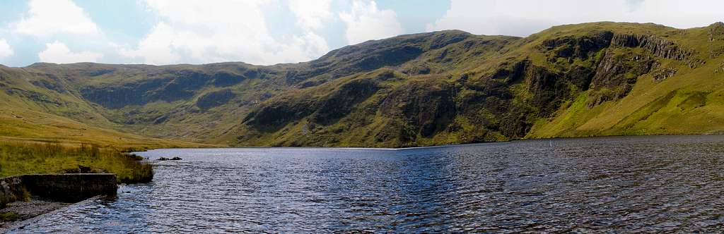
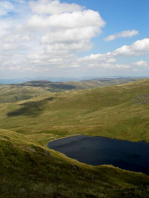
From the parking space, wherever that may be along the road at Bryn y Beddau (SH 771 877), the route goes northeasterly direction following the road until a fork in the road and a gate is reached. It then crosses the gate and follows a broad track that contours along the side of Pumlumon's lower slope. After about 1.5km the path crosses Nant y Llyn (SN 784 889), here the route leaves the path and follows the stream all the way to Llyn Llygad Rheidol (SN 791 878). The terrain is quite rough over this section of the route, with no path and plenty of grassy tussocks. After reaching Llyn Llygad Rheidol, the route follows a path on the western side of the valley in a northerly direction. After a distance of around 200m the route leaves the path, climbing the side of the mountain in a southwesterly direction, until it reaches a shallow col with Pumlumon Fach (SN 787 874) on the left hand side. It then contours around the western side of Pumlumon Fach, to another col which separates Pen Pumlumon Fawr (SN 789 869) its smaller neighbour. From here the route is a direct climb to the summit of Pen Pumlumon Fawr, which reveals some of the best views in Mid Wales. |
Essential Gear
Just a good pair of boots, waterproofs and some lunch. If walking in winter conditions make sure you also carry an ice axe and crampons. |
Maps
Guidebooks
The Cambrian Way – the mountain connoisseurs walk by A.J. Drake Cicerone Guide: The Mountains of England and Wales Volume 1 Wales by John and Anne Nuttall Cicerone Guide: Hillwalking in Wales Vol 2 by Peter Hermon |
External Links
 Llyn Llygad Rheidol Llyn Llygad Rheidol Cwm Hengwm Cwm HengwmGeneral |