
|
|
Route |
|---|---|
|
|
23.36697°S / 67.72684°W |
|
|
Hiking, Mountaineering, Scrambling, Skiing |
|
|
Summer |
|
|
Most of a day |
|
|
Class 3 |
|
|
Easy |
|
|
III |
|
|
Overview
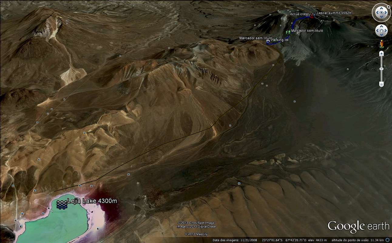
Description for the normal route of Lascar volcano. Drive up from San Pedr de Atacama all the way up to Laguna Lejia. Then climb up the smooth part in the middle of the slope. From here a very easy path runs up the volcano. However, on this side the air is often rarefied by sulphur dioxide, at which times this route becomes impossible, but rarely.Alternatively, take the way to spot ridge at the western side of the slope. However, this route is steeper, takes you higher and consists mainly of rocks. You will need approximately 3 hours for this route.
 |  |  |  |
Getting There
From the touristic center of San Pedro de Atacama a road leads through the villages of Toconao and Talabre, past Legia (or Lejia) Laggon, up to southeast foothills of Lascar. It´s a tough road and it´ll take you about three hours for a 120km trip. Beware: When it snows, the road tracks disappear, making it dangerously difficult to find the way back to San Pedro.A 4x4 vehicle is highly recommended!
Route Description
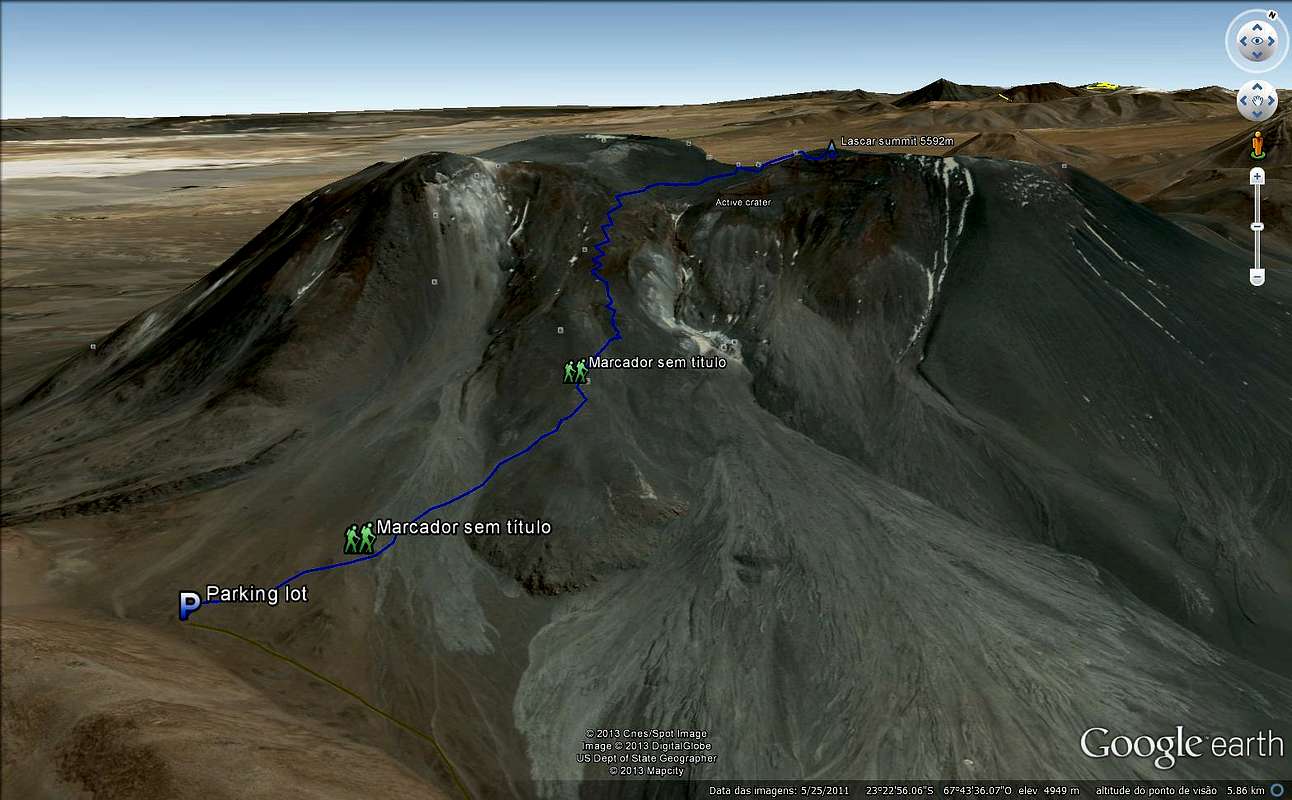
You may find some snow, between jan and march heavy loads of snow can be found on the volcano.
Always check with GVP (Global Volcanism Program) about the status of Lascar, this is a pretty active volcano, if you get caught on the middle of the climb, your life will be in danger.
Essential Gear
>Sunglasses>Suncream
>Poles
>Trad ice axe 70cms at least
>Good double boots
>Down Jacket
>Waterproof parka
>Pluma jacket
>first layer of gloves
>Second thick layer of gloves
>Crampoons (not always needed, better need and have a pair at hand)
>Small 30l backpack to some snackes
KML for download
Be my guest, it's marked the summit, the lake, the approach road, parking lot, trailhead, water point, crater and summit.For the download, please access: http://www.4shared.com/get/IrfL-xxk/Lascar_parofes.html
Legal issues
To hike/ climb is a dangerous activity and requires proper equipment and clothing, the owner of this page cannot be blamed by injuries caused to anyone who read this page for its info about the mountain, and eventually got hurt by doing so with reckless behaviour or bad weather conditions.
Paulo Roberto Felipe Schmidt – AKA: PAROFES
External Links
Before go on to the climb, take a look at this link, it will help you on the safety issue: RECENT INFORMATIONS ABOUT LASCAR ACTIVITYA brazilian website to get mountains info, including gps files to download:http://www.rumos.net.br/rumos/
My youtube channel: www.youtube.com/parofes - Now with 270+ videos online!
The biggest brazilian website about climbing and mountaineering, for which I'm a columnist: