
-
 4936 Hits
-
 70.83% Score
-
 1 Votes
|
|
Route |
|---|---|
|
|
3.41438°N / 75.29549°W |
|
|
Mountaineering |
|
|
One to two days |
|
|
USA II, Rock 5.2, 40 degrees snow |
|
|
Approach
 Routes from the south side
This image shows a topo of the normal route (via canaleta) and it variation on the rocks of the east side (variente normal, in green).
 |
Route Description
 The crater
One hour or less after you start, you will pass a waterfall called La Cascada, and then after you will reach Tierra de Gigantes (lad of giants b/c of huge firns plants), later Las Lajas (sort of flat rocks) and eventually you will reach, after some 3-4 hours of walking, the end of the cloud forest, the start of the paramus and a place called La Cueva. Here you may camp if you like, or continue up to other camping options.
Be aware that during the dry season the access on the south side may have a lack of fresh, drinkable water, this being more obvious after the 3700 meters (La Cueva) in the Rancho-Raices-La Cueva-Latas path. If the snow fields near the Oido have melted due to the sun, the sulfured water of some of the thermal springs near by will come down to the valley, rendering the streams after La Cueva polluted and undrinkable, some times as low as La Cascada. If this Cascada´s water is polluted, then water up stream will be polluted as well.
The more reasonable decision would be to take water up from 3600 meters, still inside the could forest
After La Cueva you will reach several camping opportunities between 3900 and 4200 meters, the so called “Cuatromiles” of a series of terraces amidst the Frailejones, the plants that abound in this paramus. Be aware that these plants grow at a rate of 1 cm per year (about ½ inch) so take care of them and do not use them for any other purpose than enjoy them as they are.
You will cross the "Inderena Path" or "Camino de Mesetas", a path that will take you to the east side of the mountain, where one can find the Mr. Cañon Thermal Baths, the entrance to the so called Gusano climb and one can go around the mountain. Be aware that this is an area where many people get lost, so be careful.
If you like, you can carry on for another 3 to 4 hours to Las Latas (4500 meters) a rather small place to camp, with three or four spots, in the middle of the dry and rocky fields of the once upon a time well built glacier. It is hard to spot, but as you exit the Frailejones fields and the Paramus and enter the rocky area, you will see a cross (hopefully) high up on the right side (North-north-west, some 350 degress), identifying Las Latas.
You can combine the route in any way you like and come up with any combination you want: for example, you can go in one shot from El Rancho to the Summit (10 hours) or Rancho to la Cueva, then camp there and then do La Cueva to Latas, and camp there, and then do Latas to Summit, or Rancho-Latas and then the summit.
Anyway, from Latas, go to the right (east) to the so called canaleta, an evident rock gully that can be prone to some rock fall but is relatively safe, and climb up. Continue inside this gully for some 300 meters and eventually climb to the left (west) ridge. From here you can either continue to the very circus or cwn (el Oido) or continue on the ridge straight ahead (see the route called Latas Safer variation on the Routes Section). On any case, the area is very prone to rock fall, as you are transiting the very rocky debris of the glacier.
If you decide to go to the Oido, then you will eventually find a snow slope of about 40-45 degrees, with no mayor complications, on the right side (east).Climb this slope to the begging of the very flat summit fields. The Oido is nothing but a circus surrounded buy the ice falls of the above glacier son it is very dangerous to be there. Hurry up!
If you decide to go on the rock ridge and negotiate easy but rocky terrain, you will end up in the same place, that is the top of the ramp and the begging of the summit fields, at about 5000 meters.
After this you will have to follow a gentle slope and circulate near the crater. You will be able to see the summit very easy, above and north east of the crater, at 5232 meters.
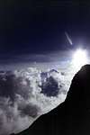
If you are lucky with the weather, you will have a great view of the Nevados National Park. Nevado del Quindio on the north east (no snow), Nevado de Santa Isabel in the middle (snow) and Nevado del Ruiz on the left (snow). If cloudy, be careful since the summit fields are surrounded by cornices and ice falls.
Please bear in mind that cloudly weather makes tha navigation in the rocky sections of Latas and above very hard and difficult. Finging Latas in such conditions can be very hard. The area is full of cairns making things worst.
 The "Rancho-Cueva-Latas" path.
For the descent you can reverse the route you climb, or just go straight down the debris paths down from the oido. This can be porblematic as this is a rock fall prone area and full of rubish and moraine type rock, making the soil soft and hard to travel.
Essential Gear
Basic glacier travel gear. |
Scott - Jan 26, 2004 9:54 pm - Hasn't voted
Route CommentFrom Las Latas, we headed directly up to the right and towards the summit of Tolima. At a convienient place, we crossed over the black lava ridge to the gully just to the east of the lava ridge. We followed this gully all the way to the snowline. We continued up the snow to the crater rim and to the summit.
By using the route that we did, we avoided crossing any crevasses. Crevasses exist on almost any other route. Take a rope jut in case however. Use caution in the gully above Las Latas. It's best to stay on one side or the other and on high ground while following the gully. The reason for this is rockfall danger. Some huge bus sized rocks come crashing down from the volcanic plug known as Cerro Negro, and some of them make it into this gully. Don't even try to pass under Cerro Negro to try and reach the summit of Tolima because a few climbers have been killed by rockfall here. The route described above is easy and safe.
Scott - Jan 26, 2004 9:58 pm - Hasn't voted
Route CommentThere are a few milk trucks a day that reach El Silencio. You can also hire a jeep for $25 from Ibague for up to five people (Dec 1998).
Las Cuevas also has a very basic refugio, but a tent is recommended. The refugio sleeps six, and was dilapidated but usable. It may not last much longer.
There are also places to camp between Las Cuevas and Las Latas, but there is no water in the dry season between these two campsites.
.