
-
 6609 Hits
-
 72.08% Score
-
 2 Votes
|
|
Route |
|---|---|
|
|
42.10000°N / 118.6486°W |
|
|
Hike |
|
|
Half a day |
|
|
Walk-up |
|
|
Approach
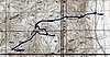
There aren’t many paved roads in this part of Oregon. One of them is the Fields-Denio Road in southern Harney County. Pueblo Mtn. is located just west of this road. The turn off from this paved road is unmarked, but it is the road that goes up Arizona Creek. This road is located just .5 mile south of Whitehouse Ranch Lane or 11.6 miles north of the Oregon/Nevada border in Denio.
This road has been repaired after several washouts this last winter, but it is still rough. You should have a high clearance vehicle. If the road is still wet from the winter, don’t bother because the clay soil is as slippery as ice. Even 4WD won’t help in this mud. Anyway, if the dirt/gravel road is dry take it up the canyon. Soon you cross Arizona Creek and head up the northeastern flank of Pueblo itself. The road seems to be heading out to the eastern side of Pueblo when you come to a fork in the road. This fork is 2.8 miles from the paved road and is at about 5,400 ft in elevation. Take the right fork. Follow this narrow road up into a canyon on the west side of Pueblo. At 3.2 miles from the paved road I came to a gate and I parked here at elevation 5,980 ft. The road continues and the sign on the gate simply says to close the gate after passing through.
 |
Route Description
I parked at the gate and could see a clear path up a slope to the north ridge of Pueblo. Follow the fence line south a few hundred yards and then continue up to the ridge about 800 ft above you where you finally top out at elevation 6,780 ft. It doesn’t look that far from the car, but it is. The footing is good and the slope is covered with low growing sage, wildflowers, and grasses.
Once attaining the ridge you get a good view of what you hope is the summit of Pueblo Mountain to the south. Unfortunately, the high point you see is the north end of the summit plateau and the actual summit is about ½ mile beyond. Take heart in knowing that this northern summit is only 70 ft shorter than the real summit.
It would be convenient to follow the top of the ridge all the way to the summit and you can do that if you want. I could see that the point 7502 on the topo would involve extra elevation gain, so I traversed on the west side of this point to the saddle on the south side at elevation 7,300 ft. Again, the footing was good, occasionally on some talus.
From this saddle you can see another steep slope that heads up to the ridge line that leads to the summit. I chose to go up this slope rather on the rocky ridgeline itself. Once up the slope, just follow the ridge line up to point 8562 which is the northern end of the summit plateau. You still can’t see the summit from here because there is another false summit between you and the true summit. The walking along the summit plateau is easy and it takes just a few minutes to pass all the way over to the southern end of the plateau where the true summit is located.
 |
Essential Gear
Water, Sunscreen, Hat, Good Shoes, and always the ten essentials. In the winter you won't be able to drive to this trailhead, so I won't bother with winter stuff.
Miscellaneous Info
If you have information about this route that doesn't pertain to any of the other sections, please add it here.