
|
|
Route |
|---|---|
|
|
39.22340°N / 105.6642°W |
|
|
Hike / Mild Scramble |
|
|
Less than two hours |
|
|
Class 2+ |
|
|
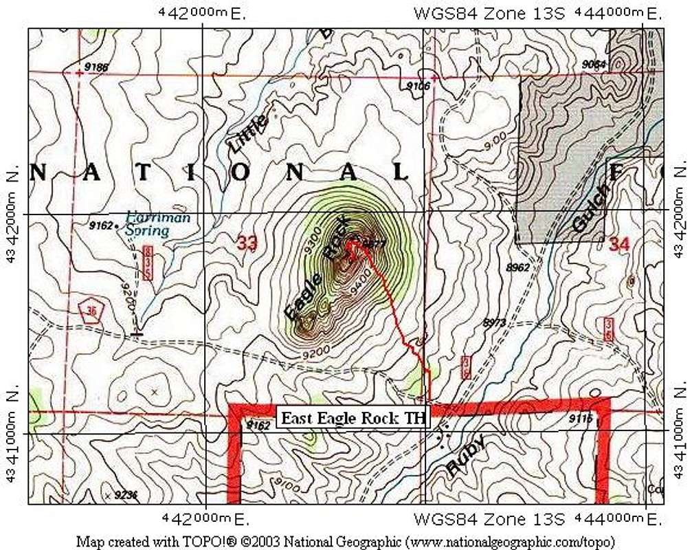
Approach
East Eagle Rock Trailhead
Begin on US 24 or US 285. Turn onto Park County 77 (Tarryall Road), from the north on US 285 or the south on US 24. Drive just south of the Tarryall Reservoir and turn onto Park County 23. PC 23 goes to US 24 also.
-Go 1.6 miles on PC 23 and turn right.
-Go 1.4 miles and turn right onto FS 146.
-Go 1.2 miles and turn left.
-Go 0.3 mile and turn right.
-Go 0.1 mile, pass a cattle guard, and park on a small turn off 100 yards past the cattle guard. There isn't room for more than one vehicle.
This trailhead should be accessilble for most cars, but the road is a little rough. A high clearance vehicle will be preferable.
Route Description
This route is slightly more difficult and longer than the Southwest Ridge Route, and requires a little bit of easy scrambling and has a few exposed spots.
From parking, bushwhack off-trail across grassy fields toward the east side of Eagle Rock. Refer to the route photo below to see this portion of the hike. Pass through some trees, and hike up a steep slope, aiming for the saddle between the North summit of Eagle and it's main summit. This saddle is not apparent as you hike, but just aim for the right side of the summit block.
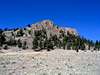
Once you reach the saddle, the summit block will tower over you. Walk 100 feet along the West side of the summit block along a grassy bench. When you are faced with a large tower ahead, just turn left (south) and find a ramp that leads easily to the top. The ramp is Class 2+ in spots. Scramble up the ramp and turn north again to gain the summit ridge.
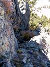
The final tricky spot is crossing a narrow row of blocks that lead to the actual summit. They are very easy to cross, but are exposed on both sides. Cross the blocks and scramble up 10 feet to the summit.
Round Trip Mileage: 1.2 miles
Elevation Gain: 710 feet
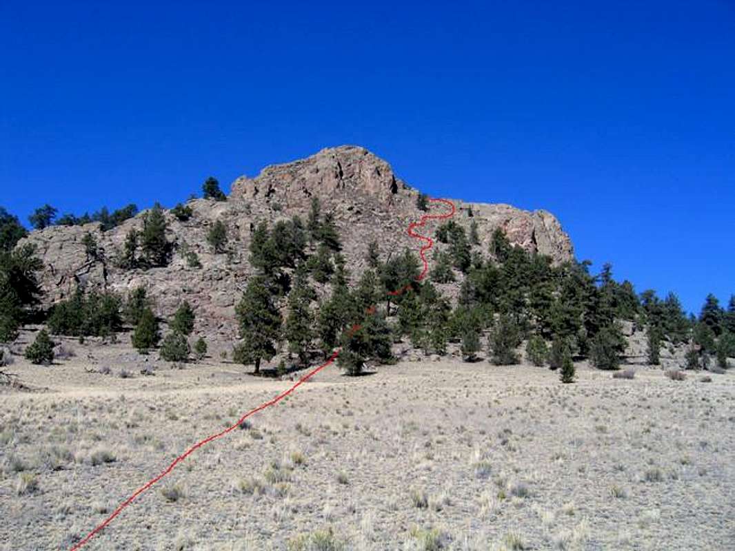
This route photo shows most of the hiking to reach the North Ridge.
 |  |  |  |  |
Essential Gear
Standard hiking gear.