Putting up Putnam - August 11th, 2012
Pt. I
Pt. II
The week after Borah and Deep Creek I received an email from Dean about some Idaho Peaks, namely South Putnam and Diamond. South Putnam is a fairly basic hike outside of Pocatello up a P2K, while Diamond is a tougher class 3 trek up an ultraprominent and one of Idaho’s great peaks. Dean had been turned back on Diamond a few times before, and after recovering from some sprains earlier in the year as well as a recent bout of the flu he was not quite sure he would be up for Diamond yet, so we decided to test his legs first on South Putnam on Saturday.
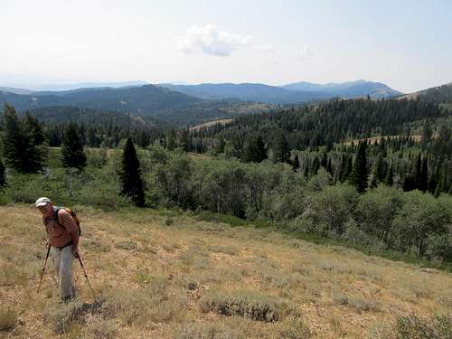
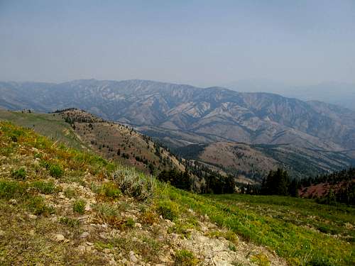
I met Dean in the morning at Lava Hot Springs off I-15, then hitched a ride through the charming and little seen countryside to reach the South Putnam trailhead. We were supposed to have good weather for the day, but I saw low clouds and lightning earlier in the morning over Bonneville Peak while driving towards Pocatello earlier in the morning. Thankfully the weather cleared up as we circled around to the eastern side of the range, and the sun seemed to quickly burn off the clouds.
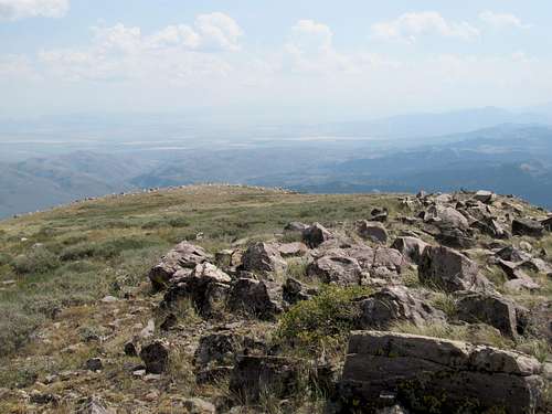
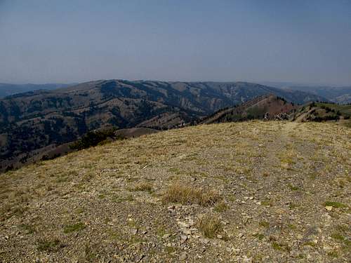
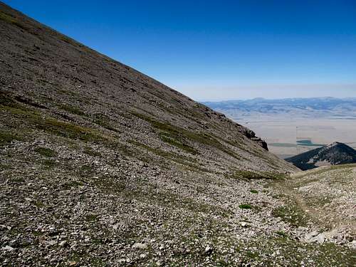
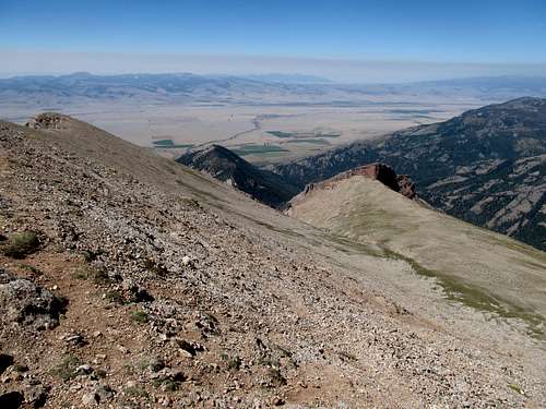
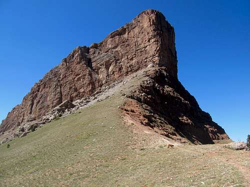
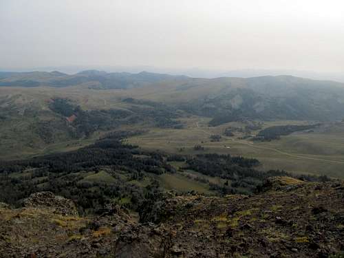
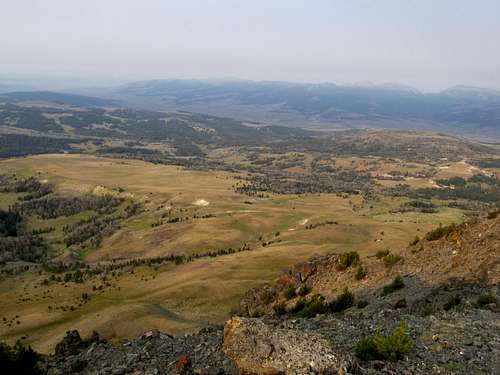
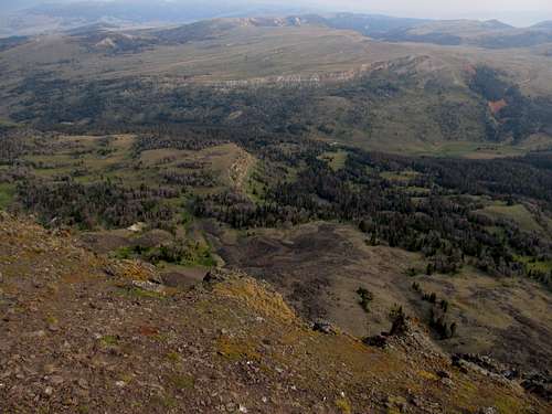
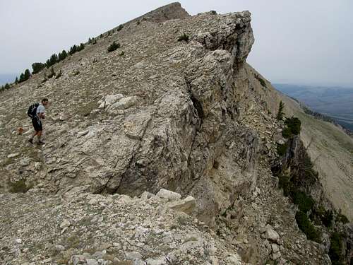
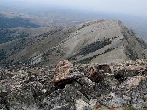
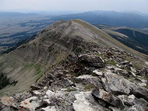
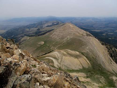
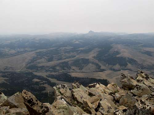
The first part of the hike was pretty basic as we walked a mile or two down a dirt road. We then reached an open meadow below the rounded flanks of South Putnam, but reaching the ridge involved some moderate but involving bushwhacking through some brush and aspen. Then it was a straightforward huff up the grassy slope. It was a hot and humid day, and we bore the brunt of the elements as a result of our later start as the air quality began to worsen due to the haze. Dean wasn’t feeling too great going up, but we had all day so as long as Dean had a will we had a way up.
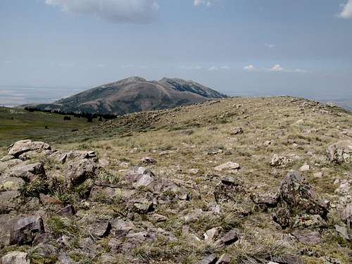
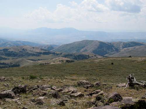
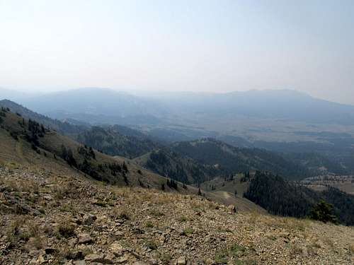
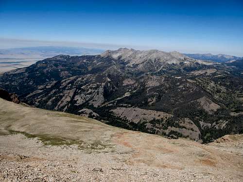
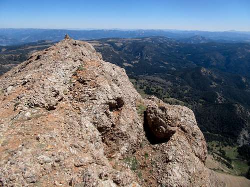
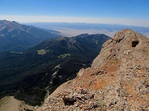
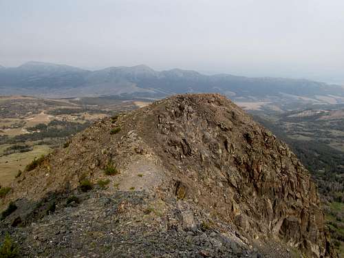
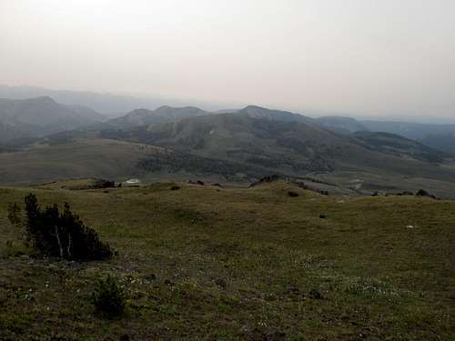
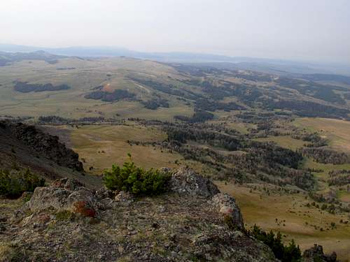
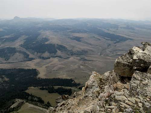
The summit being rounded, we were both in for a minour disappointment, though not much surprised, when we crested the top horizon only to find the true summit still a bit away. The views were pretty good, with massive Mt. Putnam to the north dominating the view. Further vantage points, however, were unfortunately restricted by the haze.
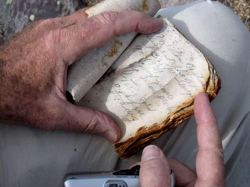
The best part however was the summit register; it took a bit of work to find the rusted old can, but it was a gem, with signatures on faded papyrus dating back to the 1930’s. The journey back down was anticlimactic, especially with the haze getting thicker and thicker. We made it through the brush alright, I introduced Dean to one of my favorite Mexican restaurants in Blackfoot, and we crashed in Idaho Falls.
Bagging Big Elk - August 12th, 2012
Diamond was out for Sunday, as after South Putnam Dean didn’t think it was a viable goal for him. We debated our destination over a hearty breakfast, and ultimately chose Big Elk Peak down near the Snake River Range over Black Butte in Montana.
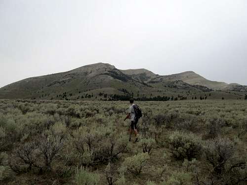
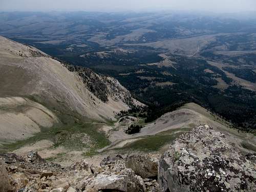
It was a pretty drive towards the Reservoir and Swan Valley Idaho as the sun rose over the Big Holes and Snake River Ranges. I hopped into Deans truck at a campground near the Reservoir, and huffed it up the long winding dirt roads leading towards the occasionally visible massif of Big Elk Mountain, tucked neatly into a complicated line of ridges between the Snake River and the Caribou Ranges.
Dean used Greg’s beta from several years before to get to a trailhead only 1,400 feet below the summit, but it was a hell of a steep bumpy road. We buckled in as the truck switchbacked up to the top; the spur road leading off to the trail to Big Elk was located a little while before the main road ended, so it took us awhile to find it as well.
Then it was up a quick dirt road section before we ascended a trail to a saddle between Big Elk and a nearby subpeak. As 1,400 ft didn’t seem like enough elevation gain to do justice to the day, I decided to hit the subpeak, which looked like it had enough prominence to be ranked, and then meet back up with Dean somewhere between the saddle and the summit, depending upon our respective progress. I huffed up a use trail to the top, then traversed over a few more minor bumps to what I thought the highpoint was.
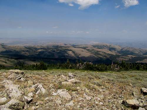
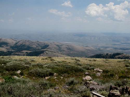
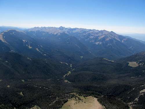
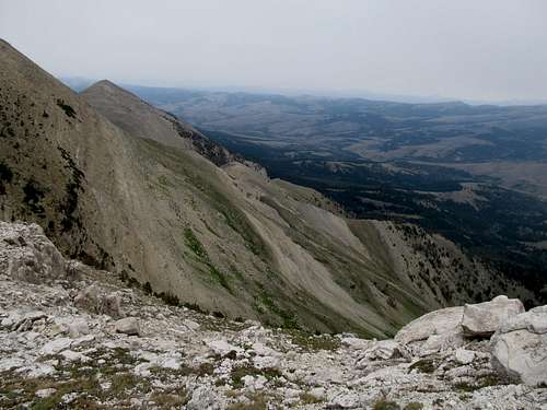
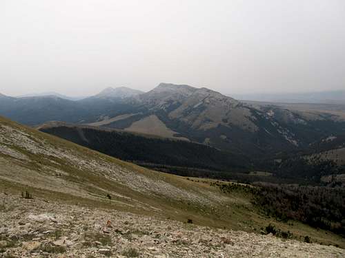
It had been somewhat clear earlier in the day driving towards the Swan Valley, but the haze was well into effect by the time we even started from the truck. The reservoir and nearby Caribou Mountain were barely visible, much less the Snake River Range or likely any grand views of the Tetons or the Wyoming or Salt River Ranges to the east.
It was a quick descent back to join the trail at the saddle, but it seemed to disappear as I huffed up the backside of Big Elk. Like the day before the air was hot and muggy, and this last cross country portion kicked my ass as I met back up with Dean minutes after he had arrived at the summit.
We enjoyed the views, limited as they were, then beat a straightforward path back down to the truck.
I bid adieu to Dean at the campground as I headed my way back to SLC. Dean would set up shop here and get nearby Red Ridge and Black in the vicinity to complete his southern Idaho P2K’s.
Solving the Sphinx - August 18th, 2012
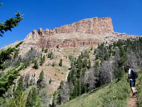
I felt sharply the clock ticking towards the end of summer in these waning days of August, and jumped at another trip to Montana the following weekend. Saturday would be Sphinx Peak, an interesting looking P2K in the Madison Range. As usual I drove up through the early morning and met Greg and Kadee at the trailhead around 9:30 ish. I hoped the open skies of Montana would yield some decent views despite the haze, and it seemed possible as I drove through the clear morning air up the Madison River Valley.
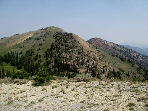
We went the direct and quicker route, taking the trail coming up to the saddle between the Sphinx and the Helmet from the south. We proceeded fairly quickly the few miles up the trail as the impressive specter of the Helmet greeted us near treeline. This impressive looking giant dominated the view and yet was dwarfed by the view of the actual Sphinx Peak up ahead.
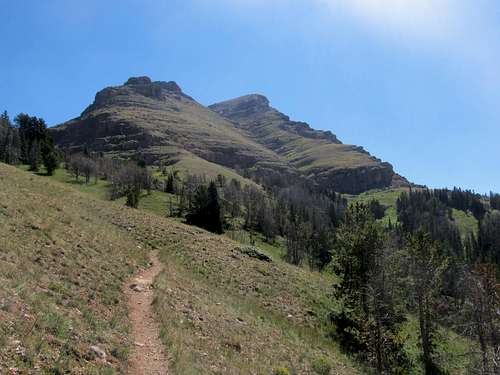
We left the trail a little bit before hitting the actual saddle, and having gone at a good pace till now without having much rest, I was winded the moment we started the steep cross country ascent. Either I was out of shape, or Greg’s pace was kicking my ass; likely both.
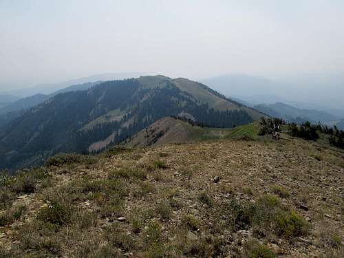
The last 1,500 feet up the big gully was however a fun ascent. There were climbers’ trails along the side of the gully, but they were often loose and annoying. The center of the gully was solid and had some fun boulder hopping, but occasionally required some more scrambling moves, usually with minimal exposure. We went up these obstacles when we could, and traversed around them when we couldn’t. It was a pleasant route.
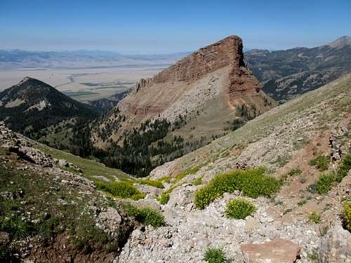
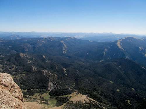
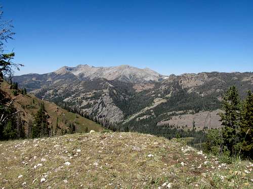
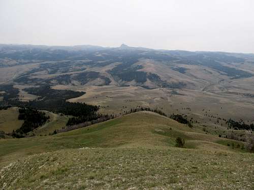
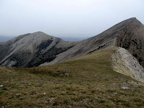
Atop the gully we hit the vast and somewhat bizarre prairie high at 10,000 feet, and then up the steep slope to the narrow ridged summit. And dammit did we luck out with the views; the haze was still there, but quite thin, and we could see the Madison Crest and Koch and Hilgard Peaks to the south, Lone Mountain and the rest of the Madisons to the north, the Gravelly’s and Centennials westward, and the Gallatins to the east, even the sharp, craggy fingers of Mt. Cowen.
We talked to a couple from Helena at the summit. They were among several parties that we encountered on this surprisingly popular trail, though others had hiked only to the saddle. On the way up we talked to some folks from Salisbury Maryland, and down a few women from New York. Speaking for myself I found it a breath of fresh air to converse with people back east (ah civilization! no offense to all ya Westerners, but home is home), and I think even Greg the Vermonter enjoyed it too.
We took the same trail back down rather than loop around the north side of the Helmet, which would have added some additional miles, then drove up the road to Ennis. I would stay here at this surprisingly delightful little town for the night, while Greg and Kadee headed down to their planned campsite by Sliderock Mountain.
Colorful Black Butte - August 19th, 2012
Here is where it got tricky; Sliderock was main item planned on the agenda, but I was hoping to hit up Black Butte, a fairly easy hike, beforehand. It was a long way from Ennis to Black Butte though, and I left predawn down the highway, eventually finding the Gravelly Range Road and bumping my way along through the range.
As the sun slowly rose through and above a layer of hazer thicker than the last day’s I motored my Camry up and down the bumps along the road. It was not a challenging drive, but I was doing fairly high speeds for a Camry on a forest service dirt road and often not seeing a bump or curve until right before it.
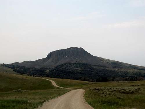
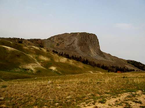
Had I time to take my time and enjoy the sights I would have, as the road wound through forested canyons and rolling hills, but I wanted to get Black Butte then meet Greg down at Sliderock. My peak slowly but surely crawled into the horizon. I descended a hill and drove past the peak, circling around for a bit before finally finding a proper place to park to its ESE.
The hike was basic. I went up and down a few small hills and gullies. The volcanic rocks were really interesting, and as I approached the immediate slopes of the peak itself I found myself on a nice little climber’s trail which seemed to wind SE from the peak. It made for a good route up the steepest portion of the ascent, but soon I made it to the upper reaches.
It was a nice stroll to the narrow summit and a surreal sight. The early morning sunlight found itself trapped under the cold low layer of morning haze, bathing the entire landscape an eerie, martian glow.
Almost directly below and across the valley lay Sliderock, and somewhere down there Greg and Kadee were waiting for me. I was running a little late, and tried to call them to let Greg know to start without me, but they, being deeper into the remote wilderness, didn’t have reception. So I hurried down and backtracked a few miles and drove down more dirt roads into the Ruby Valley as the day continued to dawn.
Slipping into Sliderock - August 19th, 2012
Greg was waiting; having driven the same roads the day before he figured that it would take me and the Camry longer than we originally planned. Nevertheless, the weather looked decent; there was a slight chance of tstorms, and we still had plenty of daylight, so we decided to try Sliderock from the SE.
There was one cliffy area we were concerned about on the east ridge, the route we originally scouted online, but as we approached the peak’s many side ridges from the SE we saw a several viable alternatives to the likely very loose and annoying looking east ridge.
We picked the middle ridge, to the south and parallel the east ridge, and ascended cross country slopes and a line of talus to reach the ridge crest. The rock formations were really cool here, and the summit impressive looking as we descended maybe 100 feet and made the long trudge up to the top.
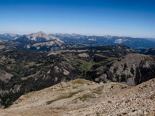
It got steadily hazier and hazier through the day, and to the SW we saw thick clouds. We weren’t sure if this was precipitation or haze, but the summit, even with its limited views, was cool enough for us to linger around for a bit. At the very least we could see (steadily decreasing views of) the rest of the Snowcrest Range, with nearby Spur Mountain and the range highpoint further to the SW with the Sunset/Hogsback two-fer.
I had left my box of granola bars in the car, so Greg lent me one of his GU’s as I found myself running out of fuel during the descent. The talus was a little annoying but nothing too complex, and we stayed dry all the way back to the car. It was a long drive over more dirt roads back to the Centennial Valley and eventually the Interstate at the Idaho Montana line, the Camry having racked well over 100 miles purely on dirt roads for the day.
My legs were sore and the air was chilly as I made a coffee stop at dusk at the Idaho Falls Starbucks. Earlier in the day Greg had noticed the leaves of the bushes and shrubs of Sliderock already turning yellow. Fall was coming early to the north country, and time was fleeting, as weekend by weekend the summer slipped away from the Northern Rockies.
Comments
No comments posted yet.