
-
 11363 Hits
-
 84.82% Score
-
 19 Votes
|
|
Mountain/Rock |
|---|---|
|
|
44.94238°N / 112.05231°W |
|
|
Madison |
|
|
Hiking |
|
|
Spring, Summer, Fall |
|
|
10439 ft / 3182 m |
|
|
Overview
|
|
|---|
The Snowcrest Range is a fairly major mountain range in Southwestern Montana that for whatever reasons finds itself oft ignored. Though it sits within 30 or so miles of I-15 winding through the small towns of Monida and Dillon, the range is for all intents and purposes a remote one. Most who venture into this area are probably locals who come to hunt, camp, fish, and maybe take in a hike. The highest peak in the range is arguably Sunset Peak, though there might not be sufficient proof to negate the possibility that neighboring Hogsback Mountain is higher. Regardless, for those interested in prominence, one of these summits is without a doubt a 3K prominence peak, and you would have to travel further north for the range’s other prominence peak: 10,439 ft. high Sliderock Mountain.

|
|
|---|
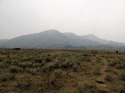
Sliderock sits by itself near the northern terminus of the immediate Snowcrest Range and towers over the narrow Ruby River Valley. Black Butte and the Gravelly Range lie across the valley and make for an impressive sight from the eastern slopes of Sliderock. The mountain and nearby Spur Mountain might be approachable from 4WD to the northwest, but the Ruby River Valley and the eastern slopes provides probably the easiest access for all types of vehicles. The ascent will be basic cross country scrambling via some open range. Whether you’re into prominence peaks or just any cool peak to climb, the broad summit of Sliderock is worth it for all those who savor the smell of obscurity.
|
|
|---|
Getting There
The Ruby Valley Road is a graded gravel road that can be reached via long approaches from similarly graded gravel roads. Any sedan can make the long and often tedious drive, and one can approach it from the south via the Centennial Valley or the north from Ruby Reservoir.From the South (Monida):
Take the I-15 exit 0 at Monida at the Idaho/Montana line. Follow MT-509 west out of town through the Centennial Valley for around 10.5 miles. Take a left onto the road leading north (marked Stibal Lane). I think there may have been a BLM sign signaling access to the Gravelly Range here. Follow this road for about 3 miles as it crosses the Red Rock River, then bear right at a Y intersection right after the crossing. You are now on North Valley Road as it is referred to on some maps. Follow this road for around 2.5 miles as it takes two rounded 90 degree-ish turns…first left then right. In both these cases stay on the obviously main road running through the area. Finally, take a left onto the Ruby Divide/Centennial Divide road, and stay on this road for 21.1 miles as it winds into the Ruby Valley (avoid the signed turnout right for Gravelly Range access). Note a large open parking spot on the left as you approached the signed Three Forks Cow Camp.
If you have 4WD, take a left and immediately ford the Ruby River. This obstacle will likely stop most passenger cars. No worries though…the road leads further for a mile or so at the most. (Note on topo maps this is FR-9665, not FR 9663; the latter continues up along a plateau lining the south bank of the river as it winds up towards the Sliderock-Hogsback Notch.) Alas the road is fairly pleasant after the crossing as it travels along the river to its gated terminus as it once more meets the Ruby River. Hop over the fence and cross the river again, this time on foot, to start you hike.
From the North (Alder):
Take MT-357 south from the town of Alder towards the Ruby Reservoir. Reach The Tate Place and Reeder Place Campgrounds after you enter the Beaverhead-Deerlodge National Forest. After around 27 miles from Alder MT-357 will fork left towards the Warm Springs Campground and the Gravelly Range. Bear right here onto the Ruby Divide/Centennial Divide Road (FR-100 on some maps) as it continues to follow the Ruby River on the eastern side of the Snowcrest Range. You will see Sliderock looming above you on the right. Drive around 9.5 miles, past the mountain, until you reach Three Forks Cow Camp. Again, any passenger car should be able to make it to this parking spot in good conditions, and 4WD cars can continue a little further (see above).
 4WD Parking Spot along the river 4WD Parking Spot along the river |
|---|
Routes
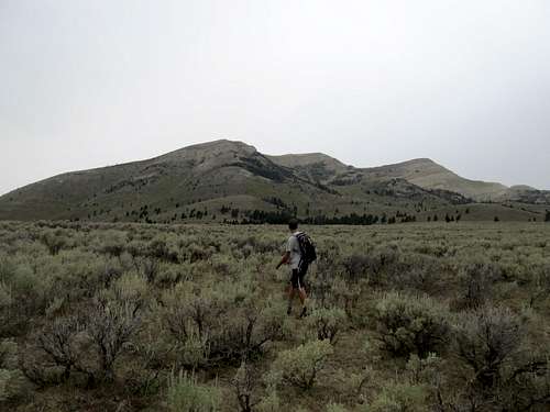
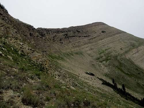
This is mostly open country, and there are many ways to gain the summit of Sliderock. There lots of various cow trails and herd paths leading through the small sagebrush fields. Use them when they are convenient but don’t get too attached, since they won’t ultimately lead you anywhere. The below picture illustrates a few options to the summit from the east.
 Route Possibilities Route Possibilities |
 Sliderock from near TH Sliderock from near TH |
|---|
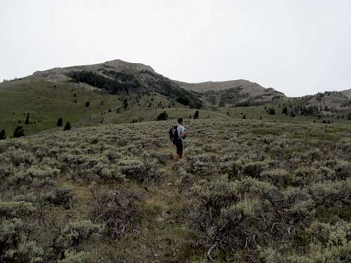
From the 2nd River Crossing (4WD) you can follow an ATV track as it ascends a hill and eventually disappears into the sagebrush benches.
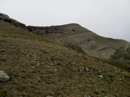
Yellow is probably the easiest option, if slightly longer. After you gain the hill up the ATV track pivot left and aim for the saddle at the low point of the South Ridge coming down from the crest of the range. Gain the ridge crest on the open southeastern aspect of the ridge and follow the ridge north over two false summits, then follow the South Ridge up 400 feet to the top of Sliderock.
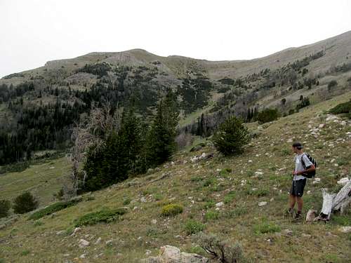
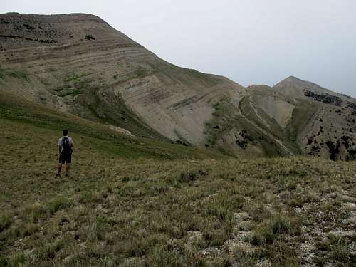
The next option (dark blue in the picture) is what I call the South-er Ridge, which is the east facing ridge leading up to the first of the two false summits coming from the south. In general, after the ATV track aim WNW ish for the green, grassy chute in between some cliffy terrain up near the ridge crest. Ascend through the open country and use this grassy chute to gain the ridge crest and avoid possibly tougher terrain.
 "South-er Ridge" Left of Center "South-er Ridge" Left of Center |
 "South-er Ridge" from Middle Ridge "South-er Ridge" from Middle Ridge |
|---|
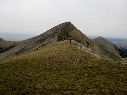
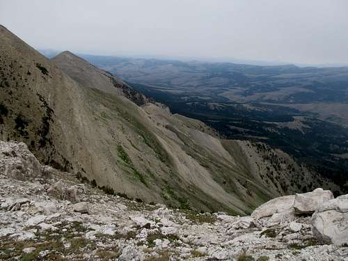
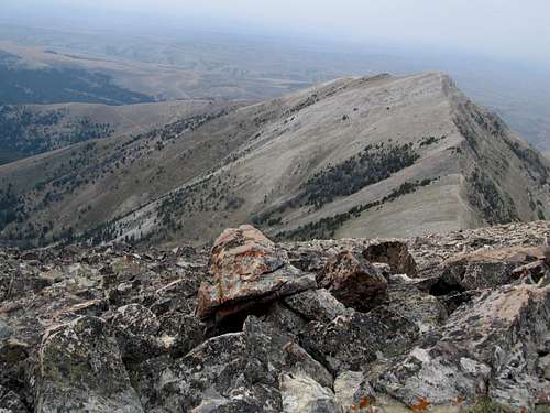
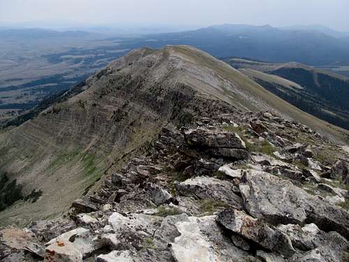
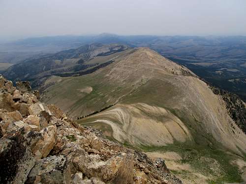
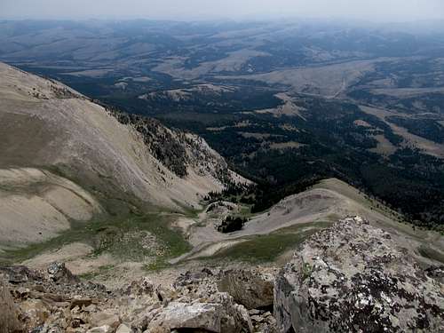
The Middle Ridge (orange) is another option and ultimately the way we ascended and descended. To ascend this route aim for the benches on the eastern aspect of the mountain and go over a hill that eventually leads west and up to the “South-er Ridge”. Walk past this ridge, then descend into a small gully to reascend the hill/ridge that leads west as the Middle Ridge up to the ridge crest. Ascend directly west up this ridge through mostly open country to the second, middle false summit around 10,141. The route gets a little talus-y for the last 800 feet or so. You will see some pretty cool rock formations as you get to the top of the false summit. Then, descend north about 100 feet and gain the last 400’ to the top of Sliderock over basic boulders. There is a cool notch/rock formation marking the saddle between 10,141’ and Sliderock.
 Low on the Middle Ridge Low on the Middle Ridge |
 View of Ruby Valley en-route View of Ruby Valley en-route |
 Upper Middle Ridge in view Upper Middle Ridge in view |
|---|---|---|
 Talus en-route Talus en-route |
 Near Middle Ridge Crest Near Middle Ridge Crest |
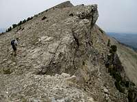 Traverse N to Summit Traverse N to Summit |
The last option is the Direct East Ridge (purple). The main obstacle to this route are a line of small cliff bands a little below 10,000’. Looking at this ridge from the top it looks like it can be climbed, and the cliffs can be avoided, though the route still looks like a loose, slippery mess that would live up to the name of its namesake peak. The only reason to even consider this route is because there is a road on the maps that goes to around 7,200’ below this ridge. This 4WD track might or might not be open for use (we didn’t check it out at the time). If you can get your 4WD vehicle there the Direct East Ridge would mean an elevation gain of about 3,200’ or so. Despite the possibility of less gain I would suggest the routes mentioned above to avoid the possibility of loose rock torcher :) along this route.
 East Ridge from Middle Ridge East Ridge from Middle Ridge |
 East Ridge from Middle Ridge East Ridge from Middle Ridge |
|---|
All other routes mentioned above are approximately 7-9 miles RT, around 3,800’ net gain, give or take a few hundred feet of loss and regain along the way.
Views
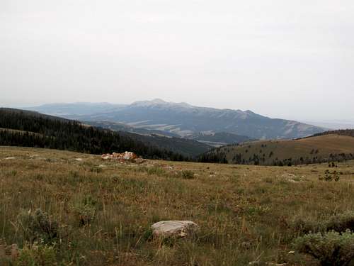
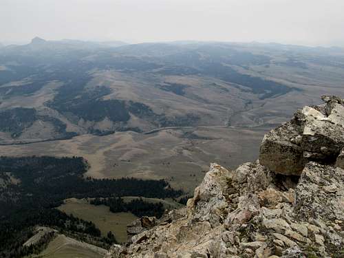
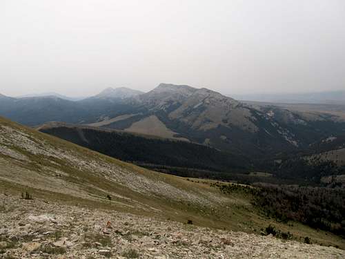
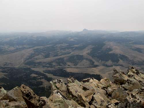
On a clear day you can probably see a wide range of peaks, from the Beaverheads and Lima Peaks to the west/southwest, the Centennial Range to the Southeast, the Gravelly's then the Madisons to the East, and the Blacktails and Rubies to the north/northwest. One might see further ranges well south into Idaho and north into interior Montana. Unfortunately the haze from our ascent limited our views only to the immediate Snowcrest Range and the neighboring Gravelly's.
|
|
|---|---|
|
|
|
|
|
|
Red Tape & Etc's
This is wild BLM land. Try to observe all LNT principles.Try to gas up as much as possible. Ennis will definitely have gas, as will Dillon. Both are far away from Sliderock. There might be gas in Alder or Virginia City, but I cannot say this for sure as I have yet to drive through those towns.
Note that there is no gas in Monida along the MT/ID border. You will need to get gas further up I-15 North in Lima, or go well south into Idaho to find a gas station.
Ennis, Dillon, and Lima will likely have the nearest motel lodging as well. There are many designated Forest Service Campgrounds in the area, however, and you can pick a spot to camp responsibly out in the open as well.
The Forest Service does not maintain these roads as far in as the Ruby Valley during the winter, so ascents will likely be limited to summer months, or late spring and early fall.
Do not expect cell phone reception in this area.