|
|
Route |
|---|---|
|
|
49.17850°N / 19.79320°E |
|
|
Hiking |
|
|
Summer, Fall |
|
|
Most of a day |
|
|
Overview
The ridge of Otrhance (The Rugged Ones), whose name refers to its fairly jagged shape and rough slopes, is the most interesting lateral ridge in the Slovak part of the Western Tatra Mountains. Its bold skyline results from the granitoid material the crest is composed of – the same as that of the main ridge between Ostry Roháč and Baníkov - akin to the rocks forming the High Tatras. What is more, the green trail running directly up onto and then along the rugged crest of the Otrhance to the summits of Jakubina and Hruby (Jarząbczy) Peak – around 4 hrs, approx. 1800m up (total elevation gain) from the trailhead – is much less popular with tourists than the parallel valley trails, so it is still possible to see few humans while enjoying a pleasant day hike on a sunny summer day.
Getting There & Maps
The head of the green trail that leads to Jakubina Peak is theoretically where the Jamnícka and Račkova valleys converge (either can serve as a descent route; the latter is much more convenient for the tired hiker) to form the Úzka (Narrow) Valley, which links this spot with the little tourist resort at its mouth, less than a half-hour walk away (cars not allowed). For those who are staying somewhere else in Liptov (endless possibilities) and have just come by bus, the hike normally begins at the village of Pribylina, 70-80 minutes' walk from the threshold of the mountains (about 100 minutes from where the Úzka Valley forks).
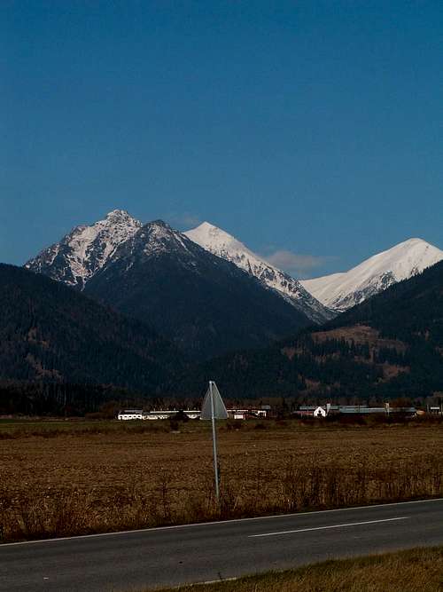
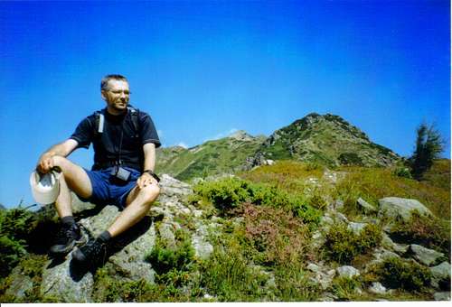
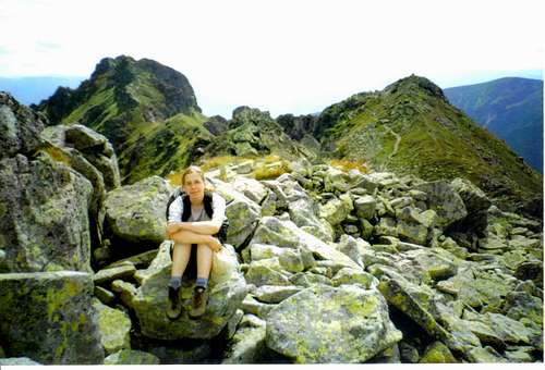
While approaching Pribylina you may notice (Gorzi did - see photo on the right!) that even the arrow-shaped road signs point to Jakubina. BTW, Pribylina boasts an open-air Museum of the Liptov Village.
- Slovak bus and train timetables
- As for paper maps, there are plenty of options (Polish maps are cheaper than Slovak). I'd recommend a 1:25,000 plastic map by WiT.
- freemap.sk online map
- hiking.sk online map
Route Description
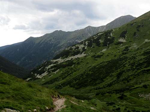
| Almost instantly, while already in the Račkova Valley, our green trail branches off the one running up the stream, and quickly heads upslope, straight north, through coniferous forest – spruce plus some magnificent larches – where fallen trees will often block your way. In spite of the sweat (no real sweat if you set off early in the morning), an altitude gain cheers you up, and timberline is passed pretty soon. Now you enter the kingdom of the dwarf mountain pine, through which the path squeezes tightly, offering the first vistas of the Lower Tatra Mountains, rising to just over 2,000m south of the Liptov Basin, as well as of the east face of Baranec. | |||
|
|||
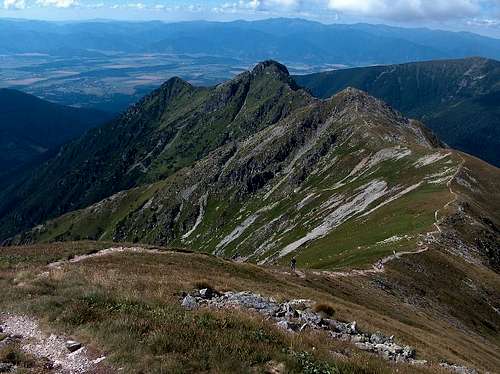
| Having passed the first peak (named Ostredok - the same as the prominent 2050m summit yet to be reached - or Malé Otrhance), you have a fine view of the summits of the Otrhance proper (Vyšné Otrhance). At the saddle, the trail will run along a fairly deep ridgetop trench, resulting from gravitational forces that patiently tear the crest apart. | |||
|
|||
| The continuous cover of dwarf pine turns into patches, giving way to a kind of dry moor (grass, heather, berries). | |||
|
|||
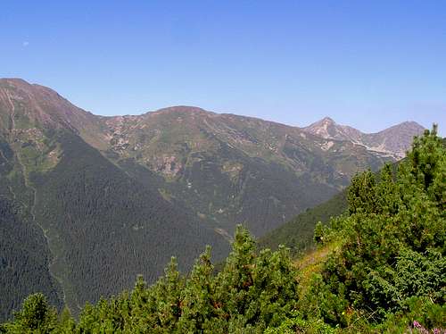
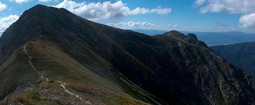
| You have extensive views to both west and east. On the left (W), first Baranec – right across the Jamnicka Valley, then the most fun section of all the nearby ridges, i.e. Banikov-Rohace, can be seen. | |||
|
|||
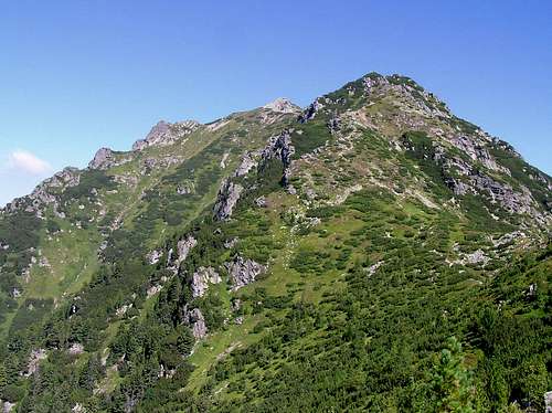
| On the right is the highest peak of the Western Tatras, Bystra, which swells up to 2248m in a parallel ridge. Around 2.5 hours after leaving the valley floor, the trail will bring you to the most picturesque section of the crest: the 2050m high Ostredok/Prostredná Magura (Higher Otrhance/Otrhance proper), which – with its granite, ruffled look and rubble – creates a tiny enclave of High Tatra scenery amidst the gentler, grassier slopes and summits of the highest parts of the Western Tatras, made up of metamorphic rocks. | |||
|
|||
| The last section of the trail will be across grass and dirt again – to spice up your hike, look around – chamois virtually guaranteed. | |||
|
|||
| At last on the summit of Jakubina... Well, actually, there'll be at least one more, undemanding ascent of Hruby (Jarząbczy) Peak unless - rather unlikely, right? - you decide to backtrack. | |||
|


Accommodation
There are an infinite number of guesthouses and a few campsites (as well as dozens of hotels) all over the region of Liptov: Liptov: guesthouses, villas & hotels.There is a campsite and a hut/hostel at the trailhead. There are a couple of shelters in the valleys at the foot of the Otrhance
Red Tape, Border Crossing & Warning
Fortunately, border crossing is no problem any longer but the national park rules are quite strict. In Slovakia, you don't pay an entry fee but you're not allowed to roam the park in winter/spring. Here are the detailed regulations for diverse activities.
In Slovakia - unlike in Poland - those who do not carry commercial insurance have to pay for any rescue services rendered by Mountain Rescue Service (HZS). Mountain rescue team's phone numbers: Slovakia (HZS): 18 300 Poland (TOPR): 601 100 300
External Photos & Video