
|
|
Mountain/Rock |
|---|---|
|
|
36.63280°N / 118.648°W |
|
|
Mountaineering |
|
|
Spring, Summer, Fall, Winter |
|
|
11462 ft / 3494 m |
|
|
Overview
This rather weak looking peak has the distinction of being the highest point in the watershed of the Marble Fork of the Kaweah River. It is situated on the boundary of Sequoia and Kings Canyon National Parks along the Kings-Kaweah Divide and helps to define the western edge of the Tableland. Even its two popular neighbors, Mt. Silliman and Alta Peak, also in the Marble Fork watershed, fall short of the modest altitude of this peak. Peak 11462 has a prominence of about 450 feet.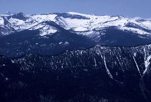
Peak 11462 from the North
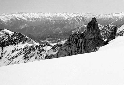
Because of it's relative height and location, the views from the summit are outstanding. Stretching from the northeast to the southeast one will have an uninterrupted vista of the Great Western Divide. To the north, the views extend to Mt. Goddard, the Evolution Group, and the Palisades, while to the south the peaks of the Mineral King region are visible. Immediately to the north is the probably rarely visited canyon of the East Fork of Sugarloaf Creek. Below and to the east, stretches the vast uplifted plateau known simply as the Tableland.
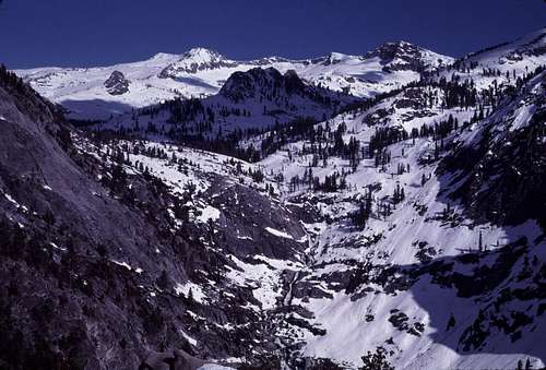
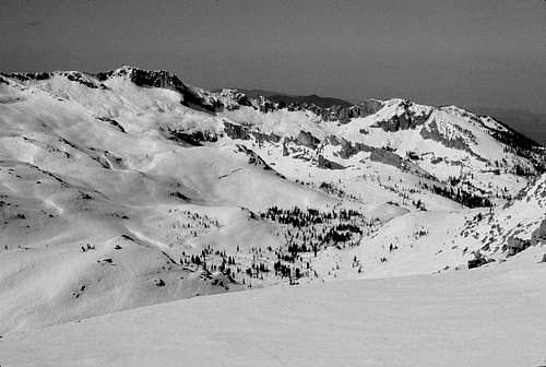 Alta Peak from Summit | 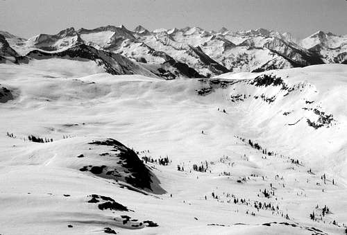 Mineral King Region |
 North From Summit | 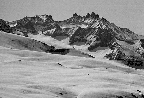 Black Kaweah Region |
Getting There
Most climbers will want to start from Lodgepole Village or nearby Wolverton.From Highway 99 in Fresno take Highway 180 east for approximately 56 miles to the junction with Highway 198, The General's Highway. Follow 198 south for about 25 miles to Lodgepole.
From Highway 99 near Visalia, take Highway 198 east. This is followed for approximately 62 miles to reach Lodgepole.
Note that the short turnoff to the Wolverton trailhead is only about 1.0 to 1.5 miles south of Lodgepole on Highway 198.
The General's Highway (198) is open year round, but may be closed for plowing during heavy winter storms. Chains should always be carried.
For current road conditions click here.
A lot more detailed and useful information regarding the Lodgepole area is here.
Route Descriptions
As one can see from the photos, climbing this peak seems to be quite trivial. There are class 1 and 2 routes on all sides except to the north which appears to have an easily bypassed cliff. The crux of this peak is in the approach. In general, the shortest approaches seem to be the most difficult ones.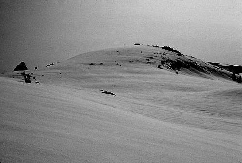
Peak 11462
From Lodgepole
7 miles one way with a 4800 foot elevation gain
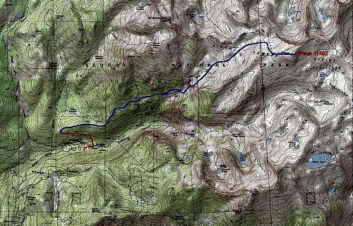
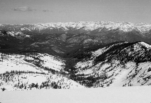
This is the closest trailhead and the beginning of the route I used during my ascent. Starting from the hiker lot at Lodgepole, cross the bridge over the Marble Fork and follow the Siliman Creek Trail. After about a mile (at about the point where the trail turns to the north) leave the trail and head cross country east along the crest of a low ridge. This is actually the right lateral moraine of the prehistoric Marble Fork Glacier. This ridge becomes somewhat steeper in about a mile. Keep following the crest through a mixture of conifers and easily bypassed brush. At approximately 8200 feet, leave the ridge and head roughly east-northeast. This is the start of a rough discontinuous bench just north of and parallel to Tokopah Valley. There are several small, but enticing granite domes and rock faces along the way that will likely capture the eye of most rock climbers.
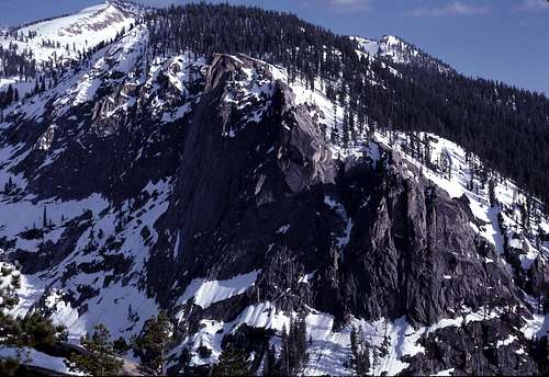
 South Slope of Mt. Silliman | 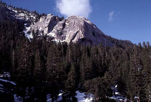 Small Dome Formations |
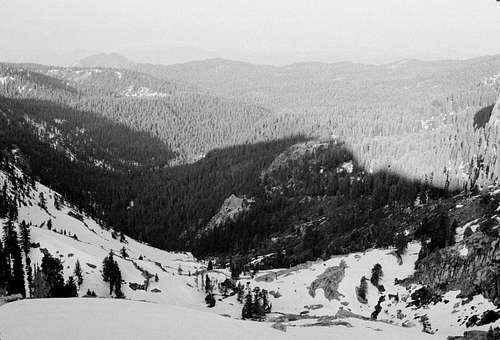
Across the abysmal Tokopah Valley is an excellent view of the impressive Watchtower.
Watchtower
Alta Peak Region
 Slabs along bench route | 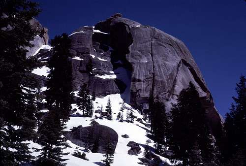 Interesting Dome |  Bench scenery |
The last part of the bench, is a steep side-hill that traverses up to almost 9000 feet. From there, the route to Horse Creek should be clear. There's about a 100 foot drop to the creek. Follow Horse Creek upward and negotiate a steep riser. Above the riser, there is a long easy hanging valley which eventually, with a bit of careful navigation, leads to Peak 11462.
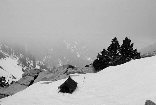 My camp in Horse Creek canyon | 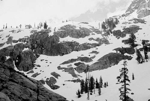 Looking up at the riser from my camp. |
 Looking down the riser | 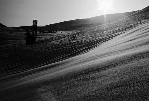 Travelling through upper Horse Creek, spring, 1982 |
A logical variation on this route would be to try and head up Horse Creek directly from the floor of Tokopah Valley- bypassing the rough bench described above. From what I've seen from nearby peaks and from the satellite views, it looks pretty ugly (lots of steep brush and some boulder hopping) but possible.
From Wolverton
8.5 miles one way with a 4300 foot elevation gain
I don't know much about this route, but it may be easier to start from Wolverton and to follow the popular trail to Pear Lake. From the lake basin, cross country travel would be necessary, but easy, to find a practical route up from the Marble Fork towards the southeast slopes of Peak 11462. Though longer, this may be the easiest route to the top and I'd be surprised if this wasn't already established as a popular ski ascent in the winter/ spring months. Hopefully, someone will create and attach this route.
From the North
There are certainly possibilities from this direction. The trailhead at Horse Corral Meadow would make a long, but interesting route. Just the cross country portion alone, from the Sugarloaf trail up the East Fork of Sugarloaf Creek, involves about 7 miles one way with a 4200 foot gain. Another even longer route could start in Kings Canyon near Cedar Grove. Lots of hiking and climbing, but that's what we live for, right?
When to Climb
Spring through fall are generally the best times to climb in the Sierra Nevada. This certainly applies to Peak 11462. Since the approach road is usually kept open all year, a winter ascent would be feasible for those who are experienced with winter climbing. Beware that in the spring, avalanches south of Mt. Silliman and along Horse Creek can be fairly common.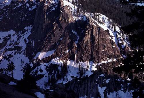 Spring avalanche on the Watchtower | 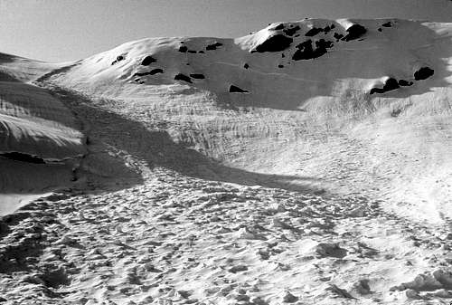 Spring avalanche debris along upper Horse Creek |
Red Tape
An entrance fee of $20.00 per vehicle is required for entering Sequoia National Park.Wilderness Permits are required for all overnight backpacking trips into Sequoia-Kings Canyon National Parks. Permits can be obtained in Lodgepole. Day hiking may be done without a permit.
This area is home to many bears. Even though bear proof canisters aren't required, they are strongly recommended. Proper food storage- whether in the trailhead parking lot, or on your hike, is a must.
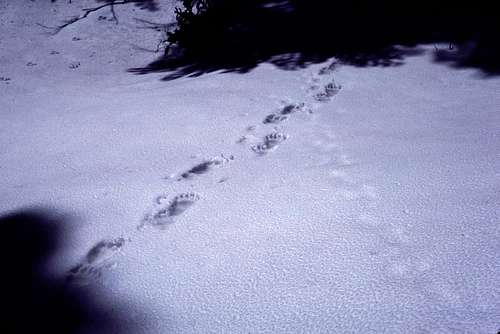
Bear tracks on bench above Tokopah Valley
Information for obtaining a Wilderness Permit as well as other updated alerts and regulations may be obtained here: The SEKI website
Etymology
When I climbed the peak in May, 1982, I did not find a register. If there was one, it was likely buried under an excessive amount of snow covering the summit at the time.Please let me know if there's a local name in use and I will update this page (and my personal notes) accordingly.
Photographic Note
One will notice many black and white photos on this page. During my successful trip to the summit, I shot about three rolls of 36 exp Kodachrome 25. During processing, there was “an unfortunate laboratory incident” per a rather apologetic letter that I got from Kodak along with three free fresh rolls of film.All the images had lost a significant amount of contrast and each image had a strong pink cast. Ugh! The only way I could find to make them somewhat viewable was to delete all the color data and tweak the contrast. I guess they're better than nothing...
 Pinnacle NE of summit | 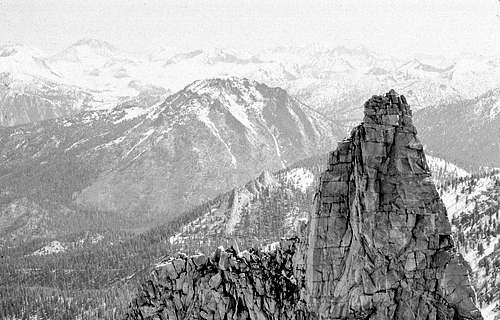 Pinnacle NE of summit- zoom |