
|
|
Mountain/Rock |
|---|---|
|
|
38.98629°N / 106.50759°W |
|
|
Chaffee |
|
|
13232 ft / 4033 m |
|
|
Overview
Note about name: This peak has no official name.
Rank: Peak 13232 ft is Colorado’s 453rd highest ranked peak.

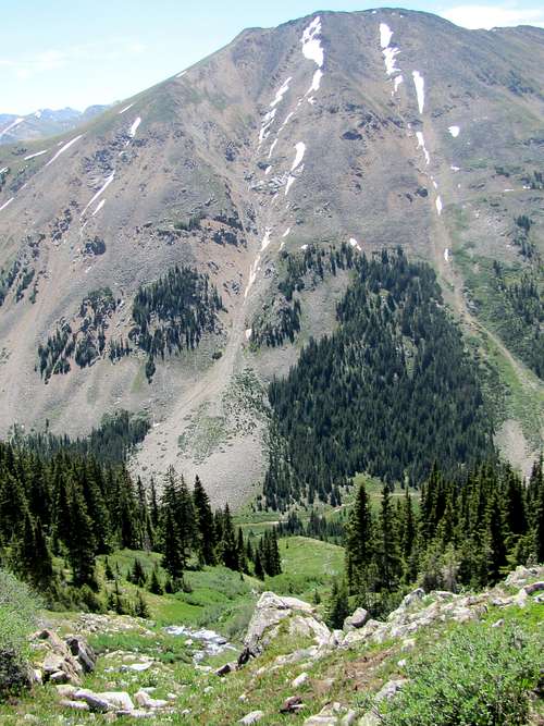
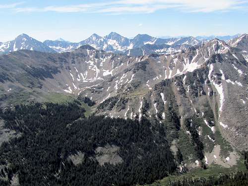
West face, Peak 13232 ft at the center of the picture
Peak 13232 ft rises in the Sawatch Mountains of central Colorado near the famous 14ers La Plata and Huron Peak. It sits on the crest of the ridgeline that separates the North Fork of Clear Creek from the East Fork of Sayres Gulch. The 12180 ft high Allan Lake sits to the northeast of Peak 13232 ft. No trails go to or near the summit of Peak 13232 ft. You can however follow a trail to an elevation of 10840 ft up the North Fork of Clear Creek where you will leave trail and find your own way to Allan Lake and then Peak 13232 ft.
East face of Peak 13232 ft
Getting There
The trailhead described here is the same as the 2 wheel drive trailhead for Huron Peak. From Buena Vista, drive 15 mile north (or 19 miles south from Leadville) to Clear Creek Reservoir Road (County Road 390). Drive Clear Creek Reservoir Road 11.7 miles to reach the ghost town of Winfield (this is a smooth dirt road passable by any car). In Winfield, turn left and cross the bridge to reach a parking area.
Route, No trail via Allan Lake
Note: This is the description of the route that I happened to take. The crux of it is off trail. If you choose to climb this peak, you must be able to find your own way.
The object is to get on the 4WD road that goes into the North Fork of Clear Creek (not the 4WD road that goes to Huron Peak Trail). As you exit the above mentioned parking area, turn right and cross the bridge to get back into the ghost town of Winfield. At the T, go straight. The road turns west into the valley of North Fork of Clear Creek. With 4WD, you can go roughly 2 more miles. Continue hiking this road past Winfield Cemetery to the end of the road. Huron Peak will be visible to the south through the trees.
 |
 Huron Peak Huron Peak |
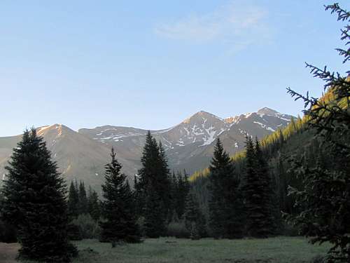
At the end of the road, continue hiking on the trail at the bottom of the valley. Peak 13232 ft will come to view.
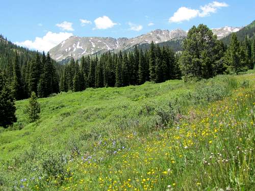 Peak 13232 ft on the left
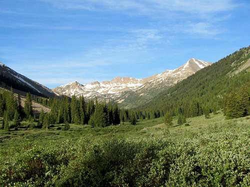
The peaks at the south end of the valley can also be seen.
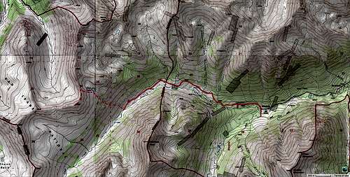
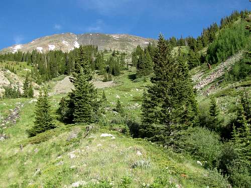
Along the length of 4WD road and the subsequent trail, you will cross a number of small streams. One of these is the stream that drains Allan Lake. You must have a good map and be able to identify this stream (Allan Lake will not be visible). This is where I left trail and went directly up the slopes parallel to the stream. The GPS coordinates for where I left the trail are: 38:59.092 North, 106:29.437 West. View of Peak 13232 ft from where I left the trail.
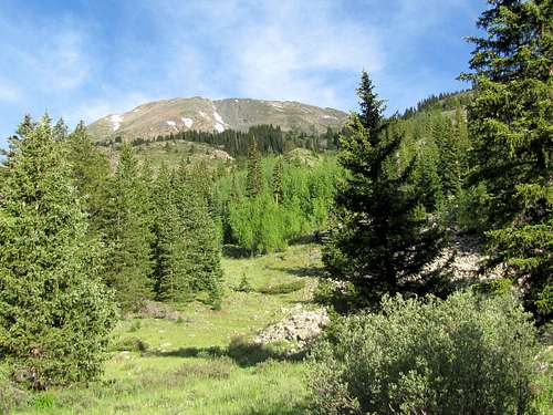 Peak 13232 ft from where I left trail
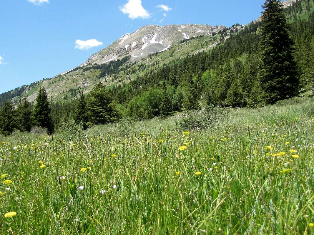
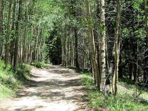
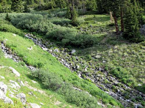
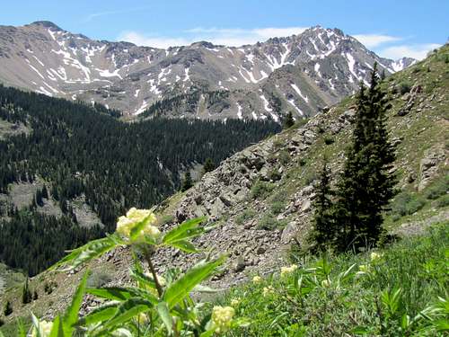
The slopes here were sparsely forested. I did, nevertheless, have to go through an Aspen forest.
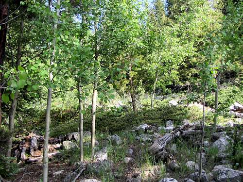
I continued up the steep but mostly grassy slopes near the stream.
 Peak 13232 ft Peak 13232 ft |
 |
 Ervin & Blaumark Ervin & Blaumark |
 |
 Virginia & West Virginia Peaks Virginia & West Virginia Peaks |
 Grizzly Peak Grizzly Peak |
 Blaumark Blaumark |
 |
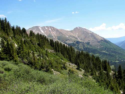
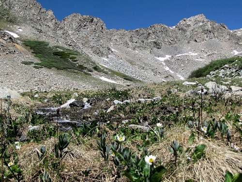
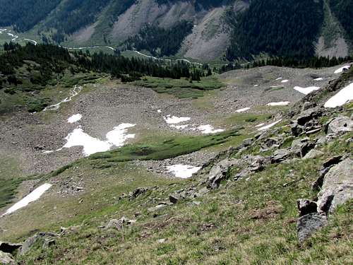
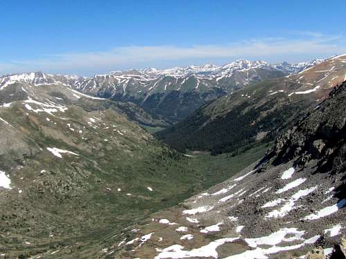
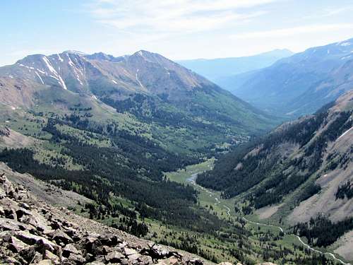
At around 12100 ft, the slopes began to ease up. Looking down the steep slopes.
 Looking down the steep slopes, Winfield Peak seen
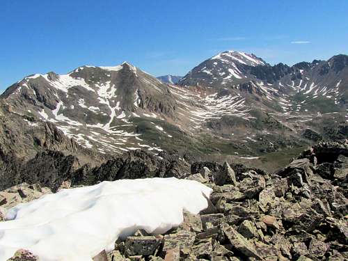
The jagged high points around Allan Lake could now be seen.
At 12180 ft, I reached Allan Lake.
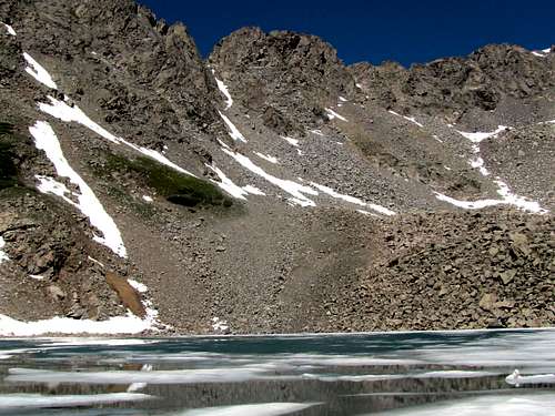 Allan Lake Allan Lake |
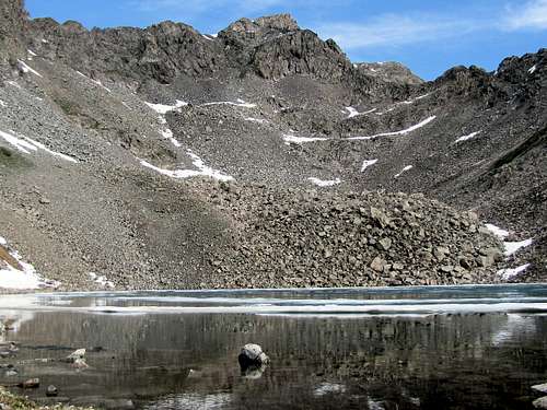 Allan Lake Allan Lake |
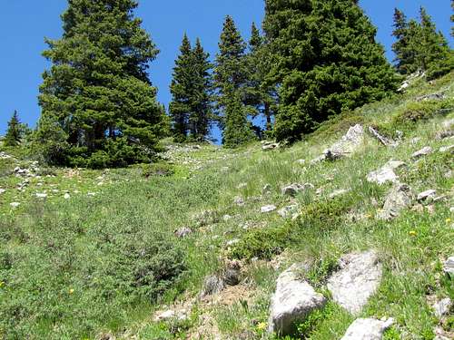
A spot just below the summit of Peak 13232 ft could be seen.
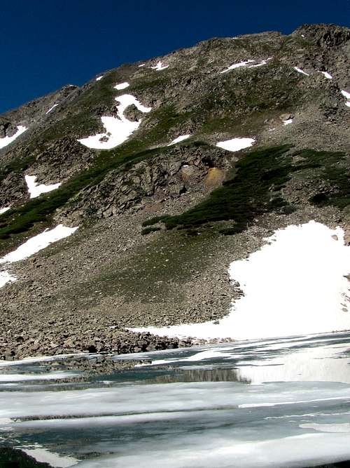 Slopes of Peak 13232 ft
I then went up the very steep but mostly grassy slopes above the lake.
 |
 |
Looking back 800 vertical feet down at Allan Lake.
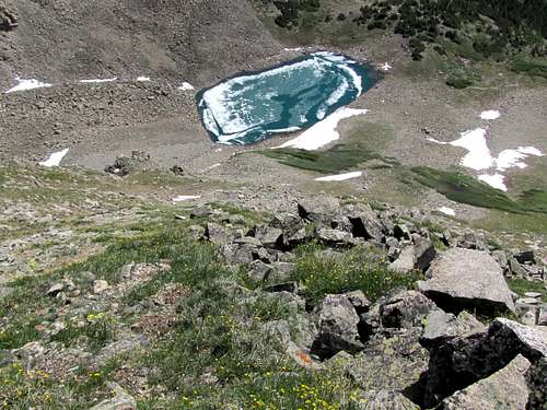 Allan Lake
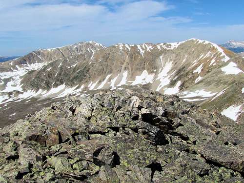
At around 12900 ft, I reached the top of a rocky ridgeline where the summit came to view.
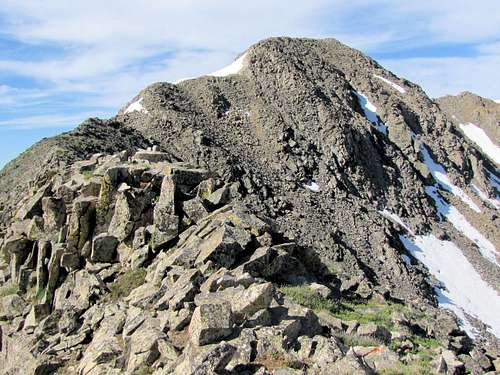 Summit
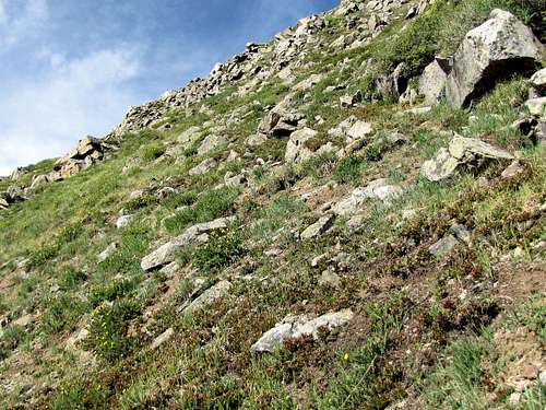
Followed the ridge-top to reach the base of the peak.
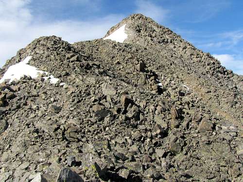 Base of the peak
Looking back at the ridge-top.
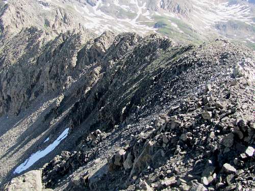 Ridge-top
Just below the summit, there was a smooth rock which I could not climb. Had to go behind this rock and do minimal hand and foot climbing to gain access to the top.
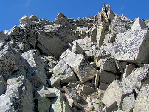 Minimal "hand and foot climbing" below the summit
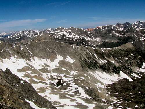
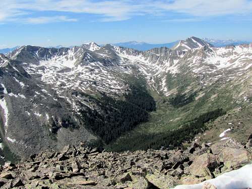
Views from the summit of Peak 13232 ft.
 Sayres Gulch Sayres Gulch |
 Red Mountain Red Mountain |
 Peak 13295 ft & Jenkins Mountain Peak 13295 ft & Jenkins Mountain |
 Grizzly Peak Grizzly Peak |
 Huron Peak & The Three Apostles Huron Peak & The Three Apostles |
 Ervin & Blaumark Ervin & Blaumark |
 La Plata & Sayres Benchmark
Red Tape
No fees or permits required.