
-
 8220 Hits
-
 75.61% Score
-
 6 Votes
|
|
Route |
|---|---|
|
|
39.73003°N / 106.26455°W |
|
|
Download GPX » View Route on Map |
|
|
Hiking, Mountaineering, Trad Climbing, Scrambling |
|
|
Spring, Summer, Fall |
|
|
Most of a day |
|
|
5.7 (YDS) |
|
|
1 |
|
|
Overview
Peak T is unique in the Slate Creek drainage because of the 12-15 foot summit block on top that is a class V climb. The route described here ascends up one of the most mellow gullys in this area. It also includes the exciting class V climb of the summit block. If you do not do the summit block climb, this route is a high class 3 to class 4.
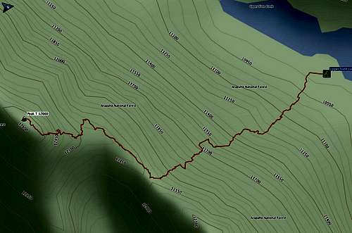
Peak T route overview
Statistics
Distance | Elevation gain | |
| Base Camp at Upper Slate Lake to Peak T | 1.1 mi | 2700' |
| Brush Creek TH to Base Camp (ascent) | 11.1 mi | 3100' |
| Base Camp to Brush Creek TH (descent) | 11.1 mi | 1200' |
Getting There
The Slate Creek Trail and Upper Slate Lake can be reached from the Rock Creek, Boulder, or Brush Creek trailheads. See Getting There for Peak Q, or for the mountain "Peak T" when it is published (I will update this at that time). Look for good camping directly opposite a narrowing of the lake (N39 44.385 W106 15.876.) This is one of the few camps in the area that is legally far enough from the water.The rocky point just down from camp has a nice breeze and rock slabs for contemplating or cleaning up.
Route Description
From your Base Camp at Upper Slate Lake, follow trails southwest along the lake to the edge of the woods where there is an open area around a drainage. Turn left (SSE) and follow the edge of the woods and drainage up the hill until you encounter a boulder field of large rocks. At this point you should be able to see the saddle between Peak 12,385 on the left and Peak T on the right. Ascend the boulder field, then the grassy slopes south to this saddle.
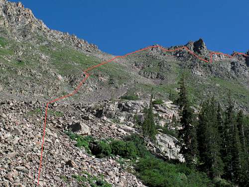
Route to Peak T
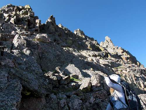
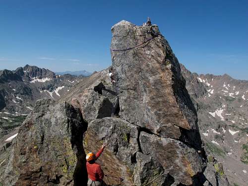
From the saddle, continue to follow the ridge to the southwest, staying mostly to the right of any obstacles. There is one point, about .2 mile along the ridge, where you will drop down significantly to avoid a large rock protrusion (see photo above).
Peak T ridge
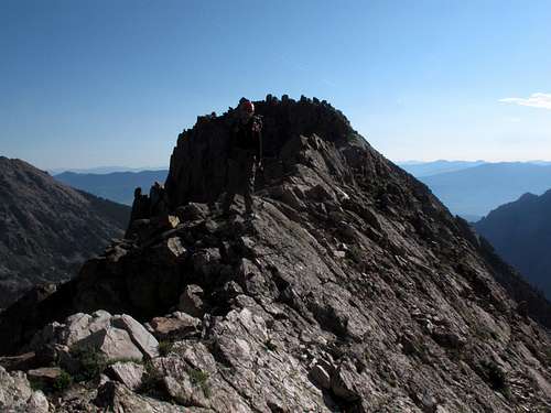
Scrambling up Peak T
Climb back up about 100' after that, back to just below the ridge. Continue scrambling and ascending class 3/4 rock. At approximately 12,500' you will round a corner and see a grassy area with rock outcroppings or ledges. Ascend this to the final summit ridge.
Grassy ledges on Peak T
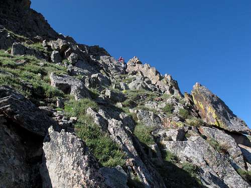
Continue up grassy ledges
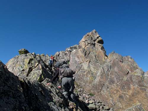
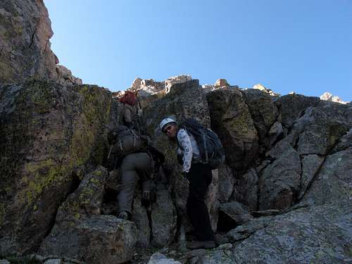
Passing below a knife edge on Peak T ridge
As of summer 2013 there was a glass register on top, placed in 2010, with very few signatures. Slings and cordelette were placed in July of 2013. The top of the summit block has a shallow U-shaped depression. Have someone climb up the summit just to the NE of the summit block to provide guidance for the placement of the rope on top. Another person should tie a rock around the end of the rope and aim it over the top of the summit block. You may need a trekking pole to retrieve the rope on the other side. There is nowhere to place protection.
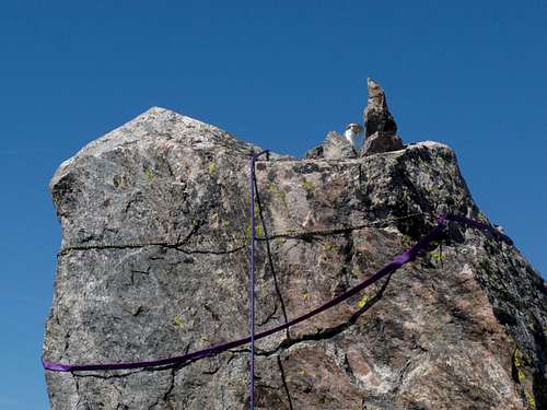
Register and webbing on Peak T
Belay for Peak T summit block
When the rope is set up and the belayer is ready, the climber should scramble up to the base of the summit block and start on the side just left of the belay side of the rope. There is an obvious protruding hand-hold. Grab this with one or both hands, and use a smear to then lift your body up and over to the left. Once at this point it is easy to attain the summit.
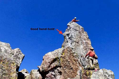
Climbing the T summit block
From the top, you can descend the same way or go on to Peak S via the Peak T - S Traverse route.
Essential Gear
Helmet
Short rope (30 m works well)
Harness or web harness
Belay device
A few carabiners
Webbing or cordelette for belay station
Climbing shoes may help some people
Ice ax (if descending between Peaks Q and R, possibly if descending between Peaks R and S)
Crampons (if descending between Peaks Q and R, possibly if descending between Peaks R and S)
Trekking pole (to reach rope if necessary)
Photo References
Below is a copy of the track containing the locations and titles of the photos above.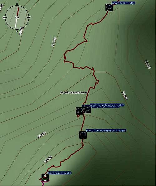
Locations of photos referenced above