Part 2: Chile
Ojos del Salado 22,615 feet
(world's highest volcano)
Part 3: Argentina
Aconcagua 22,841 feet
(second highest of the 7 Summits)
Introduction
Wait a minute! Greg Slayden, the creator of PeakBagger.com, was inviting me to join an expedition to South America? No way! It would be a climb of Aconcagua and Ojos del Salado, the world's highest volcano. I was just excited to meet Greg for the first time, but now he was posing this question and it was a bit of a shock. They were leaving in two months. I was later told that of all the people they had considered, I had been selected for two reasons, my experience with travel in third-world countries, and also the fact that I had been to high altitude before and done well with it.
La Paz, Highest Capitol In The World
The other members of the expedition would include several very accomplished peakbaggers. Adam Helman the trip organizer is the host and creator of CoHP.org, the main website for US county high-pointers. Petter Bjørstad from Norway is currently the world leader in climbing ultras (peaks with more than 5000 feet of prominence), he had also climbed a staggering 34 country high points and done a number of first ascents in Greenland. Duane Gilliland was one of the first to complete all the county highpoints in Washingon State and also one of the first to climb all the ultras in the US outside of Alaska and Hawaii. Rob Woodall from the UK had experience as a trail runner and was known for being fast. He had climbed all the Munros and Corbetts of Scotland and had done 58 of the 62 United Kingdom Island Highpoints.
Bolivian Women In Traditional Dress
These guys wanted me to join their group? The plan was to spend several weeks acclimatizing in Bolivia successively climbing higher peaks before moving on to the really big ones. Then all 6 of us would climb Ojos del Salado. After that Adam, Petter, and Duane would fly home since they had already climbed Aconcagua. That would leave Rob, Greg, and I to face the huge task. I told Greg I would need to think about it for a few days. I knew it would be a huge financial commitment and there was the matter of breaking off my own plans to go to Aconcagua with a friend the following year. I spent several days stressing-out about the choice but everyone I mentioned it to said the same thing, oddly enough even my parents, "You have to go with them!" I sent an email to the group saying I was in.
Lake Titicaca
Part 1: Bolivia
After landing in La Paz, the capitol of Bolivia, Duane and Greg and I drove to the Topas Travel office to pay for our Land Rover and the driver named German (pronounced Ayermon). It would be a couple of days until we met up with Adam and Rob and Petter in Potosi. We sat down at the main office prepared to hand over several thousand dollars in cash. Topas looked at us gravely and said "you have come to Bolivia at a difficult time". (What the hell?) He went on to explain that the government had just doubled the price of gas a few days prior and that the people of Bolivia were really pissed-off. He explained that we might have trouble buying gas in certain places if the strikes continued. "Well that's just great" I thought, but we'll have to make the best of it. Leaving La Paz, our driver did something interesting. He stopped to buy some pure alcohol and coca leaves at a roadside stand. Apparently the coca leaves were for him but the alcohol was some kind of offering. He poured some on the side of the road and said a few prayers. He did this several times during the trip.
A Reed Boat
After paying our dues we drove to Huatajata on Lake Titicaca where I bought a nice brown llama hair hat. We saw some boats made out of reeds and then met the son of the man who helped Dominique Gorlitz build the reed boat which attempted to cross the Atlantic Ocean. Near the banks of the lake I noticed three young girls trimming the grass around their house. They were down on their hands and knees using small sheers. So far Bolivia had a very old world feel to it. Many of the indigenous women wore stylized skirts called Polleras and oddly enough small bowler hats, an idea which was adopted from the British.
Cerro Anacasi (14,419 feet / 4395 meters)
The following day the three of us set out for our first acclimatization hike. Now in actuality, we had already began acclimatization because La Paz is the highest capitol city in the world. The airport itself is located at an impressive 13,325 feet. We drove northwest from the town of Oruro to the base of unofficially named Cerro Anacasi. We would start our hike in the very small village of Anacasi at 12,000 feet and work up to the summit at 14,419 feet, 8 feet higher than Mount Rainier back home. Unsure of the local laws and regulations, we hoped to be well on our way up the slopes before anyone could ask us what we were doing.
Cattle in Anacasi
The mountain's side was scattered with cactus. It reminded me of the state of Arizona. The terrain was rocky but not exceptionally difficult to cross. The only real struggle was the altitude, which manifested itself in our shortness of breath. I knew it would take several more days until I could feel comfortable above 13,000 feet. We ascended in a northern direction crossing over numerous walls constructed of meticulously balanced rocks. Having seen similar division on some of the Greek Islands I suggested that perhaps an ancient civilization had been much more prevalent than the current one.
Cactus Flowers
Cactus Flowers
We reaching the southwest ridge at just over 14,000 feet and then followed the crest up the last several hundred feet to the south summit. There were two distinct high points about 300 yards apart but fairly close in height. I was impressed when Duane pulled a leveling sight out of his pocket and began to size up the northern summit. "These guys know their stuff" I thought to myself. Duane said he thought the northern summit was higher so we dropped our packs and went over to it. From there we could see down the east side of the mountain to a flat plain where some rainwater had accumulated.
Duane And The Leveling Sight
After some food and a rest we began our descent. About half way down we discovered a trail which was far superior to our route of ascent. A couple of local men appeared in sandals who were apparently hiking up to switch their cattle from one rock pen to another. That answered the question about the rock fences. They were not ancient. The men made it clear to us that we should not be on the mountain without permission from the local police department. We feigned tourist stupidity and were as friendly and cordial as possible. For the rest of the descent I thought about the prospect of hiking in this rough rocky landscape covered with cactus, wearing nothing but a pair of sandals.
More Cactus Flowers
Driving back through Oruro, we heard on the radio that in the police had discovered a dynamite bomb in the same public square we had been in the night before. This was more evidence of the civil unrest over the rise in gas prices. Apparently demonstrations were being held all over Bolivia. I had noticed a couple of strange stuffed figures hanging in effigy from lamp posts in Oruro. We also had received news that Adam and Rob in the other vehicle were forced to change their plans when they couldn't buy gasoline. I asked Greg how many days it would be until we could safely cross the border in Chile. He replied that fairly soon we would be entering a remote area away from the cities and towns.
Cerro Rico Seen From Potosi
We drove to Potosi to join forces with the other vehicle. Potosi is a scenic mining town with narrow winding streets. Cerro Rico stands tall over this development and is the reason for the towns existence. The still active mines of Cerro Rico provided the silver of the 16th century Spanish Empire and at one time Cerro Rico had provided 75% of all the world's silver. In town I met Rob, Adam and Petter and we all discussed the plans for the rest of the trip. The following morning we would drive to nearby Cerro Cunurana and do our first acclimatization hike together as a group.
Cerro Cunurana (16,637 feet / 5071 meters)
Driving up to Cunurana we passed several small farms and one small mining operation which had a gate across the road but thankfully it was open. Higher up we passed an incredibly beautiful lake with water that was green from the mineral content. The highly eroded and barren rock formations on the surrounding peaks reminded me of the desolation of the San Juan Range in Colorado.
Driving Up To Cerro Cunurana
The Lower Of Two Lakes
We parked at 14,900 feet and walked up an old mining road towards the saddle at the base of the north ridge on Cunurana. We passed another small lake and then some old ruined buildings constructed out of rocks. At the saddle we turned south and followed the crest until we came to what looked like an impassable drop off at 15,970 feet. It was a 20 foot cliff with no way around. This would require some down-climbing. In fact, it was not as hard as it looked and soon enough we were all past the obstacle.
Green Water
The Upper Lake
Now the summit was clearly visible and not that far off either. Petter and Rob rushed ahead displaying their strength. This was a pattern that the rest of us soon got used to. Some climbers are just naturally stronger than others. No hard feelings. The final slope was a mixture of scree and loose rocks becoming more solid around the summit. I was surprised to see that there was a summit marker, very similar to the ones we find at home. The views from the top overlooking the lakes and smaller peaks were exceptionally good. Once again it reminded me of Colorado.
Above The Saddle
Following The Crest
Back at the cars, Adam expressed some frustration and said that he had really been struggling throughout the day. He said that he didn't feel good at altitude and was worried about his acclimatization. After throwing our bags in the back of the two vehicles, we drove down to the mining operation where we found that the gate was now closed. Our drivers German and Louise got out and began speaking to some of the men around the gate. This is where having two Bolivian drivers comes in handy. They explained that we were "alpinistas" and not hunters or mining prospectors. After a few minutes of discussion the gate was opened and we were allowed on our way.
Cerro Cunurana North Ridge
Downclimbing The Cliff Section
We drove south towards Tupiza crossing one long section of gravel road that was still under construction. We had heard that parts of Bolivia were similar in some ways to what the United States was like, one or two hundred years ago, before extensive development. Greg told us about a French movie he had seen called The Wages Of Fear in which some desperate men stuck in South America are forced to take a job transporting nitroglycerin in trucks cross-country on rough roads. I wondered what would happen to our giant gasoline tanks on the roof if the land cruiser was to tip over on one of these roads. I decided it was better not to think of such things.
Cunurana Summit
Descending
The area around Tupiza had some amazing geological features. In fact I think it's fair to say that it's the most amazing landscape I've ever seen. We're talking mind blowing here. I've been to Arches National Park, Bryce Canyon, The Badlands South Dakota, Golden Canyon in Death Valley, Monument Valley and many of the other stunners. This place was more impressive than all that. It had features that mimicked each of those places and the colors and formations in the rock were so varied it was really unbelievable. Every bend in the road revealed new mysteries. I wished I could have a whole month to explore the area. Now I could imagine why Butch Cassidy and the Sundance Kid had been so fond of this area. They had been killed not far from here. Unfortunately the evening light did not allow me to take any decent photographs. We made our camp on the side of the road, being careful to pick a spot above 13,000 feet. We would have to be careful from now on, keeping proper acclimatization schedules in mind.
Happy Bolivians In Tupiza
Cerro Chorolque - (18,110 feet / 5520 meters)
It was new years eve, and what a way to end the year, by climbing the highest peak of 2010! Rising over 18,000 feet, Chorolque would be my second highest peak to date. We packed up our roadside campsite and continued the drive northwest. The landscape changed and we found that we were now up on top of a high wind-swept plateau. Llamas roamed freely here and I wondered if any of them were wild or if they had just been allowed to graze these dry scrub-lands. Chorolque came into view and what a sight! This was a real peak we were looking at, much more impressive than the first two. It stood extremely high and pyramid shaped above the surrounding land. There were no other peaks around to challenge it's dominating prominence. In fact, this old eroded volcano had 5059 feet of prominence and thus would be our first ultra. We followed a long winding road up to the mining town of Santa Barbara, high on the western slopes. Located at 15,600 feet, Santa Barbara, home to about 5000 people, is the highest town in Bolivia and one of the highest mining camps in the world.
Cerro Chorolque
The Southwest Face
It was necessary to stop and ask permission to climb the mountain. Once again our drivers took care of the task with local relations but this time they were not successful. At this point Adam Helman stepped out of the car. I don't know what he said to them but it worked. We then drove higher than ever before in a motorized vehicle. Very few roads outside Asia dare to reach this altitude. We parked at 16,400 feet where the road appeared to become untrustworthy. I could feel the altitude as soon as I stepped out of the Land Rover. This one was not going to be easy. It was only my fourth day in Bolivia and already we were pushing the 18,000 foot mark. If Duane and I had caught our original flight, not getting delayed in Miami for a day, then this would be a lot easier (it's a long story about bad spark plugs on a plane and staying in a smoky casino overnight, don't ask). Adam told us that he would be staying behind today. After his experience on Cunurana, he felt that his body needed a rest day and that sitting above 16,000 feet was probably helping him anyhow.
The village of Santa Barbara
A mining Cart At 16,700 Feet
The rest of the prominence buffs (everybody but me) were in a hurry to go and we were soon walking up the remainder of the road which seemed to peter out the higher we went. The road gave way to rough trails leading up to some mines. I looked inside the mouth of one mine and was surprised to see icicles hanging down from the roof. Above the mining opps there was nothing and we were forced to make our way over loose shifting talus. I felt an altitude headache building. The headache refused to be ignored and increased its need for urgent attention the higher we went. Unfortunately, I knew that there was only one thing that would help and I wasn't willing to go down until I reached the top.
The Mine At 16,700 Feet
Icicles Inside The Mine
Periodically, lack of oxygen forced me stop and just breathe. A couple times I closed my eyes to rest for a second and then something strange happened. Like a dream, I was at home with friends, somewhere comfortable and happy. I opened my eyes and I was still on Chorolque. Weird! And a little bit disconcerting. It happened a few times. When I closed my eyes I almost immediately forgot where I was and what I was doing and imagined I was somewhere peaceful and nice. I didn't like it. Too creepy. Eventually we worked our way over to the southwest ridge which had a drop-off on the right side. Overlooking the drop-off we could see the summit area up above. The southwest ridge converged with the northwest ridge and we knew we were close.
Ascending Loose Talus
High Above Santa Barbara
On the broad summit we looked around on a landscape that appeared deceptively flat. Many of the features below were dwarfed from this high perspective. Petter pulled his oximeter out of his pocket and had us each insert our finger, one at a time, to measure our heart rate and blood oxygen levels. He talked about the unusually low levels of oxygen we experience at altitude and said that if a doctor ever recorded levels that low, he would pronounce the patient "functionally dead". This made me think of my weird experience on the way up. I didn't know it at the time but this oxygen measuring would become a regular ritual for our group. Petter liked to keep track of how we were adjusting to altitude by taking readings on summits and also the first thing in the morning. He would record his findings each day in a little black book. My oxygen levels were fairly good most of the time but my heart rate was always faster than the rest of the group and he explained that younger hearts beat faster at altitude.
Nearing The Summit
Gendarme
We spent nearly an hour on the summit soaking up the thin air. We needed to shock our bodies into the idea that this sort of strain was going to become a regular occurrence. I was very tired on the descent. The elevation gain for the day was not overpowering, but the altitude certainly was. Stubbornly, the headache increased in intensity on the way down, nearing migraine proportions. I was glad to get back to the car.
Llamas Near Santa Barbara
I was hungry that night when we got to the town of Uyuni. I ordered a llama steak, quinoa, and a chorizo omelet. Adam helped me with the translation. We were lucky to have two people proficient in Spanish because nearly no one in Bolivia speaks English. Greg was our interpreter on the road and Adam took care of the guys in the other vehicle. Our peakbagging schedule allowed very little time for touristy sight-seeing but we did make a few allowances throughout the journey. The first one was the following morning. We went to the edge of the Salar de Uyuni which is the largest salt flat on earth and also the flattest place on earth. In fact, it's so flat, that it's what the satellites use for calibration. If it was good enough for the satellites then it was good enough for us. Everybody placed their GPS units on the ground and left them there to check for accuracy. Then Adam broke out his ice axe and used it to chip off a sample of the salt to take home. We noticed rows of piles of salt that the local people had set up to dry. They make bricks out of the salt and use if for building walls and fences. We had even passed one famous hotel nearby that was made almost entirely out salt.
The Salar de Uyuni
Salt
After the salar we drove southwest toward a very remote region near the border of Chile on the edge of the Atacama Desert. We passed one small pond where a flock of flamingos was eating something underneath the salty water. We found this new region was densely full of large volcanoes. They ranged from 16,000 to 20,000 feet and were spaced only five or ten miles apart from each other. One could really spend years climbing in this country.
Wild Flamingos
Where The Heck Are We?
We were looking for a specific road. It wasn't on any maps but Rob had done and impressive bit of research using Google Earth and he was convinced that it would allow us the access we needed for the next climb. After some exciting uncertainty we found the turn off and drove up the rough side-track. The road was highly overgrown with scrubby bushes and grass. I wondered how the hell Rob had spotted it with the satellite imagery. The drivers didn't like it and tried to stop at one point but we convinced them to go a little further. We made camp at 15,300 feet among tufts of grass which I nick-named "cactus grass" because it was sharp and the tips of the grass would come off and stick in you if you brushed up against them. Our drivers informed us that this road had been made by the people of Uyuni to collect the yareta plant for tinder, which grows plentifully in the area. These plants which look like big blobs of green moss only grow above 10,500 feet have an extremely slow growth rate. In fact, some of the ones I photographed are likely to be thousands of years old. I bent down to examine one and found it to be surprisingly firm to the touch.
A Mature Yareta Plant
Cerro Caquella and Yareta
Callejón Cañapa - (19,357 feet / 5900 meters)
It was time to start the new year the right way, by climbing the highest peak of my life. But I knew that if we were successful later in the trip, the altitude record wouldn't last long. Even so, the idea of getting a few feet higher than Kilimanjaro was exciting. The effort required to do so was a little intimidating though. From our camp we would be facing 4000 feet of elevation gain. At home in the cascades I could do twice that much in a day, but at this altitude it would be a real challenge.
Callejón Cañapa East Face
Cañapa Base Camp And Cerro Caquella
We began with a slowly ascending traverse over to the northern most of two east ridges. On the ridge it was steep and we found that the blocky talus was just as loose as Chorolque if not more so. This added to the toil and we stopped just about every hour to rest. Volcán Ollagüe was now visible. It was an incredible looking peak with big white eroded slopes and continuous blooms of volcanic gas coming out of the caldera on the west side. Around this point I noticed that the little cough Adam had developed the night before sounded worse today. He was hacking away and obviously struggling to breath. He decided to stop and wait for us about half way up the ridge. It was the right choice. When your body is telling you to stop at high altitude, you better listen. Sadly, we told him we would see him in a few hours and continued our ascent.
Approaching The Northeast Ridge
Callejón Cañapa Northeast Ridge
The ridge was broken up into alternating steeper sections and then mini-plateaus. We would push through a seemingly endless steep section and then rest for awhile when we reached the next plateau. It was very slow going. I did my best to pace myself and use pressure breathing techniques but the altitude headache of a few days prior had returned with a vengeance. I felt like crap, exhausted and demoralized. But I also felt stubborn about it. In truth, comfort has no place in high altitude climbing. And besides, it was only temporary discomfort.
Volcán Ollagüe
False Summit And Cerro Tomasamil
Some wind picked up with a serious chill near the summit and I felt like I was really getting up there. Duane and I were the last to reach the top. The other guys were sitting near what looked like an old collapsed summit cross. What a push that had been! It was definitely one of the most physically demanding days I had ever had. I made a short video clip of the surrounding volcanoes and mini salt flats and then we all sat there resting and eating. Petter checked our oxygen levels and asked us to remember our numbers until we got back to camp.
Duane Ascending
Callejón Cañapa Summit
On the way down I suggested the we take the scree slope between the two east ridges. Anything would be better than that lousy talus. We started down the slope and travel was much easier but it presented the problem of Adam Helman. We had told him that we would meet up with him back on the ridge and now we were going down a different face. Greg volunteered to traverse over to the ridge and see if he was still there waiting for us. We all sat down and watched Greg, trying to keep his figure in sight as he got further and further away. Eventually he disappeared over the ridge crest and finally reappeared with Adam right behind him. Our paths converged at the bottom of the scree slope next to a giant bolder.
The air was noticeable thicker at 16,000 feet and I found my second wind. Feeling better, I went ahead of the group and got back to camp 20 minutes before anyone else. That evening was a happy time for me. We had completed our first high altitude climb with considerable elevation gain. The headache was a bummer but I had pushed through it. The other guys were happy because they had gotten another ultra, which under usual circumstances can be hard to find. I felt bad for Adam and hoped that his cough would improve.
On The Summit
Descending The Scree Slope
Cerro Tomasamil - (19,127 feet / 5830 meters)
The following morning we packed up camp and drove across the valley to a neighboring volcano of approximately the same size, Cerro Tomasamil. We really wanted to climb Ollagüe but the Chilean Difrol permit system wouldn't allow it. We had only registered for one Chilean peak, the highest one. We were willing to poach Ollagüe but the drivers couldn't be coerced into breaking the law so Tomasamil was the next objective. The problem with Tomasamil was that there weren't any roads that went very close to it. We gave ourselves the whole day to tackle the problem and try to solve the puzzle. It was possible to do the approach as a backpack, and set up camp the night before, but thankfully it didn't come to that. The main road is at its closest proximity to the mountain along the east side.
Volcán Ollagüe And Cerro Aucanquilcha From Tomasamil Base Camp
Driver German
We found the terrain there to be extremely flat and scarce of any rocks or boulders. The answer was obvious. It was time to drive cross-country. Up to this point the drivers had been sort of obstinate about going where we wanted them to go on rough roads, but here they put up no resistance. We left the road, driving straight towards the peak. It loomed larger and larger over our us until the ground became too rocky to continue. We made camp around 14,000 feet and I was dismayed to find three ticks crawling around on the ground. I crushed them, warning the others, and hoped that none of their buddies found a way onto my legs. We spent the rest of the day resting for the following day, which would surely be the biggest undertaking yet. We were facing over 5000 feet of vertical gain. I for one was not excited about another long ridge of volcanic talus, even if it was an ultra.
Starting Out On Tomasamil
Alpenglow On Volcán Ollagüe
Knowing it would be a long day, Duane, Greg, Adam and I left before sunrise. Petter and Rob were fast so they could catch up to us. Adam's cough had worsened and at times he was seized by violent fits of hacking that shook his whole body. It did not sound good. We hiked east by southeast aiming for the north ridge. By the time we reached the north ridge the sun was coming up. Rob and Petter who had started a half hour after us had already caught up. There was a lot of talus and scree but it was not as unstable as the rock on Cañapa. I also noticed that I was feeling a lot better. The air was thin, no doubt about that, but thankfully I was free of altitude headaches. Adam found a fossilized fish which he stashed on the ridge and marked with a way-point. He also stashed a water bottle for the way down.
Climbing Tomasamil
The North Ridge
Like Cañapa, there were steep sections followed by more level areas where we took regular breaks. Adam was coughing like a habitual smoker but he seemed determined and I felt positive that we were all going to make it. We came to a sharp rib on the ridge at 17,800 feet which provided some fun easy scrambling. Beyond that we could see one final obstacle before the summit. It was a big, broad, red hump on the ridge. It looked very steep and very loose. I nicknamed it Red Hill after the song Red Hill Mining Town by U2. It turned out to be just as steep and nasty as it looked. Here the group sort of split up as everyone picked their own way up through the loose rocks.
Approaching Red Hill
On The Ridge
Above Red Hill, the ridge narrowed again and it was not far to the summit. Adam made it there first and the rest of us caught up a few minutes later. Estimating from his coughing, it had been a much harder climb for him than for the rest of us. I was impressed that he had made it at all. I took a group shot of everybody on the summit. After a few minutes of settling in, everyone was laying on the ground which made for another good shot. There's nothing like a little catnap at 19,000 feet, right?
Red Rock
Loose Rock Red Hill
For the descent we decided to take a scree slope down just like the previous climb. This would be faster and easier than coming down the loose talus on Red Hill. The shortcut presented a problem for Adam though because he had stashed his water and the fossil on the north ridge. Adam would have to descend alone to retrieve his belongings and meet the rest of us lower down. The scree slope we chose was off of the left side of the ridge and it was much steeper than anything on Cañapa had been. There were a few larger rocks mixed in with the scree. If one of them was triggered by us and started rolling, it might gain enough speed to hit someone and cause an injury. For this reason, we stayed close together so that any rolling rock triggered by someone higher on the slope, wouldn't be able to gain enough momentum to pose a real hazard to someone lower down.
High On The North Ridge
Cerro Tomasamil Summit
Near the bottom of the scree I noticed a trail leading down and to the right. It was a surprisingly well developed game trail and that made me wonder why the vicuñas would venture so high. I decided that it was likely a trail that led to a water source on the upper slopes during times when these peaks were covered with snow. We followed the trail down to where it crossed the north ridge and then retraced our previous route back down to camp. It was full day. By the time we were all down, it was early evening.
The Catnap
Tomasamil would be our last peak in Bolivia, for the following day we would cross the border into Chile and begin our long drive through the Atacama Desert, the driest place on earth. In the morning we made the short drive to Estación Avaroa and waited along with a few buses and truck drives until the customs buildings opened. This was one of those surreal desolate border crossings that you read about in travelogues. Located literally in the middle of nowhere, it was home to just a few random buildings and a gate across a dirt road. There were some old abandoned wooden railway cars that looked as if they had been stationed there, immobile for at least 100 years.
Women In Estación Avaroa
Some women were selling soup and potatoes and mystery meat out of several large aluminum pots. After eating dehydrated food for days, I was hungry, so I used the last of my bolivianos to sample a little of everything. It was good! Cerro Ollagüe was smoking away and we had our closest view yet of the impressive volcano. The bus that was in line before us had a little trouble getting started so we helped push it, for a jump-start. Then we got our passports stamped for exiting Bolivia and entered the no-man's-land, on the salt flat between the two borders.
Volcanic Gas Of Ollagüe
Part 2: Chile
The distance between the two gates was about a kilometer. We were stopped at the Chilean customs buildings and asked to open all our baggage. They were looking for fresh fruits and any meat products, but especially drugs. I had hidden my salami sticks, beef jerky and some packets of tuna behind the back padding on my large pack. They didn't find it. Our passports were stamped once again, this time with a record of entry. This was it! We were on a mission now to drive directly to the highest peak in the country, without delay. Ojos del Salado was 700 miles away and we would have to spend one night at or near sea level. Actually that wasn't such a bad thing. Many high altitude acclimatization schedules include one or two trips down low to allow the body some time to recover. Beyond the border, the road turned to the south and we passed more salt flats and some really big volcanoes. Actually, they weren't much higher than the two we had just climbed but psychologically they were bigger. There's just something about a peak that passes the 20,000 foot mark. That's big! How I longed to pass that arbitrary point. What would it be like to climb well above 20k? Probably the same but colder and harder to breath.
Cerro Aucanquilcha (20,262 feet)
We drove down out of the high Andean plateau into the heart of the Atacama. I had been excited by the idea of seeing the driest place on earth. In my travels I have always enjoyed visiting deserts. The cactus in the Sonoran are unique and the sands of the Sahara are truly enchanting, but this... This was a desolate wasteland, completely ugly. Not a plant or animal for as far as the eye could see. No living thing. The rocks were gray, the dirt was gray and everything was covered with dust. My first impression was that the creator of this land had started a project and then never finished it. There weren't even any buildings or developments of any kind. Where's a 7-Eleven when you need one? Another thought was "two full days of driving through this?" It made me wish I had brought more than 2 books for the trip.
Ugly Atacama
In the evening we passed near the coastal town of Antofagasta. This was one of our options for getting a hotel for the night. We took a croup conscience and decided to keep driving. Petter was not happy about the choice as he wanted to find an internet connection in the city. The rest of us wanted to get as much of the driving done as possible. The other driver Luis claimed that he knew a road house about an hour down the road which served dinner and rented beds for the night. So we pressed on. Having spent the whole day in the cars, none of us had eaten much of anything. We were looking forward to a meal. When we got to the roadhouse we looked at each other only half amused. "This place?" It looked pretty rough. I doubted if it even had running water. The owner told us that they did serve dinner but that lodging was not an option. She further said that we might find a place another hour down the road. We got back in our Land Rovers. I started joking around about "Luis knows a roadhouse". This became an inside joke for the rest of the trip. Any time something went horribly wrong it was called "Luis knows a roadhouse".
Just before dark we drove past the famous Hand Of The Desert. I was glad I got to see it, even if not close up. The second roadhouse was the same story as the first, so we hit the road again. I felt sorry for the drivers. At least in the dark we didn't have to look at the ugly scenery. Around 10:30 pm we finally found some civilization. It had amazed me that we could drive for such long stretches without passing any kind of development. The coastal town of Taltal was shining with many lights and very active for as late as it was. Thank goodness for Latin culture! We quickly got a hotel and a meal at a Chinese restaurant. Our driver, German complained of the thick air and said that it had given him a nosebleed. I on the other hand, liked it. The moisture from the ocean reminded me of my home in Edmonds.
Arrival At Laguna Verde
Laguna Verde
In the morning I walked down to the beach. I knew that very soon we would be returning to the higher regions, where the air was thin and the chill in the wind could bite through all your layers. We drove south along the coast turning east after the city of Caldera. The area around Copiapo was especially scenic with craggy peaks covered in yellow sand. East of Copiapo we entered a narrow canyon. The road continued to gain altitude as it approached San Francisco Pass, at 15,577 feet. We wouldn't be going that far. Our destination was before that, just south of Laguna Verde. Climbing up out of the canyon, we crossed over a pass and then drove through what looked like another massive salt flat. We went past Tres Cruces (22,139 feet) which is the 5th highest peak in South America. Passing several more volcanoes we came to Laguna Verde where we turned in our Difrol permits. Then we drove to the Murray hut (14,800 feet), the lowest of three main public refuges used for Ojos del Salado. Adam's cough had improved dramatically at sea level, but now it returned worse than before.
El Muerto (21,286 feet)
First View Of Ojos del Salado
Ojos del Salado - (22,615 feet / 6893 meters)
We could see Ojos del Salado from here. Without any major cliff faces, It didn't look all that hard. If this same mountain with its gentle slopes hadn't been so high, it would probably be a very easy climb. The only feature that left a question in my mind was the crater rim. To reach the summit it would be necessary to climb the rock walls on the inside of the ancient crater. Doing that above 22,000 feet in sub freezing temperatures and high wind was an interesting proposition. This was truly one of the highest rock climbs in the world. There was some debate about the actual difficulty of the rock but our best research had suggested that the climb itself would not exceed Class 4. We had also heard that there were fixed lines in the most exposed areas. But how hard would it really be? There was no way to know until we got there.
The Murray Hut
Ojos del Salado
Inside the Murray hut there was one other couple and they had just finished cooking dinner. Our group went upstairs to organize our gear and pack what we would need on the mountain. To my great dismay, I noticed that the aluminum side-frame of my large pack had snapped from some mysterious force during travel. The pole was protruding from its sheath like a broken bone. I noticed that the inside of the pole was hollow and this gave me an idea about how I could make a temporary fix. I was able to get some thick wire from German which I slid inside the pole as an internal reinforcement. I then wrapped copious amounts of duct-tape (the 11th essential) around the break and after a lot of fighting I was able to squeeze it back into its sheath. It wasn't pretty, but it would have to do for the rest of the trip. We had a bit of a scare inside the upper floor of the refuge. The fumes from the couple who had cooked inside had accumulated up there along with a strong spilled fuel smell. Almost before it was too late, Petter and I noticed that we were feeling really strange, dizzy and out of sorts. I tried to open the windows but they were framed right into the wall. I told everyone that they should clear out and we went outside to get some fresh air. By that time I was feeling very bad, kind of numb all over. We had been planning to sleep in the beds up there but that was no longer an option. Rob and Petter ended up sleeping outside on the porch while the rest of us slept in rooms downstairs. Who would have thought that the most dangerous moment of the trip would be toxic fumes in the Murray Refuge?
After dinner, we sat down together as a group to discuss our ascent plan. We had four open days to work with. After that we would have to return for our flights. Greg and Petter had spent a lot of time working out the different possibilities and now there were just two logical options. We hoped to have more than one chance to go for the summit in case wind or some other obstacle prevented us from success on the first try. Option number one had us going up to the Tejos Refuge to spend the night with just enough supplies to go for the summit the summit the following morning. If that didn't pan out, then we would all descend back to the Atacama Refuge and try the same plan again the next two days. Option number two was that we would carry up enough supplies to stay the full four days at 19,300 feet in the Tejos Refuge. If we weren't able to summit on the second day, we could try again on the third or the fourth. This second plan presented some potential problems. It's hard on the body to stay at such a height, and a person's general health tends to deteriorate. We all agreed that we would prefer option number one.
Atacama Camp At 17,000 Feet
Ready To Go
The following morning we prepared to make the drive up to the Atacama refuge at 17,000 feet. Adam informed us that he had decided to stay behind. His chest cold was getting the best of him and his body just couldn't muster the strength to heal while at these altitudes. It was a tough choice. It was painful for the rest of us to watch him surrender this dream when he had put more work into it than anyone else. The going estimate was that he had put about 200 hours of planning, research, and correspondence into this project. Luis made it clear to us that the road up to the Atacama Refuge was rough and they would only be making the trip a single time. Once again I wondered where our drivers got the authority to make such decisions when it was us that were paying them. Granted, they were right, it was a nasty road indeed. The ground seemed to be composed of some kind of lightweight volcanic ash with hardly any traction. There were several times when I thought we were going to get stuck. It was a good thing we had four-wheel drive.
Starting Up The Trail
Reaching 18,000 Feet
The Atacama refuge consisted of two geodesic dome tents and a rangers hut. We each paid $160 for our permits and then we were ready to go. We were told that we could leave behind our crampons, ice axes, and sleeping mats. There should be enough beds for us at the Tejos Refuge. That lightened the load considerably! We started our march going very slowly. We were carrying heavy packs for the first time at high altitude and it was no picnic. Every time the wind blew it rustled up the dust. Little flashes of light appeared in front of my face and it looked like the air was full of sparkles. The dust got in my eyes and I inhaled it by the lung full. I got tired of that in a hurry and put on my ski goggles to keep it out. I later discovered that this white dust was pulverized pumice, a type of volcanic glass. So in essence, I was inhaling glass dust.
The Team Inside Tejos Refuge
The hike up to the Tejos refuge was short, gaining only 2300 feet, but it was certainly exhausting near the end. I slowed down a lot and was the last to reach the refuge. Nearby I noticed a small field of penitentes. Penitentes!!! I'd always wanted to see them with my own eyes and here they were right in front of me. I stopped to take a couple photographs. Inside the hut we made dinner and then went to bed early. I would not be using my big pack in the morning since it weighs seven pounds. My day pack on the other hand is only a few ounces. We found that sleep above 19,000 feet was light and fitful. It's hard to get true rest at that altitude.
Six Foot Tall Penitentes
Self Portrait
We got up at 2:30 am and put our plastic boots on. We were putting on all our layers this time. It was going to be nasty out there. The wind roaring around the refuge. I was not looking forward to cracking open that hatch. The Tejos refuge is a construction of two converted metal shipping containers. The door is reminiscent of a bank vault. It has to be sturdy to resist the wind. We pushed open the massive door at 3:30 am and stepped out into an extremely inhospitable environment. On average, two out of three days is very windy on Ojos and not good for climbing. Was this to be one of those days? Our hope was that the wind would die after sunrise.
20,000 Feet
21,000 Feet
Greg led the way into the darkness setting a good slow pace. I had my warmest expedition weight mittens on and still my fingers were going numb almost immediately. Again and again I had to take my thumb out of it's cover and make a fist inside the mitten to try to warm my fingers. I had a few hand warmers along for emergencies but I was hoping to save those for Aconcagua. My feet were suffering too. It was surprising how cold they could get inside of plastic boots. In fact, this was the coldest my feet had ever been while hiking or climbing. I tried to move my toes every so often to keep up circulation and stop them from going completely numb.
Finally The Sun
Cold!
After an hour or so we lost the trail but Greg consulted his GPS unit and we were able to find it again. Shortly thereafter the trail became steeper as we started up the main north face. Braided switchback trails led up through the fine dusty ash and scree. Occasionally we would encounter a patch of ground that was comprised entirely of small round pumice rocks. This stuff was very unstable. It would hold my weight for a second or two and then it would shift and I would slide back, half-way, losing half my effort. It was exhausting. High above I could see the snow slope which I had first noticed from the Murray Refuge. It seemed to take forever to get to it. I noticed that Duane was falling behind at an alarming rate. Then at one point I looked back and he was gone. Greg told me that he had turned back. I wondered why. As usual, Petter and Rob were pulling ahead. Greg and I were no match for their strength.
The View At 21,500 Feet
A View Of El Muerto
It wasn't quite dawn yet but the light of the coming sun was brightening the sky and we had a tremendous view of the valley and surrounding peaks. Enduring the cold was most difficult at this time. The wind bit right through all my layers and I worried about the possibility of frost bite on my toes. I couldn't wait for the sun. I was also coughing a lot but didn't think much of. I usually cough at high altitude. Greg and I finally reached the top of the snowfield which was off to the side of the trail as Petter and Rob disappeared over the next skyline ridge. The pumice scree was especially bad at this point and going was slower than ever. The air was becoming noticeable thinner as well. I was only able to go about six paces between 30 second breathing breaks. I closed my eyes and was immediately transported to my living room, on the couch. It was warm and cozy. I opened my eyes and was in the freezing cold wind and dust. What the F! How could I immediately forget where I was and what I was doing? With all the discomfort, I was even disappointed to be reminded of where I was. After that I kept my eyes open. No more mind tricks.
The Crater Rim
The Summit Block
The sun came up and we crested the ridge proceeding onto a new slope. Rob and Petter were nowhere in sight. The wind didn't die down as we had hoped. I joked that perhaps on Ojos, there are windy days, and then really windy days. In any case, I was glad to have Greg with me as I had no wish to do this part alone. We were well above 21,000 feet now. Our pace slowed more and more the higher we went. I could only take a few steps at a time before becoming completely breathless. It took extreme will power to continue going up. I could see the crater walls starting to come into view and I knew we were going to make it.
Snow In The Caldera
Nearing The Gully
Then we came to a flat area which had once been the caldera. It was full of snow. A path went around the left side of the snowfield towards a rocky couloir. This was the secret to penetrating the crater walls. It would lead to the notch between the two summits. From the notch, one could continue to follow fixed lines to the right and climb the highest summit which is nicknamed the "Chilean summit". The "Argentinean summit" could also be climbed, but as a secondary, lower point, it had no fixed lines and was rumored to be more difficult. We had carried our harnesses and a rope intending to do both peaks but Greg and I agreed that we were too knackered to hit both.
The Gully Above
Loose Rock In The Gully
It took Greg and I ages to scramble up the rocks in the couloir. At some point we both dropped our packs to make it easier. Rob and Petter appeared, coming down. They had climbed both peaks without the rope. They were happy to see that we had made it and they encouraged us on our way before heading down. We reached the fixed lines and scrambled up towards the notch. I changed out of my mittens and into some lighter gloves so I could use my fingers.
The Fixed Line
Rock Climbing At 22,500 Feet
It was great to do some scrambling on solid rock after so many hours of fighting the loose ground. The wind was quite fierce in the notch and we didn't hang around long. We turned right, towards the main summit. Above the notch there was considerable exposure off of the right side, down into the crater. By Washington State standards, this was probably a YDS 3.5. And there it was! The highest point in Chile and the top of the world's highest volcano. Greg scrambled the last few feet up, and I was right behind him. This was my fourth country high point and my third of the volcanic seven summits. Hot damn! Greg found the register and I signed in as gimpilator.
The Top
We didn't spend long up there, just about 15 minutes. Greg scrambled down to the notch and I did my best to follow him. There was one tricky spot just above the notch where the rock was down-sloping toward the crater. There were very few hand holds in this spot. I held onto the rope and tried to find the footholds below the rock I was on. I could not see what was below me. Thankfully Greg was able to tell me where to step and after a minute I joined him in the notch. The rest of the scramble down to retrieve our packs was easy enough and I noticed how much better I felt moving downhill. I was still struggling to breathe even on the descent but it was a lot easier. Before leaving the crater I turned around and took one last look up at the summit rocks.
Ojos Summit
Downclimbing
When we got back to those horrible scree and pumice slopes, we found that it had all been worth it. They made for an extremely easy descent. If anything speaks loudest about the loose terrain, it's our ascent and descent times. It took us 7.5 hours to reach the summit from the refuge and only 2 hours to get back down. When we saw Duane, he explained that his headlamp had quit working and he had experienced trouble trying to adjust the zips on his pant. Lastly he couldn't get his gloves on properly, so he had decided to turn back. Not long after Greg and I returned, the other three guys were ready to go down to the Atacama Refuge. Greg and I needed some time to rest and pack up, so we told the others to go ahead and we would follow up shortly. I was beyond exhausted and neither of us wanted to face this last bit of hiking. Fortunately it was only another hour walk to get down to the base. I coughed a lot on the way down, in fact I had been coughing all day. Usually my altitude cough subsides on the way down but this was something different. I suspected that all the dust I had inhaled had really agitated my lungs.
At the camp we were told we could stay in one of the geodesic dome tents. I was in a total daze from exhaustion. Inside the tent I sat down in a plastic chair and proceeded to do nothing but stare off into space for the rest of the day. People told me I looked "out of it". Well, I was out of it. Duane decided that he was going to give it a second try. He had worked out the issues with his gear and was just as determined as ever to get to the top. I was happy that he would have a second chance. That's what our plan was designed for. But it would have been nice to get to a hotel the next day and have a shower and a meal. Now we would be spending the next several days at 17,000 feet in a dusty, geodesic, dome tent. Oh well, more time to rest. Petter and Rob began talking about hiking up one of the other peaks in the area, the next morning. Greg liked the idea but I was definitely not up to that. I told them that after a day of rest I could probably join them for another peak. We agreed to rest for a day. Something funny happened when I was inflating my sleeping mat that night. It's an Exped Downmat 9 Delux so it takes a lot of air. Using the built-in hand pump, it usually only take about 3 minutes to inflate. This time it just wasn't holding the air. After 10 minutes of pumping I was starting to worry that it had been damaged in some way. After 15 minutes I finally finished the job but I couldn't understand what the issue was. Several days later, the answer came to me. We were camping at 17,000. It was the highest place I had ever used that mat. The air was very thin. So it took a lot thin air to build up the proper pressure, thus the extra time and energy. Very amusing.
Sunset Over Atacama Camp
The next day Duane hit the trail around noon. To our great surprise Adam showed up around 1:30 pm having bribed the ranger for a ride up in his truck. He said that his cough had improved while he was waiting for us and now he was ready to give it a try. He paid for his permit and then bribed the driver Luis as a porter to carry his larger pack up to Tejos. Now Adam and Duane would be able to climb together. I was excited for them. The rest of the day was uneventful. Every time we moved in the tent it stirred up that awful dust.
On the fourth day of our Ojos plan, we packed up our gear and drove down the valley. We knew that Adam and Duane would be well on their way to the summit. Looking at the map, we had selected nearby Cerro Vicuñas (19,905 feet) as the day hike. Driving down to the peak I started to doubt my ability to do the hike. I still felt just as exhausted as the day before and my cough had gotten worse staying in that dusty tent. I made a quick decision. I needed to be in top physical condition for Aconcagua which was now just around the corner. My body was wiped out and it would be a mistake to add on another tough day. I told the guys that I would be staying in the car with German. I spent most of the day sleeping, waking up only periodically to eat something. When the guys got down in the afternoon they told me it had been the windiest hike of the trip. Even Petter said that he had struggled this time with fatigue. At one point they had all huddled down on the ground, in a straight line, behind one rock, to get out of the wind. They said the rock wasn't very big. I was glad I hadn't joined them.
Cerro Vicuñas
A Wild Vicuña
Back down at the Murray Refuge we met up with Adam and Duane. Adam was not successful in his attempt. He said that his progress was just too slow and he eventually realized he would not make the summit. Duane on the other hand was successful and we were very happy for him. When he first showed up, his smile was just beaming. He told us stories about the wind. Apparently it had been much stronger than what we had experienced. He estimated that the gusts around the summit had been 70 or 80 miles per hour. What a strong resolve he must have had to summit under those conditions! We had a group celebration with a cinnamon babka cake and cinnamon tea all provided very graciously by Adam Helman. It was the best cake I had ever tasted. This was the end. After this, the fellowship of the Atacama would be broken and it would be down to three of us.
We drove to the airport the next day and said goodbye to Adam Helman. He would be riding back to La Paz with Luis to catch his return flight to San Diego. I was sad to see our driver go. German had been good to us. We also said goodbye to Duane as he was flying back to Seattle. Poor Duane hadn't even had the chance to get a shower before his flight. Four days on the mountain and then three long flights back to the states. Petter was coming with us to Santiago. His connection to Norway wasn't until the following day. We stayed in a hotel literally across the street from the airport. In the morning we bid farewell to Petter and crossed the street to the airport. It was a short flight over the Andes to Mendoza. We passed over some incredibly large glaciers which were heavily crevassed. And then I saw it to the north, standing tall above all the other peaks. Aconcagua!
Aconcagua!
Part 3: Argentina
We landed in Mendoza and were met by a young lady named Luze. She was the representative of the company Mallku, whom we had hired to take care of our transport to the mountain, and also mule services. From the airport, we drove downtown to secure our climbing permits and were dismayed to discover that the fee for a summit attempt had increased again this year, to an exorbitant 3000 pesos, which was approximately 750 US Dollars. That's $750 each. I opened my money belt and handed over the just about all that was left of my budgeted cash. We signed the liability release forms which made it clear that climbing Aconcagua was a very dangerous undertaking. One that could end in loss of life, and often did. It reminded me of the forms I had to sign when I went sky diving. But in all seriousness, Aconcagua was a major undertaking not to be underestimated. We were facing at least 55 miles round-trip, and 14,000 feet of elevation gain, not counting extra carries up and down between camps. To think that this is the shortest and easiest route on the mountain!
Near Punta del Inca
Aconcagua is also notorious for strong wind. Combine this with temperatures that can drop well below zero and you have conditions that get people into trouble. We were now much further south than Ojos del Salado so it was likely to be much colder than the previous climb. The only way we were going to get this peak was if the weather cooperated. The majority of people who attempt Aconcagua do not get it on the first try. Some have to put in three attempts before they succeed. Adam Helman had shared an email with us sent to him by a friend who had been climbing on the mountain just last month. Severe wind storms in the upper camps had brought WINDS OF 140 MILES AN HOUR. During the night, several tents had been blown out of camps, with people still inside. Some people who went outside to re-tie their guy-lines returned to their tents minutes later, only to find that their fingers were frozen solid. When Adam's friend emerged after the storm, his pack which had been stowed in the vestibule was nowhere to be found. He was forced to make a speedy retreat. Unable to carry his gear down, he had to hire porters to come back up and get it for him. The thought of facing winds like that put the fear into me. I was well aware of the fact that Aconcagua has one of the highest mortality rates of any mountain in the world, claiming 10 to 20 lives every year.
30 Second Exposure, South Face
Alpenglow
After getting our permits, our next stop was the grocery store. This was one detail of the trip I had been wondering about from the very beginning. What sort of food would we be able to buy? Against the advice of others I had brought extra food in hopes of having plenty left over for the last leg of the journey. When I had first left Seattle, one suitcase was entirely full of food and nothing else. There was even more food in my duffel bag. Now I was down to about half a suitcase, but it seemed to be enough to get me through this last climb. In the grocery store our choices were somewhat limited. We found assorted pastries and cakes and some fresh fruit and whatnot. Unfortunately the dehydrated meals that Greg and Rob had hoped for were not available. Thankfully I had about 9 of those left and I could share them. Plan B was to make pasta dinners. We found some 5 Minute Alphabet Noodles which we could add tuna and soup packets to for flavor. That would have to do.
The Rough Trail
Mule Drivers
After shopping we had nothing left to do but drive to the mountain. It was about a 2 hour drive. During the entire trip Luze drank Yerba maté out of a small, round, wooden cup with a curved metal straw. She explained that drinking maté is an Argentinean tradition and is considered a social activity. She offered the cup to us several times but I was fearful of picking up germs right before the climb so I declined. After the first hour we entered a narrow canyon with the De las Cuevas River running down below. As we drove on, the peaks on either side of the canyon were growing progressively higher. It was a lovely stretch of countryside and I realized we were entering the heart of the Andes. We pulled off the highway at Punta del Inca (bridge of the Inca) where a natural formation spans over the river from one side of the canyon to the other. I jokingly called the place Puta del Inca (whore of the Inca). Greg was not amused. My limited Spanish vocabulary wasn't sufficient to make an attempt at humor.
Mountains West Of Confluencia
Mountains East Of Confluencia
We were shown to our hostel which turned out to be a dump. Only once during my travels have I stayed in a smaller room. But that was what we had requested, just some beds for the night. It would have been much more expensive to stay at the hotel. There was one final task to perform before bedding down. We had to pack our sacks for the mule the next day. Usually for Aconcagua, you rent one mule for every two people. Each mule can carry a maximum of 30 kilos on each side for a maximum weight of 132 pounds. Since we were already acclimatized and wouldn't be spending the 20+ days on the mountain, we hoped to fit most of our supplies on one animal. Anything left over we would have to carry up ourselves. We weighed out the 60 kilos with what looked like a giant fishing scale and found that it wouldn't all fit in the two duffels, so we made two light duffels for one side of the mule and one heavy one for the other. I weighed my pack and found that it was just over 20 pounds. I knew the first day of the climb would be a hard one. We would walk 16 miles and gain over 5000 feet of elevation. Then we would spend the first night at the new location of Plaza de Mulas at 14,400 feet. It would be a grind for sure. Most parties stopped to take a rest day at Camp Confluencia before reaching Mulas but our tight schedule would not allow for that. Also, we couldn't afford to spend any more nights at low altitude and risk losing our edge.
Above The Gorge
The Last Green Plants
Aconcagua - (22,841 feet / 6962 meters)
The following morning we got up early and hit the trail in the dark. I was surprised when a ranger at the trailhead stopped us to check our permits even though it was 5:30 am and pitch-dark. We couldn't see very much for the first hour. The first several miles were a road walk. Eventually we came to a large steel bridge. The road ended there and a trail picked up on the far side. After some time, pre-dawn light illuminated a massive snowy cliff face ahead of us, which stood higher than the surrounding peaks. We were looking at one of the most dangerous big walls in the world, the south face of Aconcagua. I stopped to take some 30 second exposures. This 9000 foot high wall was first revealed as a climbing objective by the mountain explorer Lionel Terray. It has been called the "Eigerwand of the Andes" and was first ascended by French climbers in 1954. Later in 1974, Reinhold Messner completed the route solo. Having read about this incredible wall years ago, I was thrilled to the max to be looking at it in person. And to think that if conditions permitted, I might be standing at the top of it in a few days... That was a real rush!
Entering Upper Horcones Valley
The Awesome Horcones Valley
We continued our trek and after dawn, some of the first groups of mules passed us carrying heavy loads strapped to their backs. At 10,800 feet we came to Camp Confluencia just as some large guided groups were departing for Plaza de Mulas. We blew right past the camp without stopping. A short distance from Confluencia we came to a gorge where the path descended to the Horcones River and a small bridge. We took a break before descending into the gorge. I watched the large guided groups. I couldn't help but feel superior in some way, knowing that we were doing this climb on our own without the support or advice of guides. My second thought was that I had just experienced an ego flare-up and needed to keep that in check.
Entering The Wide River Section
The Wide River Section
We went down into the gorge and I stepped off the trail to jog uphill past the long line of twenty or so folks. My acclimatization gave me an edge and I used it to keep from getting stuck behind the large group. It was fun to jog past everyone as they looked at me like I was a mutant. I was feeling good so I put the speed on and went uphill until I couldn't see them anymore or even Greg and Rob. I then waited for a few minutes until Greg and Rob caught up. On the far side of the gorge we entered the upper Horcones Valley. Wow! What an amazing place! When it came to visually stunning valleys, I had never seen its rival. This is what I had imagined the approach valleys of Nepal to look like. The peaks on either side were massive and somewhat snow-capped, with amazing strata and other interesting features. Any one of these peaks would make a worthy climbing objective, but I knew that because of their proximity to Aconcagua, they would rarely ever be climbed.
More Mule Drivers
The South Face Towering Above
We passed the last of the small bushes and grasses and entered what looked like a wide flood plain where the Horcones River apparently changed its path often. The trail petered out and broke up into many small indecipherable tracks. Eventually there was nothing to follow at all and we were forced to walk over the loose rocks which resembled one giant riverbed. This was tiring terrain. Ridges of scree jutted down from the right side of the valley and we passed one after another after another, each time hoping that around the next bend we would see a trail rising up out of the riverbed and back onto the dirt. There was one peak standing at what looked like the far end of this stretch and it just didn't seem to get any closer. It went on like that for 4 miles.
This Peak Never Seemed To Get Any Closer
First View Of Cerro Catedral
We had to stop and take a few breaks. At 12,400 feet we finally came to the end of it and the trail picked up once again. Before we had been traveling in a northwest direction but here the valley cut more directly to the north. Cuerno (17,716 feet) at the head of the valley quickly came into view, covered with lovely snow and glaciers. It was almost like a mini Matterhorn beckoning us forward and I know that we must be getting closer to base camp. By now many groups were passing us heading down to Punta del Inca. Some of the individuals bore sunburns and smug confident smiles which revealed their recent success. Would I too be bearing such a smile when I returned to this point in a week or more?
Near The End Of The River Section
First View Of Cuerno
The last part of the trail was the steepest gaining 2000 feet in under four miles. Once again this would have been no big deal under normal circumstances, but at altitude it was a chore. On the left side of the valley I caught my first glimpse of Cerro Catedral (17,238 feet) which was a peak I hoped to climb if we had the time after success on Aconcagua. I had researched the route and it would include steep snow climbing and a rock chimney scramble near the summit. We passed the remnants of the old site of Plaza de Mulas at 13,500 feet. There was not much left except an old building with a collapsed roof. The new site for base camp was at 14,340 feet. Beyond the building the trail came to a very steep slope. The ground was loose here and we trigger off a couple of rolling rocks. I was fairly exhausted by this point and hoping that the camp was not much further.
The Home Stretch
Almost There
The cough that started on Ojos del Salado had not gone away and it made me worry about my ability to climb back up above 20,000 feet. I told Greg and Rob that if it got better over the next few days I felt I had a good chance for success, but if it got worse, I might have to give up my summit attempt. Either way, I would climb as high as I felt my health permitted. We crested the slope and I was amazed to see exposed ice among the rocks. This was one giant glacial moraine. A little further, the first tents came into view. So there we were at the biggest base camp in the world outside of Everest. It blew my mind that the 200+ tents were set up on a giant layer of ice insulated from the sun by a layer of boulders and rocks.
Plaza de Mulas And Cuerno Above
Our Tent Below The West Face
Plaza de Mulas was a very surreal place. We had just walked 16 miles through stark wilderness and here was a seasonal community the size of a small village, but filled with climbers from every corner of the world. Special services were offered here and there. We saw signs advertising hamburgers, pizza, beer, hot showers, and satellite internet connections. One sign even boasted the highest art gallery in the world including the world's highest webcam. There was a Japanese TV crew that was perusing around the camp, getting footage of people walking around in plastic boots and mountaineering garb. They took some clips of us as we walked up the trail. Even stranger was the army troop decked out in full camouflage. What the heck were they doing up here? Apparently climbing the mountain like everyone else.
Plaza de Mulas
A Long Way From Anywhere
At one point in the afternoon, we heard a couple of loud booms that sounded suspiciously like gun shots. It must have been those army guys messing around. Stereos powered by generators blasted reggae here and there among the giant dome tents. Down by the medical hut a group of men played some form of football with their shirts off. And then the occasional mule would pass us by, seemingly knowing where it was going. There was even a hotel across the valley, constructed on solid ground, well away from the moraine. But the most impressive feature of the camp was not anything man-made. The west face of Aconcagua towered 8000 feet above us and it served as a constant reminder of where we were and the toil that lay ahead.
Tent City
We walked around while Greg asked in Spanish if anyone knew where the mules had dropped off our duffel bags. After a half hour we found them stashed under a tarp. We determined where we had rights to a locked outhouse and a barrel of water which was filled each day from a nearby stream. These amenities were part of the deal we had made with Mallku. We set up our tent in the flattest spot we could find. With all the other tents around, there weren't many spots left to choose from. After dinner Rob and Greg crawled inside the tent, but I stayed out to watch the evening light. As soon as the sun dropped behind Cerro Catedral, the temperature at Plaza de Mulas dropped dramatically. The west face of Aconcagua, towering high above, stayed illuminated for nearly an hour and that was the reason I stayed out. I watched as it slowly turned yellow, then orange, and finally bright red. I was very tired and cold but I didn't want to miss out on such spectacular scenery. For years now I had hoped to be here, and get one shot at the summit. But I had never been certain if that opportunity would materialize. And now here I was, with the very peak right in front of me. Standing there I didn't care if I was cold or tired. This was my dream. The other peaks of the trip had just been a bonus, a warm-up, but this... This was my real objective. Aconcagua was the one I wanted.
The West Face Turning Yellow
Turning Red
After such a demanding first day, we decided to take a leisurely a rest day. Following breakfast, we went over to the trail leading off to the hotel. We wanted to have a closer look at the structure. This trail also was the approach to Cerro Catedral and Bonete (16,417 feet) which is a popular acclimatization hike. It was a half hour walk over to the hotel and we crossed a tiny footbridge over the headwaters of the Horcones River, which was fed by the glacier at the base of Cuerno. The hotel was a large three story structure reinforced inside and out with crisscrossed steel cables. I thought to myself that there must be some terrific wind in this valley to necessitate that sort of reinforcement. Inside the hotel the reception area was piled high with expedition duffel bags but other than that it had sort of deserted feel to it. There was nobody at the front desk but a few people were sitting in a side room that appeared to be a restaurant. Peter had told us that this hotel was not heated and that the rooms became extremely cold at night, so one was just as well to stay in a tent.
The Hotel
Cuerno (17,716 feet)
Back outside I looked over at the base of the southern glacier on Cuerno. I could hear roaring water and I spotted an interesting looking waterfall with raging brown water coming out of a tunnel in the glacier. I voiced my intent to go explore it and Greg said he wasn't feeling well and would meet us back at the tent. Rob and I crossed back over the river and left the trail, aiming for the waterfall. As we got closer, we saw that some other people were already there, exploring the waterfall. The water was gushing out of tunnel underneath the edge of the glacier and then spilling down over the ice in a huge torrent of brown water. Occasionally a big rock would come crashing down, dislodged by the water. On the left side of the falls, sharp towers of ice pointed skyward. It was an amazing sight. Rob and I tried to find a place to climb up onto the base of the glacier for a different vantage, but without crampons, it was not a good idea, so we went back to camp. On the way back I found a decent sized lake near the base of the moraine.
The Ice Tower Waterfall
Ice Towers
By the afternoon time I had noticed a remarkable improvement in my cough. I was coughing less frequently and without as much force. We went down to the medics hut to get our mandatory health check. Climbers must pass a physical exam to get the signature of permission on their permits, which allows climbing above Plaza de Mulas. I had been worried that if they listened to my lungs, I might cough, and then they would not allow me to make the climb. We told the doctor that we wanted to make our first carry up to Nido de Cóndores the following day at 18,270 feet. He asked us how we had acclimatized and we told him about our climbing in Bolivia and Chile.
Above Mulas
Nearing Camp Canada
I was the first one in the spotlight. He checked my blood pressure, which was normal, and then he used a pulse oximeter to measure my blood oxygen level, which was also good. Then he picked up a stethoscope and asked me to raise my shirt. The moment of truth. I took several deep breaths as he listened to my lungs. Anxiety gripped me. But I passed! No major problems. Greg and Rob also had very good results and we had our permission to climb the following day. The word at the rangers hut was that the wind was supposed to be strong on the higher slopes, as high as 90 kilometers per hour. I was glad that we would not be staying the night up there yet.
Cuerno Southeast Face
We started around dawn, knowing it would be another long hard day, with nearly 4000 feet of gain. Our packs were very heavy. We carried everything that we could afford to leave up there for our summit attempt. There was no mule service to the higher camps above Mulas. Even our plastic boots were packed as we all preferred to hike in leathers. I felt good as we made our way up the switchback trail towards Camp Canada. Once again we were going to blow right past an intermediary camp which most people use as a one day objective. The higher we climbed, the smaller the tents looked down at base camp. Eventually they became tiny colored dots, clustered together in a group on the valley floor. Even the hotel looked small. Climbers were stirring at Camp Canada, at 16,200 feet, packing up for their push to Nido. Camp Canada was just a small perch on level ground on top of a rocky outcropping. There was only enough room for about 20 tents.
Above Camp Canada
Camp Alaska Above
Higher up, we crossed a couple of snow patches, the first of the trip. Then we came to the top of the slope we had been on all the way up from Mulas. This was Camp Alaska at 17.000 feet, a spot that was not often used for overnights. From here, the slope was more gradual. Most of what lay ahead was covered with snow. Beyond a certain point, the trail was indistinct so we just climbed straight up the snow. We could see that Nido de Cóndores, which translates to "Nest of the Condors", was just up and to the left. Carrying such a heavy pack straight up the slope wiped me out. I was very tired and I ended up far behind Greg and Rob. When we reached a height about equal to the camp we traversed north on the slope heading straight for camp. I got there about 5 minutes after they did.
Almost To Nido
Nido de Cóndores 18,300 feet
Using Greg's duffel bag, we found a natural trench to stash our stuff, just downhill from the other tents. Wherever the snow had melted away, there was a slick muddy clay which stuck to anything that touched it. I called it the baño del Inca (bathroom of the Inca) and this time Greg laughed. The wind at Nido was stronger and colder than at Mulas. Standing around made us cold, so we didn't stay long. We walked over to the ranger's hut which looked like a small VW bus without wheels. We told the guy that we had made a cache and would be returning the following day. The descent back to Mulas went much faster. We discovered that there were scree trails going straight down the slope, to the right of where the switchback trails come up.
Descending From Nido
Rest Break
Back at camp we checked the weather forecast which was posted every few days at the medics hut. The following day was supposed to be extremely windy at the higher camps, especially the following night. That ruled out our going back up to Nido in the morning. We would have to wait and take another rest day. That was fine by me. Unsatisfied with rest, Rob climbed nearby Bonete the next day while Greg and I took it easy. In the afternoon we watched the lenticular clouds form over the summit and blow away, one after another. I was sure glad we weren't up there in that wind.
Plaza de Mulas Down Below
Lenticular Clouds
On the fifth day, the wind had died enough to allow us to move up the mountain. We packed up our tent and the remaining things we would need. I carried the rain tarp while Rob carried the poles and so on. With sleeping bag, mat, clothing layers, and all the rest, my pack was just as heavy as before. We followed the route we were now familiar with, making good time and getting back to Nido around the midday. At first, it appeared as though someone had stolen our gear cache. The landscape looked strangely different. Then I spotted a small piece of the huge duffel sticking up out of a hard packed snow drift. The winds of the previous day had buried our gear. We had to dig it out with axes. Next, we looked around for the best tent spot. None of the dirty muck was level enough to make a good spot. I found a site in a snow-filled trench that would work. It was just wide enough that we were able to dig out the edges of the snow with our ice axes and make it level. Also, being in a trench, it would offer some protection from the wind. We gathered some large rocks to make anchors for the tent. Bending over to pick up these stones, I quickly became light-headed and dizzy. After each stone I set on the ground, my vision would start to fade and I knew I was about to pass-out. I took rapid breaths and this made the tunnel vision go away. At the worst moment, I had to sit down quickly, or I knew I was going to fall down. We finished constructing the tent and Rob told me that he had experienced the same thing, almost passing out. Apparently, even simple tasks are difficult above 18,000 feet. There's not a lot of air to work with.
Going To Nido
The Early Morning Commute
Our crucial supplies included about two or three days worth of food, one and half cartridges of gas for the stove, and a few liters of water. Obviously it was not enough water, so we would have to melt snow whenever we needed more. I melted snow for the first time at Ingraham Flat, on Mount Rainier, in 2005, and it was a job I quickly learned to enjoy. Between adding snow, stirring the pot, and filtering out the melt water, you can stay pretty busy. The repetitive cycles remind me of saying a mantra during meditation. I decided to be the snow-melter for the climb. Greg and Rob always offered to help, but after the first time, I wouldn't allow it. Filling all our bottles took nearly an hour the first time and I started to worry that we hadn't brought enough gas. Water was a must, so if worse came to worse, we might not have the option of cooking dinner after our summit day. So be it. If I had to go a little hungry after such a huge success, then that was a small price to pay. The ranger at Nido warned Greg that the following day was supposed to windy again but that the day after tomorrow was going to be good for a summit attempt. We would just have to take another rest day, which was again fine by me. That would allow me to try the black bag trick. Sometimes if you put some snow in a black plastic garbage sack, and leave it out in the sun for hours, the snow will melt and you can filter it without using up any gas. It had worked for me when we were low on gas at 16,000 feet on Orizaba. So why shouldn't it work here?
Making Camp
Melting snow in a bag the next day didn't work. It was just too damn cold. The constant breeze at Nido kept everything below freezing, even during the middle of the day. It was so cold that none of us spent much time outside the tent. Three stinky climbers, crammed into a small tent, all day long and all night too. I was the only one who had brought deodorant. It was gnarly! But I didn't complain, except in my own thoughts. The tent was a "three man" but it was small enough that we couldn't all sleep shoulder to shoulder. So I was always in the middle, with my head down by Rob and Greg's feet. I didn't mind that, because they had allowed me to bring my oversized Exped mat, which was just a little larger than a third of the floor space. So really, I had more room than anyone else. We waited out the next day as patiently as possible. I had about 50 pages of my book left, and I rationed it as carefully as I rationed my food, hoping not to run out. I noticed that my fingers and toes were randomly falling asleep, getting that prickly sensation. It's something I've experienced many times at high altitude.
Tent View
I melted snow again in the evening and we were now well into our second canister of gas. Dinner used up even more, but it was important that we get some good carbohydrates in our system, because when 3 am rolled around, we would be going for the summit. It would be over 4500 feet of gain, and that was a tremendous amount for this altitude. Most climbers attempt the summit from the next camp up, at 19,490 feet, Camp Berlin. But Peter had told us that Berlin was much colder and much more exposed to the wind than Nido. He called it a miserable place, and advised us that so long as we were strong, we could make it to the summit from Nido in a long day. We followed his advice. So after dinner, we packed up our stuff for the summit. Just like on Ojos, I would be leaving my 85 liter pack behind, and just use a small day pack, which weighs about 6 ounces. Laying down to sleep, I had to face my fears and doubts about the following day. As I've said before in trip reports, the night before summit day on a big peak is a lonely time. Even if you are part of a strong team, the challenge of climbing high mountains is a very personal and isolated experience. Each step that you take is powered by your own inner strength. When fatigue sets in, there's nothing your fellow climbers can do to make it easier for you. So the fellowship of the group is superseded by the magnitude of the physical struggle. In a sense, we would each be alone up there tomorrow, fighting against our own weaknesses.
18,300 Feet
As the sun set, the wind picked up speed, and continued to grow in force. I put my earplugs in. I might of slept for an hour or two. When I opened my eyes, it was noisy in the tent, even with earplugs. The tent was shaking so violently in the wind that our bodies were shaking along with it. Each time a violent gust hit, the tremors of the tent frame made everything shake. I thought back to the story of Adam Helman's friend and worried about our packs blowing away. They were piled outside the tent. I had put some heavy rocks on them, but was that enough? There was no way I was going to go out there and check. The gusts were 60 to 70 miles an hour (later confirmed by the rangers). As the night wore on, none of us was able to sleep. I was just sick with worry. This was not supposed to be happening! A major wind storm, now, at this moment. WTF! If it didn't knock it off, we were going to lose our chance at the summit. We didn't have enough food, water, or gas to wait another day. Nobody said much of anything as the realization sank in. The alarm went off at 3 am, and we just went on laying there, listening to the rage outside. At 5 am, it was still howling outside, and we knew it would soon be too late to start. My attitude took a major dive at this point and I started pouting in my head, like a five year old. It wasn't fair! So much money and planning and time had gone into this climb. What was I going to tell the people back home? Would I really spend the rest of my life telling people that I had attempted Aconcagua, and had been shut down by the wind? I wouldn't be the only one. That's for sure. Perhaps I could come back and give it another try in the future. But no, the hell with this mountain. I wasn't coming back here. I felt sick and angry thinking these thoughts. I didn't want to be here anymore. I couldn't stand any more days crammed into this stinky, dirty, little tent. All I wanted was to get off the F'ing mountain and never look back. I don't know what the other guys were thinking, but I know it was a very dark time for us all.
Camp Spot
When the sun came up, it was still blowing like hell out there, but the violent gusts were starting to taper-off a little. I had been trying to do the math in my head about how many days were left before our flights, and how many days it would take to get back to Santiago Chile by bus. We had allowed 11 days on the mountain, so technically we still had one more day in which to go for the summit. The main problem was that we didn't have the necessary supplies for that. I still had a little food left down at base camp, but we desperately needed more gas for the stove, or else we would run out of water. Assuming that somehow we could get more supplies, and further assuming that tomorrow would be wind-free, we might still have a chance. But if the weather was bad again, we might as well pack up camp descend now. Throw in the towel. Greg went to ask the ranger about the forecast. He returned with good news. Tomorrow was supposed to be perfect, with a maximum wind speed of 25 kilometers per hour. I knew that neither Greg nor I had the strength to descend the 4000 feet to Mulas, return with extra supplies, and then go for the summit the following morning. I did suspect though that Rob would be able to do it. Without a doubt, Rob was the most exceptional athlete of the three of us. On multiple occasions, he had done more than 25,000 feet of vertical gain in a day, in some kind of sadistic hiking marathon. Anyone with that kind of endurance might be able help us get out of this situation. We talked about it and agreed that it was our only chance to go for the summit as a group. Rob could just go for the summit alone, without making the trip down, but then we were still going to run out of water. Without any added pressure from us, Rob agreed to make the trip. Hope slowly crept back into me, along with a sense of gratitude for Rob's selflessness. He would try to find a source at Mulas to buy gas canisters, and bring up more food.
World's Highest Poker Game
He left early in the morning, and just about the time we started to worry that evening, he showed up. He had purchased two gas canisters at the hotel, and brought up half of my remaining food, but to top it all off, he had even carried up 3 liters of water. That meant I didn't have as much snow to melt for everyone to be ready. The trip had exhausted him and I felt guilty for his sacrifice. We thanked him profusely. Now hopes were high and after Rob took a rest. Afterward, we all played a game of poker. I taught Greg and Rob how to play Texas Hold'em, and we used Greg's M&M's as poker chips. I'm sure it was the highest poker game in the world at the time, and perhaps one of the highest Hold'em games ever. Greg was a fast study, and I lost all my M&M's to him, not long after Rob lost all of his. Once again, we went to bed setting the alarm for 3 am. This was really it. There would be no more second chances. The air outside the tent was still and cold. In the silence, I slept.
The Gran Accareo High Above
January 20th, 3 am. The alarm went off and I opened my eyes. Realizing where I was, and what was about to happen, triggered an ungodly adrenaline rush. My heart started pounding hard. I listened carefully. No wind! Hot damn! As much as I dreaded getting out of my sleeping bag, I was excited to have this opportunity. I knew it was only because of Rob that we had this chance. I choked down some Christmas bread with mysterious gelatinous chunks in it, and then put on all my layers. Outside the tent, I worked to get my crampons on as quickly as possible, before my hands went completely numb. It was bitterly cold. I thought about the prospect of using the chemical hand and foot warmers preemptively. I decided against it. I would save those for emergency use only. This later turned out to be a mistake. After putting my crampons and gaitors on, I switched off my headlamp and put it away. That was the only time I used it during the climb. The moon was full and it was very bright. We could see all see all the features of the terrain with its light. We'd be climbing by moonlight! Yeah, baby!
Above Camp Berlin
Guided Groups
The path was easy enough to follow, but it was snow covered and very icy. Without crampons, it would have been impossible. Just like the climb of Ojos del Salado, my fingers and toes went partially numb within the first few minutes. Then some of my toes went completely numb. I worried about frostbite and tried to wiggle them to get back some sensation, but they stayed numb. I decided to take my boots off at the first break and put in the foot warmers. On the big slope above Nido, Rob and I were moving a little faster than Greg, to try and stay warm. Greg said not to worry, that he would catch up.
Aconcagua Shadow
Rob's Icy Face
There were other people climbing in the dark. A whole bunch of people, actually. The word must have gotten around that this was a good day to climb. Rob and I stopped for a break at 19,300 feet to wait for Greg, just below camp Berlin. Somehow, Rob had left his down parka in the tent, and now he was really freezing. I noticed that he had a bunch of ice stuck to his mustache and beard. I felt my own face and discovered the same thing. I wanted to use the foot warmers, but it would take at least 20 minutes to take everything off, and then put it back on. Rob needed to get moving again. I gave him some hand warmers. He said they helped. Greg didn't show up, so we went on without him.
Cerro Mercedario (21,982 feet) Alpenglow
Nearing Independencia
We passed though Camp Berlin, and people were up and active. It seemed like everyone on this mountain was going for the summit at the same time. We saw several long caterpillar trains of headlights on the upper slopes. I knew these were the guided groups. If I was in a long single file line like that, it would just kill it for me. We climbed slow and steady. I tried to set an even pace. I felt pretty good other than the fact that I was horribly cold. At least it wasn't windy. I saw Aconcagua's shadow like a dark pyramid in the western sky, below the full moon. The sun was starting to come up. It's first rays touched down on Cerro Mercedario (21,982 feet) to the north. We came to a level area at 20,800 feet and I realized that we were at Independecia. About 50 other climbers were there, resting on the rocks. It felt good to be in full sunlight, but it did not warm us. We put on sun block. Rob's was frozen so he used some of mine. Nearby, I saw the little broken down wooden hut. It is claimed that this is the highest refuge in the world, but it's really just in ruins. The wooden roof has been blown away. There's nothing but a snow-filled shell left.
Resting At Independencia
Independencia 20,800 Feet
We got very cold after 5 minutes of sitting, so we started moving. Once again, it was getting progressively harder to breathe. The number of steps I could take before stopping to breathe was decreasing. Rob didn't seem to be struggling with it as much as I was. We crested a snowy ridge top. Stretching far and high above us, we could now see the long traverse of the Gran Accareo, a wide open slope. This section was known to be very loose, but luckily at the moment, the entire trail was covered in compacted snow. Beyond the crest of the ridge, we were exposed to a slight western wind. At this altitude, and in the shade again, it's bite was deep. I was forced to put my balaclava back on. It was the coldest air I have ever felt with my bare skin. We got stuck behind a very slow group and Rob made a move to step up off the trail and get past them. I didn't have the strength to pass them as fast as he did. On the far side of the group, I watched as Rob gained speed on the ascending traverse. There was no way I was going to catch up to him now. That was ok.
The Snowy Ridge Above Independencia
The Gran Accareo
I looked down the slope and could see the wide open plain, where Nido was located. Further down, and to the left, 6000 feet below, I could see Plaza de Mulas and the valley floor. I slowly passed the slow group. Doing the traverse seemed to take ages. I was glad to get to the top of it and find shelter there from the stinging wind. By the time I got to the base of the Canaleta at 22,000 feet, I was dead tired, and moving incredible slow. It took me nearly 5 minutes just to walk the last 30 feet. I sat down on the rocks, surrounded by other tired climbers. There was no reason why I couldn't make it now. The Canaleta would be the steepest part of the route, but I could do it. It was going to be slow, but I was sure I would make it.
The Canaleta Above
On The Traverse
I rested for 20 minutes and forced myself to eat something before moving again. All the guide books suggest that you stay to the right in the Canaleta, near the wall, avoiding the loose rock in the middle. The Canelata is a sort of wide gully with steep walls on either side. It leads directly up to the summit. I saw some people going up the middle of it, but I turned to the right and found a better trail that went along the wall. The snow was steep enough here to warrant the use of an ice axe, but the section was short, and I felt steady on my feet, so trekking poles were enough. I took 3 steps and then stopped to breathe, then took 3 more and stopped to breathe again. Progress was very slow. Everyone else seemed to be going at the same snail's pace, so I didn't feel bad about it. At the top of the Canaleta, I was only taking two steps and then stopping for a half minute. It had taken me an hour to climb 500 feet. I didn't have much juice left. I felt like laying down and going to sleep. But I could see the summit just 300 feet above. There were people standing on it. The occasional joyful shout of somebody getting there was an encouraging sound.
Entering The Canaleta
Steep Terrain At 22,000 Feet
At this point, Rob came down from the summit and encouraged me to keep moving. I asked him how long he had been up there and he said "almost an hour". Thankfully, I had saved one thing for this crucial moment. A single Clif Shot, laced with caffeine. I washed it down with water, and a few minutes later, I was a new man. I still moved slowly, but twice as fast as before. I passed a couple of the Argentinean Army guys and then I was very close. Behind me, I could see the southwest summit. I made those last few steps, and then I saw the broad open summit area with two small crosses. There were about 15 people already there, most of them laying on the ground.
The Last 100 Feet
The Southwest Summit
I walked over to the highest rock and touched it with my hand, just like Greg Slayden does. At that moment, I was likely the highest person in the world. Climbing in the Himalayas during January is understandably unpopular. This was my fifth country high point, and my second peak of the seven summits. I was totally happy to be there, but my excitement was stifled by the deep exhaustion I felt. I shot a video and a few photos. The views were good all around. It would be nice to lay down like the other folks, but I noticed some small clouds to the south, and they seemed to be growing and coming this way. After 20 minutes, I bid farewell to the highest point in the western hemisphere, and second most prominent peak in the world. After all, this was only the halfway point.
I Made It!
Exhausted Climbers
I didn't feel any less tired on the way down. Coincidentally, about an hour after I had run into Rob, I ran into Greg at the same point. He told me the reason he had fallen behind in the beginning. He had stopped to put foot warmers in his boots. He was just as knackered as I was, but he also knew he was going to make it to the top. Now it was my turn to encourage him, as Rob had done for me. Afterward I told him I would see him back at camp. Shortly thereafter the peak was engulfed in clouds. I reached the bottom of the Canaleta and took another long rest break. Going down the traverse, it started to snow, and I thought about all the people who had been lounging around up on the summit. If the weather continued to change, and the wind picked up like the night before, they could be in real danger. In fact, if that happened, I could be in danger too. But it just continued to snow gently, and the wind behaved itself. The further I descended, the more tired I got. Soon, I was more physically tired than I had ever been in my life. I was now moving even slower than I had on the uphill. And where was everybody? There must be at least 150 people behind me, but as the hours went by, it continued to snow, and I saw not a soul. I passed Independecia, and then it seemed to take another lifetime to reach Berlin. I was stopping to sit down on rocks about every 5 minutes. I've never moved so slowly down a mountain. I knew I was going too slow, but I just couldn't go any faster.
Heart Of The Andes
Views
Having come through Camp Berlin in the dark, I was unsure of where the trail picked up on the far side, so I asked the resident ranger, and he pointed me in the right direction. Back on the trail, I continued my downward crawl, fantasizing about that moment when I would see the tent. That tiny, stinky, dirty tent, which was now heaven and salvation and home. The snow followed me all the way to just below Berlin, and then it stopped, but I could see that it was still snowing on the upper slopes. I passed somebody that was bent over on the side of the trail, and I was alarmed to see that he was coughing up blood. I asked him if he was alright and he reassured me that he was not coughing up blood, but just puking from altitude sickness. I then asked him how many days he had spent acclimatizing at Mulas. His answer was, "just one". His friends had heard the weather prediction and so the whole group had rushed up the slopes. He was the only one to get really sick, and was headed down alone. "Some friends", I thought to myself. I told him that what they had done was extremely dangerous, and that decisions like that get people killed. I stayed with him for awhile keeping my eye on him. When I got to the tent, Greg was only 5 minutes behind me. For dinner we made polenta, with soup flavoring and tuna fish.
Alpenglow At Nido de Cóndores
Our Home
The next morning, I woke up with the strange sensation of pin pricks on my face. I opened my eyes and was flabbergasted to see that it was snowing inside the tent. Condensation had frozen to every surface inside the tent. The little ice crystals were dislodging themselves when they became too heavy, floating down to land on us. I looked around and saw that there was even a little bit of accumulation on top of our sleeping bags. Weird! I felt a lot better after eating food and getting a nights rest. We rested the first half of the morning and I melted a little bit of water, just enough to get down to Mulas. Then we packed up and left. It snowed on us again on the way down to Mulas. We were now carrying all the weight of the first two carries, combined. These would be the heaviest packs of the entire trip. Not everything would fit inside our packs, so a lot of things were strapped on the outside. My pack was sagging a little bit to the left, because of the broken frame, and this became painful after awhile. It was a relief when we reached base camp and could take the packs off.
The Snowy Descent To Mulas
Rob quickly discovered that the tent poles which he had strapped to the outside of his pack were not there. Crap! Greg was very calm about the whole situation, and didn't seem to care at all, even though it was his tent. Rob said he thought he knew where they fell off, and was going back up and look for them. We tried to talk him out of it, but he felt bad, and was determined to try. So Greg and I just sat there and watched him go back up the slope. After a half hour he started coming back down and we could see that he had nothing to show for his effort. So we would have to rent a tent, it was as simple as that. For $40 we had a huge tent with a table and chairs and an electric light bulb. What luxury! Greg and I freely admitted that we were glad that Rob had lost the poles and that we were staying in this spacious tent. It even had salt and pepper on the table. That night, we rolled out our sleeping pads for the last time, and we slept shoulder to shoulder for once. I even got to have my head uphill. The next day was going to be another hard day. It was 16 miles back out to the road. At least the mules would be carrying the bulk of our gear.
Leaving Mulas
Desiccated Mule
In the morning, we weighed out our duffel bags, and this time we were well below the maximum weight. We had gone through a lot of food. We were signed out at the rangers station. I felt proud when they asked us whether we had been successful or not. Down in the Horcones Valley, I had expected it to be hot, but a nice breeze kept us cool. I was feeling good and strong. Before I knew it, Greg and Rob were far behind me. Eventually I lost sight of them, and didn't see them again for several hours. They caught up to me during a break, when I was changing my socks. In the afternoon, my strength began to wane. My feet were killing me, but the idea of blisters never crossed my mind. I had walked many hundreds of miles in these leather boots, and not once had I gotten any blisters. So why were my feet so painful today? Perhaps it was the fact that I had just descended 14,000 feet in a matter of days. The last two miles were excruciating, and I slowed way down while Greg and Rob moved far ahead. I tried to stay positive, and in the moment, but all I could think about was being done, and getting to the end. As we got closer, we started to see tourists with their families, walking around the park. Obviously these people in cotton, without packs, were not climbers. They all stared at us, with our big packs, sunhats, glacier goggles, nose guards, and trekking poles. Unshaven and unclean, we must have looked truly frightful to these people. But surely, they knew where we were coming from, and what we had done. I had a smug smile on my face, just thinking about the past few days. I felt a surge of pride to be stared at like that. I even liked the fact that I was limping from the pain of my feet. It added a sort of dramatic effect. When we got to the trailhead, I took my boots off to discover two enormous blisters, one on each heel. That explained it.
Still A Long Way To Go
Brown Water
Back at Punta del Inca we met a group of South African climbers that had also just come down from the summit. One of them was actively working on the 7 summits and had already climbed Everest. The only peak he had left on the list was Denali. This was his second attempt on Aconcagua. The first had been shut down by wind. We made friends with their group, and he offered to give us his hotel room, which was already paid for. They were going to Mendoza and wouldn't need it. We happily accepted, eager for a shower and a meal. He told us that if we ever got the chance to climb Everest, "go for it, no matter what, because it's totally worth the risk".
Crossing The Horcones
The rest of the story is just a long journey back through Santiago, Miami, Houston, and finally Seattle. After one bus, two cars, three planes, and 72 hours later, I stepped into my house, and went to bed.
Rob Enjoying A Celebratory Peach Tea With Wheat In Santiago
I gotta admit, not only do I congratulations you on this great success, but as you said putting this trip report looks like a big piece of work. Many would have either shorted the story or gotten to busy to deal with it. Thanks for sharing it all in one piece here on SP. This is one of my great goals for the future, after all South America holds a lot of wonders. In the future now that I am 18 I would love to travel to some of the cool places you go to if your willing. Anyways well done!!
Thanks Josh! It took such a long time to finish this one. By the time I was done, I was really tired of the whole thing. I think you will like South America. There are so many good looking peaks in the Andes. A person could spend there whole life there climbing and be happy. I'd always be happy to have you along on any climb, so I hope we can travel together in the future.
You did a fantastic job, not only with the success of your trip but also your ability to describe the adventures so well on SP. Congratulations on your achievements!!!
It's nice to see this all in one complete report. As mentioned before, you create a vivid narrative by mixing in your internal thought process with the situation as you cilmb the mtn. It's a great read and it sounds like the trip of a lifetime. I'd vote for it twice if I could.
Thanks Eric. I know the detailed aspect is not for everyone. It's takes an unusual attention span to read the longer trip reports but I'm really glad you liked it.
I tend to enjoy lesser developed countries more and for that reason, Bolivia was my favorite country of this trip. I hope you get the opportunity to go there.
A fascinating, breathtaking trip report that you created in such a way that one really lives it together with you while reading and viewing your amazing pictures and excellent videos! A fantastic contribution - thanks so much for all the work you did and for sharing your great adventure with us!
Many cheers,
Eric
Eric, I appreciate your kind words. When I sat down to write this, I had no idea what a big project it would turn into. I'm really happy that it's finished now and people get to enjoy memories of the trip along with me.
Parents refers to a larger category under which an object falls. For example, theAconcagua mountain page has the 'Aconcagua Group' and the 'Seven Summits' asparents and is a parent itself to many routes, photos, and Trip Reports.
Related objects are relevant to each other in some way, but they don't form a parent/child relationship. Also, they don't necessarily share the same parent.

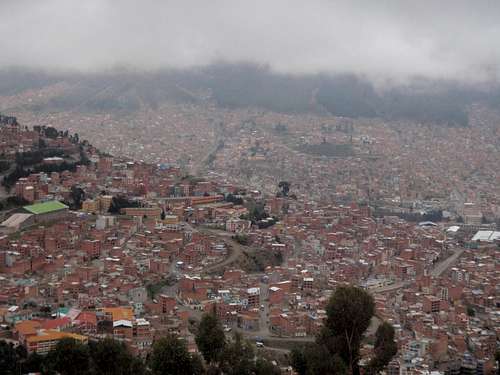
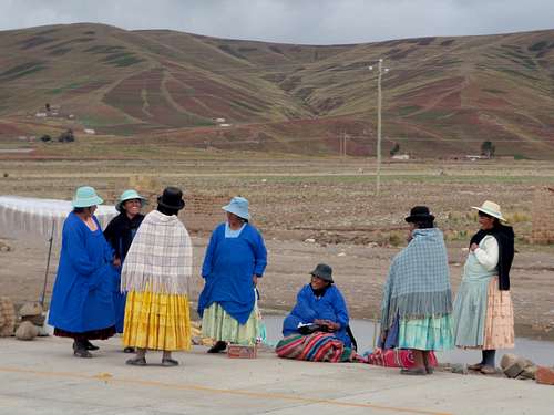


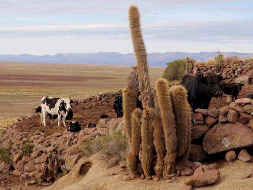
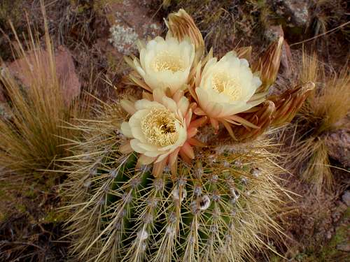
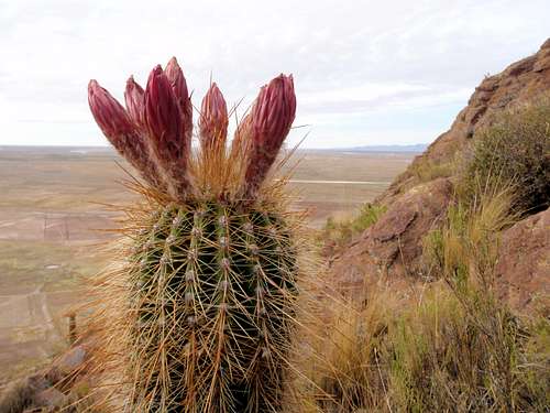
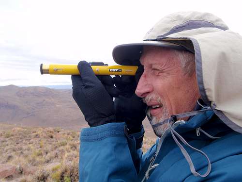
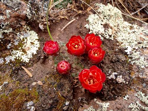


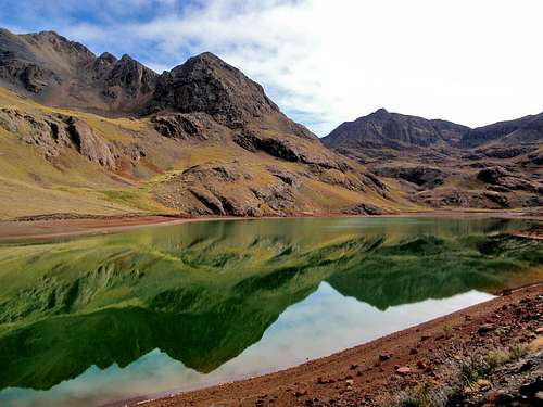


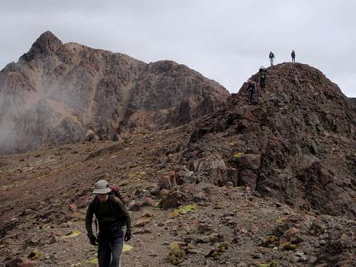


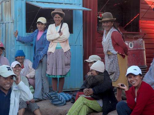
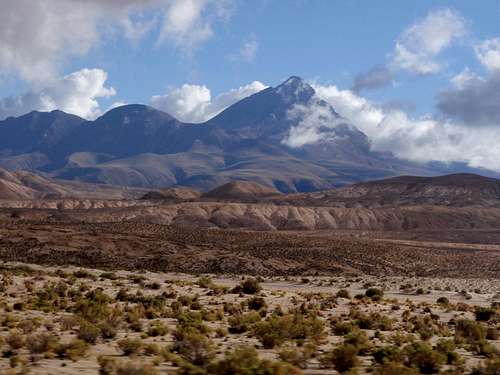
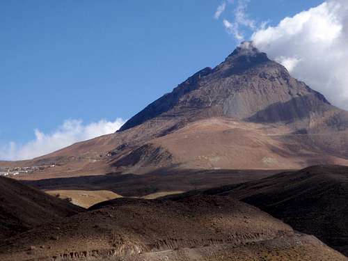

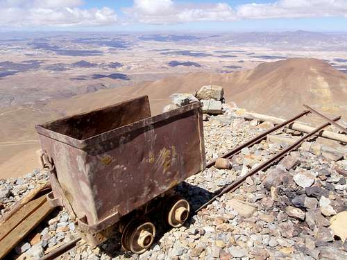

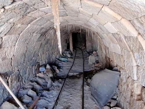

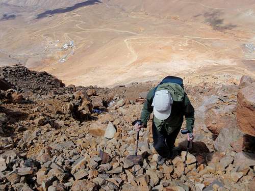
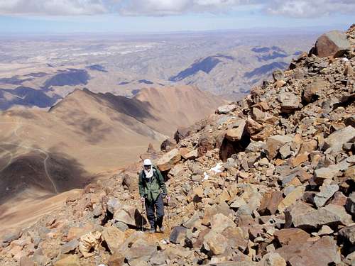
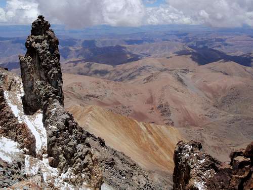


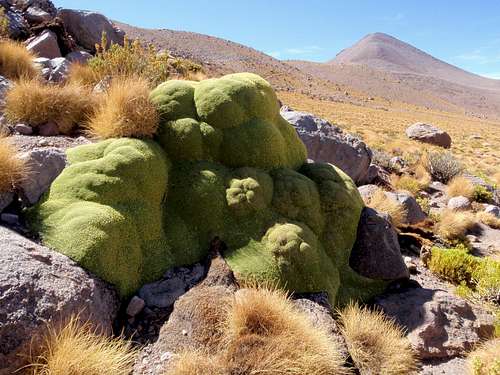


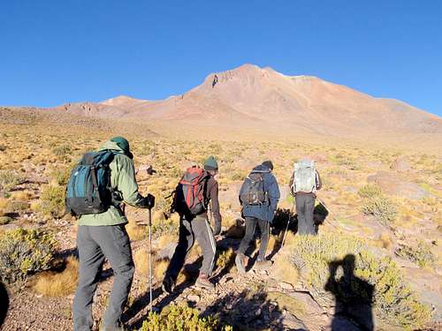

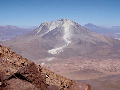

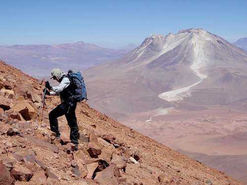
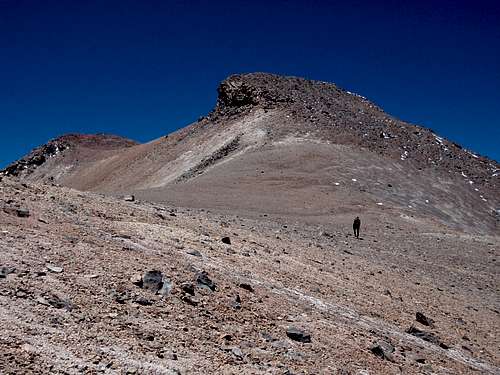
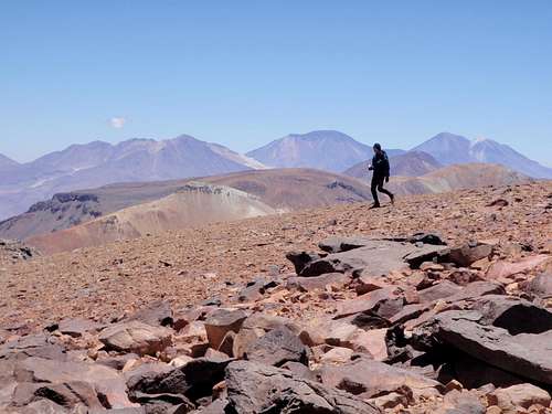


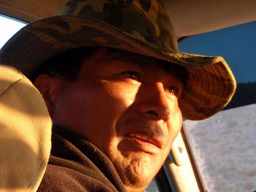

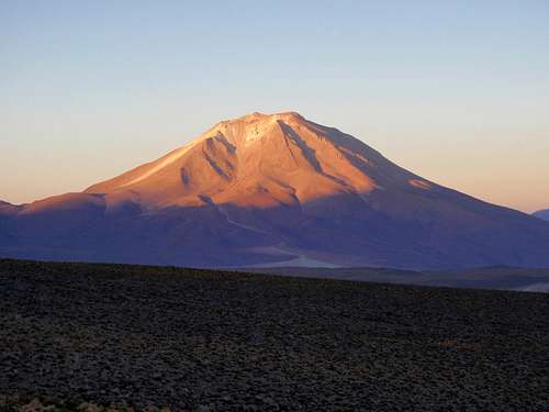

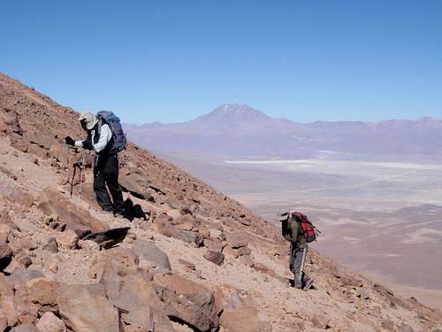


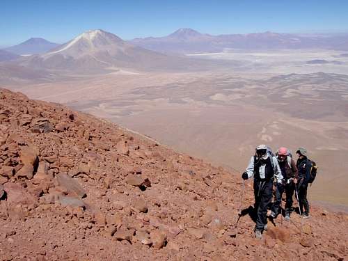


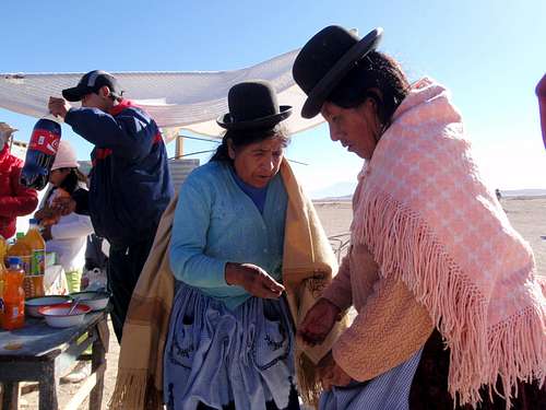

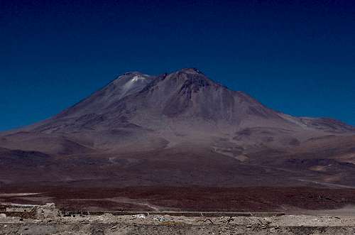


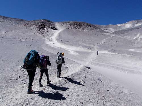
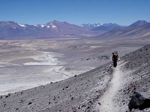
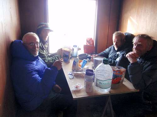
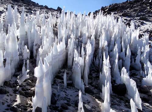


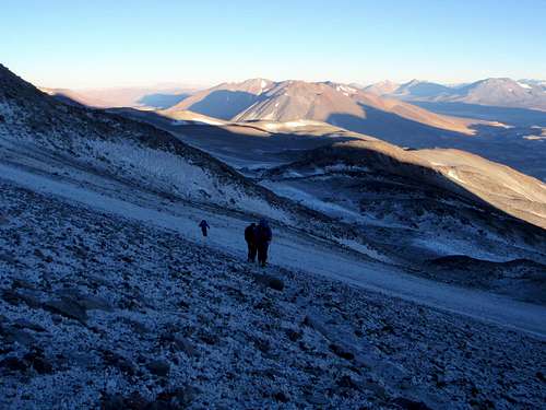

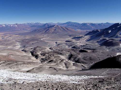


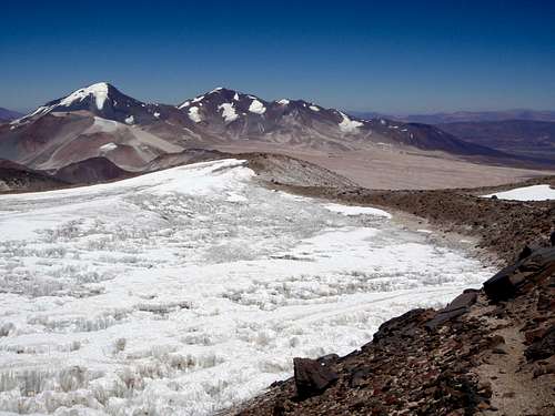

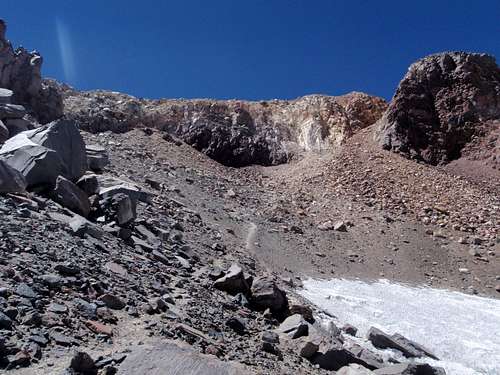


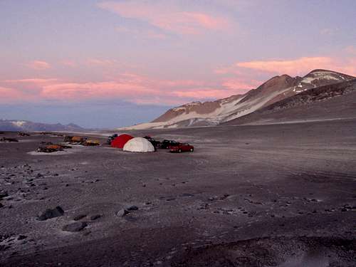


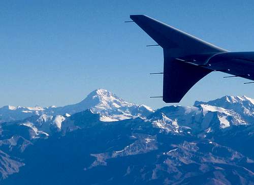


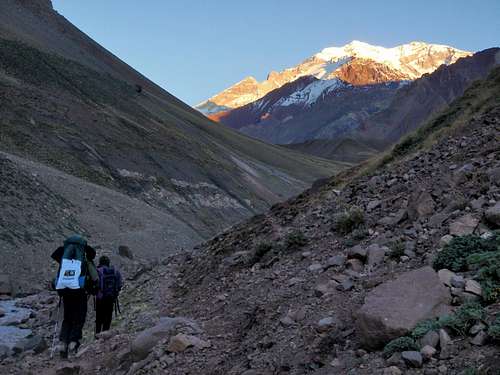
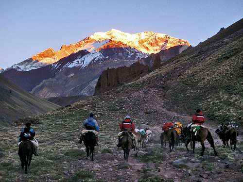
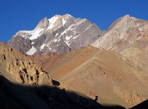


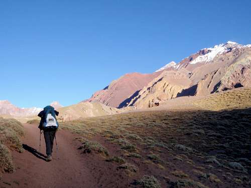

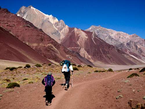
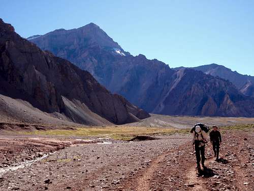


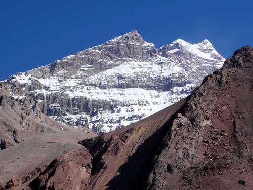
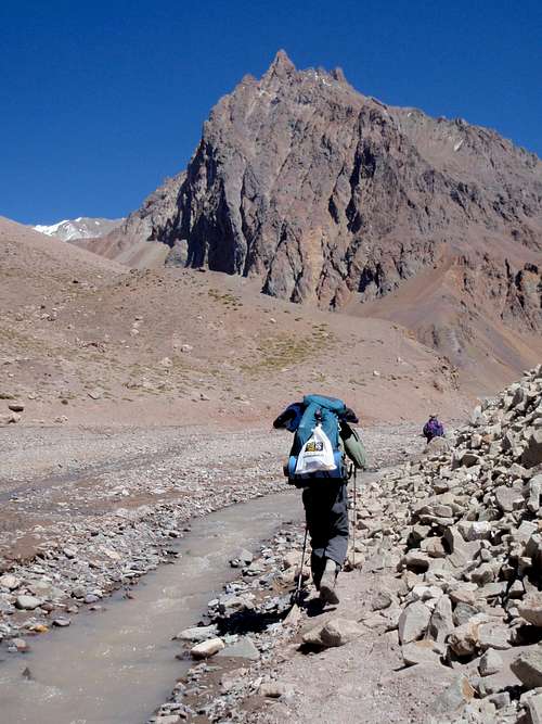


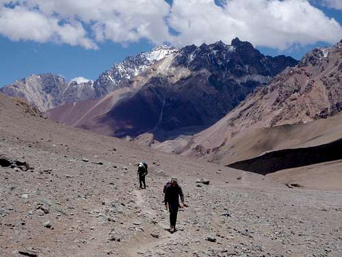


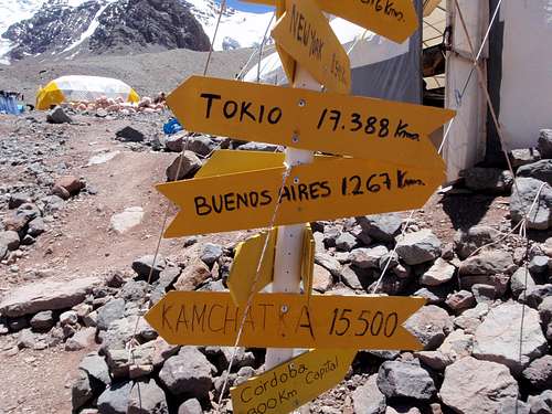
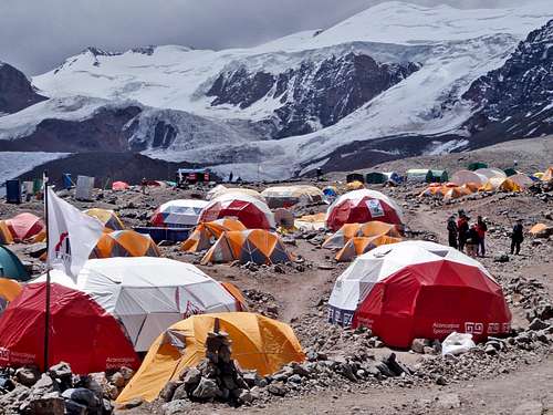
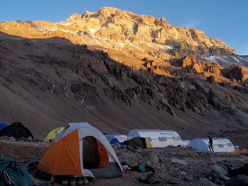


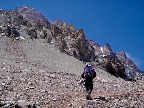


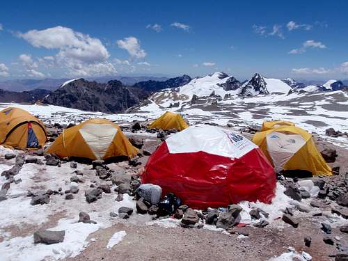
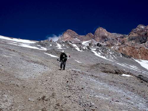
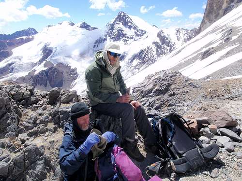
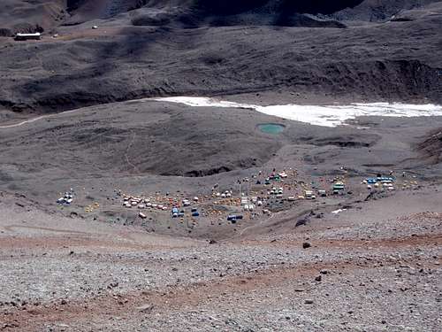


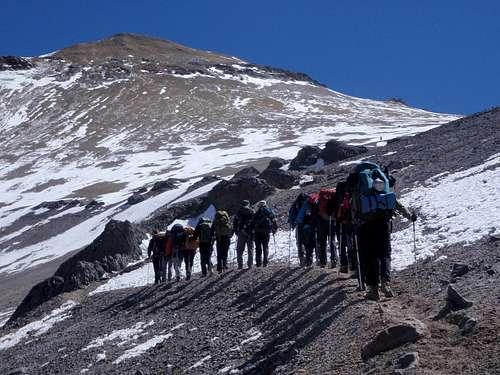


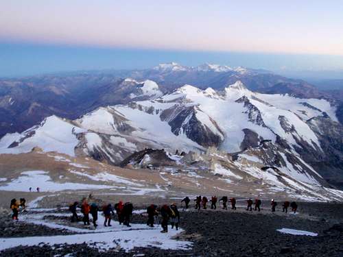


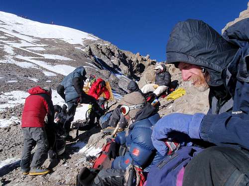


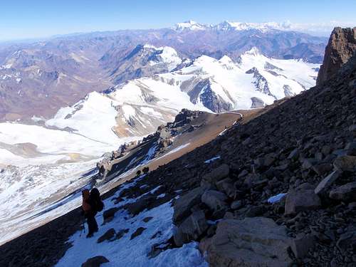


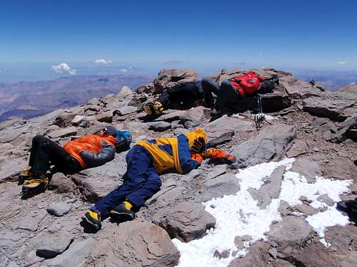


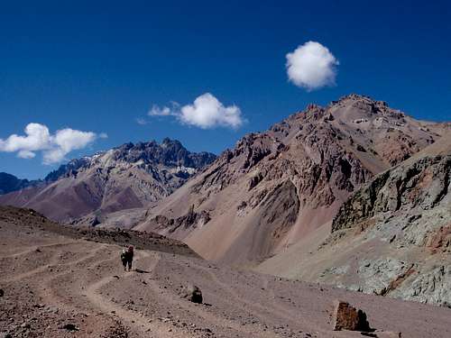


Comments
Post a Comment