Beautiful SHASTA Current Conditions

Regional discussion and conditions reports for the Golden State. Please post partners requests and trip plans in the California Climbing Partners forum.
User Avatar
clmbr

 
Posts: 678
Joined: Sat Jun 02, 2007 6:21 am
Thanked: 131 times in 91 posts

Re: Beautiful SHASTA Current Conditions

by clmbr » Wed Jun 21, 2017 1:43 am

mrchad9 wrote:
clmbr wrote:
mrchad9 wrote:... I am this weekend...
Which route are you planning? Is Ian coming too? Perhaps we can meet again on Misery Hill? :)

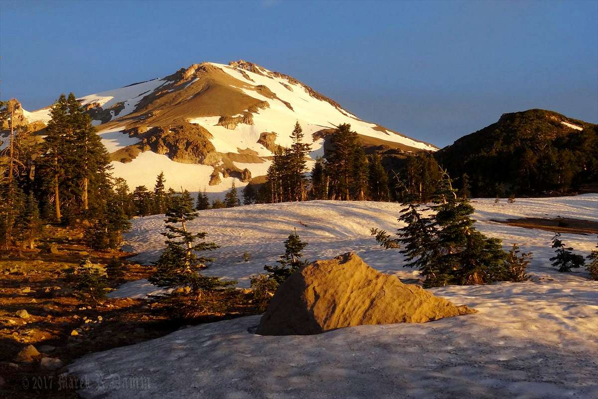
Was already driving up as you posted this... did an awesome route traversing to Whitney Glacier from North Gate, then up the north side of Shastina, then the Cascade Gulch route to the summit of Shasta skirting around the right side of the glacier, and down Hotlum-Bolam ridge. Quite a haul carrying a pack all that way but a much nicer trip than what Ian and I slogged through.

He didn't come though... I couldn't convince him to return to Shastina so quickly after the last outing lol

It did turn out to be windy Saturday though... forecast got worse and Saturday afternoon on the summit plateau I was on knees and elbows trying to keep from being blown down the east side of the mountain. Was not even possible to stand in place!

Saturday was still windy even in Hidden Valley but just above on the ridge the wind was crazy. At night it became quite and lots of people started climbing from various directions.

Ian went via Hidden Valley, summited Shastina and then finished the Cascade Gulch route to the summit. We met again on (just after) Misery Hill and summited together again (just after noon). :D We descended via West Face Gully glissading all the way down.

User Avatar
mrchad9

 
Posts: 4545
Joined: Thu Jul 02, 2009 12:01 am
Thanked: 1338 times in 911 posts

Re: Beautiful SHASTA Current Conditions

by mrchad9 » Wed Jun 21, 2017 6:48 pm

Wait... Ian went with you and did the Cascade Gulch route? I am surprised he did that given he did it once already... and wasn't sure he would solo that bit around the glacier. I'll have to ask him about it...

Yes it was good glissading... took me exactly two hours from the summit to reach the trailhead at North Gate. Two days up... two hours down.

Max on the summit just after sunrise....

IMG_3967.JPG
IMG_3967.JPG (2.13 MiB) Viewed 5361 times

User Avatar
clmbr

 
Posts: 678
Joined: Sat Jun 02, 2007 6:21 am
Thanked: 131 times in 91 posts

Re: Beautiful SHASTA Current Conditions

by clmbr » Wed Jun 21, 2017 10:13 pm

mrchad9 wrote:Wait... Ian went with you and did the Cascade Gulch route? I am surprised he did that given he did it once already... and wasn't sure he would solo that bit around the glacier. I'll have to ask him about it...

He walked above the upper bergshrund alone :)

no avatar
theschwill

 
Posts: 3
Joined: Sat Jun 28, 2014 8:06 pm
Thanked: 0 time in 0 post

Re: Beautiful SHASTA Current Conditions

by theschwill » Mon Jul 17, 2017 7:38 pm

Haven't read this entire thread. I'm looking to climb Shasta this season. I don't have any snow/glacier travel experience, but would like to make an attempt with someone that is willing to teach me. I have experience with summer climbs up 14ers in Colorado and some peaks in the Sierras. Familiar with ropes and gear. Not familiar with ice axe and snow. I had a couple of people who have offered to take me up, but both have fallen through. Willing to provide transportation, food, etc. Can't afford an expensive guide, and would rather have the experience of making new friends/climbing partners. Anyone interested? or is there a better place to post this?

User Avatar
mrchad9

 
Posts: 4545
Joined: Thu Jul 02, 2009 12:01 am
Thanked: 1338 times in 911 posts

Re: Beautiful SHASTA Current Conditions

by mrchad9 » Wed Jul 26, 2017 6:44 pm

Good time on one of Shasta's least traveled routes... and maybe the most dangerous due to some long exposure to rockfall... Konwakiton Glacier :-)

Had a couple of microwave sized chunks a short distance from us and more than enough ping pong to baseball sized rocks very close to keep it exciting. Crux was exposed and fun as well and we were more than delighted to make it to the upper glacier and the summit in this remote and rarely visited part of the mountain!

IMG_5555.JPG
Approach
IMG_5555.JPG (2.79 MiB) Viewed 5131 times


IMG_5572.JPG
Rocks below glacier and Mud Creek Canyon
IMG_5572.JPG (2.21 MiB) Viewed 5131 times


P7234829.JPG
Crux on lower glacier
P7234829.JPG (6.36 MiB) Viewed 5131 times


P7234876.JPG
Crevasse on upper glacier
P7234876.JPG (5.18 MiB) Viewed 5131 times


IMG_5689.JPG
Exiting the glacier
IMG_5689.JPG (1.91 MiB) Viewed 5131 times

The following user would like to thank mrchad9 for this post
clmbr

User Avatar
clmbr

 
Posts: 678
Joined: Sat Jun 02, 2007 6:21 am
Thanked: 131 times in 91 posts

Re: Beautiful SHASTA Current Conditions

by clmbr » Sun Aug 06, 2017 5:13 pm

mrchad9 wrote:Good time on one of Shasta's least traveled routes... and maybe the most dangerous due to some long exposure to rockfall... Konwakiton Glacier :-)

Had a couple of microwave sized chunks a short distance from us and more than enough ping pong to baseball sized rocks very close to keep it exciting. Crux was exposed and fun as well and we were more than delighted to make it to the upper glacier and the summit in this remote and rarely visited part of the mountain!

Great job guys, Chad and Ian, and really nice pictures. You just climbed Konwakiton Glacier which not many people put their foot on (guess why :o ). Honestly I met only one guy who has done that but on his skis down from Red Banks, not the same as climbing it up the way you did. Rock falls, especially, as of this time of the season, is a great hazard there! You made it safely though! Congrats!

…and it was nice meeting you on Mt Shasta again :D , although not on the summit this time but at the TH (coincidentally my attempt was delayed).

What's your next destination?

User Avatar
clmbr

 
Posts: 678
Joined: Sat Jun 02, 2007 6:21 am
Thanked: 131 times in 91 posts

Re: Beautiful SHASTA Current Conditions

by clmbr » Sun Aug 06, 2017 5:47 pm

Clear Creek route: as of 24-28 of July, 2017

Image

I spent almost a week on Clear Creek route attempting it three times. I got even lost at night :o :oops: (Sure it’s a joke but I still did. :lol: ). The conditions were great! However, there was one snow field around half way which requires, at least, an ice axe (in case of a fall) and crampons or micro spikes to cross it. Due to heat snow may be soft and some people may be fooled to attempt it without proper gear. It’s your call but in the previous year a person died on Clear Creek route while crossing a snowfield. You might go around that snowfield on its right side through rocks (don’t recommend it) or on its left side but you would have to make that decision near “base camp” (unfortunately you cannot see these long snow fields there).

There were some tinny water streams around Clear Creek springs but, as you see on the picture, most of this area was still covered with snow. Constant heat, however, melts out snow quickly and every week may be completely different.

WARNING: Do not attempt this route alone or at all if you have no idea what you are doing. Although this route is the “least technical” on Mt Shasta, people still cannot get through to the summit, get lost, get hurt and even die there. :o

User Avatar
mrchad9

 
Posts: 4545
Joined: Thu Jul 02, 2009 12:01 am
Thanked: 1338 times in 911 posts

Re: Beautiful SHASTA Current Conditions

by mrchad9 » Thu Aug 17, 2017 11:13 pm

Did a nice route out of South Gate Meadows, across Mud Creek Glacier, then past Konwakiton and up the snow chute beyond it to reach the summit.

This was the first weekend the road to Ski Bowl was opened up. There was not a lick of snow anywhere near there or en route to the meadows. It is offensive how long it took the USFS to open the road up there... it has been closed for weeks for literally no justifiable reason at all. It seems the once competent Shasta-Trinity NF management has disappeared and now it is no better than the buffoons elsewhere. Such a shame.

Nice views though!

IMG_6448.JPG
South Gate Meadow
IMG_6448.JPG (993.77 KiB) Viewed 4899 times


IMG_6501.JPG
Above South Gate
IMG_6501.JPG (917.02 KiB) Viewed 4899 times


IMG_6834.JPG
Mud Creek Glacier
IMG_6834.JPG (525.13 KiB) Viewed 4899 times


IMG_6724.JPG
Mud Creek Canyon
IMG_6724.JPG (645.81 KiB) Viewed 4899 times


IMG_6739.JPG
Konwakiton Glacier
IMG_6739.JPG (734.33 KiB) Viewed 4899 times

The following user would like to thank mrchad9 for this post
clmbr

User Avatar
clmbr

 
Posts: 678
Joined: Sat Jun 02, 2007 6:21 am
Thanked: 131 times in 91 posts

Re: Beautiful SHASTA Current Conditions

by clmbr » Fri Aug 18, 2017 1:24 am

mrchad9 wrote:... It is offensive how long it took the USFS to open the road up there... it has been closed for weeks for literally no justifiable reason at all...

"...literally no justifiable reason at all..." Are you sure about that? :o :oops: :lol:

User Avatar
Bubba Suess

 
Posts: 726
Joined: Tue Oct 04, 2005 9:15 pm
Thanked: 183 times in 105 posts

Re: Beautiful SHASTA Current Conditions

by Bubba Suess » Fri Aug 18, 2017 3:06 pm

clmbr wrote:
mrchad9 wrote:... It is offensive how long it took the USFS to open the road up there... it has been closed for weeks for literally no justifiable reason at all...

"...literally no justifiable reason at all..." Are you sure about that? :o :oops: :lol:


For what it is worth, the USFS does not actually determine when the road opens. The Everitt Memorial Highway is a county highway and is maintained by county road crews. They open and close the gate, as well as do the plowing up to Bunny Flat in the winter. This year the traditional date for the gate to open was pushed back from July 1st to some undetermined date because there was snow both on the road and on Panther Meadow. They typically open the gate when the snow has been gone from the meadow for a week or so to let it dry out before it starts getting trampled. This is usually prior to July 1st. This year it was near the end of July. However, all the county resources were by then committed to a chip-sealing project on Old Stage Road. Once they finished that they sent a crew over and cleared the rocks and logs that had drifted onto the road during winter. Then the gate was opened, 5 weeks after the normal date.

There certainly are problems at the Shasta-T, but the road opening is not one of them. They have to field the calls from people wanting to know when it opens, but they are actually powerless to open it themselves.

User Avatar
mrchad9

 
Posts: 4545
Joined: Thu Jul 02, 2009 12:01 am
Thanked: 1338 times in 911 posts

Re: Beautiful SHASTA Current Conditions

by mrchad9 » Tue Aug 22, 2017 7:23 pm

Bubba Suess wrote:because there was snow both on the road and on Panther Meadow.

Actually there was no snow on or even near the road or Panther Meadow. Snow line is much higher than Panther Meadow even as of when the gate opened... so this goes far beyond letting the meadow dry out. If they were too busy doing something else to unlock a gate then that just supports that they are not doing a good job with respect to road openings. And maybe a different agency has primary responsibility for this... but I bet someone at the USFS has a key to that gate. So they are not off the hook.

Bubba Suess wrote:There certainly are problems at the Shasta-T, but the road opening is not one of them. They have to field the calls from people wanting to know when it opens, but they are actually powerless to open it themselves.

Someone has the power to make the phone call or go up there and open it themselves if they get no response. They just chose not to do it. But that isn't powerless. And yes the problems with their management are getting more and more numerous.

User Avatar
Bubba Suess

 
Posts: 726
Joined: Tue Oct 04, 2005 9:15 pm
Thanked: 183 times in 105 posts

Re: Beautiful SHASTA Current Conditions

by Bubba Suess » Thu Aug 24, 2017 5:19 pm

mrchad9 wrote:Actually there was no snow on or even near the road or Panther Meadow. Snow line is much higher than Panther Meadow even as of when the gate opened... so this goes far beyond letting the meadow dry out. If they were too busy doing something else to unlock a gate then that just supports that they are not doing a good job with respect to road openings. And maybe a different agency has primary responsibility for this... but I bet someone at the USFS has a key to that gate. So they are not off the hook.


I meant earlier in the summer, around July 1st, when the were initially supposed to open the gate. That is when there was snow on the ground. I hiked up and saw it myself. It started receding rapidly past the original open date, but it was there.

mrchad9 wrote:And yes the problems with their management are getting more and more numerous.


Just out of curiosity, how are you seeing the problems manifest?

User Avatar
mrchad9

 
Posts: 4545
Joined: Thu Jul 02, 2009 12:01 am
Thanked: 1338 times in 911 posts

Re: Beautiful SHASTA Current Conditions

by mrchad9 » Thu Aug 24, 2017 7:08 pm

It has been posted in other threads. They have closed down various areas of the national forest to camping for no reason. Kicked others out for camping in those closed areas when they weren't even actually in the closed area. Are incapable of adequately performing or participating in even the most basic search and rescue activities... and when others do it for them they just continue to harass them... perhaps embarrassed by their own incompetence. They actively encourage the guide services to keep overrunning the Avalanche Gulch route... really to no one's benefit including the clients. And couldn't get that road opened in a timely manner. They also have miles of roads on the southeast side of the mountain gated shut when it absolutely need not be.

They have talked about increasing the fee for the annual climbing pass. Good for them... but if they do so with the forest management currently in place I will simply stop paying it. I know of several others who feel the same way. If they want more money they can just increase the cut they are taking from the guides that are currently half of what is in Avalanche Gulch and Clear Creek lol.

The following user would like to thank mrchad9 for this post
clmbr

User Avatar
mrchad9

 
Posts: 4545
Joined: Thu Jul 02, 2009 12:01 am
Thanked: 1338 times in 911 posts

Re: Beautiful SHASTA Current Conditions

by mrchad9 » Wed Sep 20, 2017 9:26 pm

I got to recommend Ash Creek as an awesome route on Shasta and conditions are still very nice. Having done every approach all around this peak in my opinion this stands out as the best most enjoyable and scenic approach from trailhead to camp that there is to offer. Start right from the top of the waterfall in the creek to the base of Wintun Glacier!

IMG_8299.JPG
Ash Creek
IMG_8299.JPG (4.48 MiB) Viewed 4596 times


IMG_8327.JPG
Following Ash Creek
IMG_8327.JPG (4.43 MiB) Viewed 4596 times


IMG_8468.JPG
Camp
IMG_8468.JPG (3.34 MiB) Viewed 4596 times


IMG_8623.JPG
Below Wintun Glacier
IMG_8623.JPG (3.21 MiB) Viewed 4596 times


IMG_8638.JPG
Returning down the creek
IMG_8638.JPG (3.36 MiB) Viewed 4596 times

The following user would like to thank mrchad9 for this post
clmbr

User Avatar
clmbr

 
Posts: 678
Joined: Sat Jun 02, 2007 6:21 am
Thanked: 131 times in 91 posts

Re: Beautiful SHASTA Current Conditions

by clmbr » Thu Sep 21, 2017 5:19 pm

mrchad9 wrote:I got to recommend Ash Creek as an awesome route on Shasta and conditions are still very nice. Having done every approach all around this peak in my opinion this stands out as the best most enjoyable and scenic approach from trailhead to camp that there is to offer. Start right from the top of the waterfall in the creek to the base of Wintun Glacier!

Good you did not get lost... :)

PreviousNext

Return to California


  • Related topics
    Replies
    Views
    Last post

Who is online

Users browsing this forum: Romain and 0 guests