Ventana Camp Trail in Ventana Wilderness
7 posts
Page 1 of 1
-

JHH60 - Posts: 1244
- Joined: Tue Oct 21, 2008 6:59 pm
- Thanked: 111 times in 91 posts
Ventana Camp Trail in Ventana Wilderness
Has anyone been up the Pine Ridge trail and down the Ventana Camp trail in the Ventana wilderness recently? If so is the trail passable and camp in reasonable shape? The ventanawild.org website had no recent information on the Ventana Camp trail, and the Big Sur Station ranger I talked to said he though it was open but hadn't heard anything recently.
-

Bob Burd - Forum Moderator
- Posts: 4271
- Joined: Sun Jul 22, 2001 10:42 pm
- Thanked: 572 times in 296 posts
Not recently, but I was down to Ventana Camp in October, just after they reopened the Pine Ridge Trail. The steep trail down to Ventana Camp had significant blow down and overgrowth (lots of P.O.) and I lost it several times, but managed to find my way. From the look of things, I thought this side trail had been abandoned. There was barely a use trail and this area did not burn in the recent fires. The camp had been washed out with heavy rains at least once in the past, though there were several fire rings near the river and the outhouse looked serviceable. It didn't look at all inviting for camping (I was just there for a day hike and I can't recall if the there were usable tent sites). The camps east of there were in far better shape.
-
JHH60 - Posts: 1244
- Joined: Tue Oct 21, 2008 6:59 pm
- Thanked: 111 times in 91 posts
I checked out Ventana Camp this weekend. The trail down to the camp, as well as the camp itself, was actually in good shape, and we had the entire camp to ourselves. The sign pointing out the trail was down (probably burned in the fire) but I knew where the turnoff was from past visits. Wildflowers are out in full bloom along the Pine Ridge trail, and annoying insects and poison oak still minimal.
-

rhyang - Posts: 8960
- Joined: Wed Apr 28, 2004 8:55 pm
- Thanked: 59 times in 38 posts
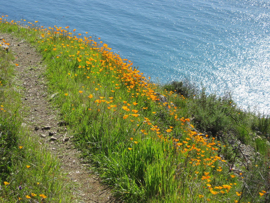
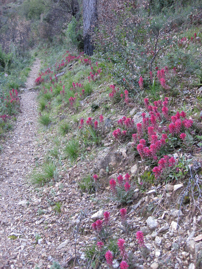
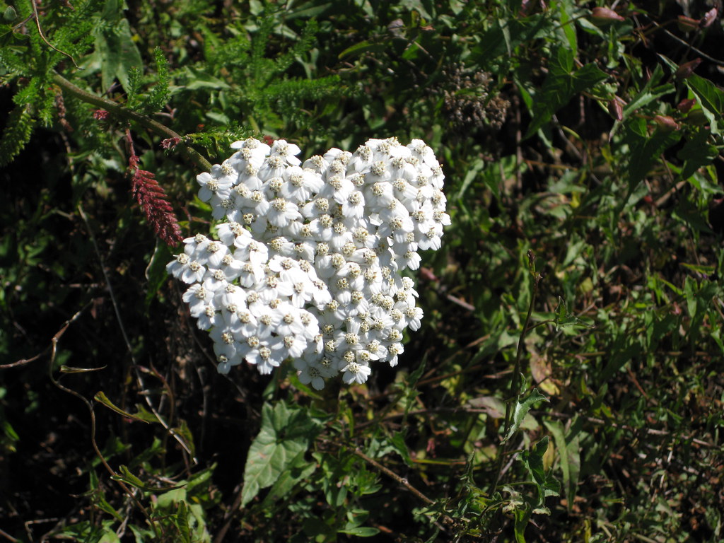
I too headed down to the Ventana this weekend. The wildflowers were pretty nice on the Vicente Flat trail -
The trailhead had this sign posted -
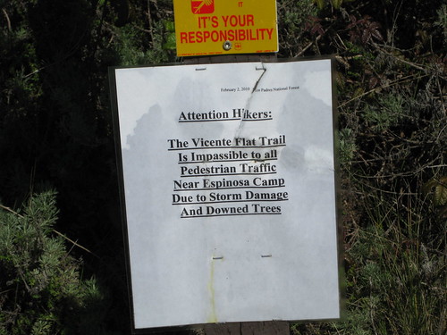
Which referred to this mess -
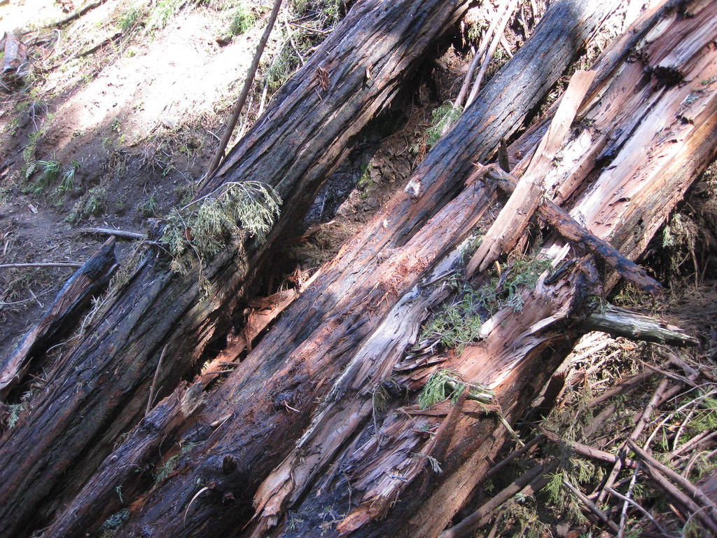
But I managed .. someone with a big pack, kids, dogs, etc. might not want to chance it though.
The trailhead had this sign posted -
Which referred to this mess -
But I managed .. someone with a big pack, kids, dogs, etc. might not want to chance it though.
-
JHH60 - Posts: 1244
- Joined: Tue Oct 21, 2008 6:59 pm
- Thanked: 111 times in 91 posts
Nice pics, Rob! I will go through my and the family's photos and see if there are shots from Pine Ridge worth posting. Vicente Flat was actually my first choice for the weekend, but the rangers told me that there were downed trees and I was in fact bringing kids and packs - though since Clara's getting to be a pretty good gymnast she might just have been able to vault over those trees. 
-
rhyang - Posts: 8960
- Joined: Wed Apr 28, 2004 8:55 pm
- Thanked: 59 times in 38 posts
Thanks John. You can get through the logs if your pack is not huge, and the trail is a wilderness freeway between Vicente Flat and Cone Peak Road -- best I've ever seen it, in fact.
I generally don't camp at Vicente Flat in the springtime because it's too busy, and after seeing the sign at the trailhead I figured nobody else would be there .. wrong I normally like to head out to Goat Camp on the Stone Ridge trail, but it was in sad shape last year and probably no better this year .. I know the VWA has it on their list of trailwork priorities.
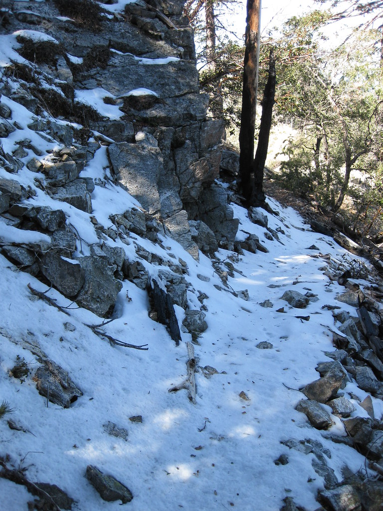
Some more shots - lingering snow near Cone Peak, heading down towards Trail Spring.
The only tracks in the snow I saw were feline I've come up that way in the winter, and seen those cat tracks in the snow a number of times.
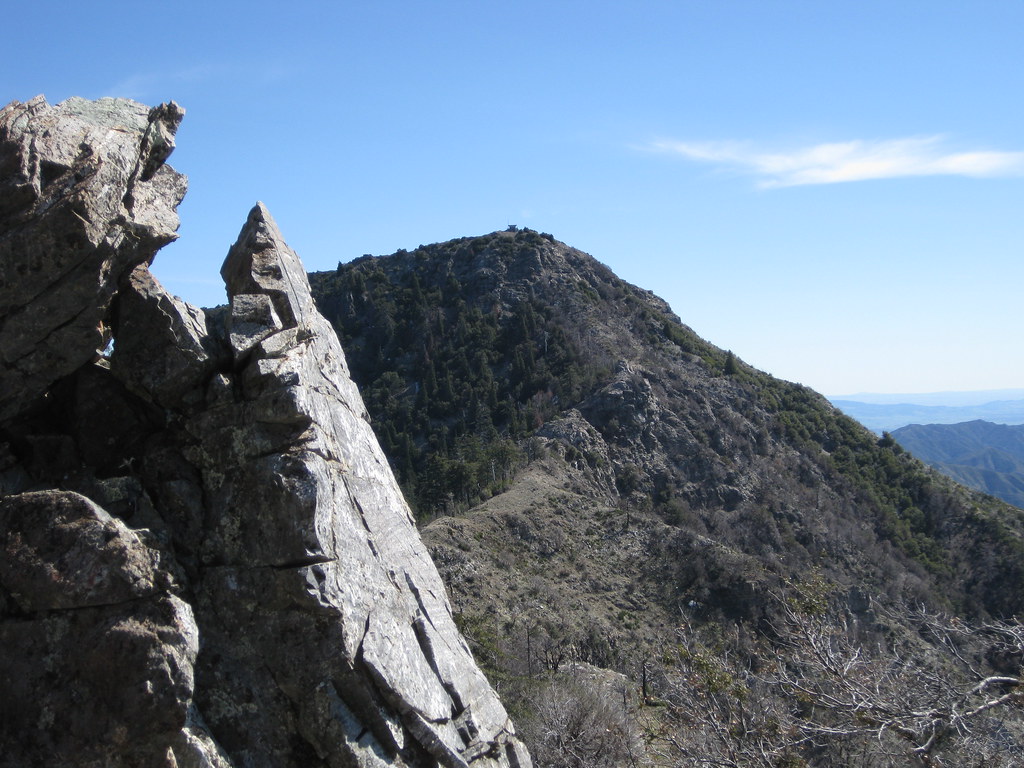
Cone Peak from near Twin Peak (4843')
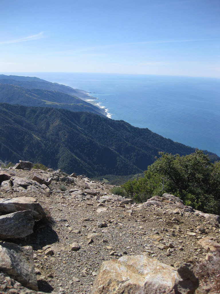
Looking south from Cone Peak (5155')
I generally don't camp at Vicente Flat in the springtime because it's too busy, and after seeing the sign at the trailhead I figured nobody else would be there .. wrong
Some more shots - lingering snow near Cone Peak, heading down towards Trail Spring.
The only tracks in the snow I saw were feline
Cone Peak from near Twin Peak (4843')
Looking south from Cone Peak (5155')

7 posts
Page 1 of 1
-
- Related topics
- Replies
- Views
- Last post
-
- Flowers in Ventana Wilderness
by SpazzyMcgee » Thu Mar 25, 2010 8:07 pm - 2 Replies
- 1126 Views
- Last post by 1000Pks

Thu Mar 25, 2010 11:46 pm
- Flowers in Ventana Wilderness
-
- 5 Rescued from Pine Ridge area of Ventana Wilderness
by colinr » Tue Jan 01, 2013 9:18 am - 1 Replies
- 1179 Views
- Last post by fedak
Tue Jan 01, 2013 8:47 pm
- 5 Rescued from Pine Ridge area of Ventana Wilderness
-
- La Ventana + Mt. Kandlbinder via Ventana Creek Advice
by tawnymouse91 » Thu Feb 23, 2012 5:02 pm - 2 Replies
- 1428 Views
- Last post by fedak
Fri Feb 24, 2012 1:57 pm
- La Ventana + Mt. Kandlbinder via Ventana Creek Advice
-
- Momyer Trail - San Gorgonio Wilderness
by MCGusto » Tue Jun 21, 2011 5:04 am - 4 Replies
- 2413 Views
- Last post by MCGusto
Tue Jul 05, 2011 6:55 pm
- Momyer Trail - San Gorgonio Wilderness
-
- Desolation Wilderness trail conditions at this link
by BrendanHickey » Thu Jun 23, 2011 4:52 am - 1 Replies
- 3707 Views
- Last post by fedak
Thu Jun 23, 2011 8:28 pm
- Desolation Wilderness trail conditions at this link
Who is online
Users browsing this forum: No registered users and 0 guests