
-
 8905 Hits
-
 84.27% Score
-
 18 Votes
|
|
Route |
|---|---|
|
|
46.49378°N / 8.39991°E |
|
|
Sport Climbing |
|
|
Summer |
|
|
Most of a day |
|
|
5.10a (YDS) |
|
|
TD inf., French 6a |
|
|
10 |
|
|
Overview
Piccadilly Bedretto
Poncione di Cassina Baggio is an imposing rocky castle located in upper Val Bedretto, Ticino Alps, on the right side of the road to Nufenen Pass, between the village of All'Acqua and the pass. This fine mountain is one of the typical one day shot summits in the Southern Swiss Alps, easy and fast to approach, with a fantastic rock and without special problems along the descent.
On its sunny face 400 m drop, early released from snow, some different amazing modern routes had been climbed in the 90s. The wall is characterized by a first slabby section and a second one rather steep. Piccadilly Bedretto is one of these ones, a long good route on excellent rock climbing the South face; after the starting six pitches, on sloping slabs, the climbing way changes, becoming steeper and developing on fine cracks and flakes.
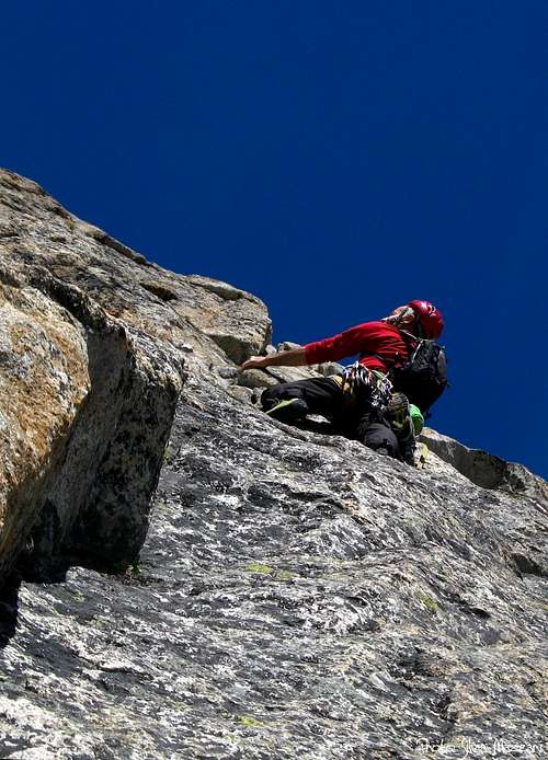
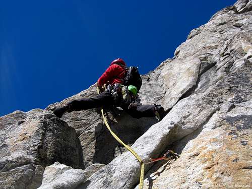 On Piccadilly Bedretto On Piccadilly Bedretto |
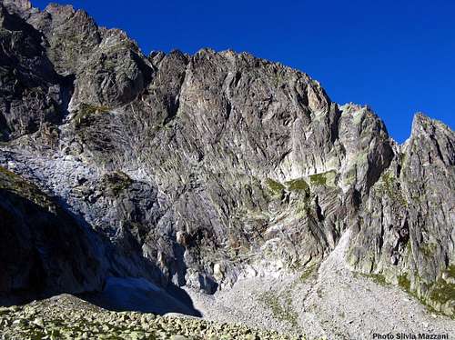 Poncione di Cassina Baggio South face Poncione di Cassina Baggio South face |
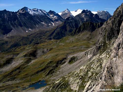
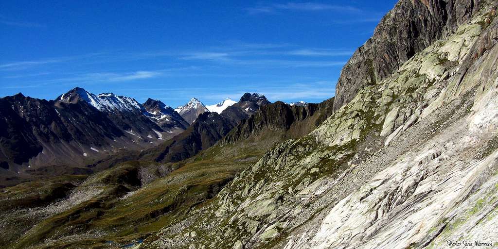 Ticino Alps seen from Piccadilly Bedretto
Getting There
From Airolo, a little town at St.Gotthard southern exit, follow the road to Nufenen Pass, going inside the green bucolic Val Bedretto and reaching All’Acqua village. Here you can take the path to Capanna Piansecco, if you want to spend a night in the hut. A few kilometres past All’Acqua, at a road's hairpin towards left, leave the car (m. 2095). Parking. Here you can take the path rising directly to South face, if you want to climb without stay overnight at Capanna Piansecco.
Piccadilly Bedretto report
Piccadilly Bedretto
Summit altitude: mt. 2621
Climbing length: 400 mt.
Exposure: S
First ascent: Jurg von Kanel – D. Hodel 1991
Starting point: Nufenen Pass road mt. 2095 (parking)
Hut: Capanna Piansecco SAC m. 1980, open in the week-ends
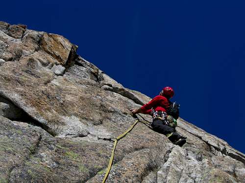
A long interesting route "alpine style" on excellent granite, divided in two clear different sections: the first 6 pitches run on sloping slabs, the next pitches are steep and airy and develope on fine cracks and flakes. Equipment on bolts, often spaced.
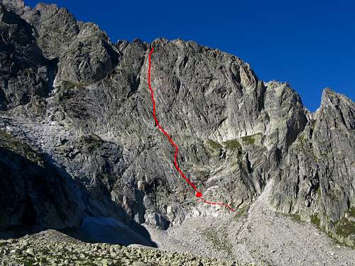 Piccadilly Bedretto topo route Piccadilly Bedretto topo route |
 Ninth pitch steep wall Ninth pitch steep wall |
Piccadilly Bedretto report (French scale)
You can climb the route directly from the parking along Nufenen Pass road; otherwise you can spend the night at Capanna Piansecco SAC (Swiss Alpine Club) mt. 1980, available from All’Acqua in 45 minutes.
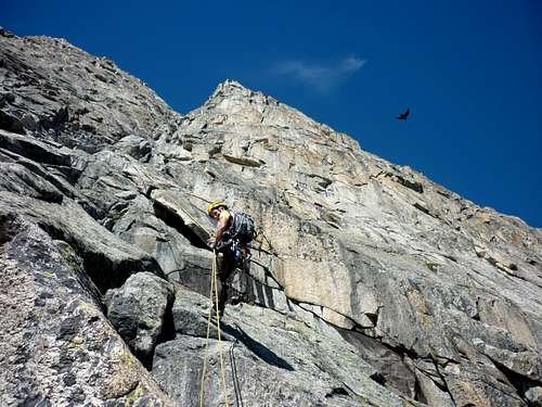
From the parking a mainly level track leads towards the face; finally the track rises along some steep stones’ slopes towards right, reaching the right side of the face (1,10 hour from the hairpin). To get to the starting point, situated below some red stones, walk along a good legde rising towards left.
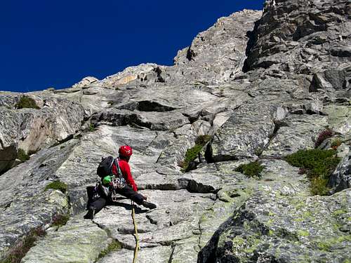 Starting slabs Starting slabs |
 Last but one pitch Last but one pitch |
 View towards Nufenen Pass from the route View towards Nufenen Pass from the route |
L1 - Easy rocks lead to a sloping slab slantways towards left (4c).
L2 - An other slab with a final thin crack (5c).
L3 – Slabs and little corners slantways towards right ( 4b).
L4 – A dihedral crack, then a slab to a little belay (4c).
L5 – A slab with a smooth move, then easier rocks to the belay (6a+, or 5b with 1 p.a.).
L6 – Slabs and little corners to the wide central gully which divides the face in two parts (4b) .
L7 - Cross the gully towards left, reaching a vertical wall. Climb the wall along fine flakes (6a).
L8 – A superb pitch along flakes and cracks to a good stance (5b).
L9 – Another superb pitch; a short steep wall over the stance, then a vertical corner (6a).
L10 – Slantways towards right to the summit ridge (5c).
 Final pitches Final pitches |
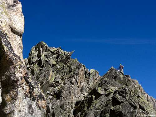 Party on the summit ridge Party on the summit ridge |
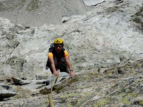
 Rapping on the route Rapping on the route |
Descent: abseiling the route. The first anchors are 7-8 meters below the summit, on the right (facing out).
Other routes
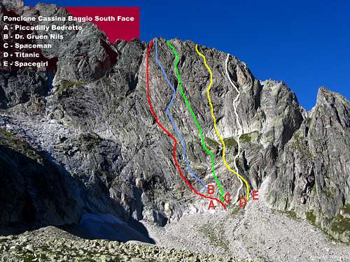
From left to right:
- Tanti Auguri V+, 400 m.
- Tage der Kalte VII, 400
- Herbstwind VII-, 400 m.
- Dr. Grüen Nils VI, 400 m.
- Spaceman
- Titanic
- Spacegirl
Descent: abseiling the routes
Essential Gear - Climbing Grades
Ropes 2 x 50, helmet, 12 express; excentrics 5-8 and some friends 2-3 are useful
Climbing Grades:
| Rock Climbing main Rating Systems | ||||||||
|---|---|---|---|---|---|---|---|---|
| French | YDS (USA) |
UIAA | French | YDS (USA) |
UIAA | French | YDS (USA) |
UIAA |
| 1 | 5.2 | I | 6b | 5.10c | VII- | 7c+ | 5.12d | IX |
| 2 | 5.3 | II | 6b+ | 5.10d | VII | 8a | 5.13a/5.13b | IX+/X- |
| 3 | 5.4 | III | 6c | 5.11a | VII+ | 8a+ | 5.13c | X- |
| 4 | 5.5 | IV | 6c+ | 5.11b | VII+/VIII- | 8b | 5.13d | X |
| 5a | 5.6 | V- | 7a | 5.11c | VIII- | 8b+ | 5.14a | X+ |
| 5b | 5.7 | V/V+ | 7a+ | 5.11d | VIII | 8c | 5.14b | X+/XI- |
| 5c | 5.8 | VI- | 7b | 5.12a | VIII+ | 8c+ | 5.14c | XI- |
| 6a | 5.9 | VI/VI+ | 7b+ | 5.12b | VIII+/IX- | 9a | 5.14d | XI |
| 6a+ | 5.10a/5.10b | VI+/VII- | 7c | 5.12c | IX- | 9a+ | 5.15a | XI+ |
Hut

Capanna Piansecco m. 1988 (C.A.S. Bellinzona)
Situation: orographic left side of Valle Bedretto
Open: always, guarded from june to october
Size: 50 persons
Winter shelter: 25 persons
Owner: C.A.S. Bellinzona e valli
Guardian: Enrica Vicari-Vella, 6781 Bedretto - Phone: +41 (0) 79 312 83 86 E-mail: enrica.vella@bluewin.ch
Refuge's phone: +41 (0) 91 869 12 14
Getting here: from All'Acqua in Val Bedretto (1 hour)
Red Tape
There are not particular restrictions in climbing and hiking.
When to climb
Best season goes from May to middle October.
Meteo
Guidebooks and maps


"Schweiz plaisir SUD" by Res von Känel, Sandro von Känel - Ed. Filidor 2011
"Arrampicate sportive e moderne tra Varese e Canton Ticino" AA.VV,
Ed. Versante Sud 1998