Toggle navigation
Mountains
Routes
Images
Trip Reports
Forum
What's New
People
Areas & Ranges
Articles
Trailheads
Canyons
Huts & Campgrounds
Albums
Logistical Centers
Fact Sheets
Lists
Custom Objects
Gear
Plans & Partners
WELCOME TO SUMMITPOST
SIGN IN
REGISTER
Pinder Peak
Additional Parents
Image
Pinder Peak
View High-Resolution Image
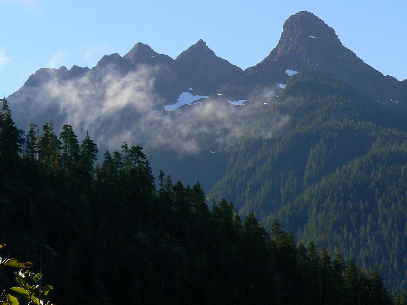
Pinder Peak
Pinder Peak, north Vancouver Island. NE aspect from Atluck Lake. Pinder on the right. Moving left "The Horn" then the "Stone Trolls". These are not official names. September 13, 2007
« PREV
NEXT »
vancouver islander
on
Sep 17, 2007 6:10 pm
Comments & voting
Other parents
Image ID:
337987
6467 Hits
86.85
% Score
23
Votes
Log in to vote
Comments
No comments posted yet.
to post!
Don't have an account?
Pinder Peak
(Mountain/Rock)
You are at
the First
Image
Viewing
#1 of 15
GALLERY
NEXT »
vancouver islander's Image Gallery
« PREV
Viewing
#23 of 1858
GALLERY
NEXT »
Vancouver Island
(Album)
Loading....
×
You need to login in order to vote!
User Name
Password
Remember me
Forgot your password?
Log me out when I close my browser.
Keep me logged in all the time.
sign in as a user
Don't have an account?
Register now for FREE
Rating available
Suggested routes for you
People who climb the same things as you
Comments Available
Create Albums
Register Here


