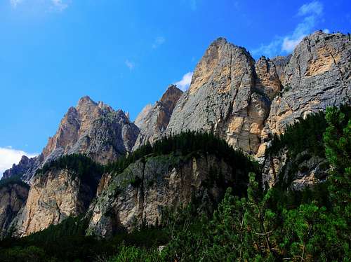
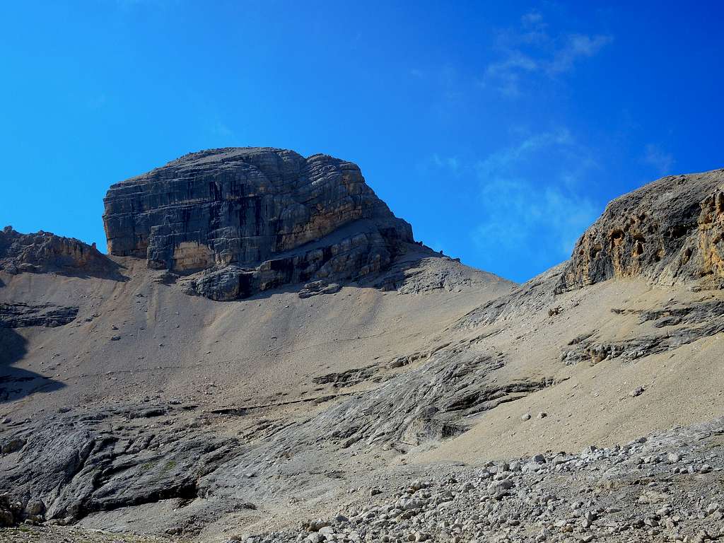
Piz Cunturines 3064 m is a great mountain that exceeds the 3000 meters of altitude, the main and highest peak of the Fanes Group, subgroup Cunturines-Lavarela. In fact, it overcomes by a few meters the nearby Piz de Lavarela 3055 m, from which it is separated by a high saddle. A few meters below this saddle there are two minor lakes, often dry in summer. The Cunturines - Lavarela massif closes to the south the large basin of the Alpe Fanes. It is divided from Sass dla Crusc by the Forcella Medesc and overlooks the Val Badia towards La Villa and San Cassiano with high and vertical walls. It is instead more accessible and articulated in ridges and valleys on the opposite side (NE). It is just from this side that it rises the standard route to the top.
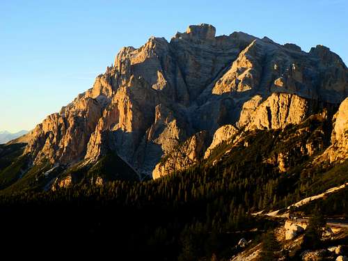
Cunturines at sunset from Valparola
Piz Cunturines, overlooking the valley of San Cassiano (Alta Badia), is also named Piz dles Cunturines in Ladin dyalect and Cunturines Spitze in German. Somewhere it is also found under the denomination Conturines. Anyhow it is always the same mountain. It is located entirely in Alto Adige-South Tyrol, but very close to the border with the province of Belluno. A few meters below this saddle there are two minor lakes. The mountain is mainly built of dolomia and due to the high altitude and the vertical walls there is no vegetation on the peak. It is bare rock.
The standard route runs on the NE side, across the wild valley called Büsc da Stlü - meaning "Hole to be closed" - and overcomes in the and the Via Ferrata Tru-Dolomieu. This route requires good training and resistance in reason of the high difference in level, plus a sure step on the Via Ferrata and the rock near the top, not always of good quality and often wet. To be faced with good weather, in the upper part it's possible to experience orientation difficulties in case of mist. Cunturines can be combined with the nearby Lavarela, with which it has common access, in a very solitary and wild Dolomite environment.
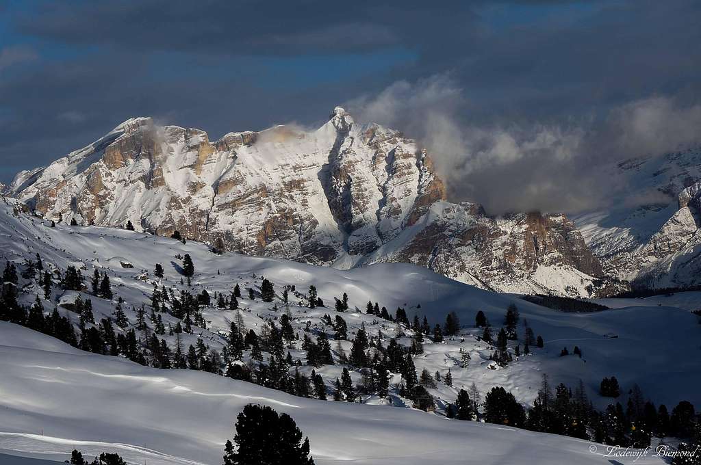
A winter image of Lavarela and Cunturines - Photo Lodewijk
Very interesting detail: the discovery in the year 1987 of the remains of the prehistoric cave bear in a cave at about 2 800 meters just below the Piz Cunturines. It was later called Ursus Ladinicus, to which it was dedicated the museum Museum Ladin - Ursus in San Cassiano.
Getting There
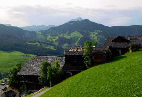
Tipical farms in Alta Badia valley
Road access to Capanna Alpina (upper Val Badia)
- From Bolzano: take the Brennero Motorway A22 towards North, exit Ponte Gardena and then follow the road SS242 up the Val Gardena to Passo Gardena and then descend to Corvara and La Villa. In La Villa turn to right to San Cassiano and Passo Valparola. Drive up along the road SP37, pass San Cassiano and Armentarola getting the bridge over the Rio Sciarè. Near the bridge (1652 m, 6,5 km from La Villa) turn left on the paved road for about 1 km until Capanna Alpina 1726 m.
- From Passo del Brennero (Brennerpass): follow the Brennero Motorway A22 towards South, exit to Bressanone and then follow the road SS 49 (E66) up the Val Pusteria, getting to San Lorenzo, a few km. before Brunico. Here leave the main road SS 49 and take the road SS 244 up the Val Badia getting La Villa. Drive on the road SP37 in the direction of San Cassiano and Passo Valparola along the road to the bridge over the Rio Sciarè. Near the bridge turn left on the paved road for about 1 km until Capanna Alpina 1726 m.
- From Venezia-Mestre-Treviso follow the A27 Motorway, exit Belluno, then take the road SS51 to Cortina d'Ampezzo, Passo Falzarego, Passo Valparola. From Passo Valparola drive down towards San Cassiano and near the bridge over the Rio Sciarè take on the right the road to Capanna Alpina 1726 m, parking lot.
Route Description
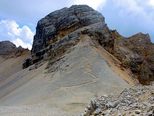
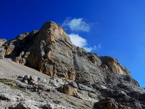
Piz Cunturines summit rocky head
Piz Cunturines from Capanna Alpina via "Büsc da Stlü" and Via Ferrata "Tru Dolomieu"
Summit: m. 3064 Difficulty: EEA Difference in level: 1338 m. from Capanna Alpina Exposition: NW Starting point: Capanna Alpina 1726 m
Very interesting climb, long and a bit tiring. The final stretch on via ferrata to reach the summit is not particularly difficult, but it is exposed and should not be underestimated. Via Ferrata gear is essential.
Route description
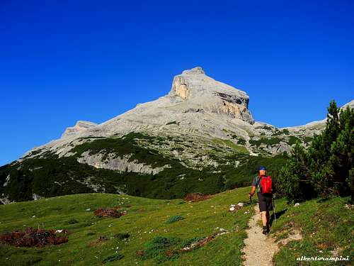
From the parking area take the path n. 11 which runs along Pian de Furcia on a forest road. After a few minutes ignore the path to the right to Rifugio Scotoni, continuing on the left track. The route proceeds with a series of hairpin bends, reaching a small clearing, then other hairpin bends on rocky terrain (wooden legs and rocky steps) lead to the magnificent balcony of the Col de Locia 2069 m. From here the itinerary enters the great plain called Gran Fanes. Proceed on a white runway alongside the stream in the midst of expanses of mountain pines, which then give way to wide meadows (Plan de Sumorones). Ignored the junction with the path 20B that leads to the Forcella del Lago, after about 30 minutes you reach another junction on Passo Tadega (also named Forcella da l'Ega) at about 2157 m.
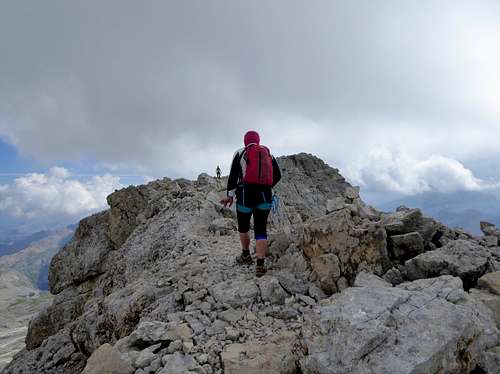
The Bandiarac seen from Piz Cunturines approachPiz Cunturines seen from the approach path
Here leave the main path and take the path on the left (signposts Cunturines-Lavarela) that climbs up through dwarf-pines and grassy clearings towards the wide valley bordered to the north by the Piz Parom ridge and to the south by the Piz Taibun-Cunturines ridge. After about an hour you reach the Lago Conturines 2523 m, often dry in the summer. Near the lake there are two possibilities: we ignore the left and steep left track and proceed in the middle of the valley on terrain gradually becoming more and more detrital, heading progressively to the right, left orographic, overcoming a rocky ridge.
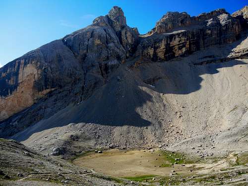
Stunning rock wall along the  Büsc da Stlü, CunturinesThe Lake Cunturines in dry condition
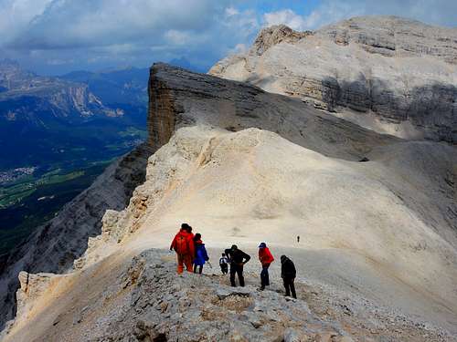
After it we reach the ridge called Piz dles dues Forceles 2887 m, the wide saddle between the Lavarela to the right and Cunturines to the left. Here the path forks: on the left we take the route towards the Cunturines peak. From the large saddle traverse towards SE across rocky terraces, reaching the steep slope at the foot of the short North face below the summit at about 2950 m.
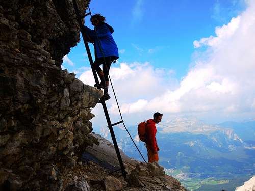
Here it begins the stretch of Via Ferrata TRU DOLOMIEU, equipped with ladders and steel cables. A metal ladder equipped with a rope allows the access to the right to an equipped ledge, at the end of which you pass on the left a short rocky wall. On a short scree slope reach another gravel ledge on the right.
Piz Cunturines summit bump
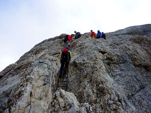
At the end of this turn left, where a long inclined ladder allows the overcoming of a rocky cliff. Overcome rocky step on iron pegs and continuing to the left to two other ladders.
Approach to Via Ferrata, Piz CunturinesStart of the Via Ferrata Tru Dolomieu, Piz Cunturines
These ones lead to the right on a ledge, finished which it begins the thin and aery summit ridge. You reach a small fork, from which you reach the wooden summit cross on a last rocky step.
Via Ferrata Tru Dolomieu, Piz CunturinesNearing the summit of Cunturines
Descent: reversing the same itinerary
Essential Gear
Normal hiking gear. Harness, helmet and safety lanyard (Via Ferrata gear) absolutely reccomended on the Via Ferrata.
Red Tape
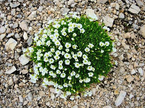
Cerastium Uniflorum (Mouse ear chickweed) grown in the scree desert, Cunturines
No fees no permits required. Paying parking at Capanna Alpina. Piz Cunturines and the whole area are located in the Fanes-Sennes-Braies Natural Park, so many activities are not allowed. It's one of the nine areas acknowledged by the UNESCO. More info about in this article by Silvia Mazzani on SP: Dolomites living mountains.
When to climb
The best period goes from the end of June to the end of September.
Accomodation
Several possibilities of accomodation in Val Badia (hotels, B&B, apartments). The mountain huts Capanna Alpina 1720 m in the Upper Valley of San Cassiano and Valparola 2 168 m near the Valparola pass.
Camping Sass Dlacia.
Bibliography
"3000 delle Dolomiti" - Ed. Idea Montagna, Collana "Vie Normali", 2012
Parents refers to a larger category under which an object falls. For example, theAconcagua mountain page has the 'Aconcagua Group' and the 'Seven Summits' asparents and is a parent itself to many routes, photos, and Trip Reports.