|
|
Mountain/Rock |
|---|---|
|
|
45.97263°N / 6.43936°E |
|
|
Aravis |
|
|
Hiking |
|
|
Spring, Summer, Fall |
|
|
7756 ft / 2364 m |
|
|
Overview
The Pointe du Midi is located at the heart of the Massif des Aravis.People come here for an easy ascent with a wonderful view on the Mont-Blanc range.
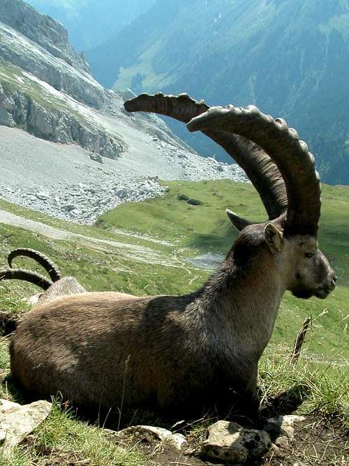
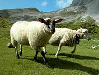
In summer on weekends, there can be quite a few hikers in area, as it is very pleasant with Lac de Peyre, and ibexes & sheep hanging around.
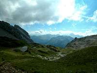
But on the peak itself, it will be peaceful and nothing obstructing the 360° view on the surrounding mountains.
Its altitude is rather modest with 2364m, but it can be a perfect summit to prepare the ascent of the king of the Aravis, the Pointe Percée located nearby.
Getting There
From the town Annecy (Haute-Savoie region), take road D909 up to St Jean de Sixt (29 kms)Then carry onto road D4 to go through Le Grand Bornand (3 kms) first, until you reach Col de la Colombière (11 kms).
You can park there (free).
No fee or permit required.
Respect the surroundings anyhow.

Trail to the Top

The trail starts at Col de Colombière (natural pass at 1613m). Very easy to find and to follow.
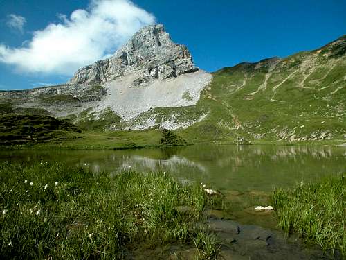
After 1h30 hours you will reach the Lac de Peyre (2085m).
Beautiful landscape, with grey/white summits around, and green grass everywhere.
Go around the lake on the left bank to catch the trail that climbs up to the Col de Balafrasse (2250m).
From there, head North / North East to follow the ridge that goes through the Pointe de Balafrasse.
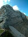
Be careful, the trail is bit airy, with some deep gap on your left.
You will quickly reach the bottom of Pointe du Midi. Go around its base on the east side.
Once you've reached the North side, follow a trail that will appear on your left. It will you you to the top (2364m).
Again be careful, with unstable rocks and airy atmosphere.
From the lake to the top, it takes about 1h30.
The descent can be done by the same way, or you can walk down the stone field at the bottom of Pointe du Midi to reach directly the Lake.
It avoids to around the ridge and the pass of Balafrasse.
Camping
Two sites in the nearby town of Le Grand Bornand (which happens to be a big ski resort in winter) :
- Camping Caravaneige L'Escale
Chef Lieu 74450 Le Grand Bornand
Tel : 04 50 02 20 69
- Camping Caravaneige le Clos du Pin
Clos Pin 74450 Le Grand Bornand
Tel : 04 50 02 27 61
Book, Map & Weather
A very good guidebook describing this climb, and including other surrounding summits :
Randonnées sur les sommets de Hautes-Savoie
The best map is undoubtedly :
IGN 3430ET La Clusaz/Le Grand Bornand
And for weather forecast, check :
Meteo France > Le Grand Bornand