
|
|
Mountain/Rock |
|---|---|
|
|
46.36722°N / 8.37935°E |
|
|
Hiking, Mountaineering, Scrambling, Skiing |
|
|
Spring, Summer, Fall, Winter |
|
|
9734 ft / 2967 m |
|
|
Overview
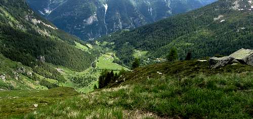
Tucked away deep in the Italian Alps lies the scenic Val Formazza. It is the northern- and uppermost part of a long valley, starting out by the name of Valle Antigorio just north of the small city of Domodossola. From its southern entrance to the Swiss border at the head of the valley, the distance is about 35 kilometers. With all its turns, the length of the main road is closer to 45 km, and it doesn't go further than Lago di Morasco, still some 3 km from the border.From Riale (1740m), 2 km before the end of the main road, there is a private road that does go all the way to the border.
In fact, Switzerland isn't just to the north, but also on the east and the west, the border being quite naturally defined by the many high peaks surrounding the valley. However, there are plenty of peaks completely in Italy as well, and Punta Clogstafel is one of those, located west of the valley floor and still 5 km from Switzerland.The absence of border crossings, for motorized traffic that is, makes the area a quiet part of Italy, visited only by those that know about its charms. Yet in summer it's a paradise for hikers and the occasional mountaineer, and in winter it offers fine opportunities for activities such as skiing and ice climbing. There are a few small developed ski areas, but in addition there are lots of possibilities to go off piste. Punta Clogstafel itself offers a fine, very long ski descent right from the very summit.
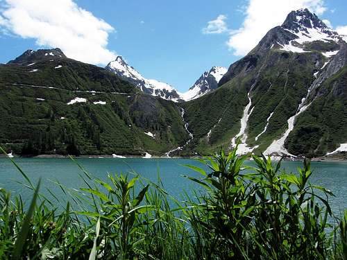
There are many lakes in the area, almost all dammed and used for generating hydroelectric power. Of these, Lago Vannino and Lago Busin inferiore are right next to the mountain, to the northwest and southwest, respectively.
About the Name
In the part of Switzerland west of the border, the language is a form of German. Centuries ago, people migrated across the Alps and one such movement brought people from Switzerland to Val Formazza. Although those that I met in the area didn't speak or understand German at all, Clogstafel still sounds very German to me.Ridges and Faces
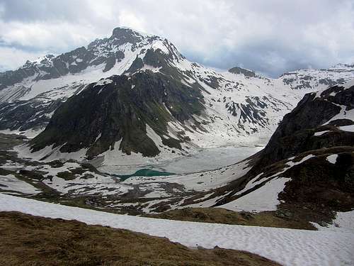
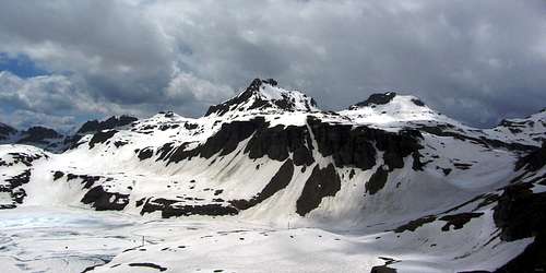
Punta Clogstafel from the NW, with Lago Vannino at its base. The ENE ridge is coming from the left; the WNW/NNW ridge is more or less seen head on.
Ridges
Punta Clogstafel has three distinct summit ridges. The only easy one is the gentle and wide WNW ridge (see photo on the left). Near the summit, when it's not covered by snow anymore, the surface is a fairly level mixture of dirt, a bit of scree and small rocks. When descending, after about 700 m from the summit and 200 m lower, the ridge turns towards the NNW and from there on down it gets a lot rockier, more complicated and more exposed.
Forca del Giove from the WSW
Google terrain view centered on Punta Clogstafel. Zoom in for a closer view, or click here for a larger map
Faces
While these ridges look pretty, at least as impressive are the two high, sheer rock faces: one to the north and one to the east.North
The north face rapidly drops 400 m over a distance of 300 m. The bowl below it holds the remnants of the Ghiacciaio del Clogstafel (ghiacciaio = glacier), but the ice is all but gone and by the time the snow has melted, it's mostly scree.
In addition to the ENE and WNW ridges, a third ridge lines this bowl, branching off from the WNW ridge just over 200 m from the summit. Like the ENE ridge, it's an exposed, jagged rocky one, but much steeper. It's rather short, just 400 m, with more or less the same elevation difference. Well shaded by the three ridges, snow and ice can still linger deep into the summer where the glacier used to be.
East
Between the ENE and south ridges, the east face is just as steep. Below it, southeast of Punta Clogstafel, and shaded by the impressive north face of Monte Giove, is the former home of the Giacciaio del Giove.
West
The west face is relatively benign in comparison to the other two, the main exception being where it gets close to the south ridge.
Armed with this information, it won't come as a surprise that the easiest way to the summit is to climb the mountain from the west, staying well away from the south ridge, and follow the WNW ridge for the final bit. But while never technically challenging, when there is no snow anymore high up on the mountain, the loose rocks high up on the face make the ascent somewhat laborious. In addition to being lower than 3000 m, this means that the mountain doesn't see many visitors in the summer season, and you're unlikely to meet another party. But the summit views are well worth the effort, especially to the north face of Monte Giove.

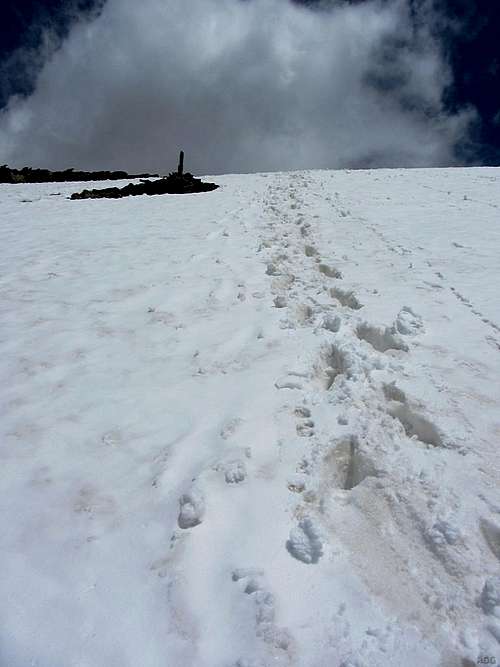
Temporarily enlarged summit cairn
There is a small cairn on the summit, but unlike many other mountains in the area, there is no cross.
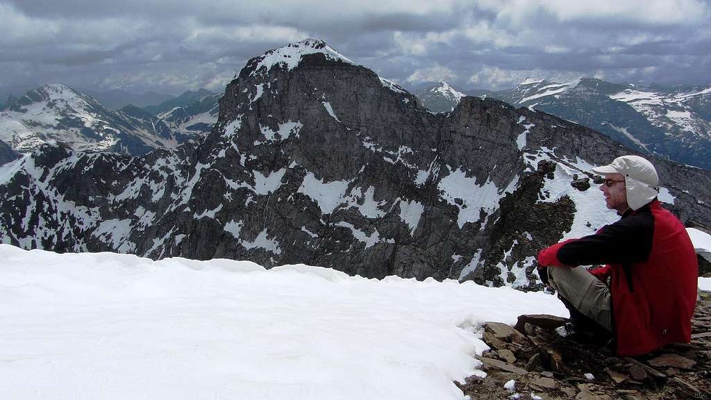
Enjoying the summit views, with the impressive Monte Giove north face
Getting There
The green paddle points at Punta Clogstafel. Zoom in for a closer view, or click here to view a larger map
Domodossola (270m) is the nearest economic center. It has a mixture of industry and logistical services, and a lively historic town center that attracts quite a few tourists. Domodossola is also the first stop in Italy for the important international train service from Brig, Switzerland to Milan, and the railroad provides an easy way to get there by public transport. Since the Swiss Franc is expensive with respect to the Euro, Domodossola is also a popular shopping center for visitors from across the border. Another, much slower and less used international train service connects Domodossola to Locarno, Switzerland, to the east.
From Domodossola, buses go to Val Formazza.
By car, Domodossola can quickly be reached from Milan by a modern highway, or from Brigs, Switzerland by way of the long but scenic road over the Simplon pass, or from Locarno via a less traveled mountain road.
Routes
Looking up Valle di Nefelgiù from the shores of Lago di Morasco
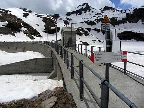
Signs at the dam at Lago Busin inferiore, with Pizzi della Satta behind
Trailheads
To get to the mountain from Val Formazza, the first goal is to get to Lago Vannino (2177m).The easiest way to get there is from the west, hiking up Vallone del Vannino. Either start at Valdo (1276m) and head west directly, or at Canza (1419m) and first hike south, traversing the slopes west of Val Formazza to get to Vallone del Vannino. The latter route is slightly longer but requires less elevation gain. In winter, it's easy to ascend on skis by these routes.
The main road ends at Lago di Morasco (1815m). There is a parking area near the bottom of the dam, at around 1750 m. In summer this is a possible trailhead too. The shortest route goes up Valle di Nefelgiù, across Passo di Nefelgiù (2583m). Lago Vannino is down the other side. Compared to the other routes, on the descent this one has the disadvantage of an additional 400 m elevation gain to cross Passo di Nefelgiù again.
Looking down on Alpe Vova. The route is through the woods on the left.
Normal Route (F)
Solitary cairn high on the western slopes
From the refuge, the normal route starts by crossing the dam, to a good trail to the south along the eastern shores of Lago Vannino. Past the lake, the trail climbs up to Passo Busin (2493m) and then down to Lago Busin inferior on the other side. However, to get to Punta Clogstafel, crossing Passo Busin would be a (small) detour. Directly east of the pass is a small hill (2590m), and directly east of that hill is another, unnamed saddle (±2530m). This is the saddle to aim for. The easiest way up there, and consequently the best point to leave the trail, depends on whether there is snow or not, and whether you are on skis or on foot. With snow it's best to follow the shoreline or the trail until not far from the southern end of the lake, and then go straight up the easy slopes to the unnamed saddle. There is the very occasional cairn to show the way, but it doesn't really matter much.
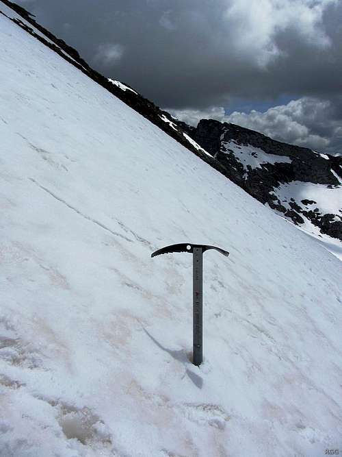
Steepest angle: 37°
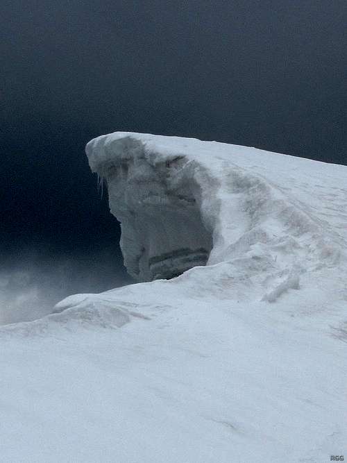
Cornice on the summit ridge
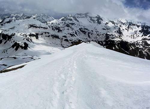
View down the wide, easy summit ridge
When coming from the south, right before getting to the base of the mountain the route reaches Lago Busin inferiore. It's not necessary to go up to the unnamed saddle from there. Instead, follow the eastern shores of the lake until the trail turns sharply west. At this point you have just passed the Forcla del Giove on your right, and are southwest of the summit. The easiest way up aims for the crest of the WNW ridge instead, well left of the summit, and follow the easy ridge to the top. This was my descent route. At the steepest part, I measured the angle as 37°. Although it was summer, there was still a lot of snow, and as a precaution I had an axe with me.
Punta Clogstafel and Monte Giove panorama from the SSW, from the shores of Lago Busin inferiore. The "unnamed saddle" is on the far left.
Ski Routes
On the ascent, the popular normal ski route follows the same way as the summer route. On the way down, depending on the snow conditions, it can be much faster and easier not to drop down to Lago Vannino but aim directly for the dam.A much steeper ski descent is possible from Forca del Giove towards the northeast, straight down to Valdo.
Red Tape
None.When to Climb
All year round, though with fresh snow there may be avalanche risk. The refuges in the area are open in summer and during the winter/spring ski season.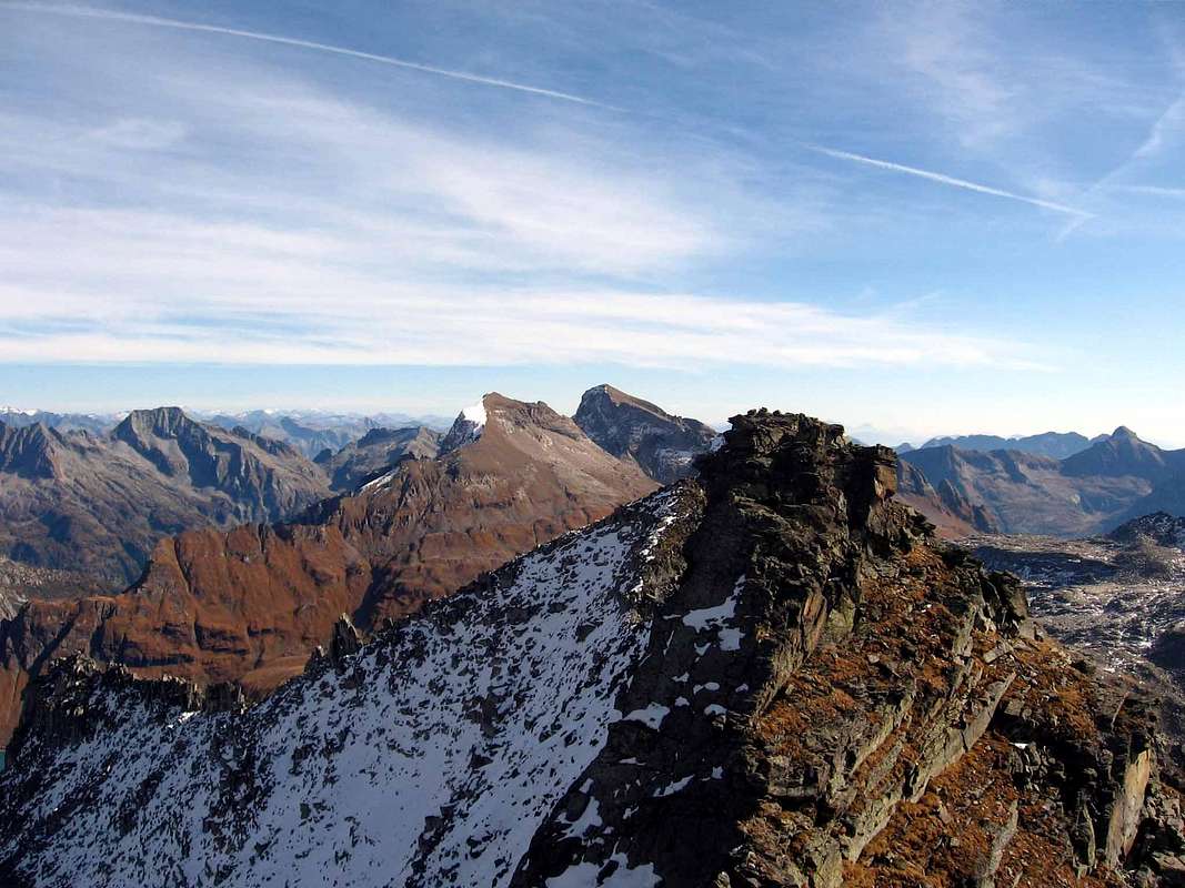
In front is Cima del Cust; Punta Clogstafel and Monte Giove are further back. These are more normal summer conditions, with little or no snow on the western slopes of Punta Clogstafel.
Accommodation
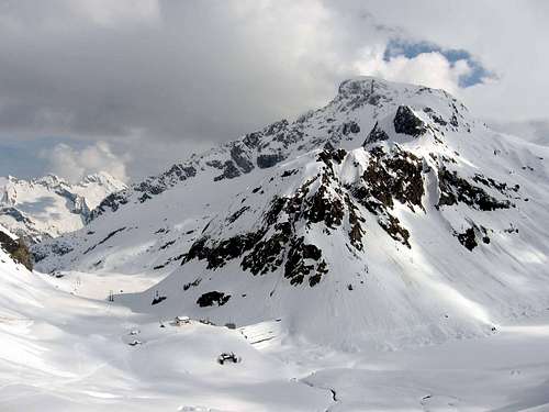
The white building is Rifugio Margaroli. Punta Clogstafel towers over it.
A bit further down in Vallone del Vannino is Rifugio Miryam.
Pizza della Satta and Monte Minoia above Lago Busin Inferiore, seen from the slopes of Punta Clogstafel. Colle Scatta Minoia is the saddle on the far right.
Domodossola and the many small villages in the valley offer many accommodation options, ranging from campgrounds to hotels.
Maps
The 1:25 000 Swisstopo maps are easily the best and most detailed ones available, but each map covers only a relatively small area. The summit of Punta Clogstafel is in the bottom right corner of map 1270 Binntal. It's fine for the normal route from Rifugio Margaroli, but neither Val Formazza nor the lower part of Vallone del Vannino are on it, nor is the southern approach route. For complete coverage, the additional maps are 1271 Basòdino for the Vallone del Vannino approach, and 1290 Helsenhorn and 1291 Bosco/Gurin for the southern one.The 1:50 000 Swisstopo maps are still excellent. Map 265 Nufenenpass has Punta Clogstafel at the bottom, and 275 Valle Antigori has the southern approach.
The map I had with me at the time was the less detailed but still good Italian IGC map 11, "Domodossola e Val Formazza", 1:50 000, which, as the name says, covers a much larger area.